General Central/Eastern Kansas Forecast
Short-Term (Thursday-Friday)
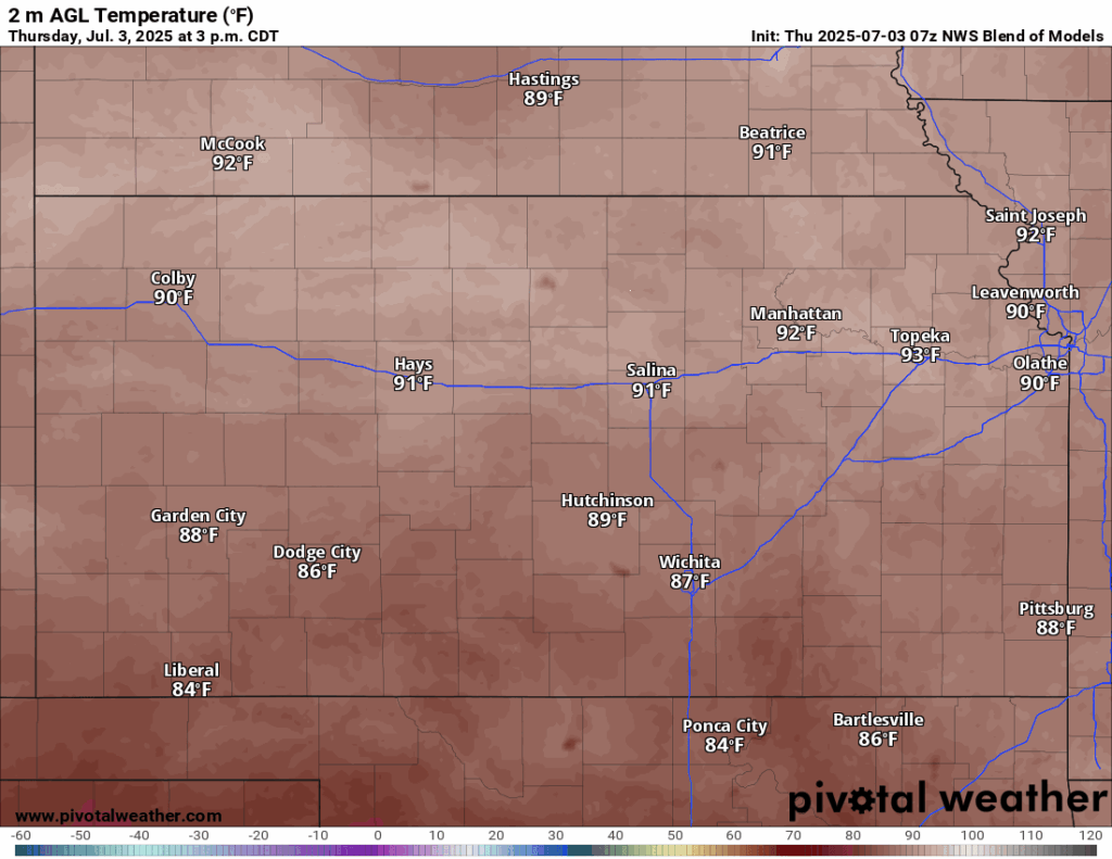
Another regular hot summer day is in store for us in central and eastern Kansas, as we sit underneath a lobe of high pressure that’ll keep us dry throughout the day today. Temperatures look to reach the upper 80s to low 90s, with winds out of the south at 5 to 15 mph, with gusts up to 25 mph closer towards central Kansas. The humidity will be back on the rise again, as rich gulf moisture streams northward throughout the afternoon, raising our relative humidity back into the 50-60% range as dew point temperatures climb back into the mid/upper 60s to low 70s. Heat indices in some spots may reach the upper 90s today due to the increasing moisture content in the air.
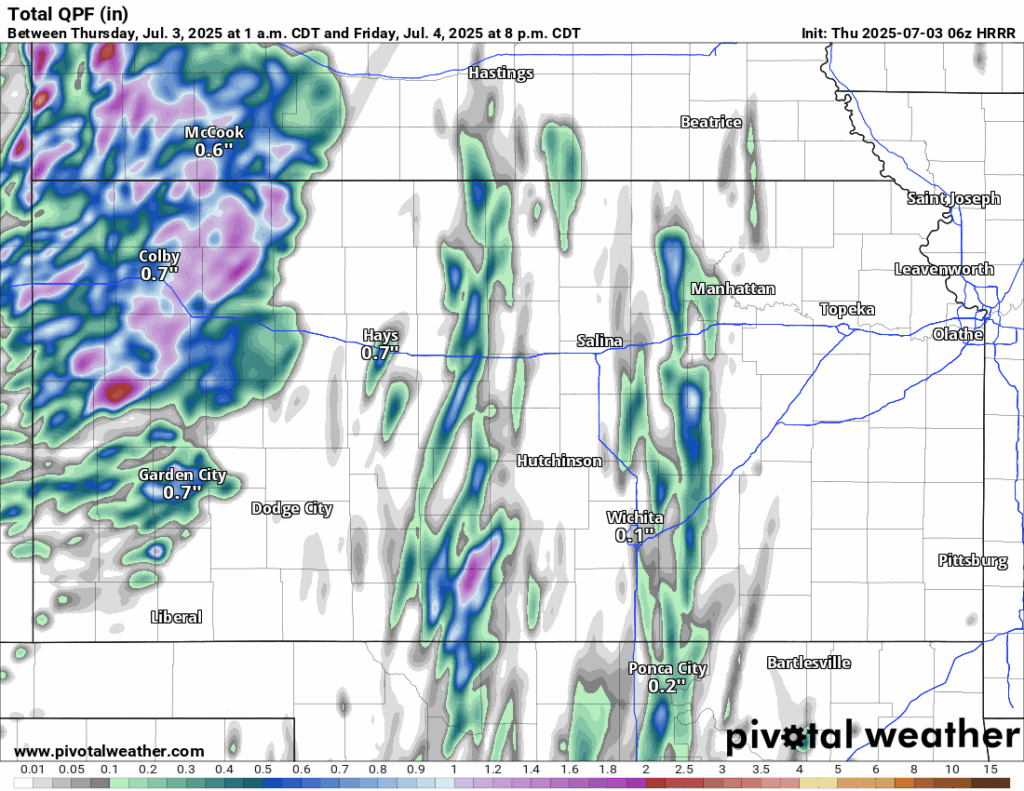
Tomorrow will see our chances for rainfall increase across the area, as this high pressure breaks down and a return to southwesterly flow follows in. A couple disturbances within the flow will help cause the formation of isolated showers and thunderstorms tomorrow afternoon and evening. Due to the lack of even modest upper-level support, these storms will be shorter-lived and not that organized. Otherwise, it will be another hot and humid day for Independence Day, with temperatures in the mid 80s to low 90s and southerly winds of 5 to 10 mph, gusting to 25 in the afternoon. Our humidity will only increase further, as we reach values between 60-75% in the afternoon. Heat indices again may reach the mid to possibly upper 90s with the increased humidity.
Long-Term (Saturday-Wednesday)
A more organized line of showers and storms may be possible, especially for central Kansas around midnight Saturday, as a stronger upper-level disturbance moves in from the northwest. This round of showers and storms look to taper off as they progress eastward due to increasing convective inhibition through the morning hours. After this, isolated to scattered showers and thunderstorms will be possible virtually throughout the long-term forecast period, as we sit under weak northwest flow, which will allow for just enough influence from small-scale perturbations to trigger thunderstorms. Temperatures will remain fairly steady, fluctuating between the mid 80s to low 90s throughout the afternoons as the hotter temperatures of summer are still removed from our area for the meantime.
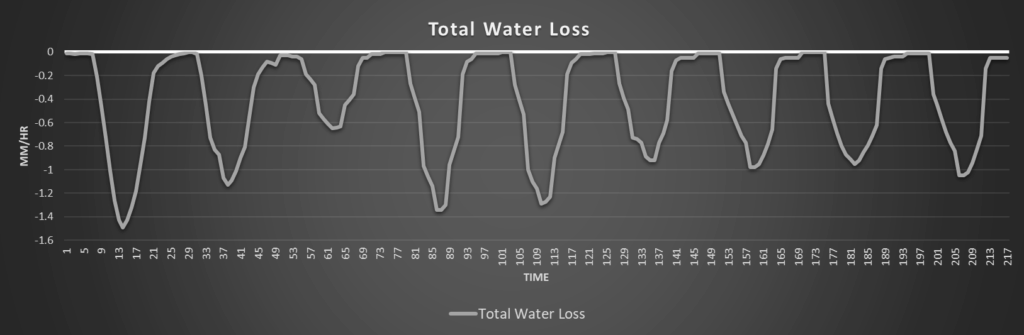
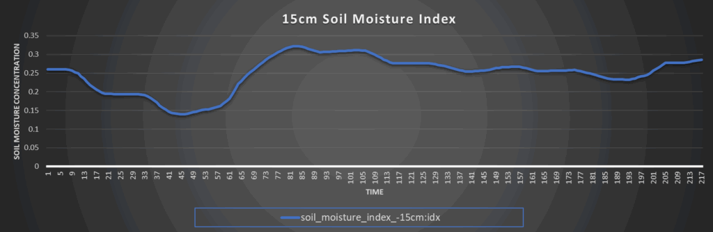
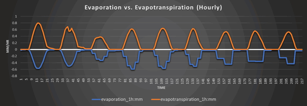
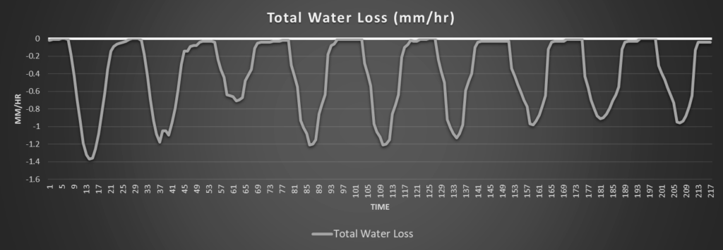
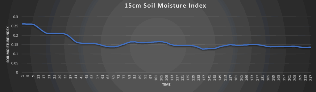
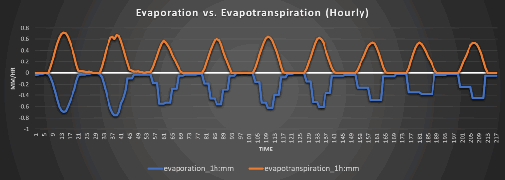
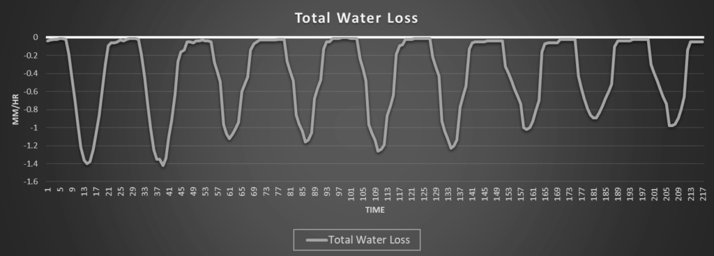
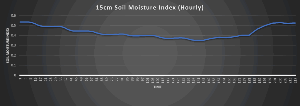
Regional Soil Moisture Forecast
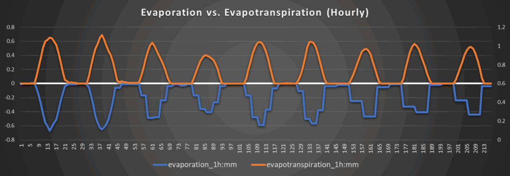
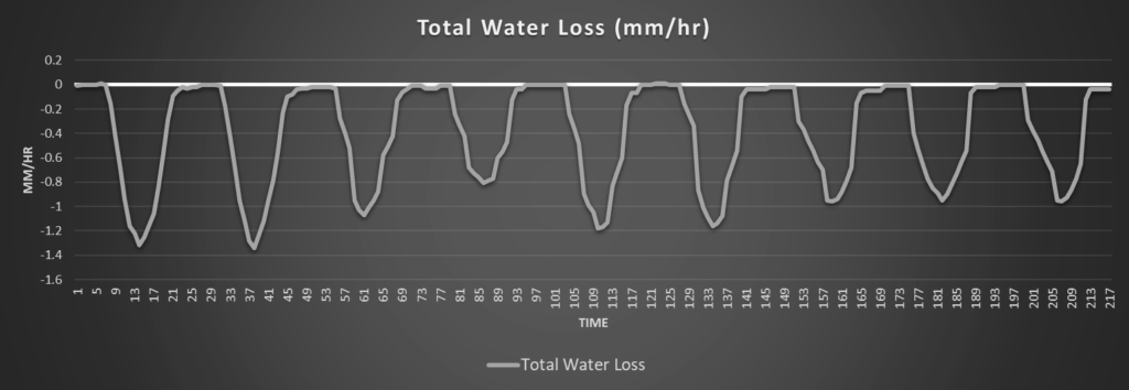
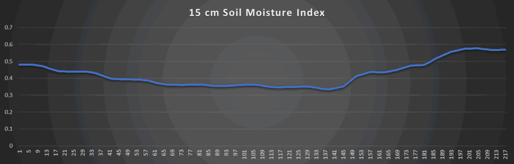
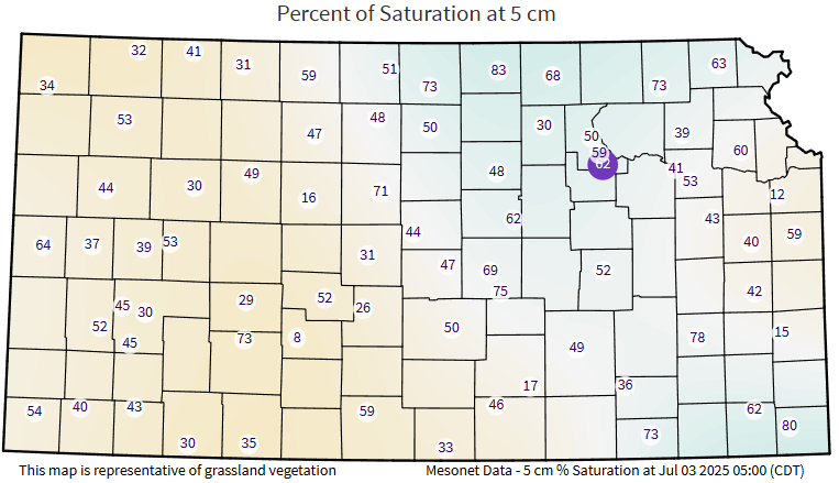
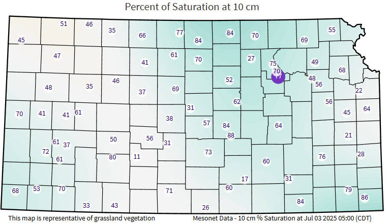
Continued drying of soils has been ongoing across central and eastern Kansas due to the overall lack of rainfall and summerlike temperatures. Further drying is to be expected today and tomorrow, except for those that do see isolated precipitation by tomorrow afternoon. Overall water loss looks to remain fairly steady, if not improve somewhat throughout the long-term forecast period as daily chances for rain begin to return by the weekend and heading into next week. Some soil moisture replenishment may be evident across the area during this time, but for the most part, soil conditions look to remain fairly unchanging.
Around Westmoreland
Around Scranton
Around Burlington
Around Altoona