General Central/Eastern Kansas Forecast
Short-Term (Wednesday-Thursday)
Dry and warm conditions today will be in place across central/eastern Kansas, as high pressure tries to creep in and return the summer-like heat and dryness to the region. High temperatures today will be in the mid 80s to low 90s, with winds out of the southeast at 5 to 10 mph. A stray shower can’t be ruled out today, especially across north-central to northeast Kansas today (along and north of I-70 would see the best chances), but the overall odds will remain very low and will leave much of the area dry. Low temperatures tonight will fall into the mid 60s to low 70s.
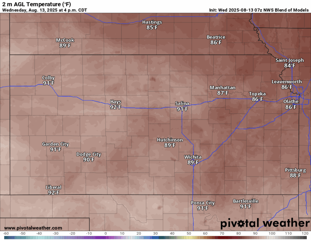
Heat continues to creep upwards tomorrow as the main axis of ridging approaches closer to us. High temperatures will reach the upper 80s to low 90s, with winds south of the south at 5 to 15 mph, gusting to 25 (mainly in north-central Kansas). Heat indices won’t be too big of a concern just yet, but peak heat indices will reach the mid 90s given relative humidity values of 50-60% and dew point temperatures approaching the low 70s. Low temperatures tomorrow night will be in the low 70s across the state.

Long-Term (Friday-Tuesday)
The heat will really return by late this week and into the weekend, as temperatures get back into the mid to upper 90s and heat indices once again approach or top the 100 degree mark. Rain chances do look to make a return by the weekend and into early next week from some weak, transient disturbances in the flow aloft. Details regarding this are still murky at this range, but at this moment, no more than scattered unorganized activity is expected with this. Temperatures during this time may also decrease somewhat, but only into the low 90s.
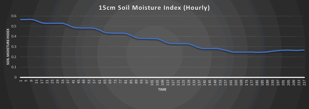
Regional Soil Moisture Outlook
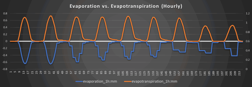
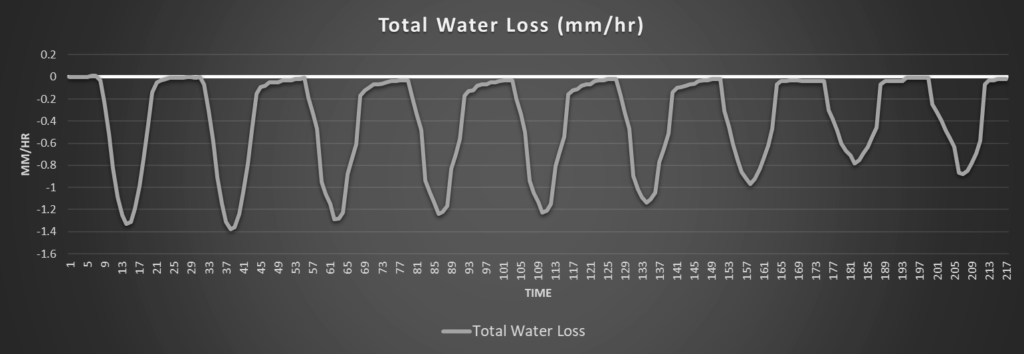
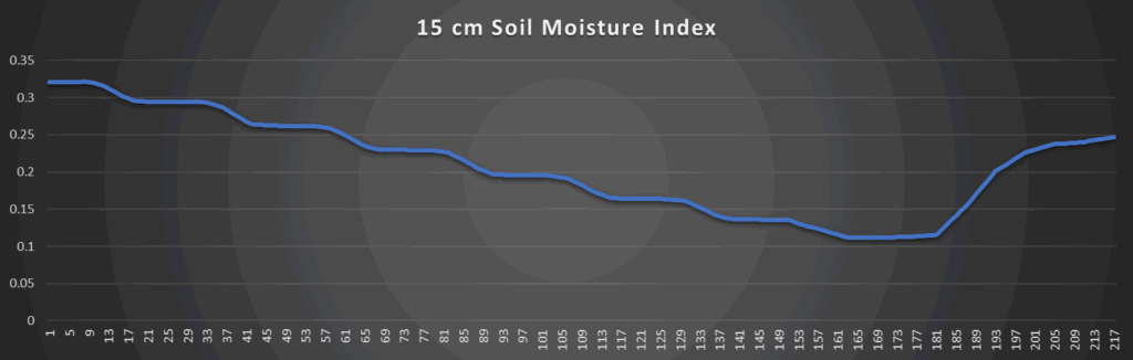
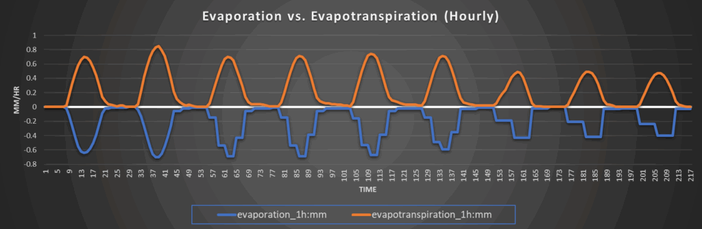
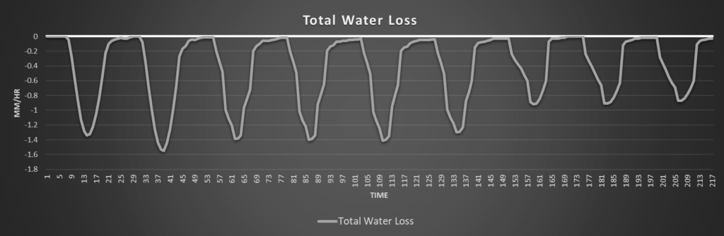
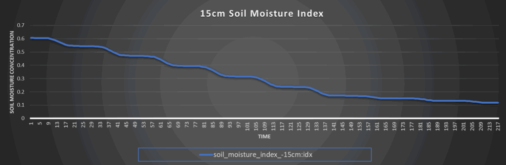
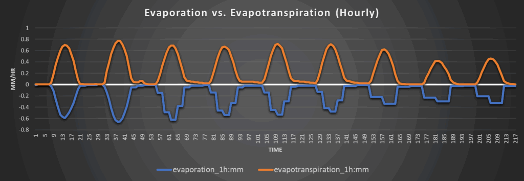
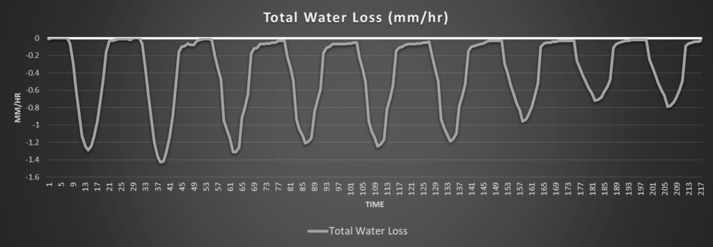
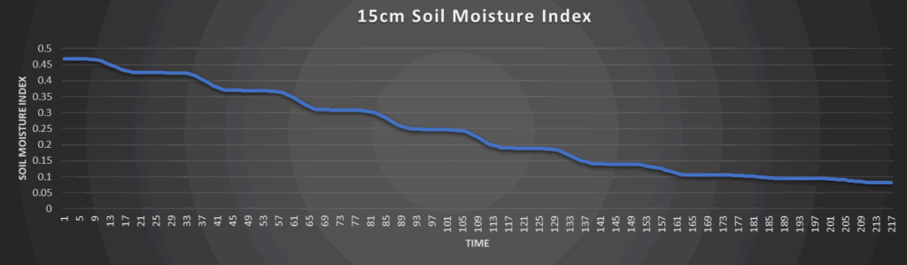
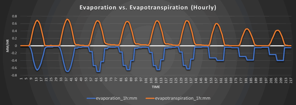
Soils still remain saturated across central and eastern Kansas from the rains a few days ago, with most of the area still gaining moisture. Even with temperatures climbing and water loss rates increasing to 1.2 to 1.6 mm/hr over the rest of the week, no new areas of abnormally dry soil conditions should make themselves present (if any do, it will remain very isolated) before our next chance at rainfall arrives by the weekend and early next week.
Around Westmoreland
Around Scranton
Around Burlington
Around Altoona