General Central/Eastern Kansas Forecast
Short-Term (Wednesday-Thursday)
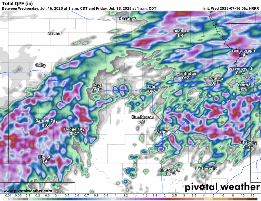
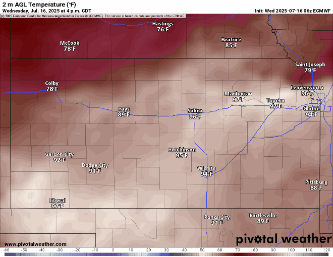
Scattered rain showers and thunderstorms will be making their way across northern and northeastern Kansas (mainly north of I-70) through the early morning hours before gradually dissipating by the afternoon. This will then yield to another dry and hot day across the region, as has been for the last few days, with high temperatures again in the mid to upper 90s. Winds will be generally southerly at 5 to 15 mph. By this evening and into the overnight hours, a cold front will begin to make its push through the state from the north-northwest and will help initiate scattered showers and thunderstorms. Some of these storms may be marginally severe across northern Kansas, with damaging winds being the main hazard. Heavy rainfall will also be possible with these storms given a very saturated atmosphere and strong instability. Isolated pockets of rain totals exceeding 1 inch may be possible overnight with these storms. Overnight lows will drop down into the upper 60s behind the front while remaining in the mid to upper 70s in front of the cold front.


The cold front will continue to push through the state tomorrow, and as a result, scattered showers and thunderstorms will persist throughout the morning and afternoon hours. These will taper off from northwest to southeast throughout the day, although some isolated to regionally scattered thunderstorms may persist in southern and southeast Kansas throughout the evening and overnight hours tomorrow night. Some of these storms may be marginally severe, with small hail and locally damaging winds possible. Heavy rainfall will again be the greatest threat, with isolated pockets of 1-2 inches possible.

Temperatures will be noticeably cooler behind the front tomorrow, with highs in the upper 70s to low 80s throughout the day and lows in the mid 60s to low 70s overnight. Winds will be mainly out of the north-northeast at 5 to 10 mph.
Long-Term (Friday-Tuesday)
Chances for scattered showers and thunderstorms may continue into Saturday as multiple disturbances pass through our area. Exact placement of these storms is still uncertain at this range, but generally, those in the northern half of the state will have the best chance at seeing rainfall. As we get into Sunday and early next week, high pressure begins to build over us and will really ratchet up the heat consistently, as we will see high temperatures reaching the mid to upper 90s daily. Heat indices will consistently be in the upper 90s to low 100s, so some heat stress to persons outdoors and to livestock may start to become a more magnified issue by next week, as well as the persistent drying of soils.
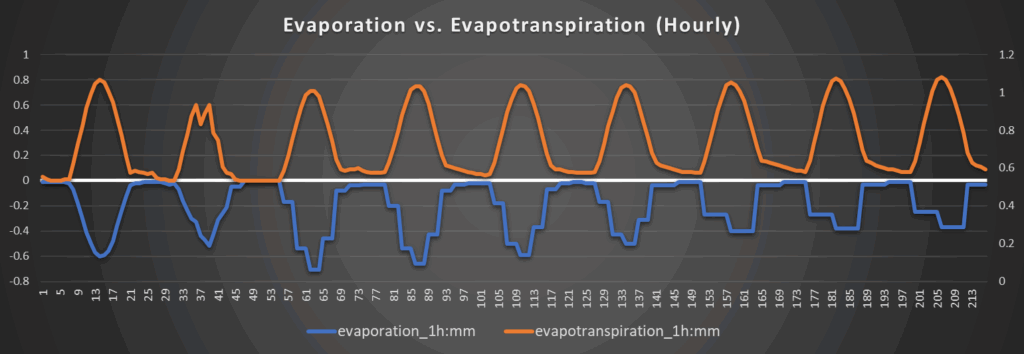
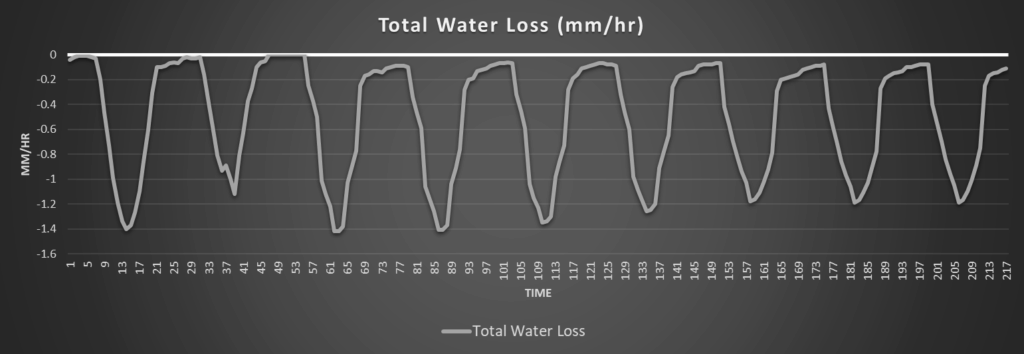
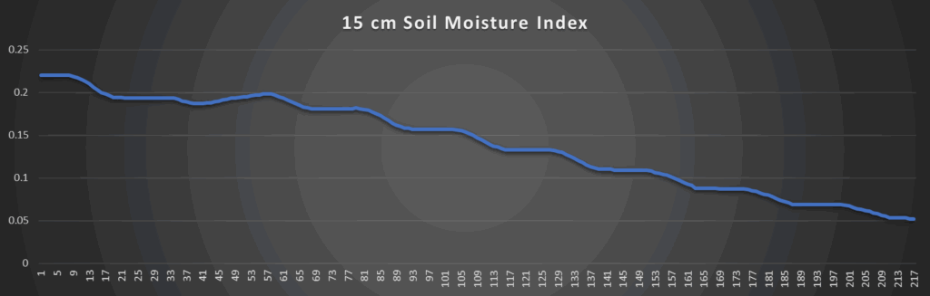
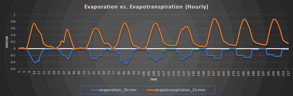
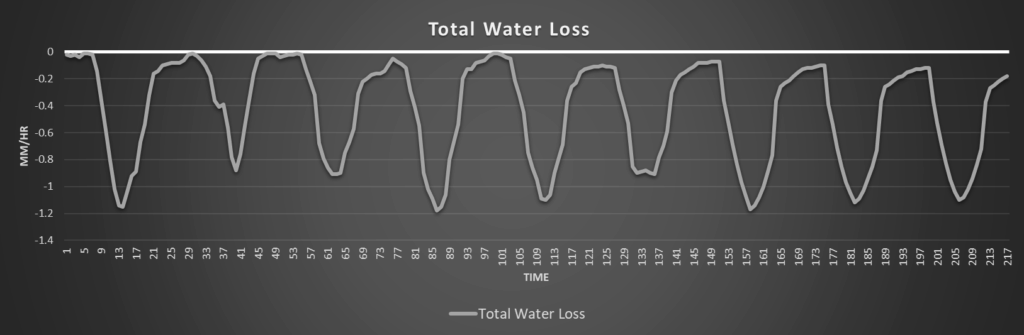
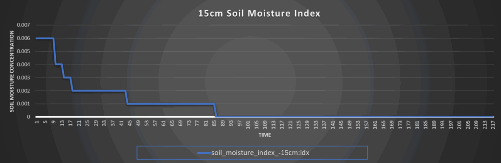
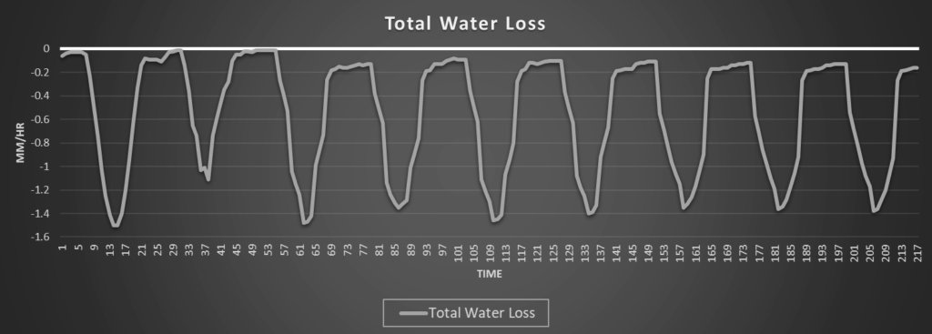
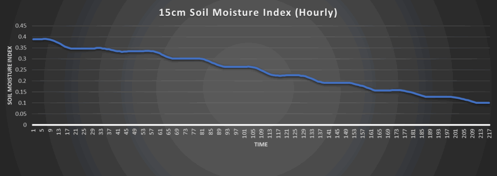
Regional Soil Moisture Outlook
Short-term relief from rains should take place over the next couple of days, but the overall drying trend will persist through the forecast period. High pressure is expected to build in once the better rain chances depart by the weekend and really bring the heat to our area, which will exacerbate already dry soil conditions. Further development of abnormally dry areas may be possible by early next week and developing drought conditions will have to be monitored.
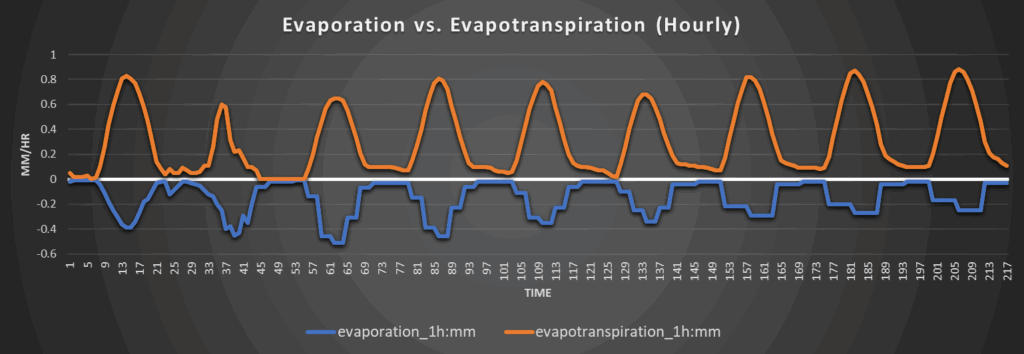
Around Westmoreland
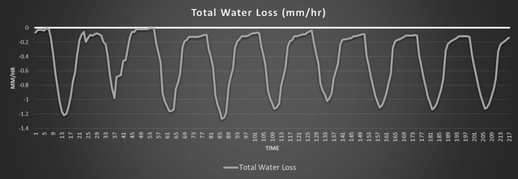
Around Scranton
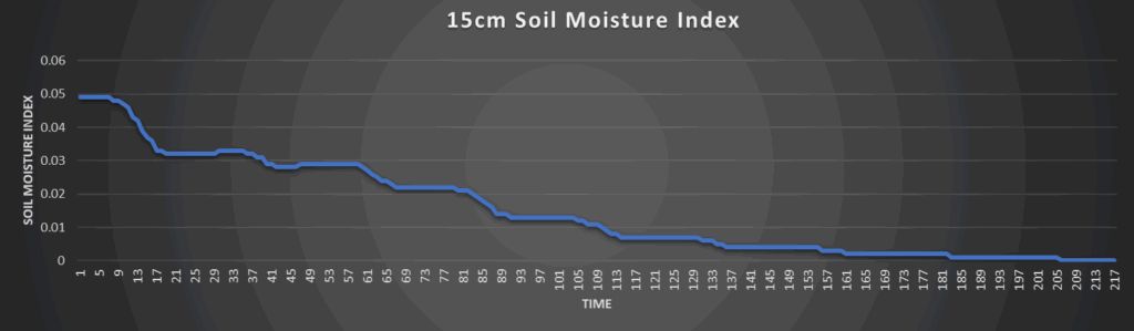
Around Burlington
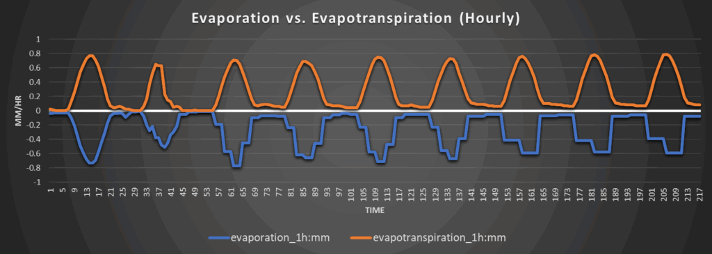
Around Altoona