The rain finally made its way out of here yesterday leaving us with clearer skies. We’ll have a few clouds today, but they’ll eventually move out by the afternoon leaving us with a clear winter-like day. The north winds will prevail before calming down this evening. Highs will be in the low 50s and lows falling into the low to mid 30s. Expect some patchy dense fog in many areas as well.

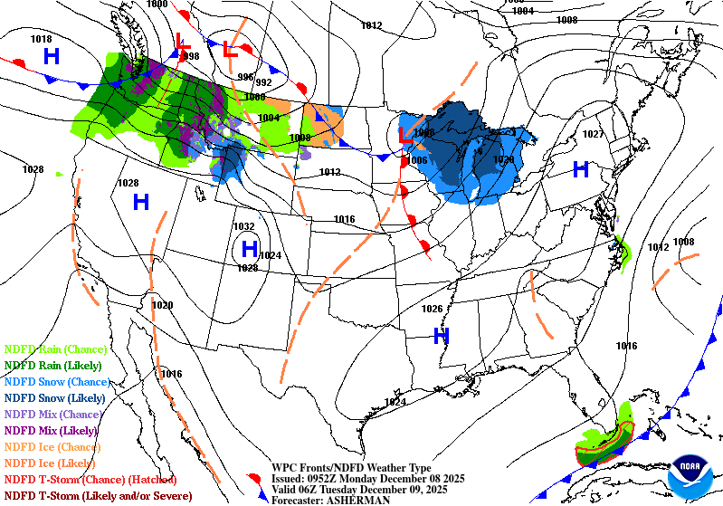
Tuesday will see a shift in the winds towards the south. Temperatures will warm up a bit compared to Monday into the upper 50s with clear skies. Overnight it’ll reach the upper 30s. The rest of the week will warm up from the mid 60s on Wednesday to the upper 60s by Friday. Lows will follow suit from the low 40s to the mid 40s. Rain chances are diminishing, however the National Weather Service is calling for a possible chance of rain Thursday night as a front moves in. This chance is looking fairly low so far, but still possible.
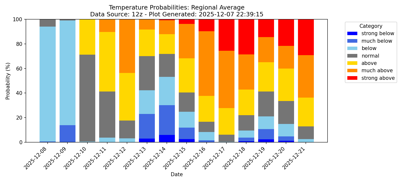
Looking at the regional average probabilities from the NQLBOT model, we can see a general warming trend by the end of the week. After the cold front moves in on Friday, the weekend looks to be more on average for this time of year before we enter another warming trend next week. Combine this with low chances for rain and we have some overall warmer than average temps for a while.