General Central/Eastern Kansas Forecast
Short-Term (Tuesday-Wednesday)
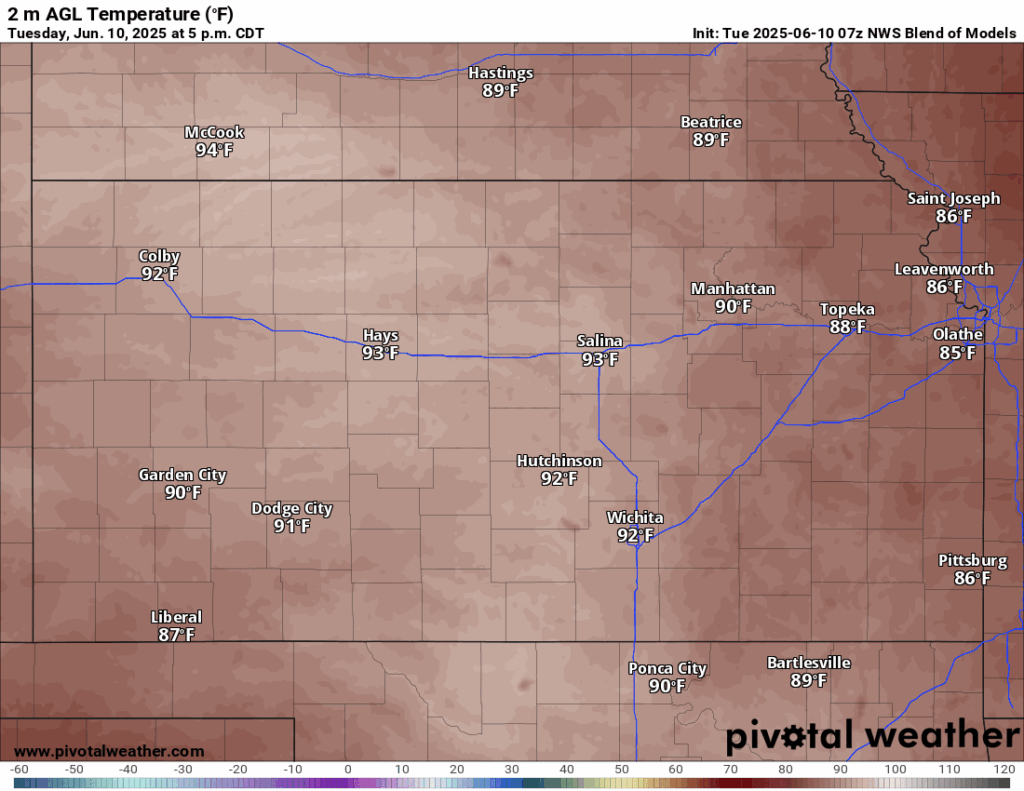
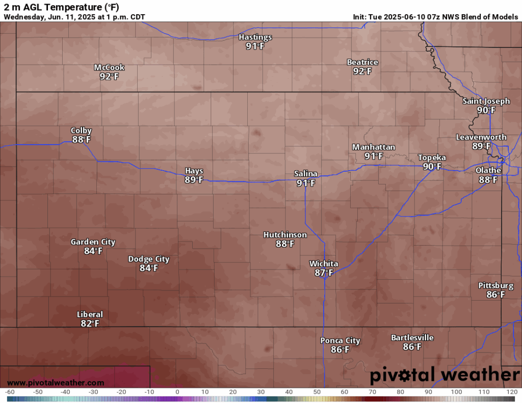
High pressure will continue to build in over the area through the short-term period, which will help our temperatures continue their climb. High temperatures will reach the upper 80s to low 90s both today and tomorrow, with winds out of the south at 5 to 10 mph. Heat indices do not appear to be much of a concern as they will be near the actual air temperature. Low temperatures overnight tonight will be between the mid 60s to low 70s before increasing slightly by tomorrow night to the upper 60s to low 70s. Relative humidity values today will range between 25-45% and increase slightly to between 35-50% by tomorrow.
Long-Term (Thursday-Monday)
Some rain chances will try to make themselves evident Thursday-Saturday, as a weak low-pressure system slowly moves its way across northern Oklahoma/southern Kansas. Due to the lack of wind shear, no organized severe storms are expected at this time, rather favoring just low chances of regular airmass thunderstorms in the afternoon and evening hours. Currently, the areas with greatest chances at seeing any showers or storms are those in southeast Kansas. Dry conditions will return after Saturday as high pressure returns to the state and tries to shut down our rain chances once again. Temperatures over the long-term period will stay very consistent in the mid 80s to low 90s daily. Heat indices may become more of a factor towards the end of the weekend, where we will see heat indices rise into the mid 90s by the Saturday-Sunday timeframe.
Soil Forecast by Area
Around Scranton
Around Burlington