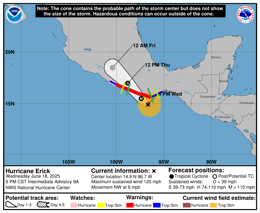
Hurricane Erick is currently undergoing rapid intensification. As recently as 5am this morning, this storm wasn’t even a hurricane yet. But it’s now Category 3, and may intensify further, before it landfalls tomorrow morning near the border of the Mexican states of Oaxaca and Guerrero. The storm is now 60 miles south of Puerto Escondido moving northwest at 9 mph. Central pressure is 991 millibards. Let’s analyze the threats one-by-one:
Las actualizaciones del huracán Erick en Español están disponibles aquí:
https://www.nhc.noaa.gov/refresh/graphics_ep5+shtml/182344.shtml?spanish_key_messages#contents
https://smn.conagua.gob.mx/es/pronosticos/pronosticossubmenu/pronostico-extendido-a-96-horas
WIND
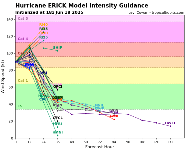
Tropical storm force winds are already likely present in southern Oaxaca. Things will only deteriorate as the night grows dark as the storm intensifies and draws closer. Thunderstorms have been spotted in the eyewall, which may indicate further intensification. At landfall, winds in the eyewall will likely be between 120 and 130 miles per hour, making it the first major hurricane this year in the East Pacific. Communities in the eyewall, close to the hurricane center, will be subject to winds similar to those in an EF2 tornado. Given the underdeveloped nature of this area, it is likely many homes and businesses will experience severe damage, and power and infrastructure outages are expected. Prepare a weeks worth of supplies, and consider taking shelter in an interior room when the eyewall hits. Hurricane Warnings are in effect from Acapulco to Puerto Angel, indicating winds above 74 miles per hour, which is plenty good enough to knock down trees and damage the exterior of buildings.
STORM SURGE
Storm surge is expected to stretch from the center of the storm, and extend on east for about 100-150 miles. Communities along the coast in Oaxaca and far eastern Guerrero should be on high alert. The good news is this is a very mountainous area, so there’s plenty of evacuation options. If you are told by authorities to evacuate, please do so to protect your life and retreat to higher territory. Typical storm surge with a category 3 hurricane is typically 9 to 12 feet above normal tide levels. I expect this to be on the lower end due to the hurricane being smaller and younger, but 9 feet of surge is still deadly. Any building on the coast is likely to have its ground floor inundated.
RAIN
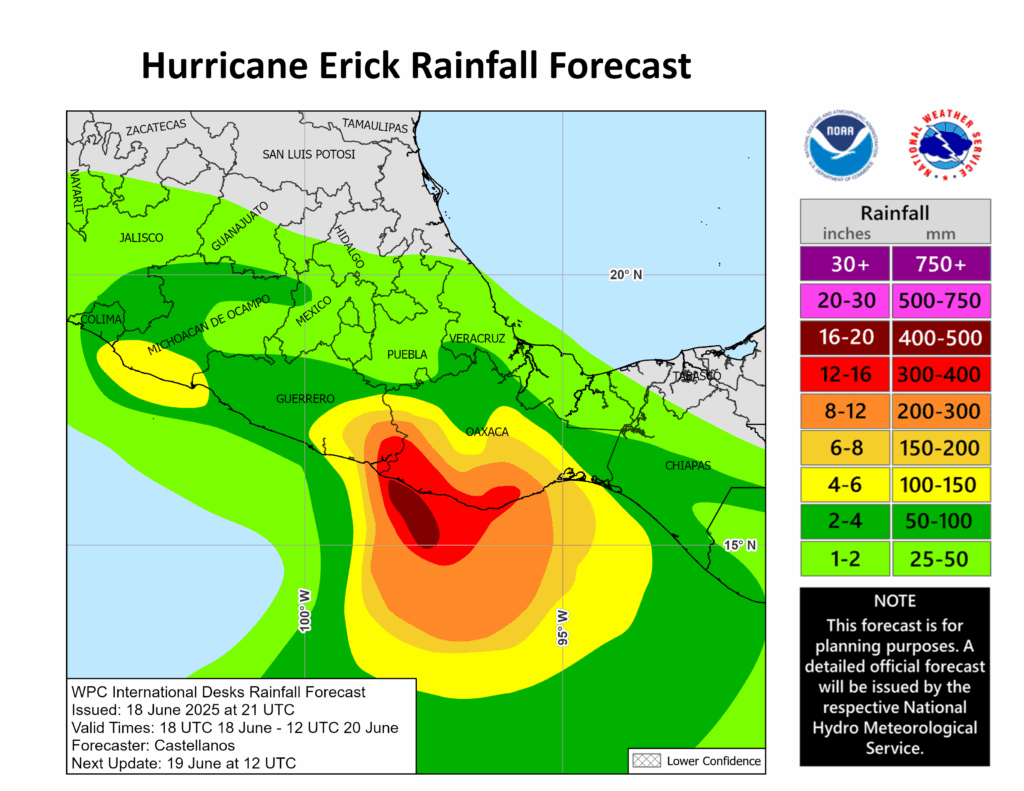
The worst of the rain is likely to occur in western Oaxaca, where the outer bands will have the most time to be present before the hurricane makes landfall and subsequently weakens. Rainfall may reach up to 16 inches, which is concerning given the topography of the area. Mudslides, downslope flooding, and communities being cut off due to roads being washed away are hazards in the inland mountain areas. If your area is prone to flooding, consider seeking higher ground. Parts of Guerrero, especially the southern and eastern parts, will also experience heavy rainfall. Keep in mind flooding could worsen even after the storm has left the area, especially near rivers or in mountain valleys.
TORNADOES
Due to low shear and instability in the upper right quadrant, combined with the storm arriving in the morning, the tornado threat is low compared with storms of a similar intensity. Thunderstorms have been observed in the eyewall, if any take a supercell form, a weak tornado or two could form. But the stronger wins will be from the eyewall itself.
WHAT’S NEXT?
Most models have this storm moving into inland Mexico, where it will be weakened by stronger shear, more arid air, and the mountainous topography. Mexico City may see 2-4 inches of rain. The moisture from this storm may influence weather this weekend or early next week in northeastern Mexico and the southeastern United States.
Stay tuned to local and national news and government outlets, like the National Hurricane Center, the Servicio Meteorológico Nacional, and local media as the storm rolls ashore. Make sure any additional preparations for the storm are completed by midnight.


