There exists a wide range of weather across the lower 48 for the next few days. The Northwest will see near record heat as temperatures soar past 100F while the Southwest begins the peak of monsoon season bring much needed rainfall. Heat warnings are also issued for parts of the Southern Plains and Mid-Atlantic. Near the Tennessee Valley and Northeast, severe weather will roll through with a frontal boundary.
Extreme Heat
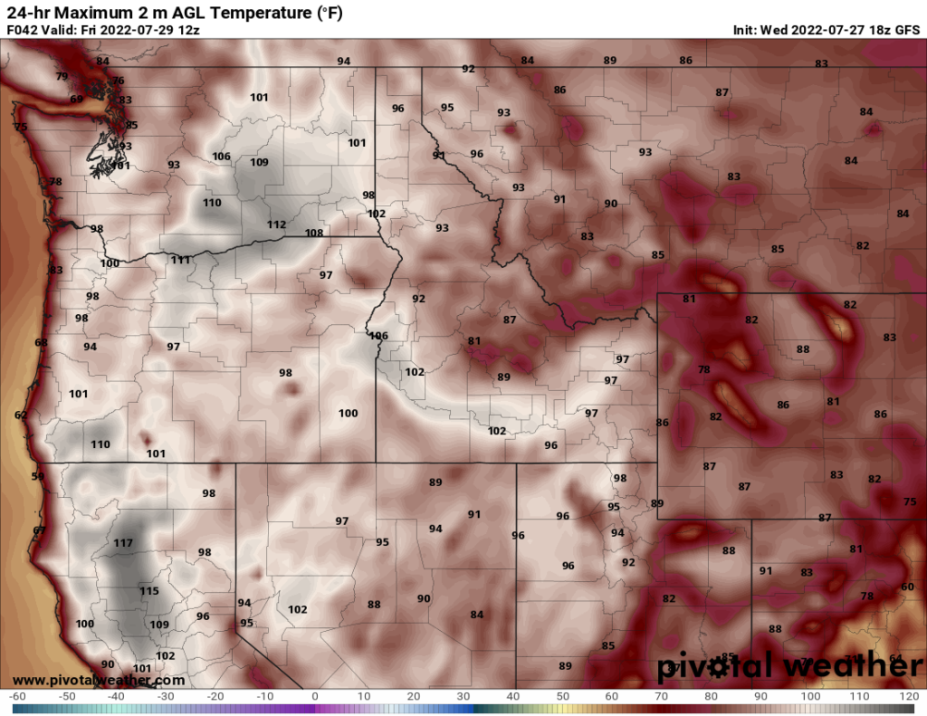
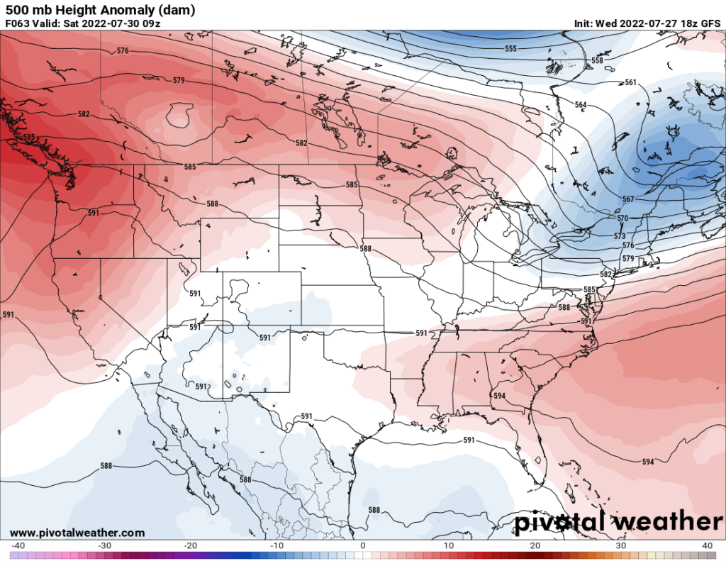
An upper-level ridge is sitting over the Western U.S. bringing high heat to the Northwest. Widespread triple digit temperatures are expected in this region. Parts of Northern California could see highs near 110F to 115F. Over the lower elevation in Eastern Washington, temperatures should reach past 105F. Thursday and Friday will be the peak of this as temperatures will ease off a few degrees into the weekend.
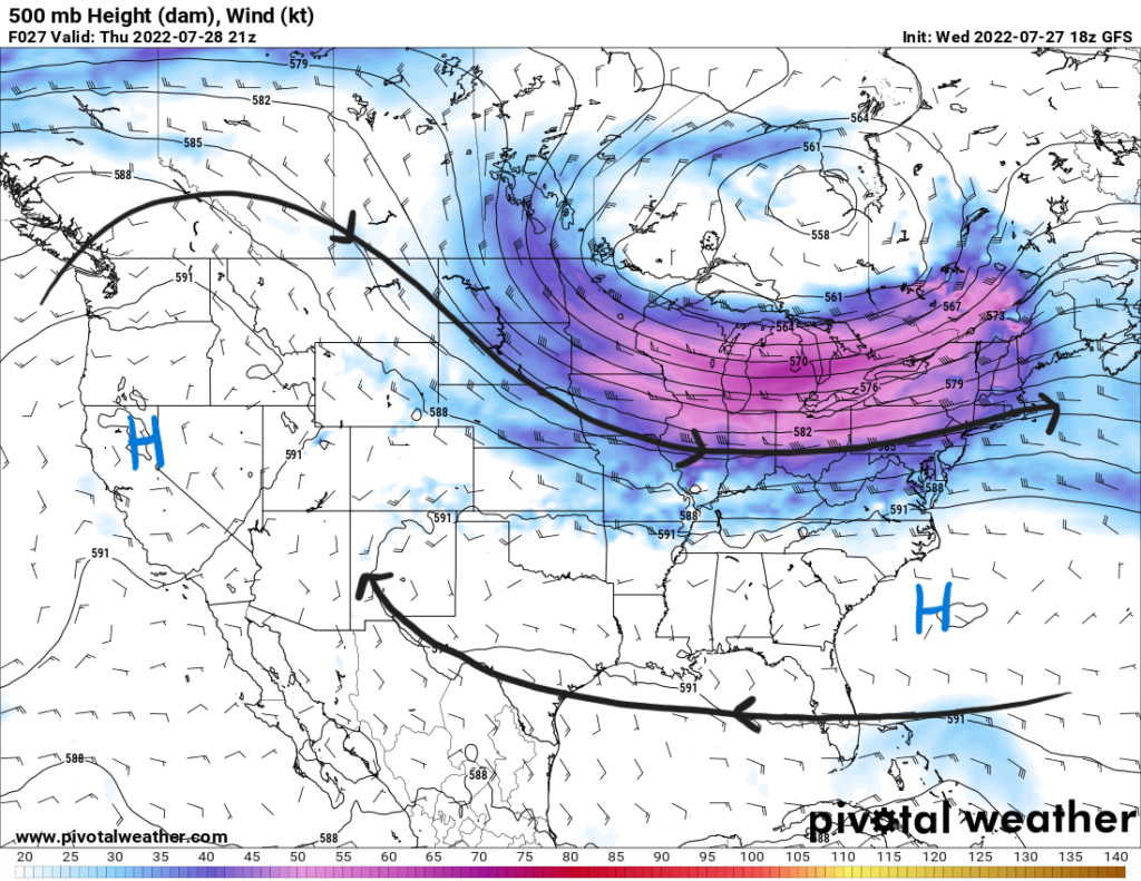
Based on a few models, the ridge seems to stick around through the weekend before it weakens and a shortwave in the upper levels moves from the Pacific bringing some moisture for some possible showers and storms. This feature will bring relief from the extreme heat.
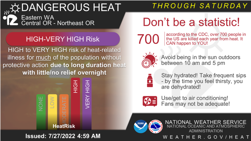
This extreme heat affects a vulnerable population as not every home in the Northeast has air-conditioning based on their usual mild temperatures. This creates the threat of overheating even in your home. There a very high risk of dangerous heat that needs to be taken seriously.
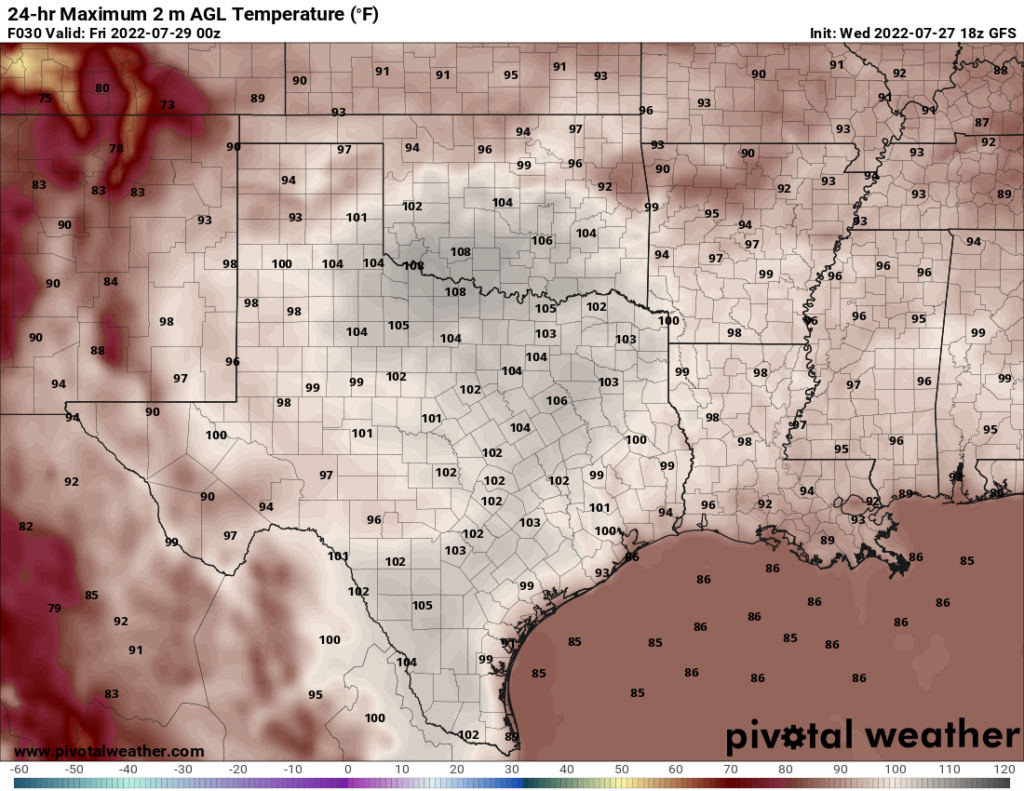
Extreme heat is also forecasted for the Southern Plains in Oklahoma and the Texarkana region. Highs will reach past 105F during peak heating of the day. With increased moisture compared to the Northwest, heat indices will reach up to 108F. This has prompted heat advisories to be issued for these high temperatures and humidity that present the risk for heat related illnesses.
As always, stay hydrated, take breaks from being outside in the sun for prolonged periods, and check in on family and neighbors.
Severe Weather
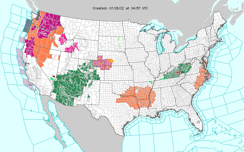
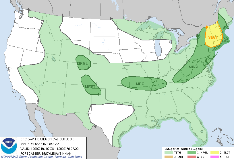
An upper-level trough is moving through the Great Lakes region towards the Northeast that is bringing a cold front through the area. Southwesterly flow ahead of the front should support the risk for severe wind gusts and maybe even a possible spin up tornado. For this, the Storm Prediction Center has issued a slight risk for the region.
As the other cold front moves towards the Mid-Mississippi Valley, a moist environment couple with strong daytime heating ahead of the boundary could support the marginal risk for severe winds with the stronger line segment of storms. Heavy rainfall can also be expected from some of the storms. In their outlook, the Weather Prediction Center has a moderate risk (3/4), between 20 and 50-percent chance, of excessive rainfall over the Ohio Valley.
Monsoon Season
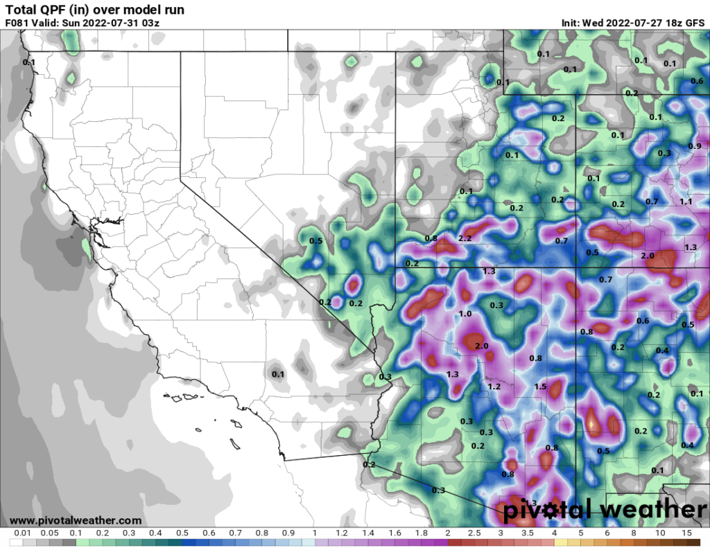
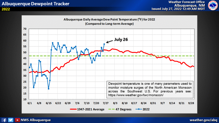
Nearing the peak of the monsoon season that run from June 15th to September 30th, the Southwest is seeing plenty of rainfall. The ridge over the West positions southeasterly flow into the region bringing tropical moisture with it. Near Albuquerque, NM, dewpoints have once again surged past the average indicating an increase in thunderstorm activity for the Four Corners region.
Northern Arizona will see the most rainfall for the next few days with scattered storms moving northward throughout the day. Widespread storms that will cause heavy rainfall and likely flash flooding. A flood watch is currently in effect for much of the area. Rainfall totals could reach past 2″ over the three days over Northern Arizona and Southwestern Colorado.