Hey everyone! Today’s shaping up to be a typical summer day, with a few areas facing severe weather, dangerous heat in the South, and a tropical update on the newly named Tropical Storm Erin. Let’s break down all the details.
Today’s Overall Setup
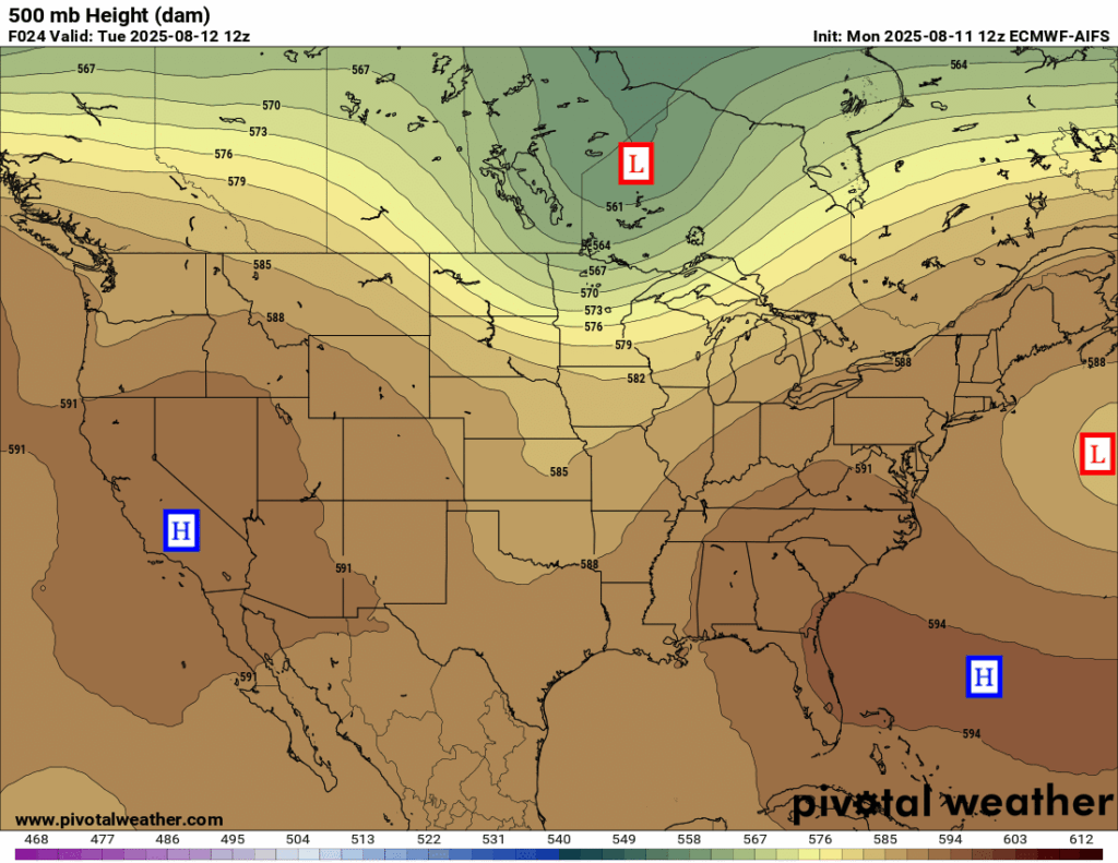
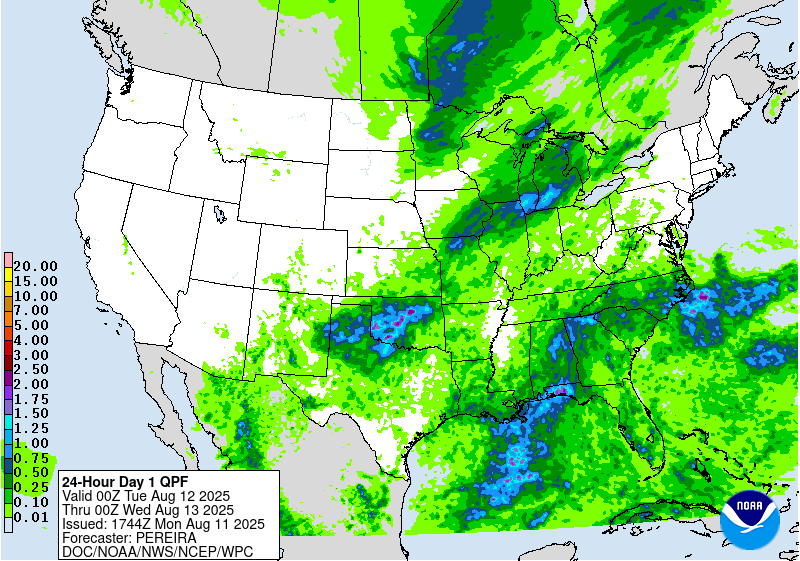
The mid-level (500 mb) pattern today features broad ridging across much of the country, with the exception of the northern tier where troughing is present due to a low pressure system moving through Canada. Despite the dominant ridge, there is still enough atmospheric lift and moisture, especially in the East, to support areas of rain. Most of today’s precipitation will occur near cold fronts or stationary boundaries, while parts of the Southeast are seeing showers and storms develop along a surface trough typical of summertime conditions.
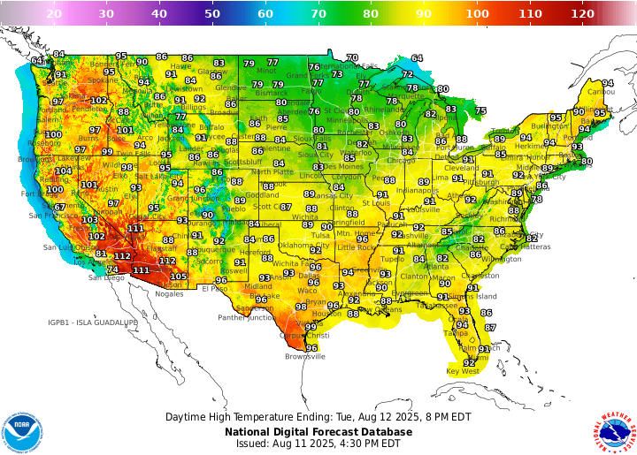
High temperatures today are soaring into the high 80s or 90s for most of the CONUS, asides for those in the desert southwest who are seeing 110 plus! In contrast, those who are under the trough in the northern tier are seeing cooler temperatures, only reaching the 70s or even 60s in some spots!
Today’s Severe Weather Threat
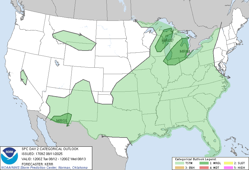
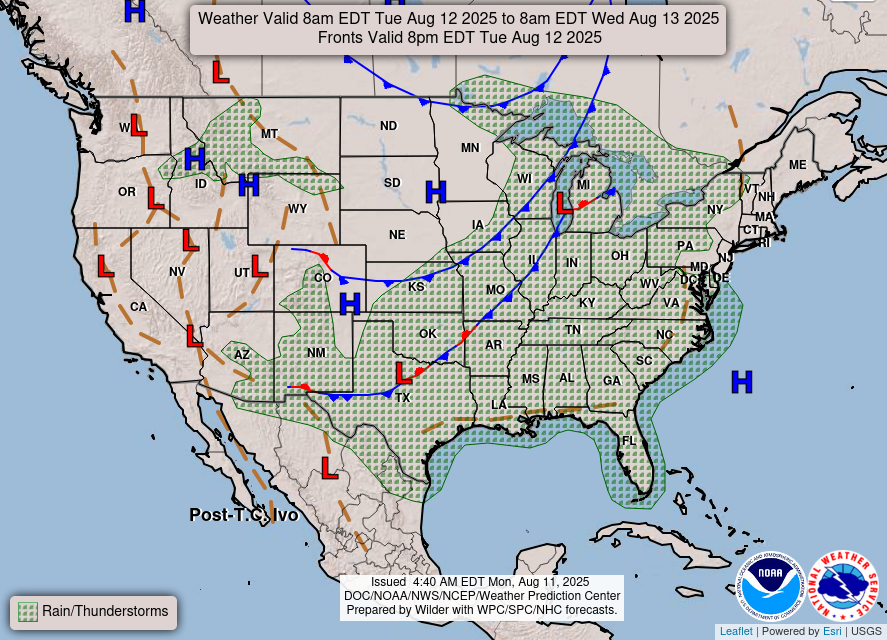
Today, there are 3 areas we are watching for severe weather across the U.S. The first one is located in eastern Wisconsin and the upper peninsula of Michigan. The second is just to it’s southeast, in southern Michigan and northerns Illinois, Indiana, and Ohio. The third is in an unusual area, in southern Arizona and extreme southwestern New Mexico. All 3 risk zones have a Marginal (level 1/5) threat. Let’s look into each one:
Today’s Upper Midwest Severe Weather
Today in the Upper Midwest, there is a chance for a few strong to severe thunderstorms to develop by late afternoon into the evening, mainly across parts of southeastern Lower Michigan into northeastern Illinois, and from Upper Michigan into eastern Wisconsin. The main threats would be strong wind gusts, with some potential for hail in stronger storms. Storm coverage and intensity will depend on how much sunshine and heating can break through the cloud cover during the day.
Today’s Southwest Severe Weather
In the Southwest, a few strong to severe storms could develop this afternoon in parts of southwestern New Mexico and southeastern Arizona. Storms forming over the higher terrain may move into lower elevations, bringing the potential for strong downbursts and gusty winds as they push out into the warm, dry boundary layer.
Tomorrow’s Severe Weather
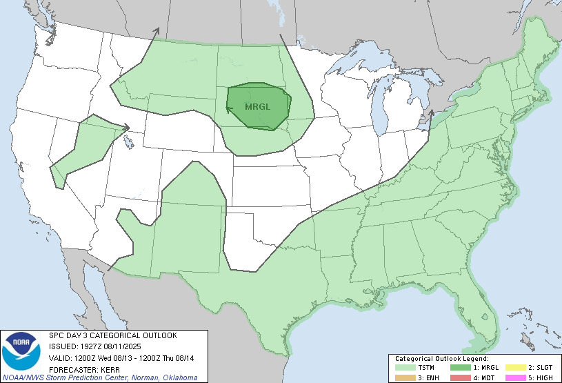
A Marginal (level 1/5) risk of severe weather is highlighted over South Dakota for tomorrow, Wednesday 8/13/25. Parts of central and eastern South Dakota could see a few strong to severe thunderstorms, mainly in the evening and at night. The main threat looks to be strong wind gusts, but some storms could become organized enough to produce more widespread severe weather. While details are still coming together, it’s possible that the severe risk could be upgraded in later forecasts.
CONUS Weekly Precipitation Outlook
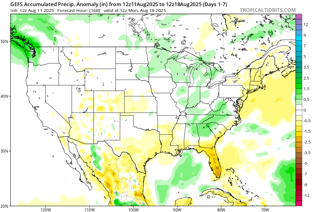
Here’s a look at the GEFS modeled precipitation anomalies through Monday 12z. Green indicates above average precipitation, white indicates average precipitation, and yellow indicates below average precipitation. Let’s look into the details by region:
Weekly Outlook: Western United States
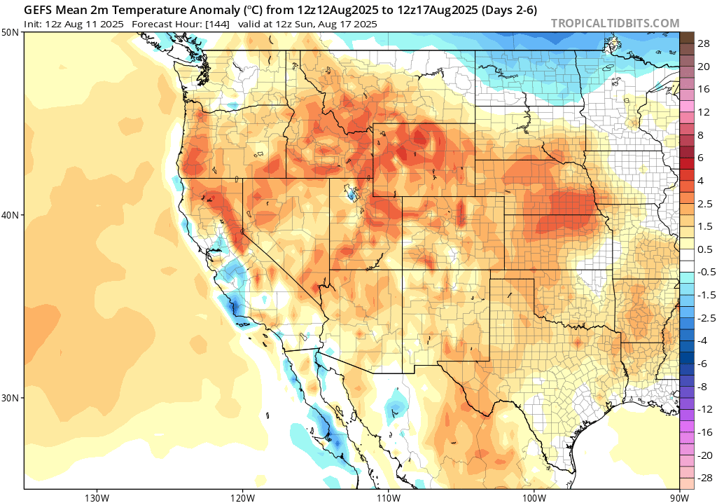
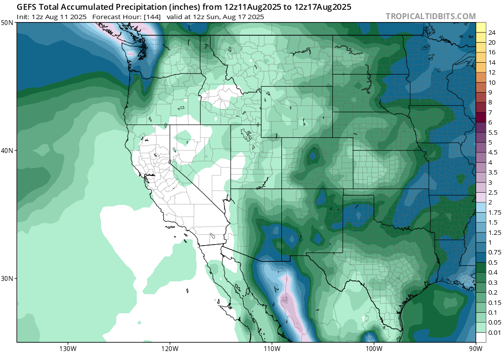
The heat is cranking in the west region this week, with some areas seeing up to 10 degree above the normal on average. Some areas near the coast are expected to see some cooler than normal temperatures. Near average, or slightly below average rainfall is expected for the week. California, as a whole, will see another week of bone dry conditions.
Weekly Outlook: Central United States
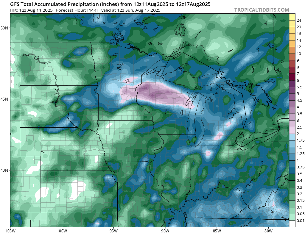
Models are showing a robust collision of frontal systems, which may squeeze out 3-6 inches of rain on Saturday. Both the Euro and GFS are showing the front converge, so a Marginal (at least 5 percent chance) risk zone for flash flooding is already in place for the general region from the WPC.
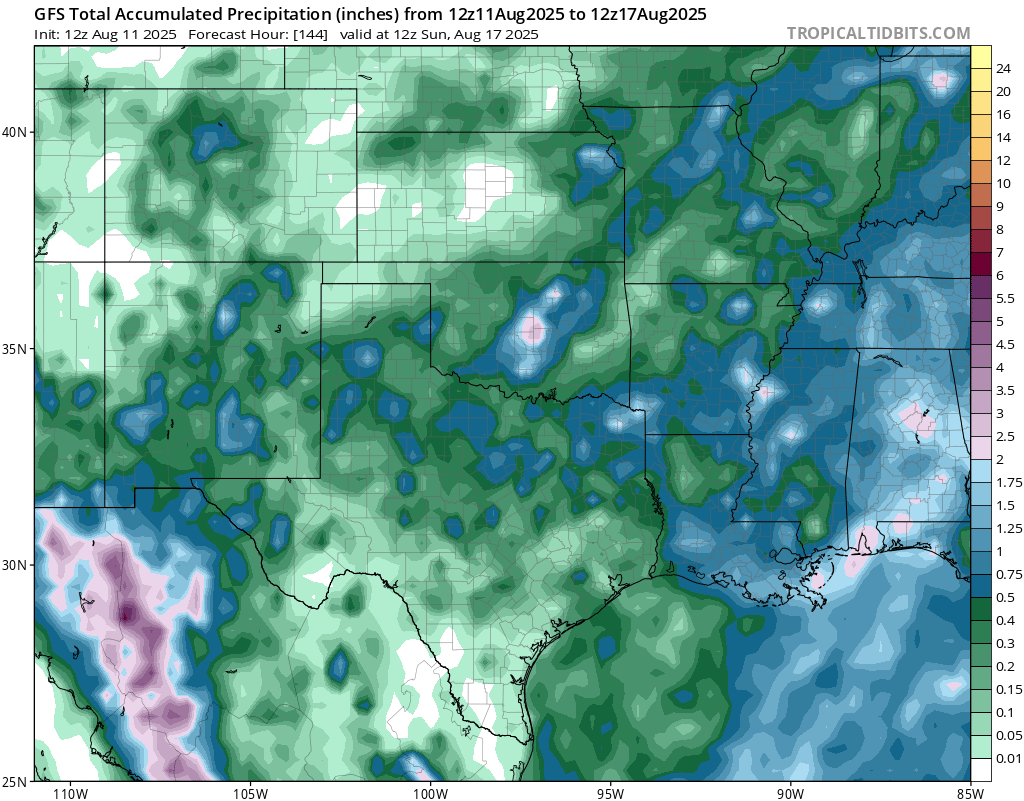
Slightly below normal rainfall is expected for this week, as the intense ridging is staying in place and limiting much rainfall. Of course there will be outliers of areas who see some heavy downpours from a passing system, but overall this week, drier than normal conditions are expected.
Weekly Outlook: Eastern United States
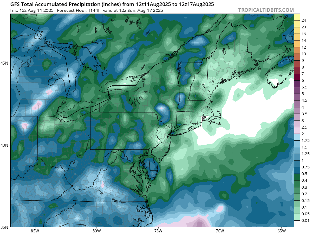
Not much rainfall is in the forecast for the northeast this week. The days with the highest chance is Thursday and Friday as a cold front passes through. The weekend is expected to be mostly dry given the high pressure system that will move through.
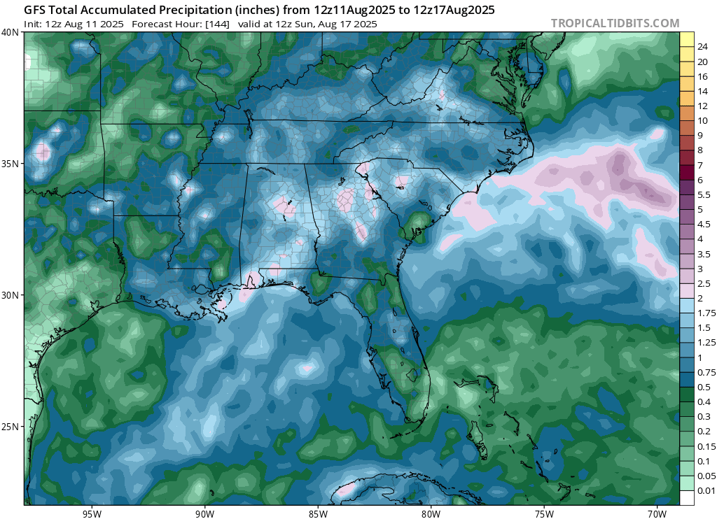
Due to the cold front passing through on Thursday and Friday, some above normal rainfall is expected for southern Appalacia for the week as a whole. After seeing a surpluss of rainfall this past weekend in Florida, much below normal rainfall is expected this week.
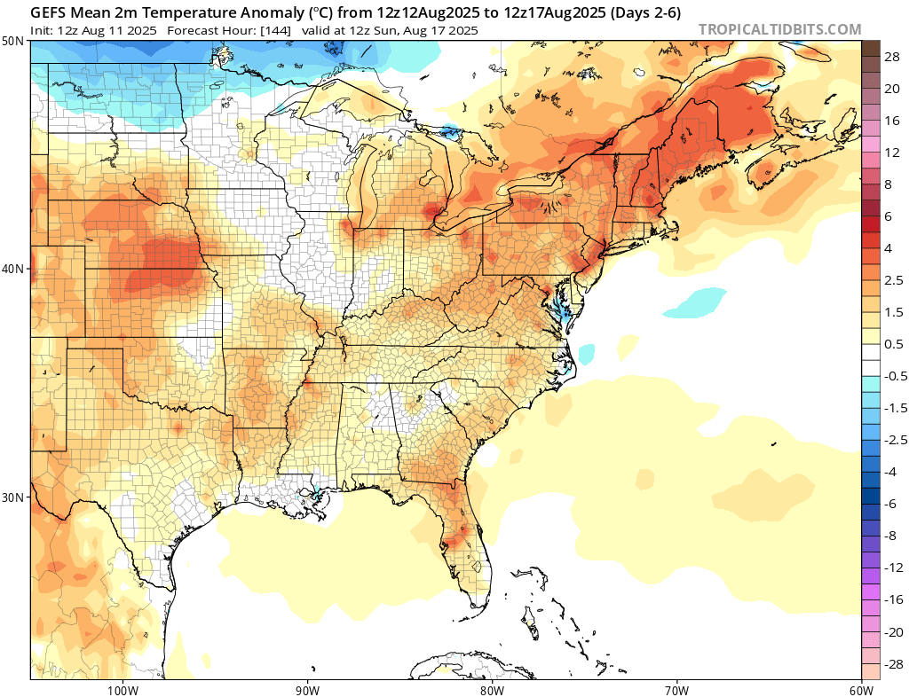
A good amount of ridging will be in place for this week, which will bring up temperatures to above normal for most of the central/east regions. This pattern is expected to flip by the week following, as troughing will take over and bring with it more average or even cooler than normal temperatures.
Travel Outlook
If you’re traveling tomorrow in the Great Lakes region, including stretches of I-75, I-80/90, and I-94, or in southern Arizona along I-10, be ready for changing weather conditions. Storms in these areas could bring brief heavy downpours, gusty winds, and reduced visibility, especially in the afternoon and evening, so allow extra travel time and drive with caution on wet roads.
Extended Outlook
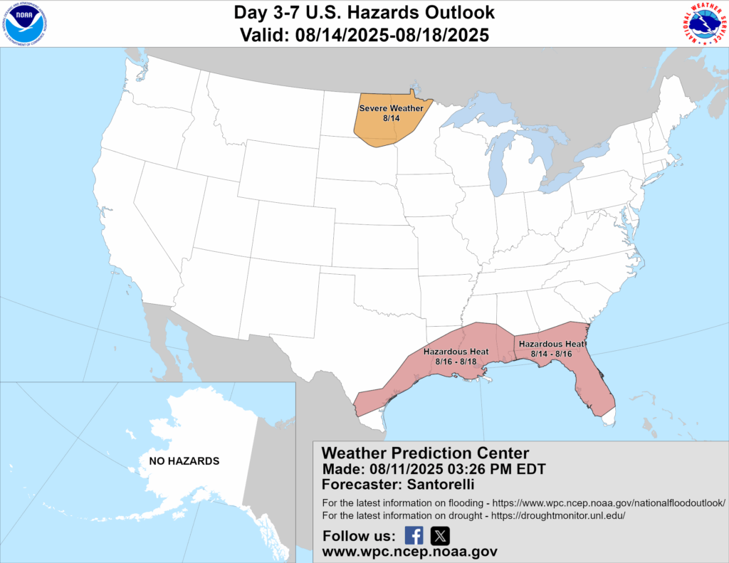
Above is a look at the U.S Hazards Outlook from NOAA, highlighting areas of extreme weather to be aware of for the next 3-7 days. A 15 percent chance of severe weather is highlighted for the northern Plains for Thursday 8/14. Hazardous heat conditions are expected in the coastal southeast from 8/14 through 8/18.
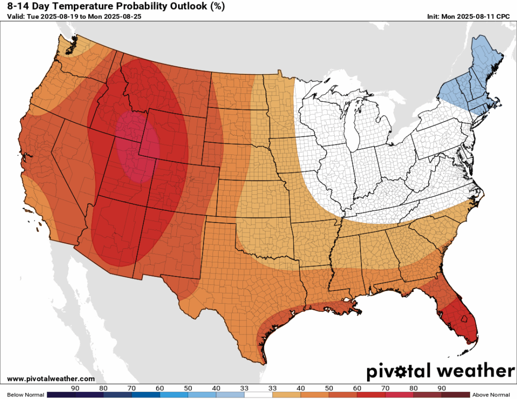
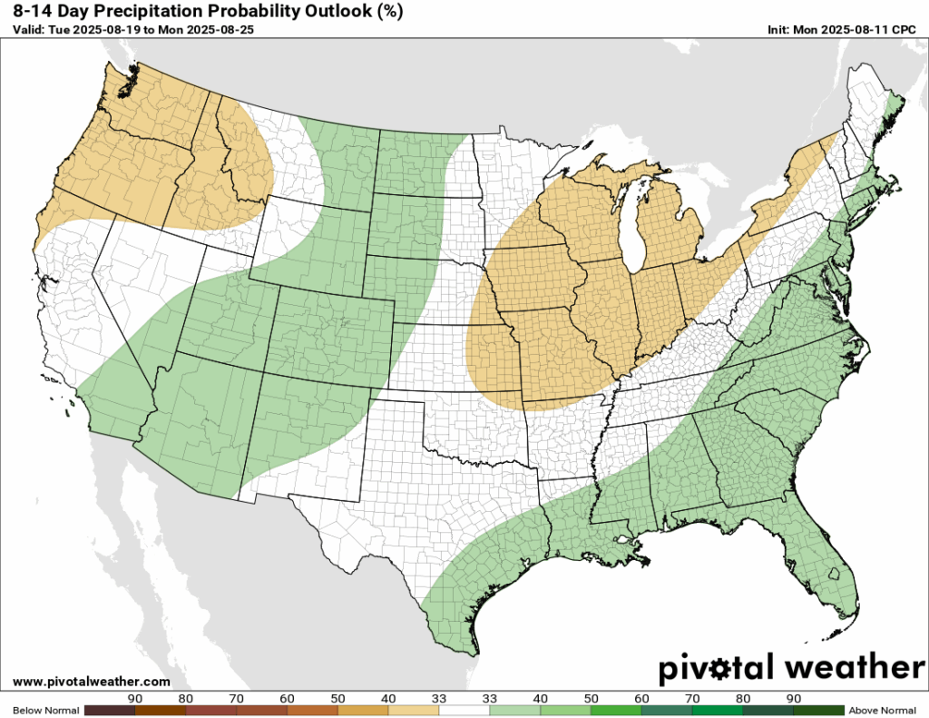
A deep trough is expected to dip into the northeast in the 8-14 day timeframe, bringing a chance for cooler than normal temperatures for the New England region. A decent amount of frontal systems are looking probable based on the model guidance for the southeast into the coastal northeast, as well as some more systems passing through the southwest into the northern Rockies, which is increasing the chance of above normal rainfall for the regions highlighted in green.
Quick Tropical Update
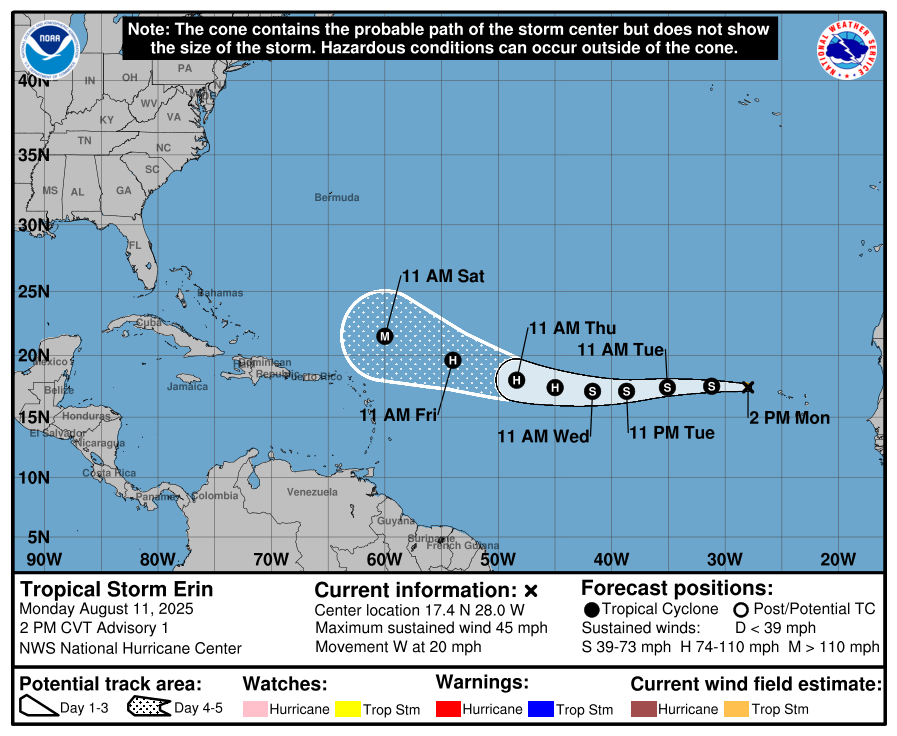
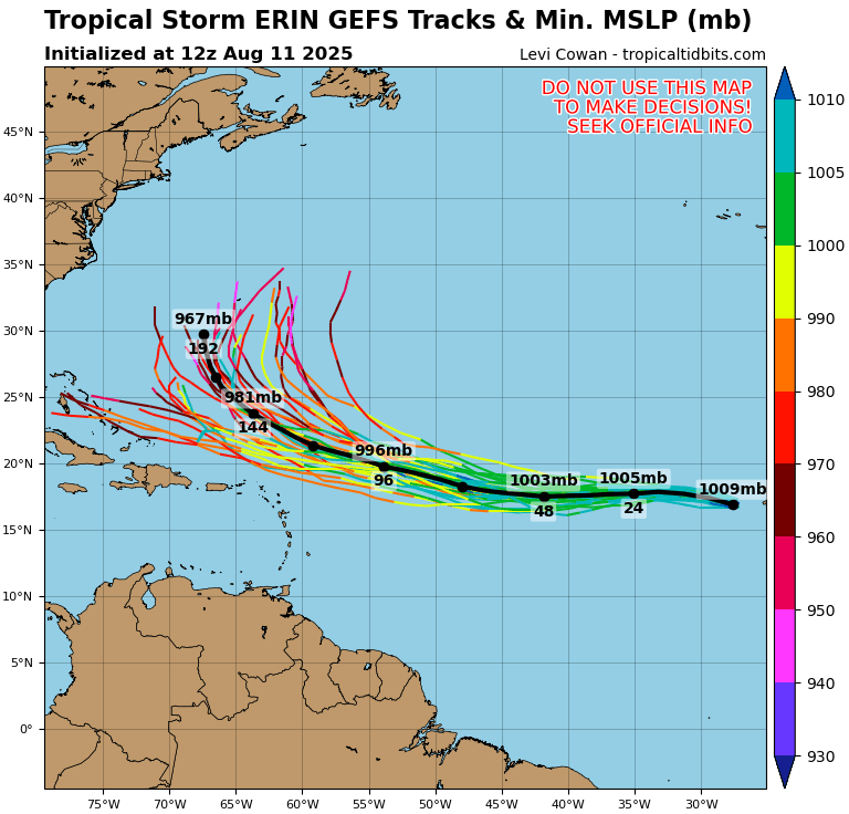
Tropical Storm Erin is moving west at 20 mph with winds near 45 mph and is expected to become a hurricane by midweek, possibly reaching major hurricane strength this weekend. Most models show it curving north later this week as the Bermuda High weakens and a cold front moves into the western Atlantic, steering it away from land. If that turn happens later than expected, the risk to the East Coast would increase, so it’s worth preparing now just in case.
Thanks for tuning in to this National Forecast! Tune in to our local, tropical, and regional forecasts to stay updated on the latest!


