General Central/Eastern Kansas Forecast
Short-Term (Monday-Tuesday)
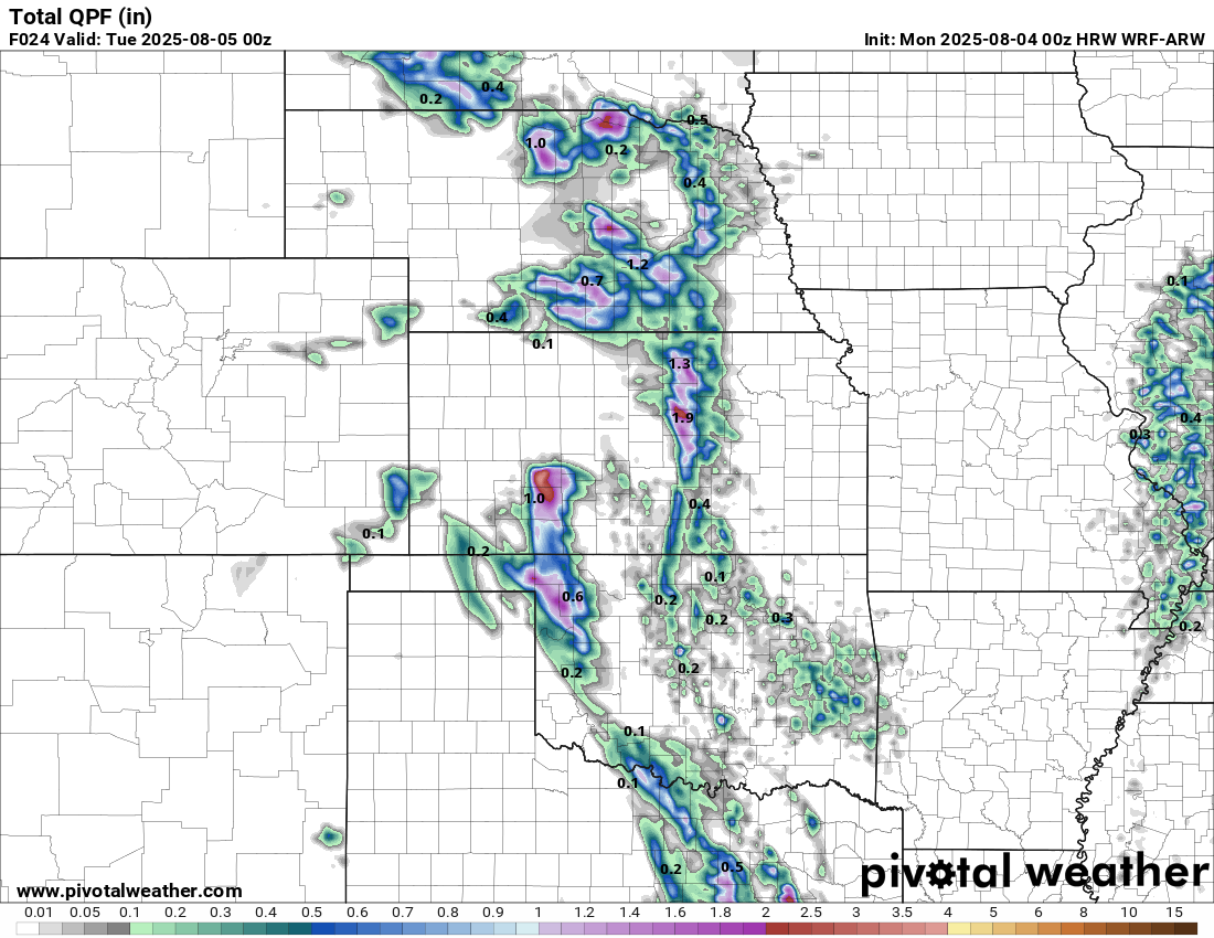
Today looks to be mostly dry, save for some isolated showers and thunderstorms in central Kansas during the morning hours. Currently, showers and thunderstorms are in progress from Council Grove to Clyde and are slowly making their way to the southeast. This activity will slowly taper off over the next few hours, giving way to mostly dry conditions by the afternoon and evening. Overall new rain totals will remain under an inch, but isolated pockets of 1.5 to 2 inches may be possible with heavier downpours.
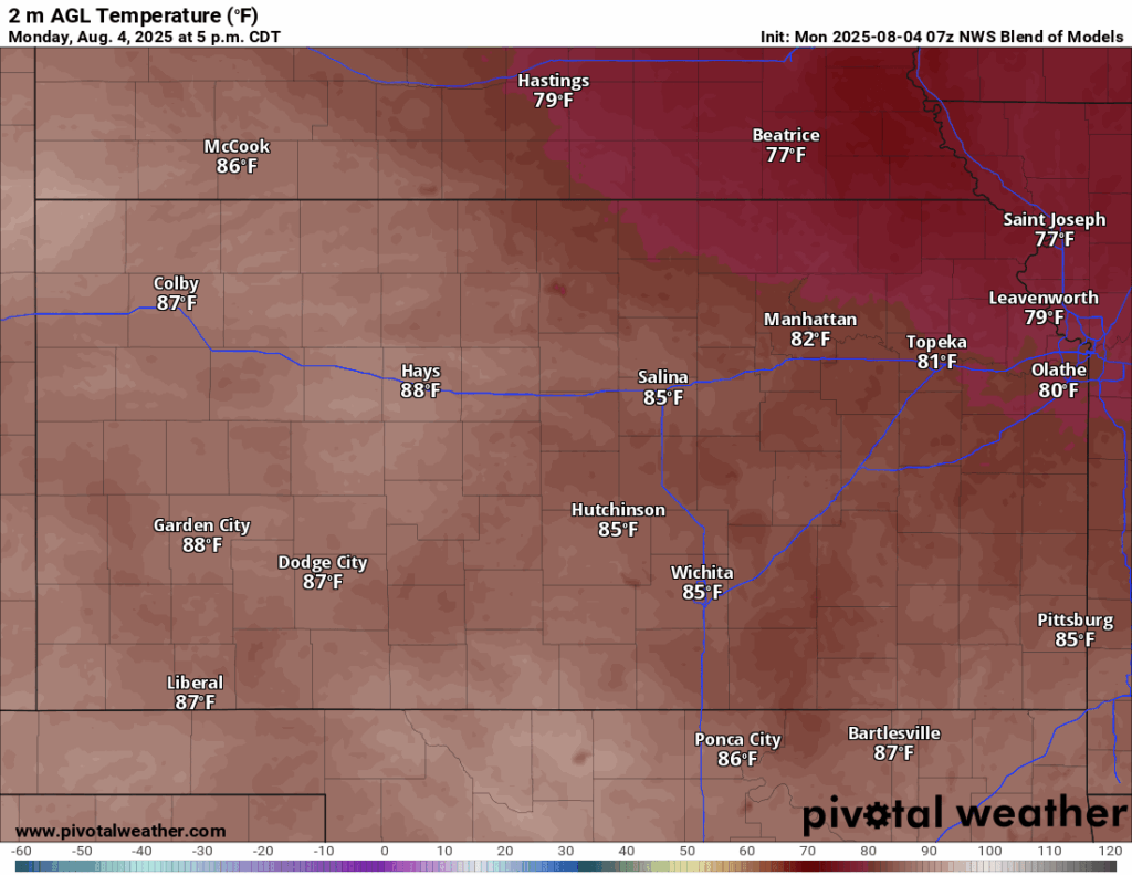
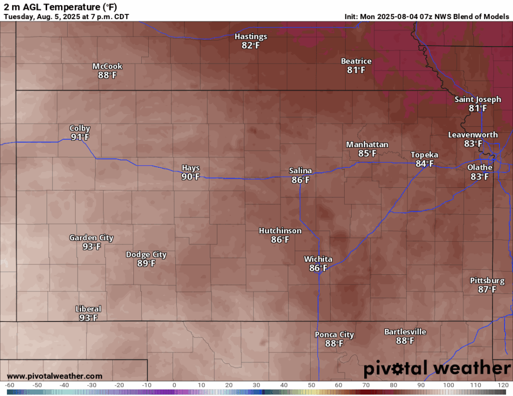
Temperatures today will be warmer than days previous, but still slightly below normal this time of year, with high temperatures in the upper 70s (northeast Kansas) to mid 80s (central Kansas) this afternoon. Winds will be largely out of the east-southeast at around 5 mph. Conditions may feel humid in south central Kansas, where dew point temperatures will approach the low 70s and relative humidity around 60%, but otherwise this afternoon will be comfortable for the summertime. Low temperatures tonight will cool off into the low to mid 60s.
Tomorrow will offer mostly the same conditions as today, being warm and dry across the region. Very low, but non-zero, chances for showers and thunderstorms will linger for central Kansas (along I-135/US-81) during the morning hours from possible leftover activity in northwest Kansas. Otherwise, it’ll be dry and slightly warmer, with high temperatures in the low to mid 80s, with winds out of the southeast at 5 to 15 mph. Moisture will begin surging northward again in response to a surface low in eastern Colorado, with dew point temperatures reaching the upper 60s to low 70s across the state. We will start to feel this air a bit more, especially with increasing temperatures as our relative humidity reaches between 55-65% tomorrow afternoon. Low temperatures tomorrow night will be warmer in the upper 60s to low 70s.
Long-Term (Wednesday-Sunday)
Temperatures will be steadily climbing throughout the rest of the week with building high pressure, eventually making it into the mid 90s by the weekend. Heat indices may be a concern again beginning Wednesday, as we return to the upper 90s to low 100s again and will stay there through Saturday. Depending on trends with humidity and temperature, a return to advisory conditions may occur during this time. This high pressure may then break down by Sunday, as hints of a larger system traversing the northern US tries to displace it southward. This would mean a decrease in our temperatures and a general increase in precipitation chances.
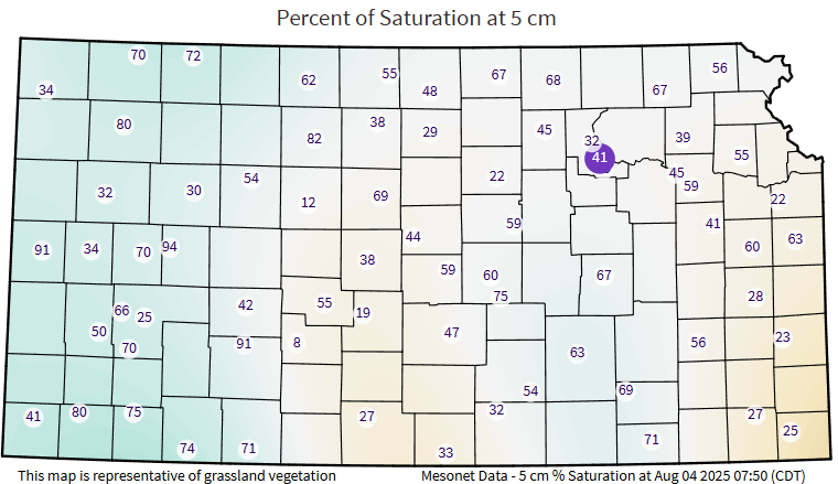
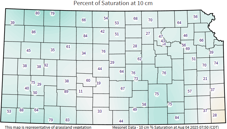
Regional Soil Moisture Outlook
Soils will slowly but steadily dry out throughout the forecast period as rain chances cease and temperatures slowly increase. While 10 cm soil saturation remains slightly higher than at 5 cm, this will slowly but surely dry out over the next week. Some abnormally dry conditions may begin to develop across northern and northeast Kansas once again from the overall dryness of the soils up to this point in the season. Evapotranspiration rates will slowly increase again with lack of rainfall and increasing temperatures.