General Central/Eastern Kansas Forecast
Short-Term (Thursday-Friday)
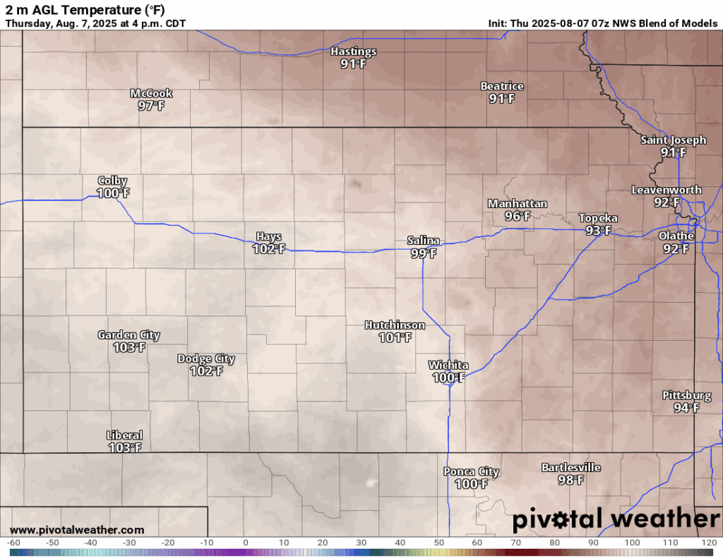
Not much will be changing across the region today and tomorrow, as we will continue to be hot and dry. Temperatures today look to reach the mid 90s to low 100s, with southerly winds of 10 to 20 mph gusting to 30. Heat indices today will reach the low to mid 100s, and as such, a Heat Advisory is in effect from 1pm this afternoon to 8pm this evening for portions of central and southeast Kansas. Low temperatures tonight will generally be in the upper 70s, but pockets of low 80s may exist as well.
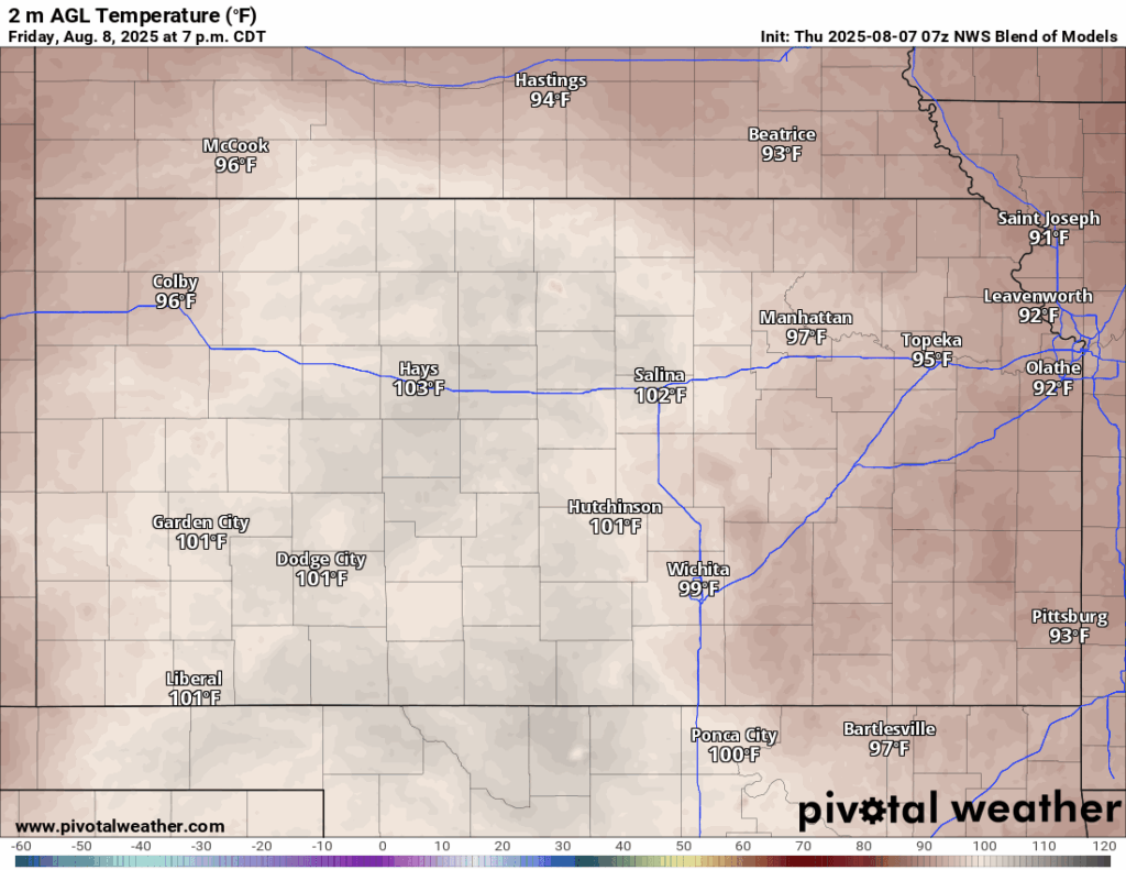
For tomorrow, wash, rinse, and repeat of today. Hot and dry conditions will continue, with high temperatures in the mid 90s to low 100s, with southerly winds of 10 to 20 mph gusting to 30. Heat indices will again reach the low to mid 100s, which has prompted continued Heat Advisories for central and southeast Kansas from 1pm to 8pm tomorrow. Temperatures overnight Friday/Saturday will be slightly cooler, making it down into the mid to upper 70s.
Long-Term (Saturday-Wednesday)
This weekend we are still looking at potentially another cold front coming into the area, helping to drop temperatures and increase rain chances. This front associated with a larger system traversing across the northern US will enter the state overnight Friday/Saturday and advance southeastward before stalling out across central to northern Kansas. Temperatures behind the front will drop into the low 90s and will generally increase rain chances in the vicinity of the front, but substantial ran chances don’t look to arrive until Sunday. This front will hang around for a couple of days before retreating back northward by Monday, letting us gradually warm up through the middle of next week.
Climate Outlook
Overall, long-range guidance does not suggest much change in conditions over the next month. High pressure looks to be firmly planted over the southwestern US for the second half of summer and will keep the hot and dry conditions around, as is the usual for this time of year. Temperatures will continue to be slightly above normal (up to 5 degrees above normal) and rainfall will be slightly below normal. Looking ahead into early September, we may start to get some more consistent return to northwesterly to zonal flow, which would bring down our temperatures a bit and steadily increase our rain chances somewhat, as large-scale weather systems would be more able to impinge on our area.
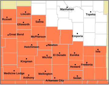
Regional Soil Moisture Outlook
Around Westmoreland

Around Scranton

Around Burlington


Around Altoona