General Central/Eastern Kansas Forecast
Short-Term (Monday-Tuesday)
Today looks to be another very hot and humid day across central and eastern Kansas this afternoon as we continue reside underneath a dome of high pressure. High temperatures today will again rise into the mid to upper 90s, increasing with westward extent, with southerly winds of 5 to 10 mph gusting to 20. Heat indices will continue to be absolutely brutal, with peak values ranging from the mid to upper 100s, potentially topping out at around 110. This all thanks to an extremely humid and oppressive airmass across the region, with dew point temperatures in the mid 60s to mid 70s and relative humidity values around 50-60%. As a result, a Heat Advisory is in effect for all of central and eastern Kansas through 8pm tomorrow. Low temperatures tonight will drop down into the mid to upper 70s area wide.
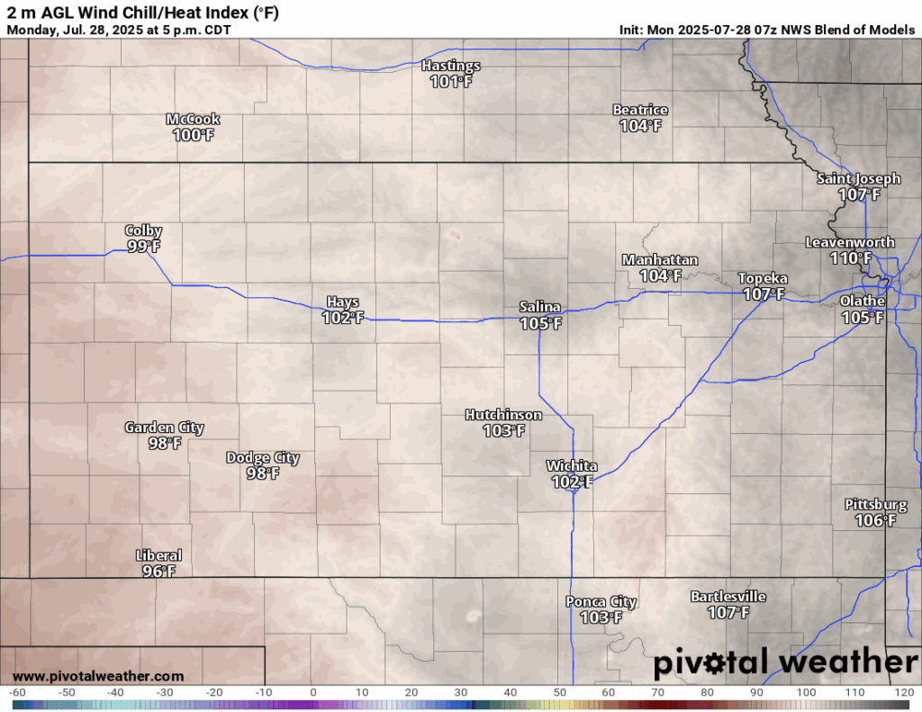
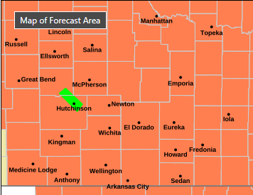
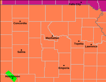
Tomorrow does not look to be any better than today, essentially copy and pasting today’s conditions. High temperatures again reaching the mid to upper 90s, with a south wind of 5 to 10 mph. Heat indices will reach the low to upper 100s, possibly peaking at around the upper 100s in the afternoon. Dew point temperatures and relative humidity values will be around the same tomorrow as well, ranging in the mid 60s to mid 70s and between 45-60% respectively. Low temperatures tomorrow night will reach down into the low to mid/upper 70s.

Long-Term (Wednesday-Sunday)
Relief from the heat does look to be on the way, as a strong cold front enters the region early Wednesday morning and advances southward throughout the day. As a result, scattered showers and thunderstorms will be possible throughout the day Wednesday and extending into Thursday along and behind the front. Heavy rainfall may again be seen, with new potential rain totals looking to reach locally up to 2 inches. Once this front passes, temperatures will fall dramatically to well below normal for this time of year, reaching daytime highs in the mid 70s to low 80s (!) for the rest of the week. Sporadic rain chances will persist the rest of the week as well but will be more isolated to regionally scattered in nature.
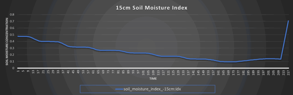
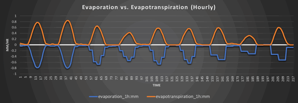
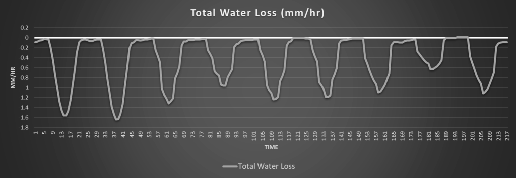
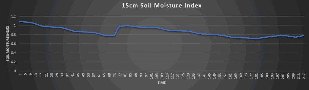
Regional Soil Moisture Outlook
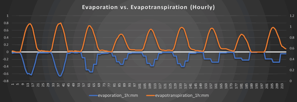
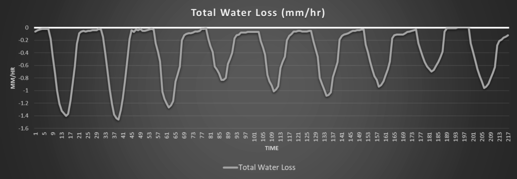
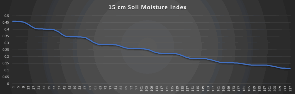
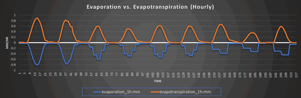
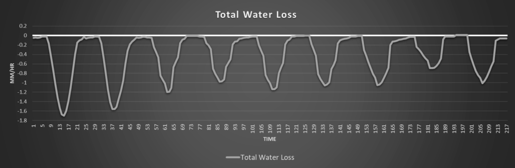
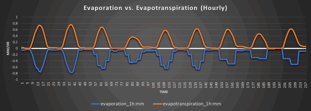
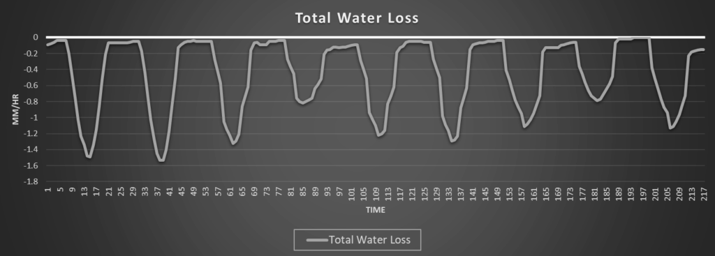
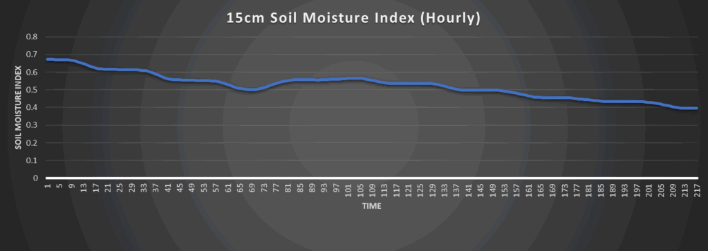
Soils will remain in relatively good shape, even with the heat over the next couple of days, due to the rainfall events of a few days ago. This will stave off any flash drought conditions, although areas that did not see as much rainfall may experience locally drier soils, but overall moisture content should remain fine even with daily water losses of 1.4 to 1.7 mm/hr today and tomorrow. Increasing rain chances by Wednesday will continue to moisten soils through the rest of the week, helping to improve drought conditions especially with the abnormally low temperatures expected.
Around Westmoreland
Around Scranton
Around Burlington
Around Altoona