“Feels like” temperatures will exceed 110 degrees in many areas in our region today, with scattered showers and possibly a thunderstorm to popup later this afternoon and into the evening. Moving forward, heat indices will stay relatively high, and more afternoon storms will be coming through our area throughout the rest of the week and into next weekend. Let’s get into the details:
Our Current Setup
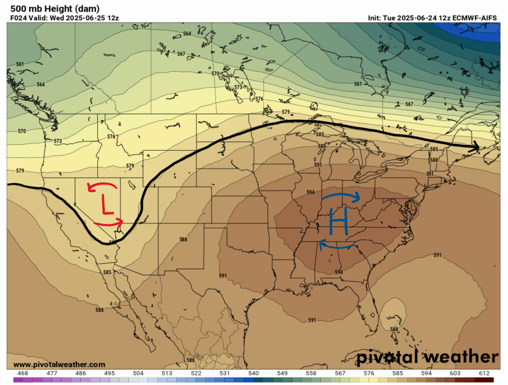
Looking at our upper-air map, we can see a trough over the Southwest, and our region is currently located under a ridge and an area of high pressure. Over time, this ridge will diminish and we will find ourselves under a trough by next week.
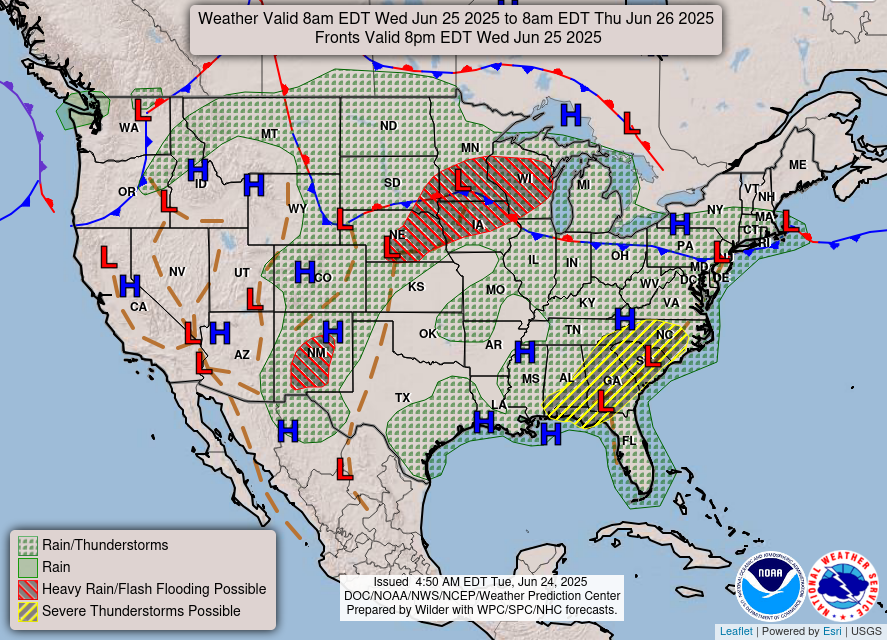
Looking at out National Forecast Chart on the surface level, we can see once again that we are in an area of high pressure, but some rain and thunderstorms are possible, with severe storms even being possible for much of southern Alabama, due to that associated low pressure area over Georgia and South Carolina.
Today’s Weather:

There is still a heat advisory for our region today, due to temperatures reaching the mid 90s in many areas, with high dewpoints making it feel much hotter than the actual temperature:
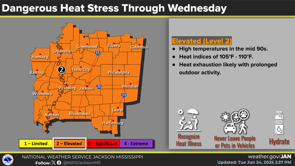
Like the graphic says, today it will be crucial to be extra careful in the heat today. If possible, try to stay inside in the air conditioning, and if you have to be outside today, make sure to stay hydrated, take lots of breaks, find a shady spot, and wear looser clothing. For a more detailed look, check out the experienced, or “feels like” temperatures for today:
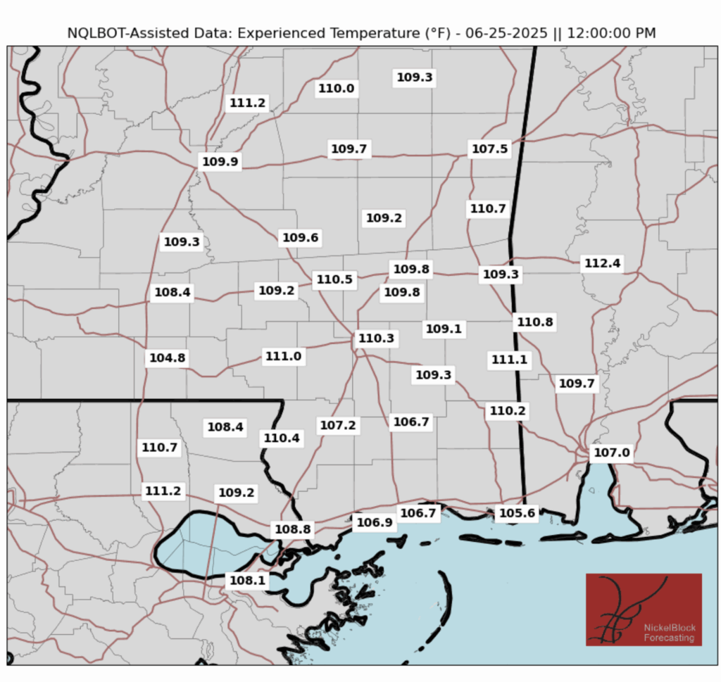
In many areas, the experienced temperatures will break 110 degrees!
As for the rain, The Storm Prediction Center has part of the area under a Marginal Risk and other sections under a Slight Risk – that is a “1” and a “2” on the 1-to-5 scale, where a “5” is the highest risk for the most significant severe weather.
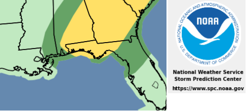
The Storm Prediction Center noted the risk for today is mainly for strong wind gusts from stronger storms that may form along sea-breeze boundary convergences.
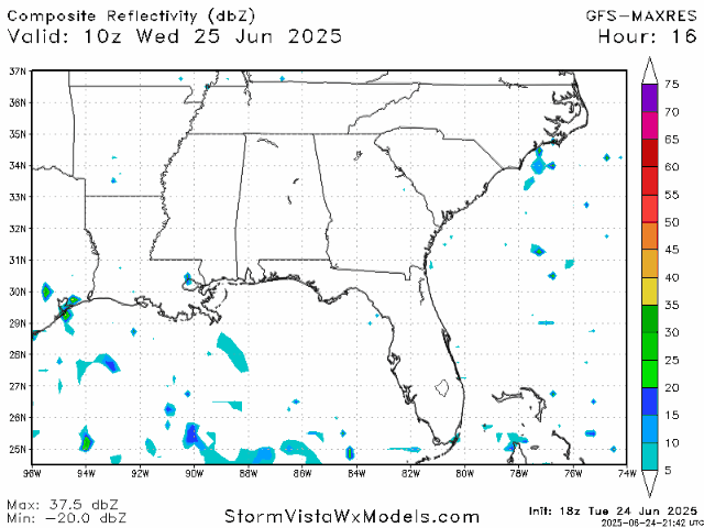
Looking at our precipitation for today, we can see some light, scattered showers beginning in the early evening, around 5pm, and persisting through the night. Since these storms will be scattered and clustered, we don’t expect organized severe weather. So if a storm does necessitate any type of warning, it will likely be short-lived.
Looking Forward:

As I mentioned at the beginning of this post, our upper-atmosphere will be shifting into a trough over our region very shortly, and there is also a shortwave coming in causing an MCS, increasing our chances for severe storms going into next week. An MCS (Mesoscale Convective System) is just an organized cluster of thunderstorms that typically last for a few hours or longer. Although it is too early for any watches, warnings, or advisories for severe weather to be issued just yet, it is definitely something to keep an eye on.
It will also be very important to look out for any more heat advisories for the rest of this week and next week, as our heat indices will stay above 105 degrees for the most part. Of course, NickelBlock will keep you updated with any heat or severe weather concerns!
Regional Day-to-Day Forecast
Today: Sunny in the morning with a chance of showers and thunderstorms later in the afternoon/evening. Highs in the low 90s, with heat indices from 105-110 degrees. Chance of precipitation 50%.
Tonight: Showers and thunderstorms throughout the evening. Lows in the mid 70s. Chance of precipitation 60%.
Thursday: Mostly sunny in the morning with a chance of showers in the afternoon. Highs in the low 90s during the day and lows in the mid 70s at night. Chance of precipitation 40%.
Friday: Mostly sunny in the morning with a chance of showers in the afternoon. Highs in the low 90s during the day and lows in the mid 70s at night. Chance of precipitation 30%.
Saturday: Mostly sunny in the morning with a chance of showers in the afternoon. Highs in the low 90s during the day and lows in the mid 70s at night. Chance of precipitation 50%.
Sunday: Mostly sunny in the morning with a chance of showers in the afternoon. Highs in the low 90s during the day and lows in the mid 70s at night. Chance of precipitation 40%.
Monday: Mostly sunny in the morning with a chance of showers in the afternoon. Highs reaching 90 during the day and lows in the mid 70s at night. Chance of precipitation 50%.
Tuesday: Mostly sunny in the morning with a chance of showers in the afternoon. Highs reaching 90 during the day and lows in the mid 70s at night. Chance of precipitation 50%.
Wednesday: Mostly sunny in the morning with a chance of showers in the afternoon. Highs reaching 90 during the day and lows in the mid 70s at night. Chance of precipitation 50%.


