Hey everyone! For your CONUS weather forecast, we will be discussing the severe weather threat for the upper Plains/upper Midwest as well as in the southeast over Georgia and South Carolina. We also have a look at the weekly outlook outlined by region! Let’s take a look at all of the details:
Today’s Overall Setup
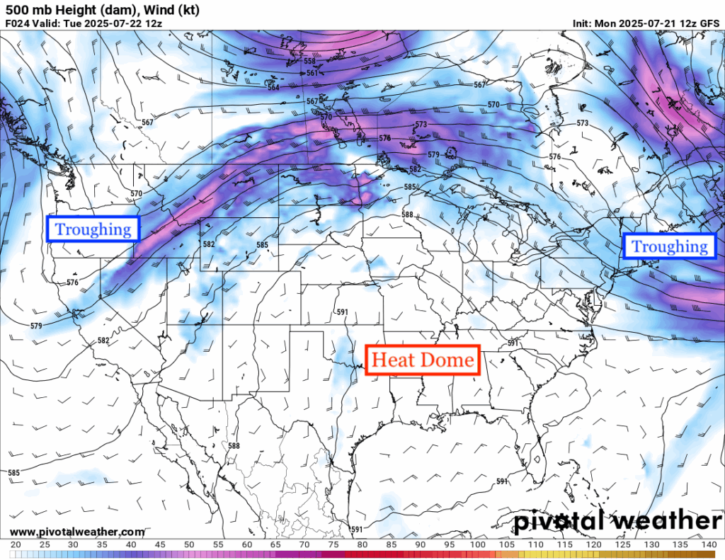
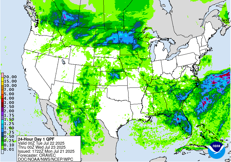
The ridging over the central and eastern part of the country is acting as a heat dome, bringing hazardous high heat and dry weather for those under it. For those on either side, there is some unsettled weather to deal with, including flooding rain in the southwest desert region, the northern Plains and upper Midwest, as well as coastal Georgia and South Carolina. A severe weather threat also exists over the northern Plains and upper Midwest, as well as a less of a severe weather threat in Georgia and South Carolina.
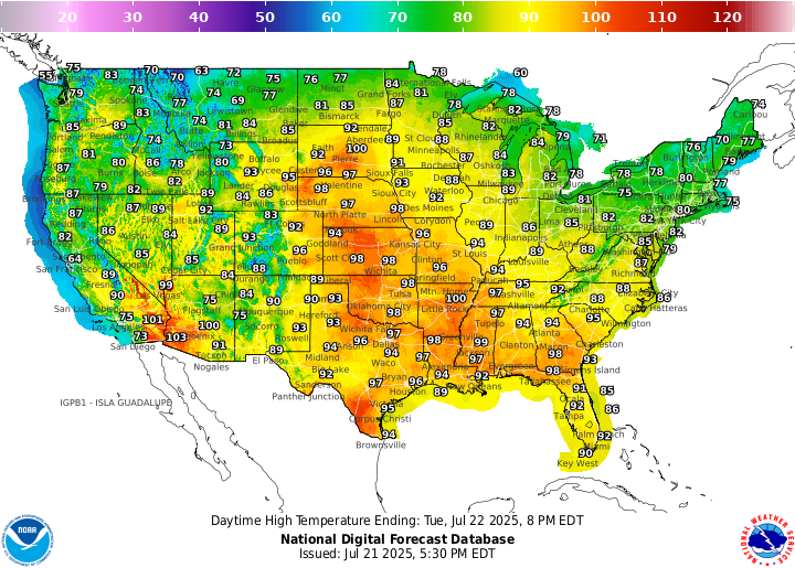
Here’s a look at the high temperatures today across the CONUS. You can see that areas under the heat dome are approaching 100 today and areas outside of it are actually seeing much cooler temperatures than average. For example, the northeast will see a high in the high 70s and low 80s today with very little humidity due to the northwesterly flow from above, bringing in the cooler temps and a drier airmass.
Today’s Severe Weather Threat
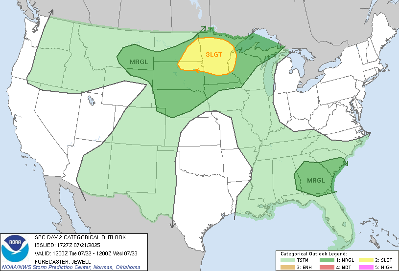
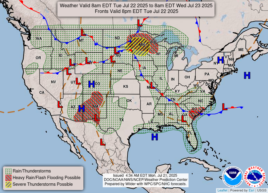
It wouldn’t be a summer day without some area in the country outlined for a severe weather threat! A Slight (Level 2/5) risk is outlined in yellow for those in the northern Plains and upper Midwest regions. This is primarily a hail and wind driven risk, with a 2 percent tornado risk, a hatched 15 percent wind risk, and a hatched 15 percent hail risk. What that means is that there is a 10 percent or greater probability of two inch diameter hail or larger within 25 miles of a point, or winds 65 knots and higher.
For the southeast, there is Marginal (Level 1/5) risk of severe weather for those in Georgia and South Carolina. Alabama and northern Florida could see some spotty action from this as well. This risk zone is only a wind driven one, with a 5 percent chance of winds greater than 50 knots within 25 miles of a point.
Upper Plains/Upper Midwest Severe Weather
Let’s look at the timing in the upper Plains and upper Midwest. The storms from yesterday’s severe weather will continue east into the region at around 8 am. This will continue into the afternoon and evening, though the greatest risk of severe weather is in the morning hours. Stay weather aware during this event!
Southeast Severe Weather
For those in Georgia or South Carolina, you can expect storms to start in the early afternoon, sticking around through the evening into the early night. The SPC is concerned with severe storms due to the interaction between a sea breeze, elevated terrain, and a surface trough being in the area. Damaging winds are the most probable threat if severe storms were to form, so tie down the outdoor furniture and be weather aware in the afternoon and evening!
Tomorrow’s Severe Weather
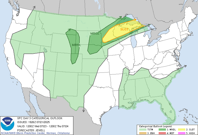
The severe weather doesn’t end after today! The system moves east in the northern tier, effecting those in southern Minnesota and northern Wisconsin and Michigan. I would not be surprised if an upgrade is put in place by the SPC, since this is already a Slight risk at day 3! Check back on my posts for the recent updates.
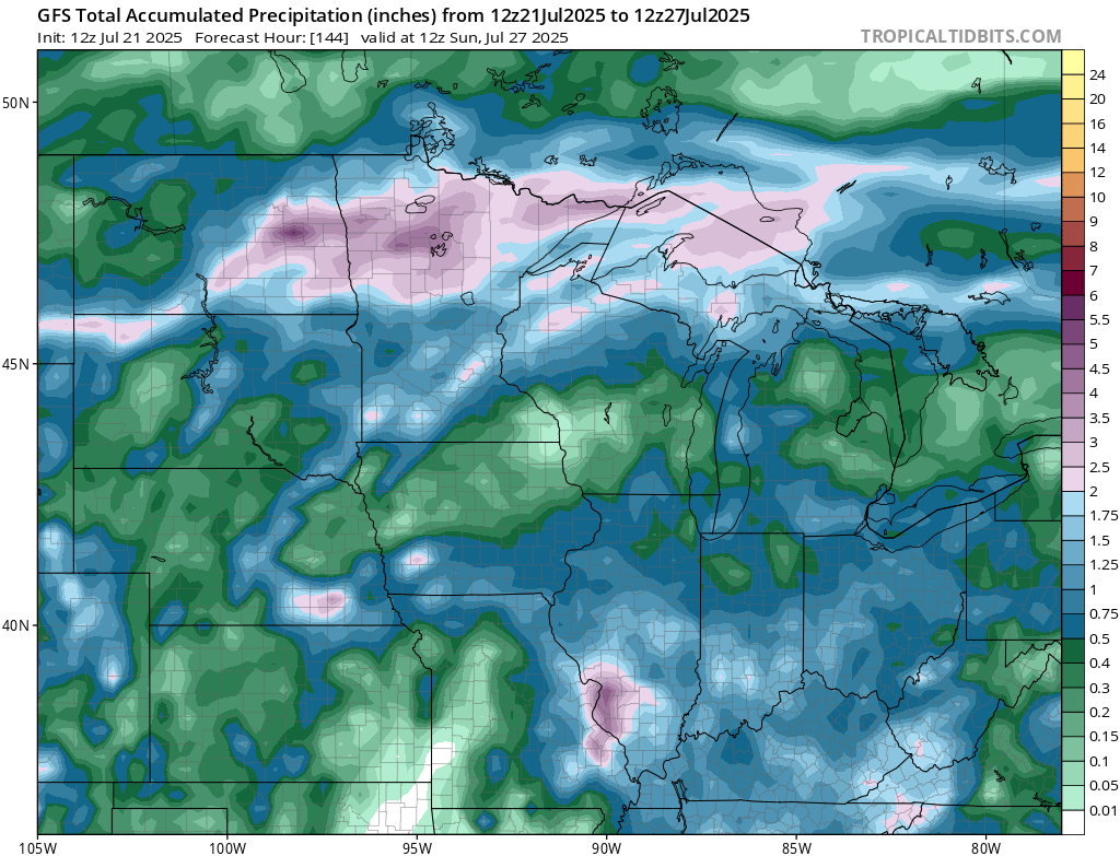
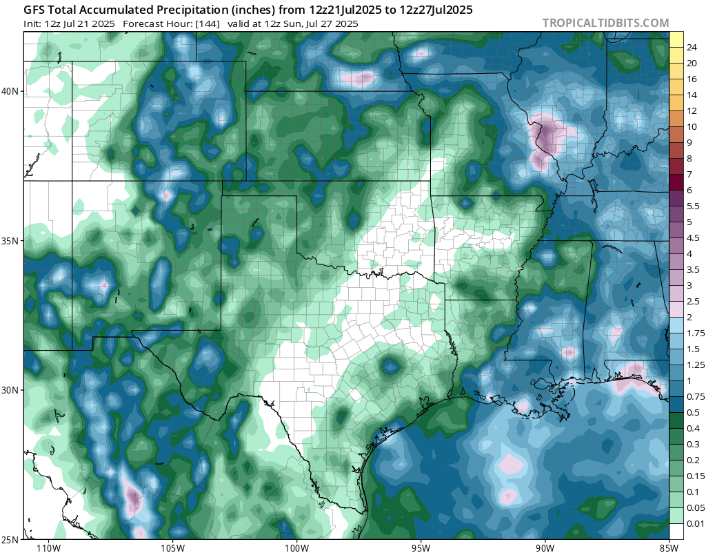
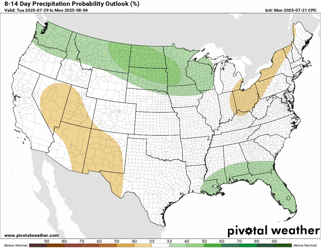
CONUS Weekly Precipitation Outlook
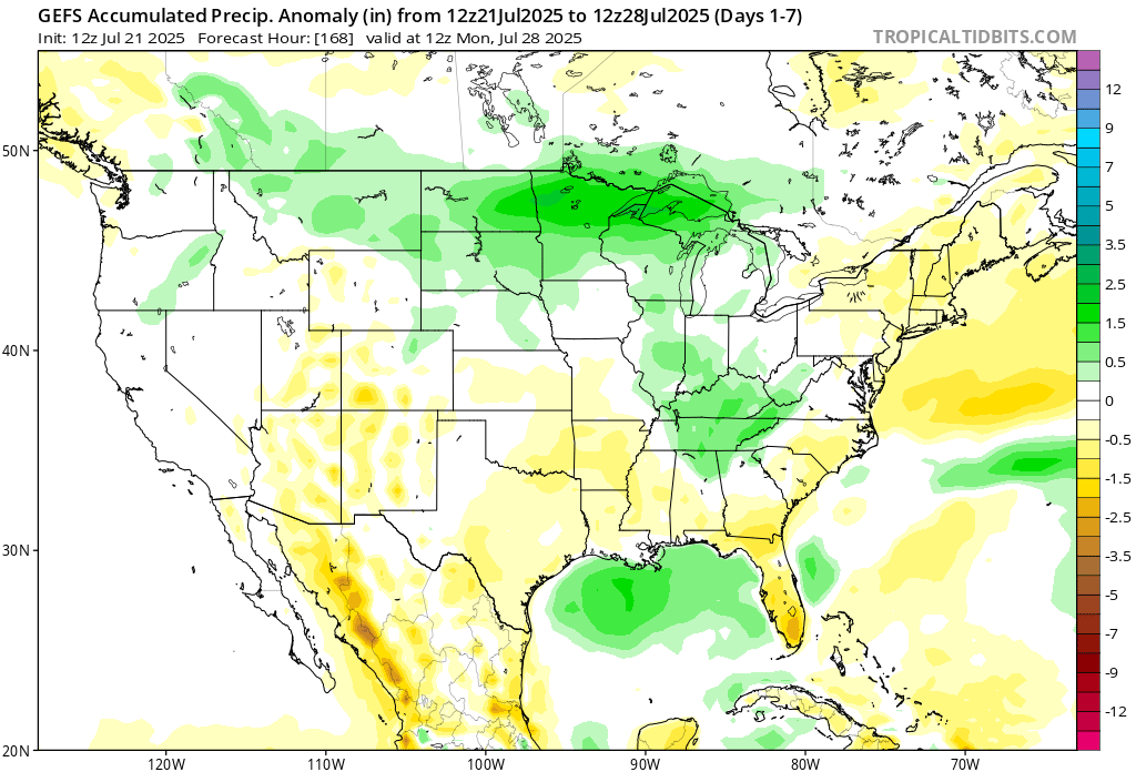
Here’s a look at the GEFS modeled precipitation anomalies through Monday 12z. Green indicates above average precipitation, white indicates average precipitation, and yellow indicates below average precipitation. Let’s look into the details by region:
Weekly Outlook: Western United States
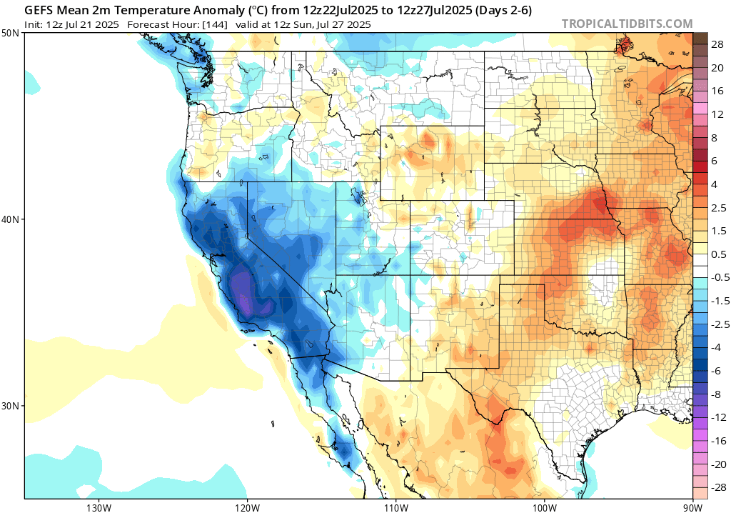
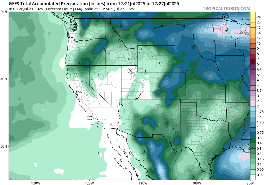
Looking into the week, the west region will mostly see cooler than average temperatures. Central coastal California is expected to be much cooler than average. A cutoff low will sit around the area and keep temperatures 10-15 degrees below average!
Weekly Outlook: Central United States
In the northern Plains, today’s and Wednesday’s rounds of rain will bring up the weekly rain total, as well as some more rain chances this weekend. 5-8 inches with locally higher amounts is certainly possible this week. Wetter than average conditions are expected when the week is all set and done.
A decent amount of rain will fall over Arizona and New Mexico this week, which always brings the threat of flash flooding in these dry areas. Rainfall anomalies are sitting below average for this region as a whole this week.
Weekly Outlook: Eastern United States
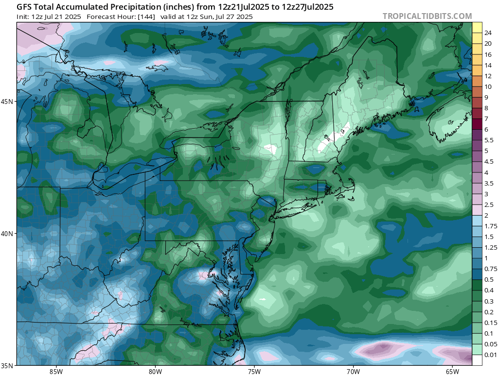
A nice high pressure system will sit over the northeast this week, with rain back in the forecast for the weekend. Below average rainfall is expected for the week, due to the weekdays being so dry!
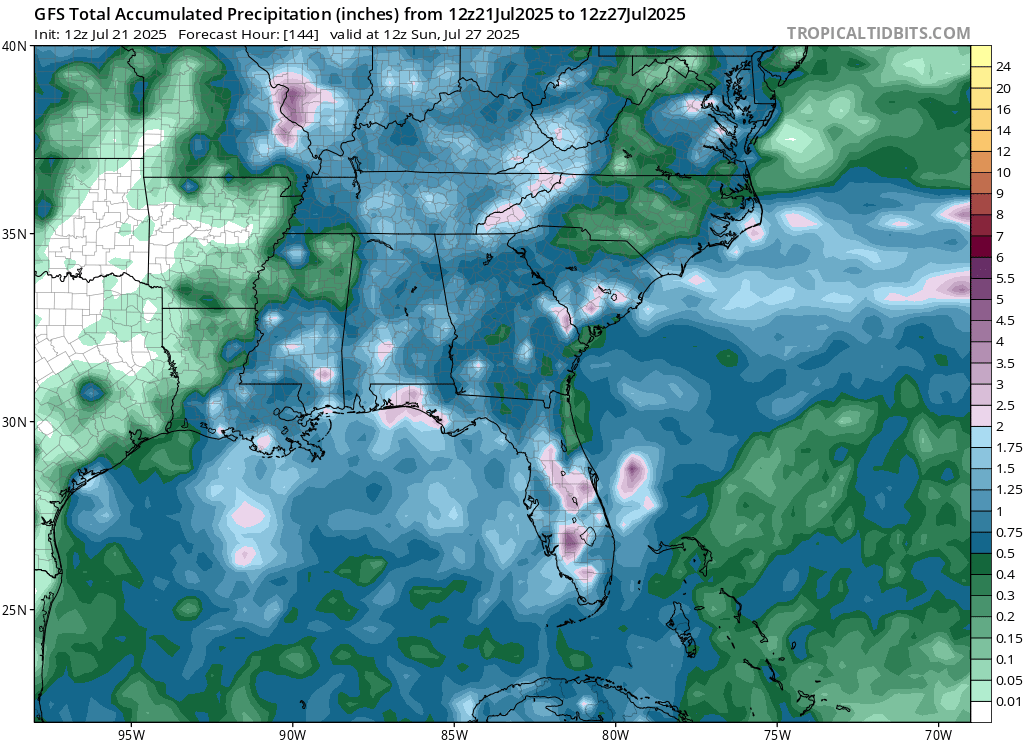
A stalled frontal boundary will hang out over the southeast coast this week, which will bring scattered rain to those in the region. We are watching the remnant moisture from last weeks Invest 93L, which is still expected to travel back into the Gulf and bring some rain with it.
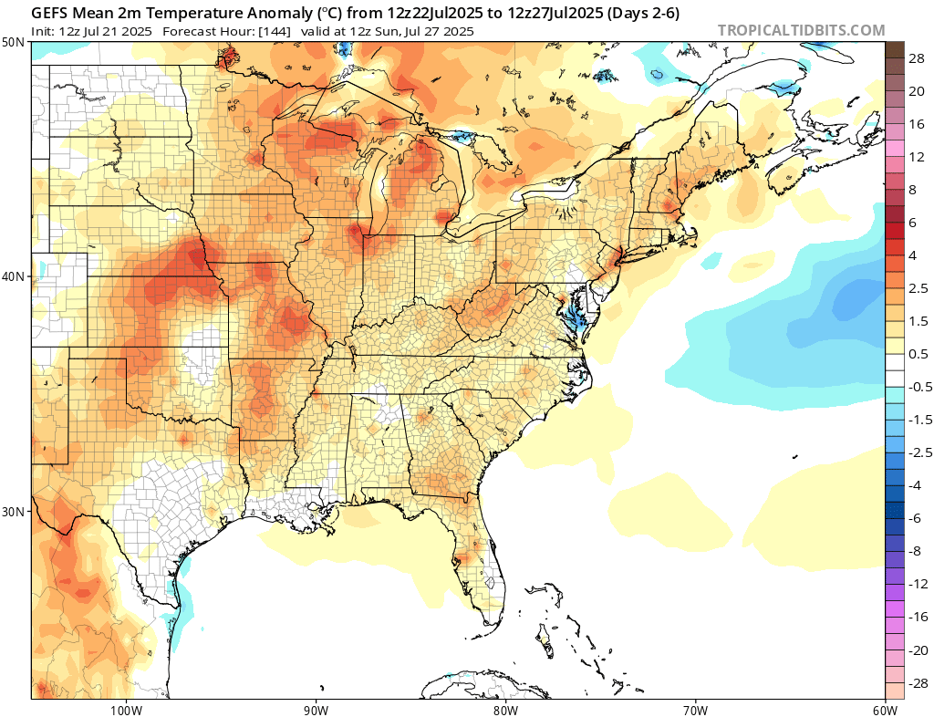
A warm week ahead is expected for the entire east region under the heat dome of high pressure! Summertime is in full swing!
Travel Outlook
Storms in the northern risk zone will kick off in the morning and push east through the day. If you’re driving on I-94, I-90, I-29, or I-35 through eastern Montana, the Dakotas, Minnesota, or western Wisconsin, be ready for on-and-off storms, likely severe.
In the Southeast, storms will be more hit-or-miss but could get strong by the afternoon. Areas along I-20, I-75, I-85, and I-95 in places like Georgia, and the Carolinas may run into some slowdowns through the evening.
Just a reminder, if you’re on the road, check radar updates and pull over if needed.
Extended Outlook
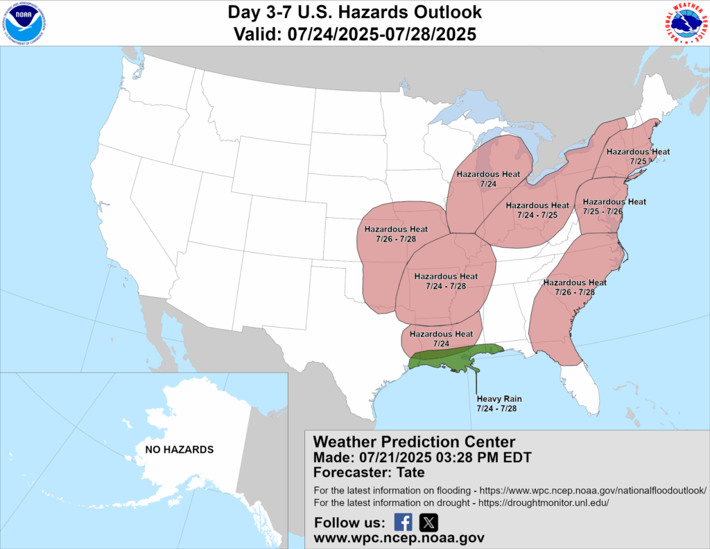
Above is a look at the U.S Hazards Outlook from NOAA , highlighting areas of extreme weather to be aware of for the next 3-7 days.
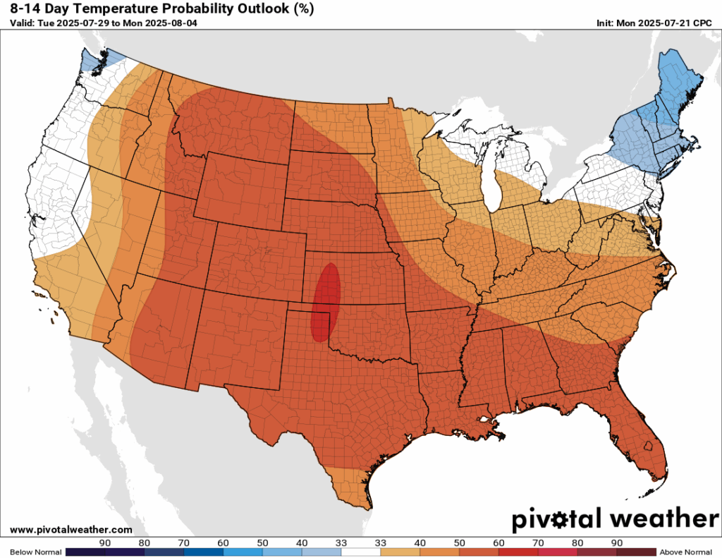
Looking further ahead into next week, current signals are for an above normal temperature anomaly for almost all of the country, with a higher chance in the central part of the country. Models are expecting a very large ridge to take shape, even larger than the one we are seeing this week. This will also keep rainfall near normal or even below normal for those in the southwest or Midwest and interior northeast. Some above normal rainfall is possible in the northern tier and the coastal southeast.
Thanks for tuning in to this National Forecast! Tune in to our local, tropical, and regional forecasts to stay updated on the latest!


