Good morning, and happy Thursday to everyone! Today’s update brings a lot of good news, so let’s get into it!
First, looking at the tropics, which I will do in more detail in a separate post, the NHC has completely done away with the system in the Gulf-meaning that formation is NOT expected. Over the past few days, they’ve given it between a 20- and 30-percent chance of forming, but yesterday they decided to stop forecasting formation at all.
To be clear, all of the impacts that were forecasted to occur will still occur-heavy rain and flooding will remain a big issue for parts of the region, but this means that we likely won’t be dealing with a more organized system that could bring strong winds.
Let’s look at the current state of the atmosphere and see where we’re at right now:
First, we’ll start with a 500 mb mab, which shows us the general location of high and low pressure systems.
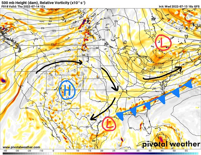
This map also shows 500 mb vorticity, which is a measure of how the air rotates. High vorticity moving around the planet can lead to rising air, and that means more unsettled weather, so it’s an important thing to look at.
Looking at the current conditions, we have a pretty strong high pressure system situated over the Southern Rockies. This is a change from previous weeks when it was stuck over the Southeast.
Looking over towards our part of the country, there is actually a trough over our area-that is to say, an area of lower pressure.
The long strip of oranges and reds indicate a decaying frontal boundary-this has been mentioned in previous discussions but this old front is going to stay put over our area, decay, and produce showers and thunderstorms.

Looking at this atmospheric moisture anomaly map, you can see that relatively drier air is located in the Tennessee and Ohio Valleys, while air over the Deep South is more humid than usual this time of the year. This measure of atmospheric moisture helps us see potential for heavy rain, which we will have up and down the frontal boundary.
In fact, the rainfall potential from this system is pretty high!

As I usually do, I have the 7 day rainfall forecast from the WPC. Widespread 1-2” totals are anticipated, but some areas may see rainfall as heavy as 3” or perhaps an isolated 4”.
With that being said, the WPC has also forecast a flash flood risk for this area today and tomorrow.
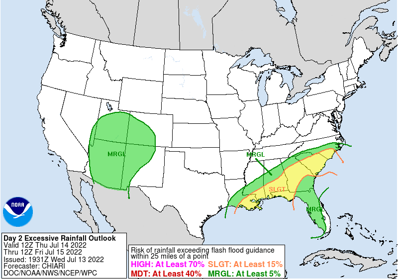
Today’s flash flooding risk // Courtesy: WPC 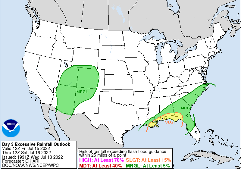
Tomorrow’s flash flooding risk // Courtesy: WPC
Since the front will pass through over the next few days, the flood risk will also push South, and will be the highest today. Last night, some flooding happened in Waynesboro, but it was localized and not too severe, which is probably what’s likely to happen today and tomorrow.
Some good news is that our temperatures are going to be lower as long as the thunderstorms are around. After Hattiesburg hit a heat index of 105 yesterday, some cooler weather will be a welcome sight for all of us around here.
Over the next few days, the frontal boundary will slowly push to the South, and ridging will push back into the area.

Looking at the 500 mb map for tomorrow, we can see the front has not moved much. It’s a little further South, but really, not much has changed. This slow progression sets the stage for a drawn out rain event.

This is the temperature anomaly map over the next 5 days, and since we have that frontal boundary and the thunderstorms, we will actually see cooler temperatures than average over the area. What this means is that instead of seeing temperatures in the mid 90s, we’ll have more upper 80s.
Looking a little more in detail on today, we will see some thunderstorms develop during the day. Current models indicate that thunderstorms will develop in the early afternoon, and slowly move to the South.

Since there will be a lot of instability, and moderately high DCAPE (downdraft potential), we will have to watch some of the storms for damaging wind gusts. The risk isn’t all that great, and is lower than yesterday’s risk, but we may see some strong thunderstorms.
The Storm Prediction Center doesn’t have a risk outlined, but don’t be surprised to see a strong storm or two.
Day-to-Day Forecast
Today
Mostly cloudy with an 80-percent chance of afternoon thunderstorms. Highs in the upper-80s. Some storms may be strong.
Tomorrow
Party cloudy, with a 60-percent chance of afternoon thunderstorms. Highs in the upper-80s.
Saturday
Mostly sunny, with a 30-percent chance of afternoon thunderstorms. Highs in the upper-80s.
Sunday
Clouds increasing throughout the day, with a 60-percent chance of rain and thunderstorms in the afternoon. Highs in the mid-80s.
Monday
Partly cloudy, with a 60-percent chance of afternoon thunderstorms. Highs in the upper-80s.
Tuesday
Mostly sunny, with a 60-percent chance of afternoon thunderstorms. Highs in the low-90s.
Wednesday
Mostly sunny, with a 50-percent chance of afternoon thunderstorms. Highs in the low-90s.


