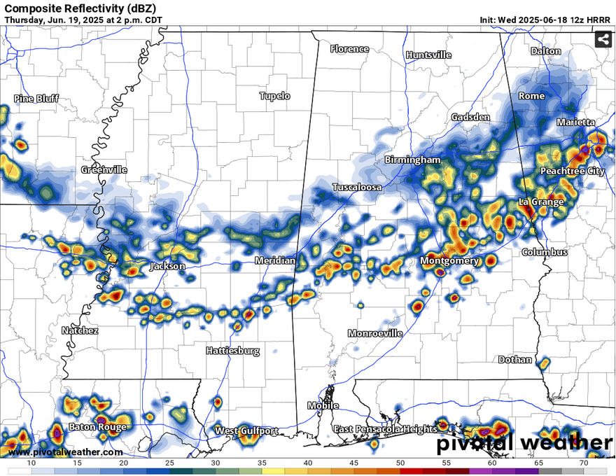
There’s been a steady stream of thunderstorms developing from the southwest. It’s almost been like a conveyor belt of storms across much of Louisiana and Mississippi. Outflow boundaries are pushing out from the cells which will enhance some thunderstorm development and inhibit others across much of south Mississippi.
Thunderstorms will continue on across south Mississippi for the remainder of the afternoon and they’ll lose much of their mojo by sunset. This will cool us off a bit by the evening hours. Tomorrow will be another chance for thunderstorms, this time from a front farther north. Expect an MCS line of thunderstorms to move through most of the Deep South states during the afternoon hours and move south by the evening.
Friday is when we’ll get some real heat. The “experienced temperature” will feel like it’s over 100 degrees! Be sure to stay cool and keep plenty of fluids with you if you’re outside. Some afternoon thunderstorms will help to cool it off, but the heat index will ramp up by the early afternoon. Saturday and Sunday will also be very hot with temperatures in the mid 90s and heat indices in the triple digits. Both will have a chance of thunderstorms developing from the coast by the afternoon, but not without the overwhelming heat first.
Select Data Set:


