General Central/Eastern Kansas Forecast
Short-Term (Thursday-Friday)
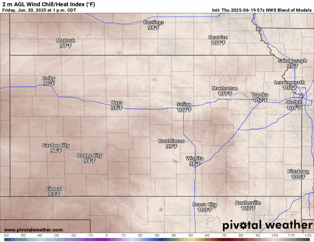
The heat will be on the rise today and tomorrow, as a high-pressure system fully displaces the trough to our east and sits over us, resulting in hotter and drier conditions. Temperatures today will jump into the upper 80s to low 90s, with southerly winds at 5 to 15 mph. Dew point temperatures today won’t be as bad as later in the week, with temperatures in the 60s and relative humidity between 35-50%. For tonight, low temperatures will be quite warm in the low to mid 70s. Tomorrow’s highs will be a touch higher, in the low to upper 90s, with a much stronger southerly wind of 25 to 40 mph. Heat indices will break the 100-degree mark during the afternoon, as dew point temperatures rise into the low to mid 70s. Low temperatures tomorrow night will be very warm, being in the upper 70s to low 80s.
Long-Term (Saturday-Wednesday)
Long-term offers more of the same as today and tomorrow, as temperatures stay in the 90s daily. Some rain chances to try to return by Sunday-Monday as the high-pressure system gets moved off to the east enough to allow for some disturbances to pass through. The discreteness and subtleness of these features however will keep our overall chances for rain low and rather isolated at this current time.

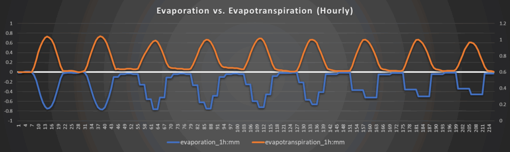
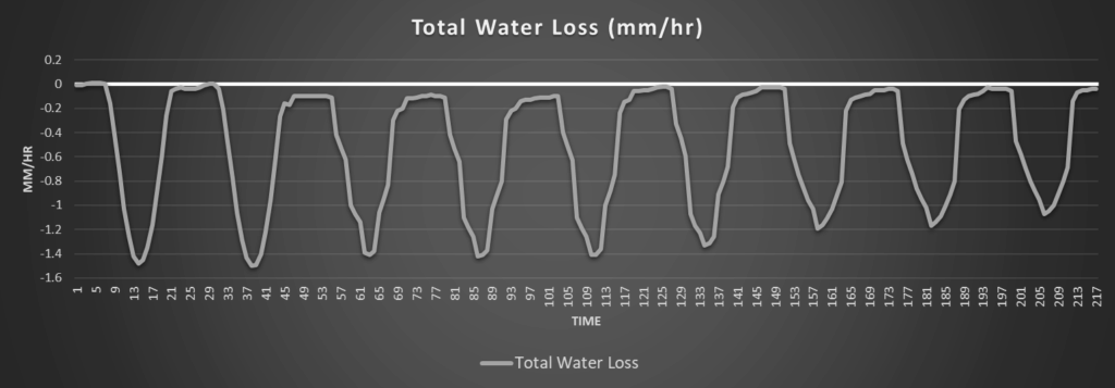
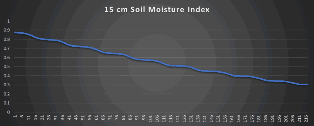
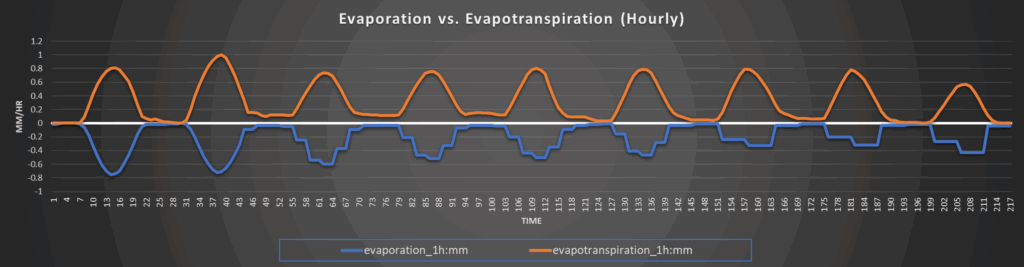
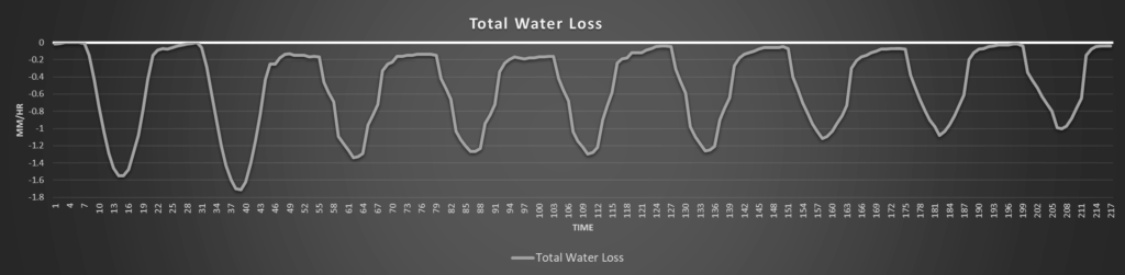
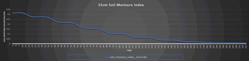
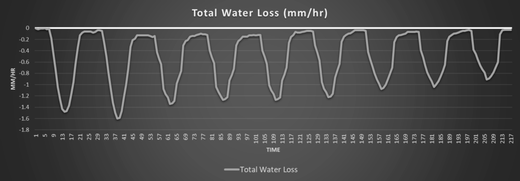
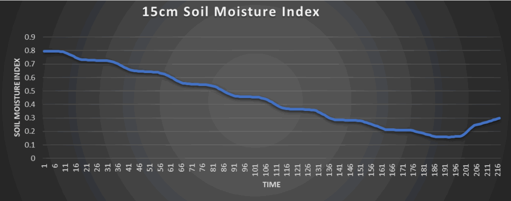
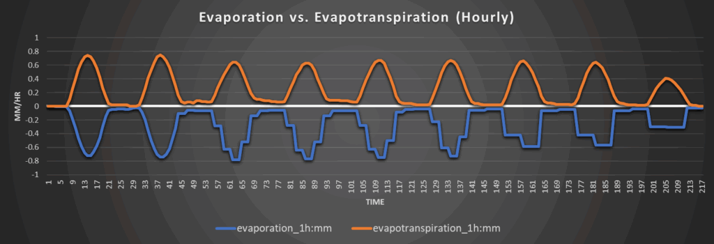
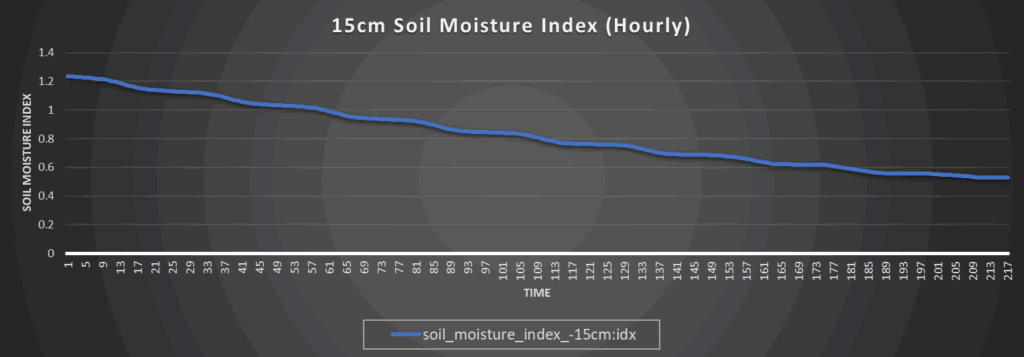
Regional Soil Moisture Forecast
Drying out will still continue over the region as rain chances become minimal over the next several days and the heat increases. Those in south central-Kansas will still fare better and maintain at least some saturation over 7 days while pockets in central and northern Kansas may be completely dry by that point,
Around Westmoreland
Around Scranton
Around Burlington
Around Altoona