This weekend’s weather is off to a good start, with a nice ridge coming in with a high pressure area placed perfectly over our region, helping to diminish some of the soggy weather. High temperatures reaching the mid 90s and high dewpoint will create excessive heat indices, so taking extra time to be safe in the heat will be very important this weekend and next week as well. Let’s get into the details:
Our Current Setup:
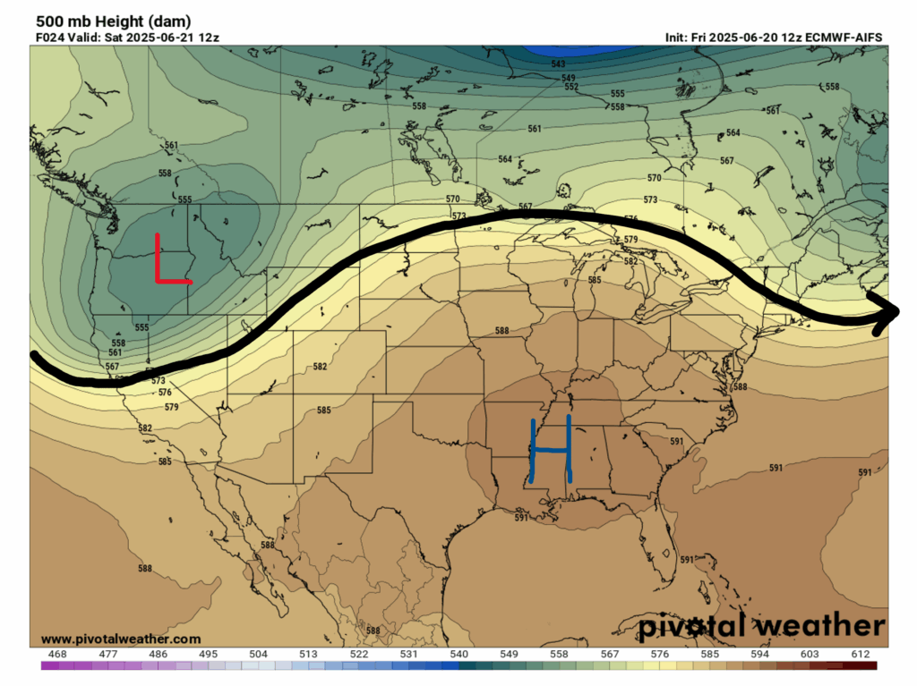
Looking at our 500 mb map for today, we can see a trough and low pressure area over the Pacific Northwest, and a large ridge with an associated high pressure area right over us. The pro of this setup is that it will relieve us from some of the stubborn wet weather we’ve been experiencing, but the con is that we will experience some excessive heat in our area, especially this weekend and going into next week.
Now focusing on our surface map, we can see that there is some rain and thunderstorms forecasted in our region today, but that will most likely be the typical popup shower that rolls in around the afternoon. With this ridge starting to form over us, we can expect some longer stretches of dry weather, with scattered showers and thunderstorms still coming through, but smaller and not very long-lasting. Also, there are no nearby fronts moving toward us, also minimizing the amount of soggy weather.
This Weekend’s Weather:
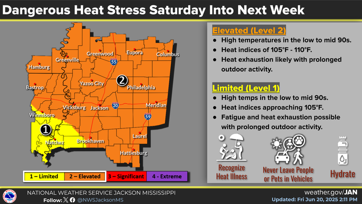
The most important thing to keep in mind for this weekend’s weather is high heat indices beginning today and going into next week. Every day high temperatures will reach the low to mid 90s, and in combination with high dewpoints it’s going to feel much hotter than the actual temperature. Check out the experienced temperatures for both days this weekend:
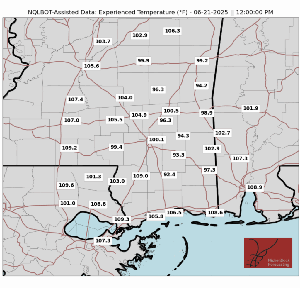
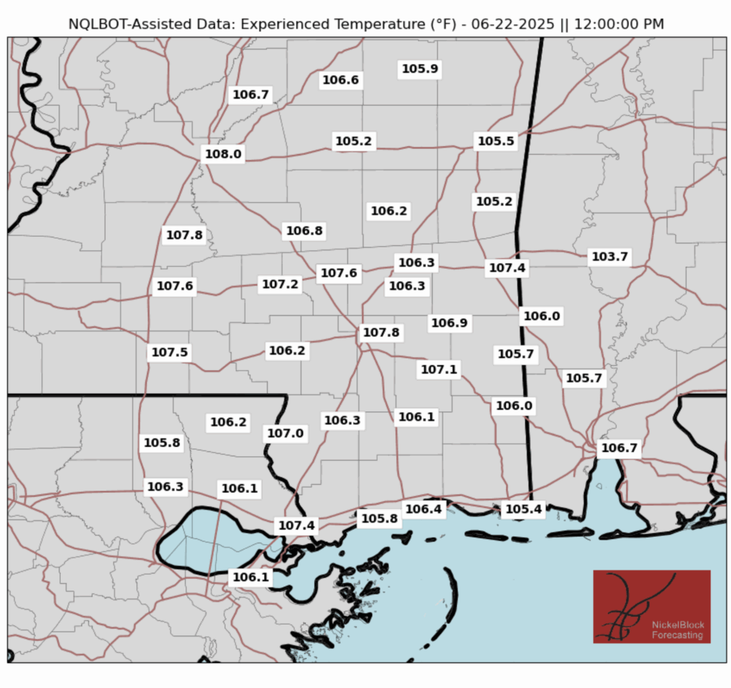
We can see that across the region, the “feels like” temperatures will exceed 100 degrees, and in many places break 105. It is extremely important that if you plan on being outside this weekend and even into next week that you stay hydrated and take plenty of time to rest in a cool spot!
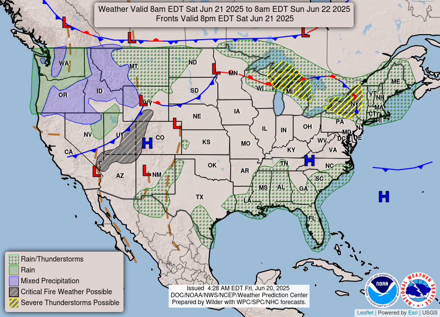
Looking at the forecasted precipitation, we can still see some scattered showers throughout the weekend, but they are pretty light and short-lived. Also keep in mind that thunderstorms are still possible even though the threat for severe weather is not very high, so it’s not a bad idea to take a quick look at the radar before heading outside.
Next Week’s Weather:

As you can see in the 15-Day forecast, our rain chances are looking very low, a less than 10% chance every day, and while storm chances are higher, they are below 50% for the most part. This is because of that big ridge that’s building in over us, fending off the wet, stormy weather. Similar to this weekend, heat indices will be quite high, with experienced temperatures even breaching 110 degrees some days. Once again, being careful in this heat will be absolutely necessary, and make sure to stay tuned to NickelBlock for more updates!
Regional Day-to-Day Forecast:
Today: Sunny skies in the morning with a slight chance of showers and thunderstorms in the afternoon. Highs in the low 90s. Chance of precipitation 20%.
Tonight: Partly cloudy. Winds will be calm. Lows in the mid 70s.
Sunday: Sunny skies in the morning with a slight chance of showers and thunderstorms in the afternoon. Highs in the low 90s during the day and lows in the mid 70s at night. Chance of precipitation 50%.
Monday: Sunny skies in the morning with a chance of showers and thunderstorms in the afternoon. Highs in the low 90s during the day and lows in the mid 70s at night. Chance of precipitation 60%.
Tuesday: Mostly sunny skies in the morning with a chance of showers and thunderstorms in the afternoon. Highs in the low 90s during the day and lows in the mid 70s at night. Chance of precipitation 60%.
Wednesday: Mostly sunny skies in the morning with a slight chance of showers and thunderstorms in the afternoon. Highs in the low 90s during the day and lows in the mid 70s at night. Chance of precipitation 20%.
Thursday: Mostly sunny skies in the morning with a slight chance of showers and thunderstorms in the afternoon. Highs in the low 90s during the day and lows in the mid 70s at night. Chance of precipitation 20%.
Friday: Mostly sunny skies in the morning with a slight chance of showers and thunderstorms in the afternoon. Highs in the low 90s during the day and lows in the mid 70s at night. Chance of precipitation 20%.
Saturday: Sunny skies in the morning with a slight chance of showers and thunderstorms in the afternoon. Highs in the low 90s during the day and lows in the mid 70s at night. Chance of precipitation 30%.


If the rain chances are going away (which is a welcome relief), why do you have a 60% chance on Monday and Tuesday? Even the NWS, which is notorious for getting carried away with the rain chances, is only showing a 40% on Monday and 30% on Tuesday.