Overall Setup
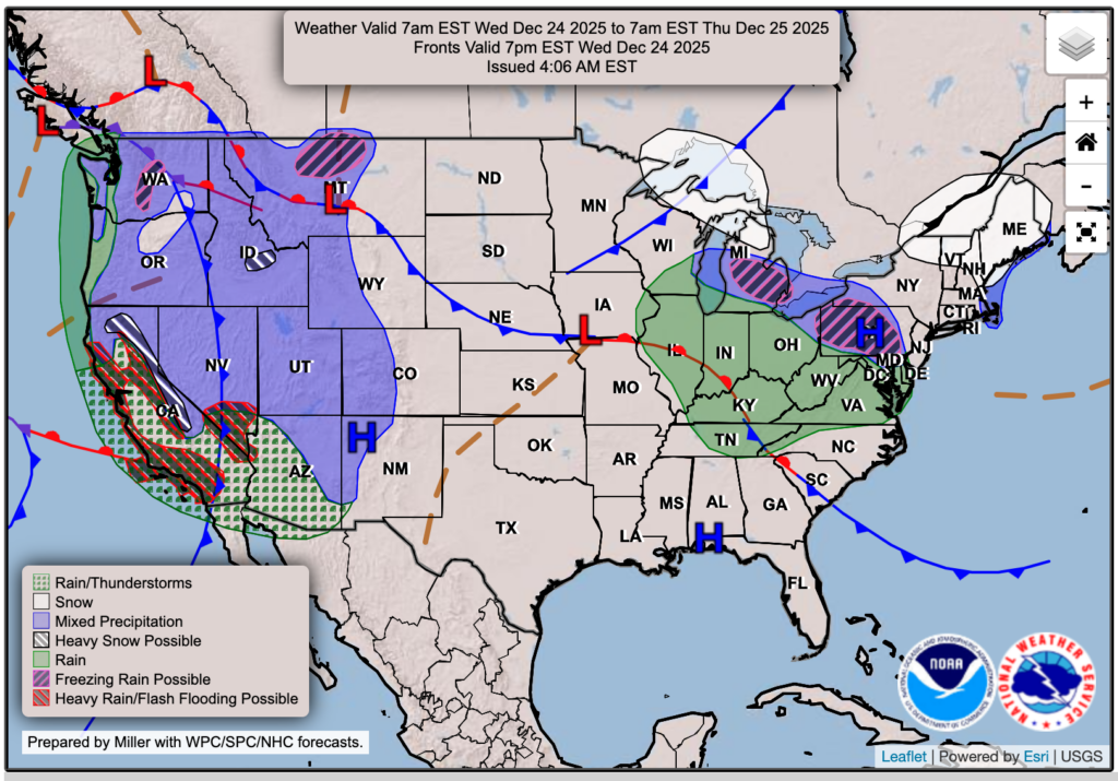
Merry Christmas Eve Eve! I chose to zoom out on the surface map above for tomorrow to show how much weather will be impacting travel on this busy travel day for much of the West, the Midwest, parts of the mid-Atlantic, and New England. It’ll be quite the hassle for them. For us, though, nothing in the way of the weather will get in your way for tomorrow if you’ll be on the roads, assuming you are staying in our region of the US. A nice high pressure will keep skies clear, but also rather warm for our Christmas Eve.

Tonight’s Forecast
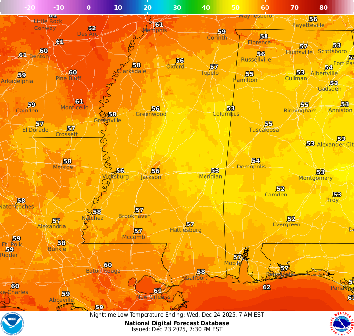
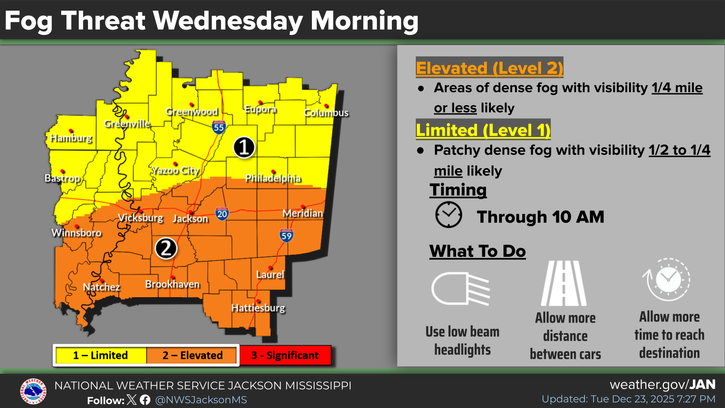
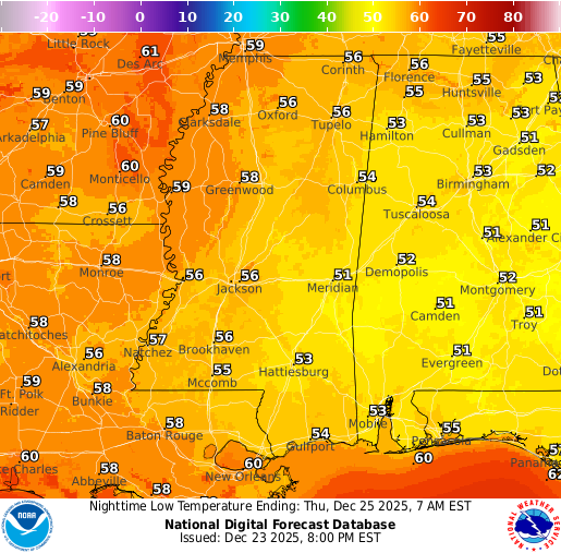
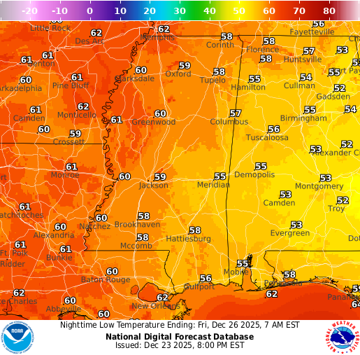
Tonight, expect lows to be quite mild, sitting in the upper 50s for most areas. Given the calm winds tonight into tomorrow, as well as our relative humidity reaching 100 percent, we will see areas of fog for much of the region through around 10 am. Areas in orange below could see dense fog with visibility less than 1/4 mile, and those in the yellow region could see patchy dense fog with visibility between 1/2 and 1/4 mile. A Dense Fog Advisory is in effect through 10 am.
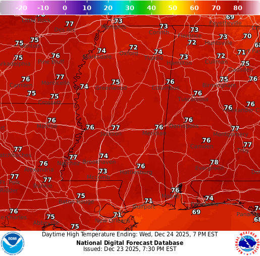
Christmas Eve Forecast: Wednesday, December 24
If you happened to have scrolled down to the Christmas Eve forecast and have not read “tonight’s forecast”, ensure you do!
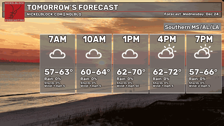
Now that you’re all caught up, that fog could disrupt that early morning travel and cause low visibility through around 10 am. Be extra cautious if you’ll be on the roads, and allow some extra time if possible.
After we get through the fog, we’ll be left with some mostly cloudy skies, but the sun will come out shortly after, and we’ll have a mix of sun and clouds throughout the day. There’s no chance of any precipitation, and highs will sit in the mid-70s – a little too mild for Christmas if you ask me! Low’s tomorrow night when Santa flies his way into the NickelBlock region will be in the low-to-mid 50s.
Christmas Day Forecast: Thursday, December 25
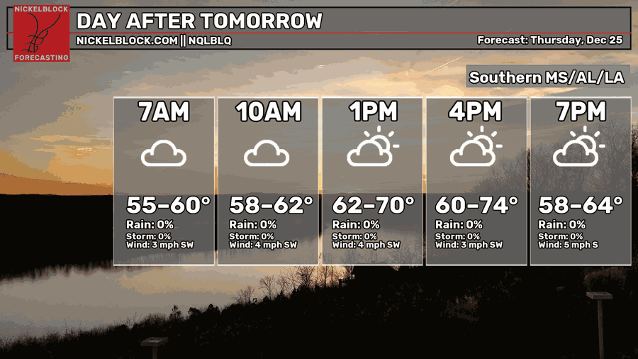
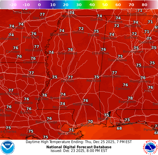
I think we could also see some fog on Christmas Morning, as we’ll have another morning of calm winds, mild temperatures, and a relative humidity of 100 percent. We’ll see that burn up at around 10 am or so, similar to Christmas Eve, and have a mix of sun and clouds for the remainder of the day. High temperatures are very similar as well, in the mid-70s. We’ll see a low temperature in the upper 50s. Enjoy the holiday for those who celebrate!
Extended Local Outlook
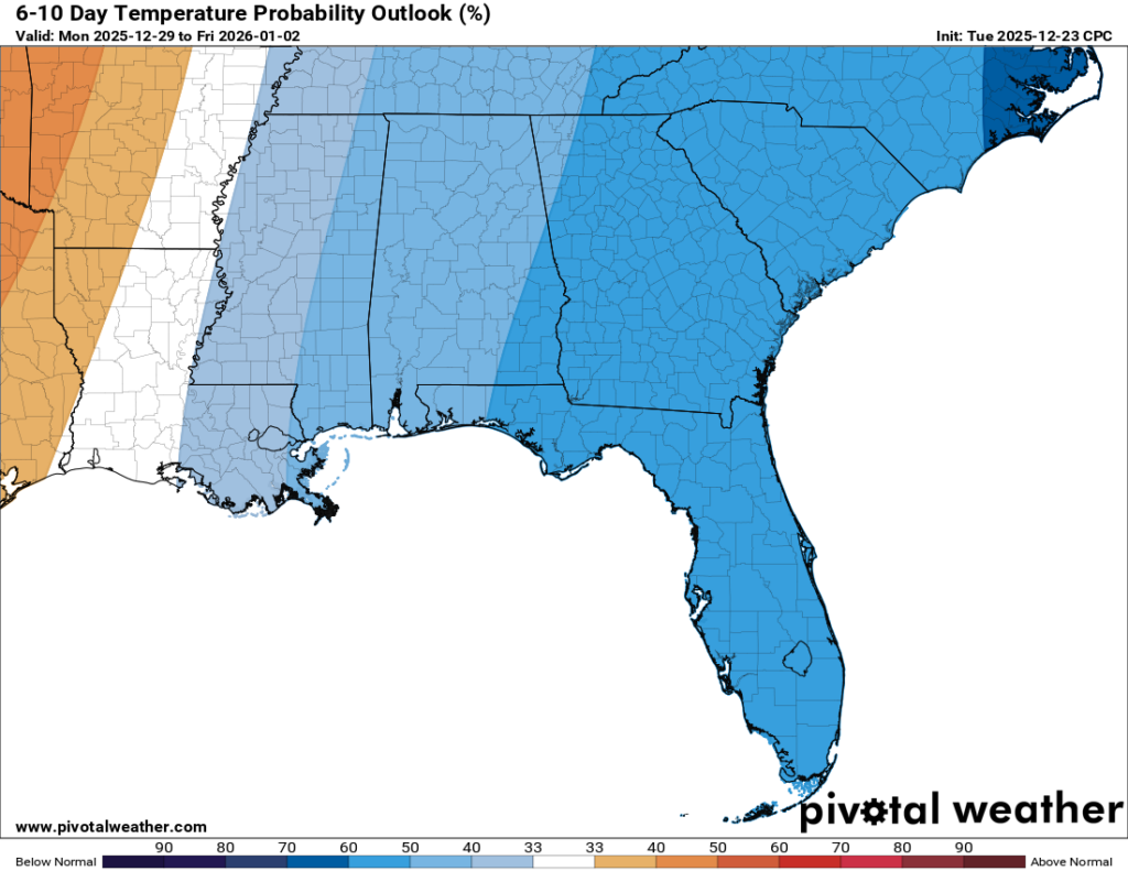
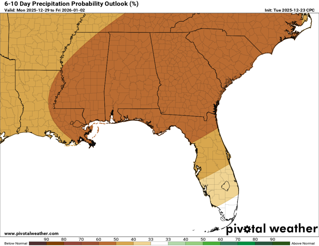
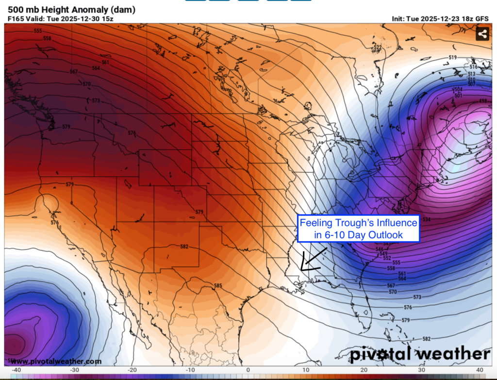
We’re not looking at any significant rain chances for the near future. Maybe some rain is possible for Sunday/Monday, but the details are a little vague this far out. Overall, the next 6-10 days (12/29-1/2) will be drier than normal, and actually a little cooler than normal. There will be a strong trough that will sweep through the east/northeast, and models show it essentially skimming us on its way out, as you can see in the image below
We’ll still have to get through the next 5 or so days of above normal temperatures, but after that it is looking like a small stretch of “cooler’ days. That is only short-term term though, because 1/3-1/6 jump back to above normal. Overall, we’re in a bit of an irregular temperature pattern as we approach the new year.

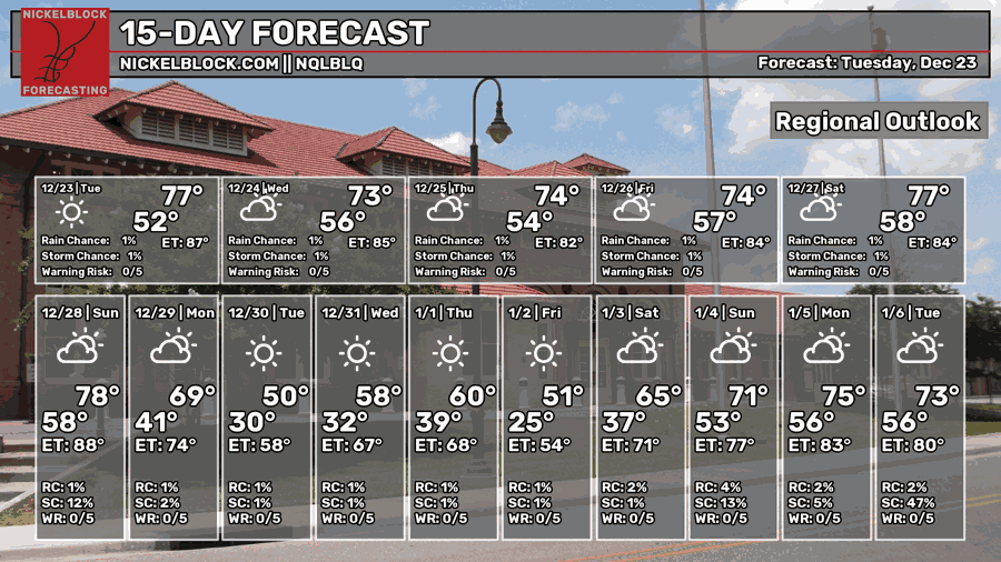
REGIONAL DAY TO DAY FORECAST
Tonight: Patchy dense fog before midnight, then widespread dense fog after 1 AM. Otherwise, increasing clouds. Lows in the upper 50s. Calm wind.
Christmas Eve: Widespread dense fog before 10 AM. Otherwise, cloudy through mid-morning, then gradual clearing. Highs in the mid-70s. Calm wind.
Wednesday Night: Partly cloudy. Lows in the mid 50s. Calm wind.
Christmas Day: Mostly sunny. Highs in the mid-70s. Calm wind becoming southwest around 5 mph.
Thursday Night: Partly cloudy. Lows in the upper 50s. Calm wind becoming south-southwest around 5 mph.
Friday: Mostly cloudy. Highs in the mid-70s. Southwest wind 5 to 10 mph.
Friday Night: Partly cloudy. Lows near 60. South-southwest wind around 5 mph, becoming calm after midnight.
Saturday: Partly sunny. Highs in the upper 70s. Light southwest wind increasing to 5 to 10 mph in the morning.
Saturday Night: Partly cloudy. Lows in the upper 50s. South wind around 5 mph, becoming calm in the evening.
Sunday: A chance of showers after noon. Partly sunny. Highs in the mid-70s. Chance of rain 20 percent.
Sunday Night: A chance of showers. Mostly cloudy. Lows in the lower 40s. Chance of rain 30 percent.
Monday: Partly sunny. Highs in the upper 40s.
Monday Night: Mostly clear. Lows in the upper 20s.
Tuesday: Sunny. Highs in the upper 40s.


