General Central/Eastern Kansas Forecast
Short-Term (Wednesday-Thursday)
Today looks to be another typical summer day across the region, with average temperatures and isolated showers and thunderstorms possible, especially across central Kansas this afternoon. Some more mid-level disturbances will traverse over the state through the morning and afternoon hours and may provide enough lift to induce precipitation chances, mainly for central Kansas west of US-77. No severe weather is anticipated but an isolated heavy downpour cannot be ruled out. Overall, expect new rainfall totals to remain under an inch with this potential activity. Meanwhile, the rest of the eastern third of Kansas will look to stay largely dry, although an isolated storm occurring during peak heating (around 4pm) can’t be ruled out.
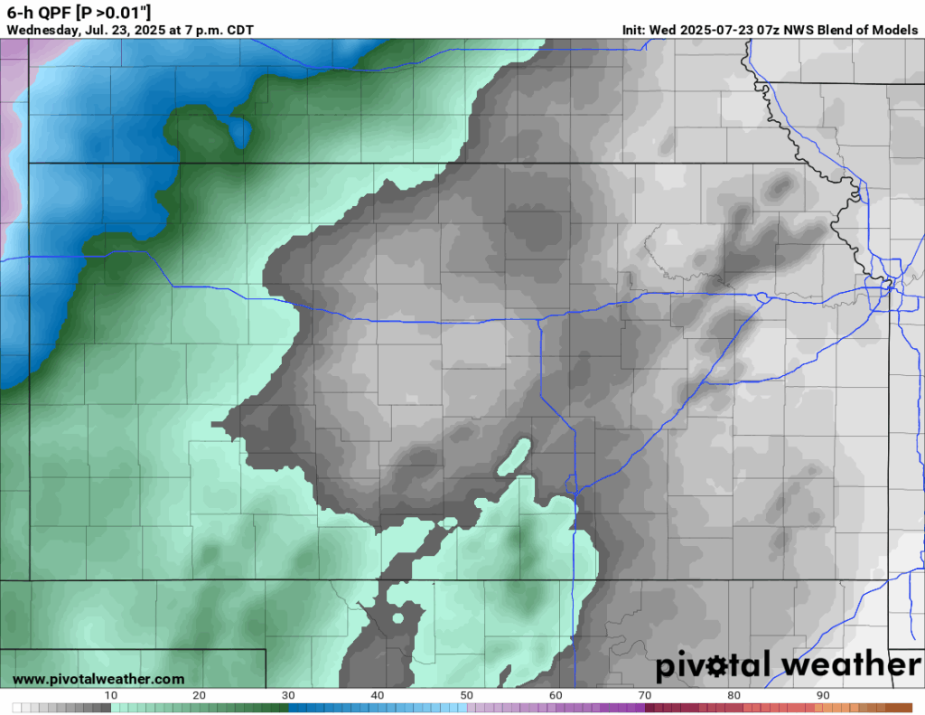
By tomorrow morning and afternoon, a weak cold front will start to enter our area and slowly advance its way through. This will bring greater chances for showers and thunderstorms across central and eastern Kansas, perhaps in two rounds, with the first round developing in the early morning hours just before sunrise (3-5am) and a second round developing in the afternoon by around 1pm and lasting through the evening hours. Pockets of heavy rainfall will be possible with these storms, given moderate instability, high moisture content, and the possibility of training thunderstorms. New rainfall totals look to be around an inch, but higher amounts of 2-4 inches will be possible in the heaviest of storms/areas that see multiple storms. No severe weather is currently anticipated with this activity.

Temperatures today will be very warm and seasonal, with highs in the low to mid 90s with a south wind of 10 to 15 mph, gusting up to 30 in some places (especially in central Kansas). Heat indices again look to make the upper 90s to low 100s given relative humidity values of 45-60%. By tonight, temperatures again will look to fall back to the low to mid 70s. Temperatures tomorrow may be slightly cooler with the impinging cold front, ranging from the low to mid 80s behind the front to low to mid 90s in front of it. Winds will be southerly at 5 to 10 mph before becoming northerly at around 5 to 10 mph as the front passes throughout tomorrow afternoon and evening.


Long-Term (Friday-Tuesday)
Continued scattered showers and thunderstorm chances will remain throughout the day Friday with the cold front lingering around before slowly retreating northward by Saturday. Once this occurs, our warming trend will resume as high pressure begins to build back over us and will help increase our daily highs back into the mid to upper 90s through the early part of next week. Heat indices by early next week may climb back to meet Extreme Heat Warning criteria so this trend will have to be monitored over the coming days.
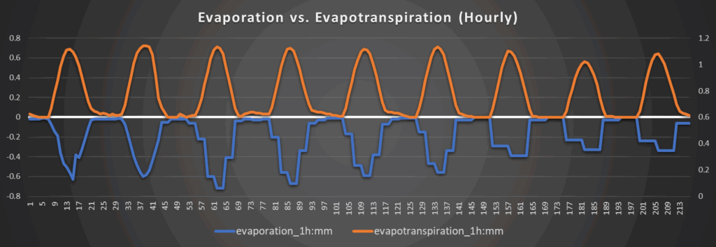
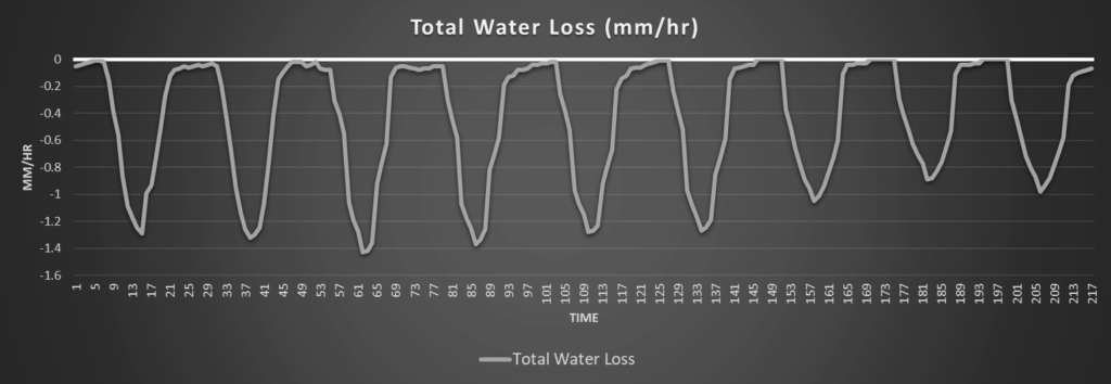
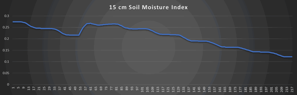
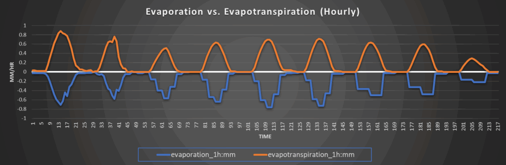
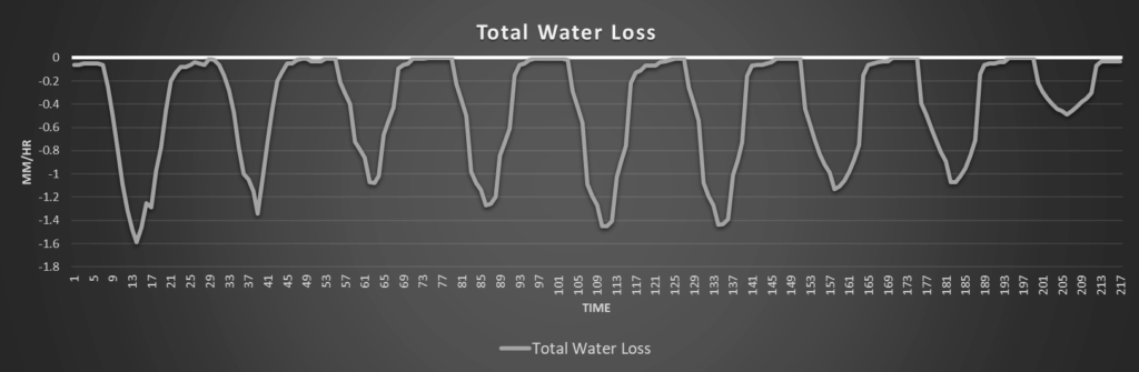
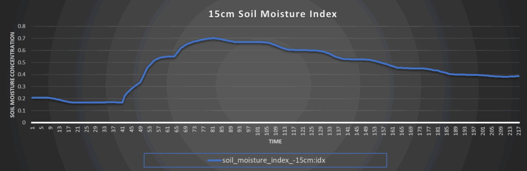
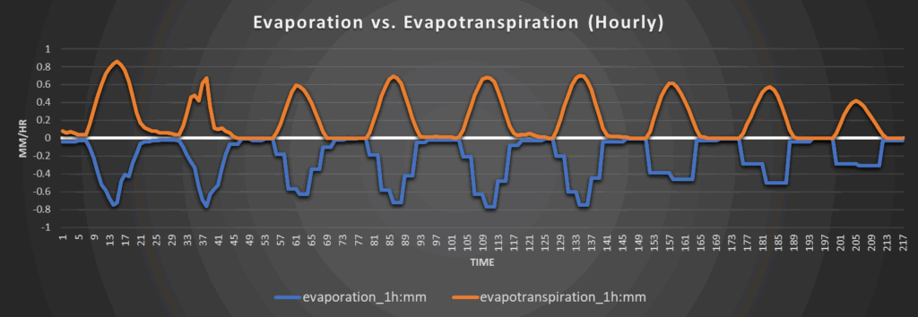
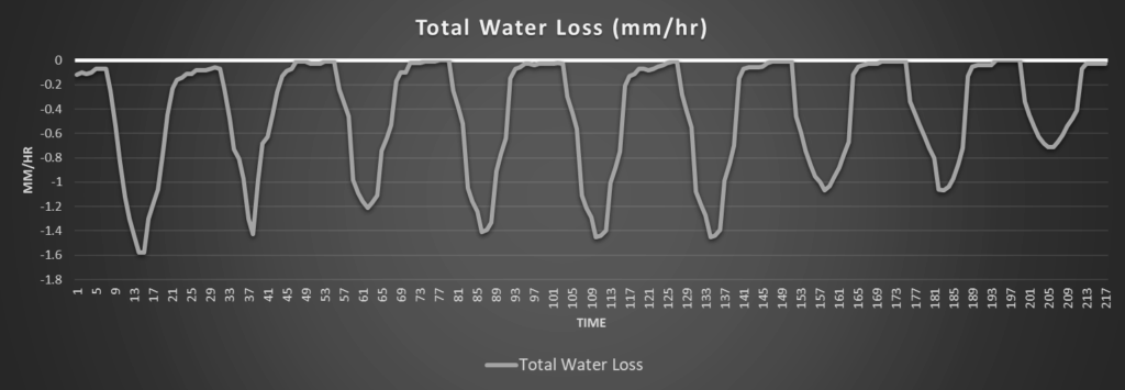
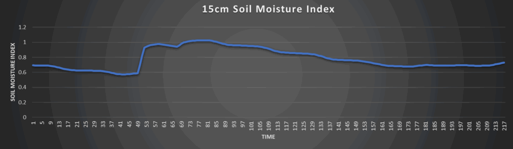
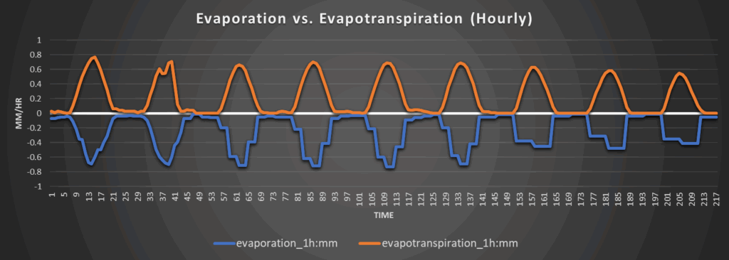
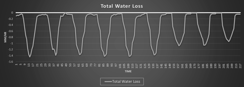
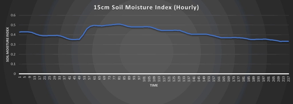
Regional Soil Moisture Outlook
Soil moisture loss will be substantial over the next couple of days before the cold front arrives and increases our rain chances quite a bit to hopefully recharge soils and alleviate any abnormally dry conditions that did not get taken care of from yesterday’s rain episode. As high pressure builds in once the front leaves our area by the weekend, steady drying of soils will return with those closer to southern and southeast Kansas potentially being in the worst of shape. Abnormally dry to some drought conditions may develop down here due to the heat and reduced rainfall over the long-term period, so trends will have to be monitored here.
Around Westmoreland
Around Scranton
Around Burlington
Around Altoona