Today looks to be the last day of normalcy before the potential tropical system moves into our area and dumps a lot of rain on us. Temperatures will be HOT today, with real feels up to 115 degrees! Plus, temperatures seem to stay above normal through at least next week. Let’s dive into the detailed forecast:
Today’s Overall Setup
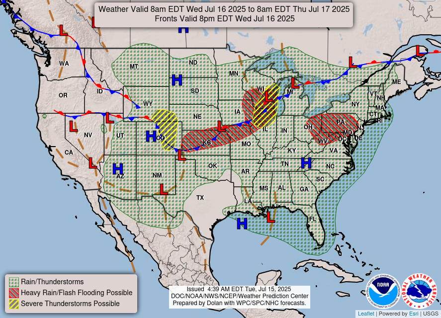
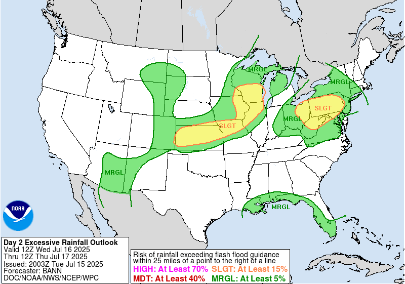
Today’s weather is filled with flash flood potential and severe weather potential for the central plains into the midwest and in the Ohio valley into PA. A stationary front is strung across most of the northern tier of the country and there is also a lot of troughing going on over the central and west regions, which brings unsettled weather with that. There is a slight risk of flash flooding highlighted in the yellow in the above figure, as well as margnial risks highlighted in green; our area being one of the marginal risk zones.
Today’s Local Forecast
Some isolated thunderstorms will popup in extreme southern MS later today, at around 4 or 5 pm. These will gradually start to become more scattered in nature, and will stick around through the evening hours with increasing clouds. Some of these storms could dump a lot of rain over a short period of time, which is why the WPC has a Marginal (at least 5 percent) chance of flash flooding through tonight. Overall, though, today is looking to be mainly a dry and sunny day for most of it!

Here’s an hourly look at the forecast for today for the region.
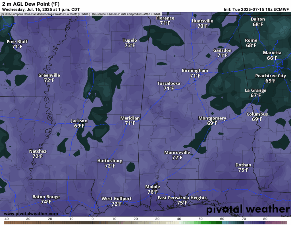
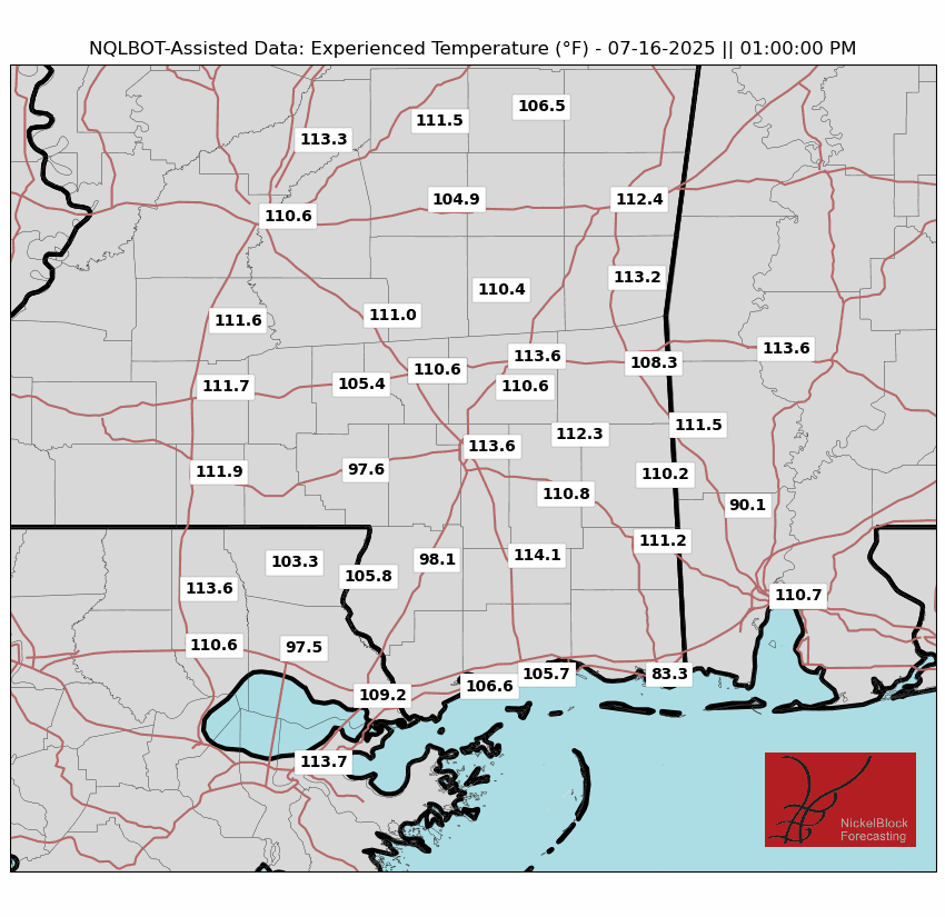
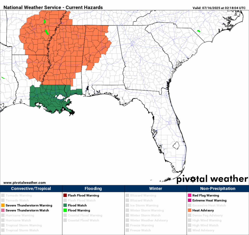
High temperatures today will be very hot, in the mid-to-high 90s! High humidity will make it feel as hot as 115 during peak sunshine when there is no shade! We are sitting under a Heat Advisory for this dangerous heat, so stay inside if you are able and drink plenty of fluids to stay hydrated. Also, don’t leave children or pets unattended in a car!
Thursday-Saturday Forecast
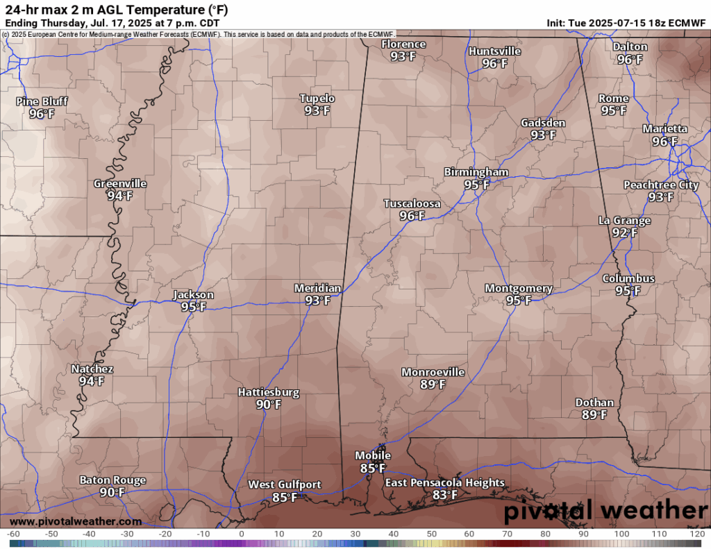
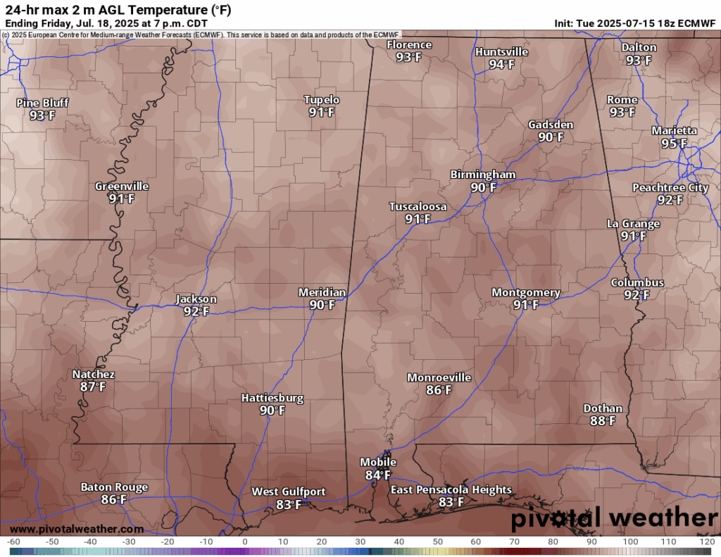
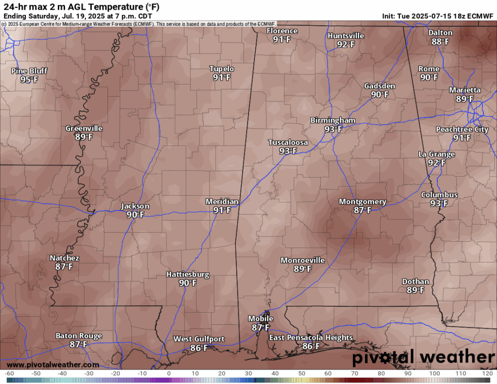
High temperatures on Thursday will be normal in the low-to-mid 90s. As the potential tropical system moves into our area on Friday and Saturday, it will prohbit our temperatures from reaching higher than 90. Regardless of the slightly lower temperatures than usual, it will still feel much hotter with the high humidity and moisture content.
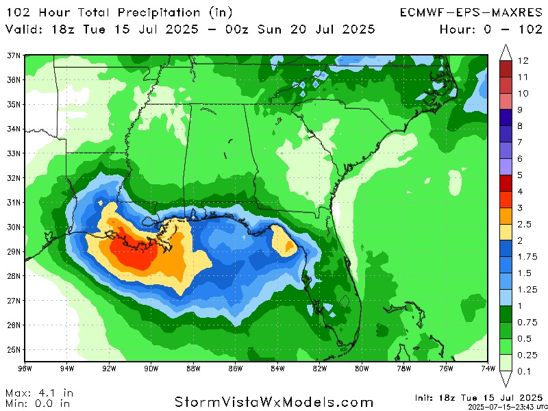
As the potential tropical system moves into our area, it will dump a lot of rain in its path. Thursday, Friday, and Saturday are all days that we will see rain from the system moving in. As of the current Euro ensemble model guidance, anywhere up to 5 inches of rain are possible in southern Louisiana, with locally higher amounts possible. The exact placement of the rain bands, which depends on the exact track of the low pressure, is still uncertain. In general, the biggest risk from this system will be the large amount of rain and rough surf. A flood watch is in effect for southeastern LA and coastal MS.
Extended Local Outlook

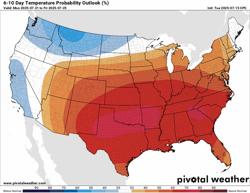
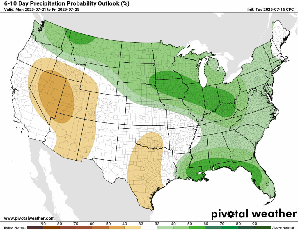
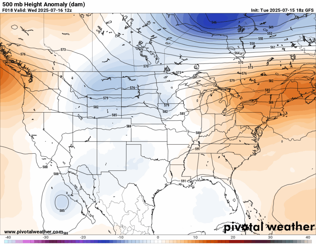
Looking ahead to the next 6-10 days, which would take us from Monday-Friday next week, temperatures are very likely to be above normal for our region, which makes total sense since we are staying into the negative phase of the Pacific North-American Pattern (PNA). We are also looking at a good chance of above average rainfall during that time. High pressure over the eastern Gulf will funnel in a very moist tropical airmass that will bring rounds of rain to our region. Have that umbrella handy next week!
Latest Tropical Update
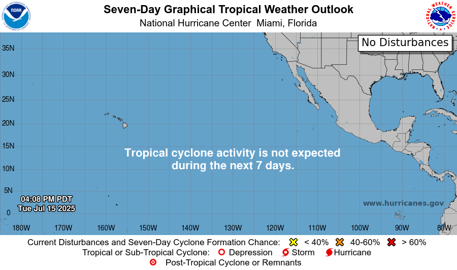
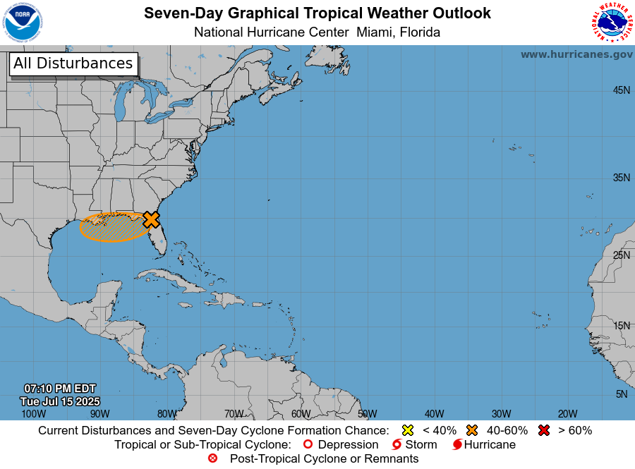
Here’s the latest in the tropics. Invest 93L is currently spinning over Florida and will move parallel to the MS and AL coastlines into our area. As of now, current guidance is having this not move too far southwest into the open waters of the Gulf. If it did have a chance to, it would increase the odds of it stregnthening into a depression or tropical storm. So, it is relatively good news that the guidance mostly has it staying off of the ocean waters. Regardless of development, a lot of rain will fall along it’s path.
Want the latest details on these systems? Check out our daily tropical updates for more in-depth information on the tropics!
REGIONAL DAY TO DAY FORECAST
Today: Sunny and hot. Scattered showers and thunderstorms in the afternoon. Highs in the upper 90s. Calm winds becoming north northeast around 5 mph. Chance of rain 30 percent.
Tonight: Mostly cloudy. Scattered showers and thunderstorms after 4 pm and before 1am, then a slight chance of showers. Patchy fog after midnight. Lows in the mid 70s. Calm winds. Chance of rain 60 percent.
Thursday: Mostly cloudy. Showers and thunderstorms likely in the late morning through afternoon. Highs in the low 90s. East southeast winds around 5 to 10 mph. Chance of rain 90 percent.
Thursday Night: Mostly cloudy. Chance of showers and thunderstorms. Lows in the mid 70s. East southeast wind around 5 mph. Chance of rain 30 percent.
Friday: Mostly cloudy. Showers and thunderstorms likely in the morning and again in the afternoon. Highs around 90. South wind 5 to 10 mph, with gusts up to 20 mph. Chance of rain 90 percent.
Friday Night: Mostly cloudy. Slight chance of showers and thunderstorms before 1am. Lows in the mid 70s. South wind around 5 mph. Chance of rain 20 percent.
Saturday: Mostly sunny. Showers and thunderstorms likely in the afternoon. Highs in the low 90s. South southwest wind 5 to 10 mph. Chance of rain 80 percent.
Saturday Night: Partly cloudy. Lows in the mid 70s. South wind around 5 mph becoming calm.
Sunday: Mostly sunny. Scattered showers and thunderstorms in the afternoon. Highs in the mid 90s. Chance of rain 50 percent.
Sunday Night: Mostly clear. Lows in the mid 70s.
Monday: Sunny. Scattered showers and thunderstorms in the afternoon. Highs in the mid 90s. Chance of rain 40 percent.
Monday Night: Mostly clear. Lows in the mid 70s.
Tuesday: Sunny and hot. Scattered showers and thunderstorms in the afternoon. Highs in the upper 90s. Chance of rain 50 percent.


