General Central/Eastern Kansas Forecast
Short-Term (Wednesday-Thursday)
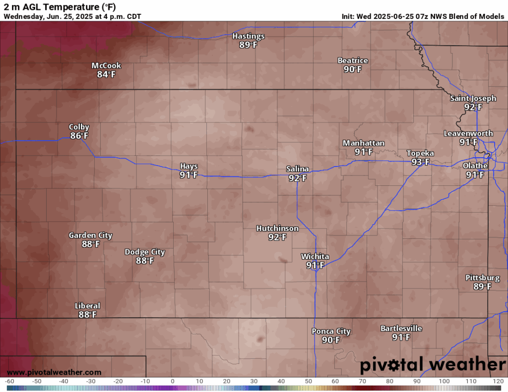
Another seasonal summer day is in store for the area today, as the last of the rain showers have moved off to the north and more quiescent conditions set in for today. Temperatures today will be in the upper 80s to low 90s, with southerly winds of 10 to 20 mph and gusts between 25 to 30 mph. Relative humidity values will generally be around 45-55%, which will help keep our heat index below triple digits but will still be in the mid to upper 90s today. By tonight, temperatures will fall into the low to mid 70s, still offering a somewhat pleasant, but still rather warm night.
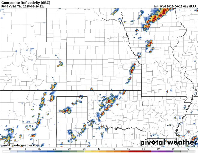
Rain chances look to return west to east after midnight tonight, as several small impulses pass over us and a weak cold front from the northwest encroaches in. Showers throughout the morning and afternoon hours will be lighter in nature before heavier scattered thunderstorms go up in front of the cold front by around 4-6pm. A couple areas of damaging winds would be possible with these storms, as well as localized heavy rainfall.
Temperatures throughout the day tomorrow will be largely similar to today, with highs in the upper 80s to low 90s and south-southwesterly winds of 5 to 15 mph, with gusts up to 25 mph. Relative humidity values will again range between 45-55% mostly, offering us heat indices in the mid to upper 90s. Low temperatures tomorrow night will be a little bit cooler in the low to mid 70s.

Long-Term (Friday-Tuesday)
Thunderstorm activity will continue in the long-term period but will be a bit more nebulous in the back half of the week and into the weekend, as we enter a pattern very weak flow aloft. Any storms that do form will probably be more akin to pulse storms rather than organized convection unlike on Thursday. By Sunday though, a cold front will approach from the north and increase rain chances once again across the area. This front will completely move through by Monday morning and punch out our moisture across the state, leaving us with drier conditions by the Monday-Tuesday timeframe.
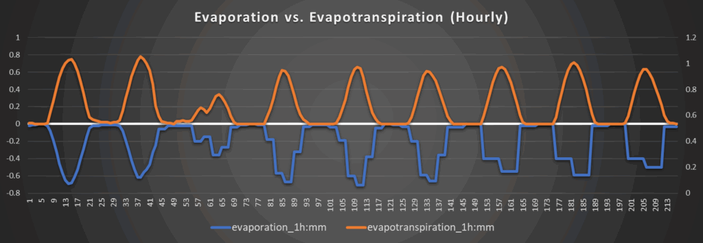
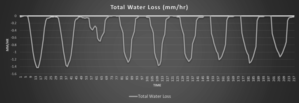
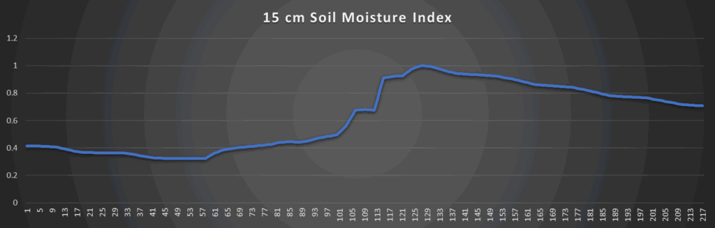
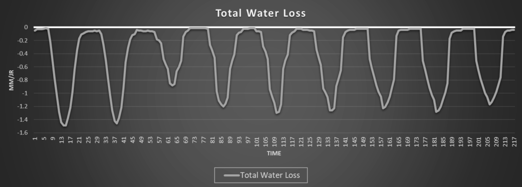
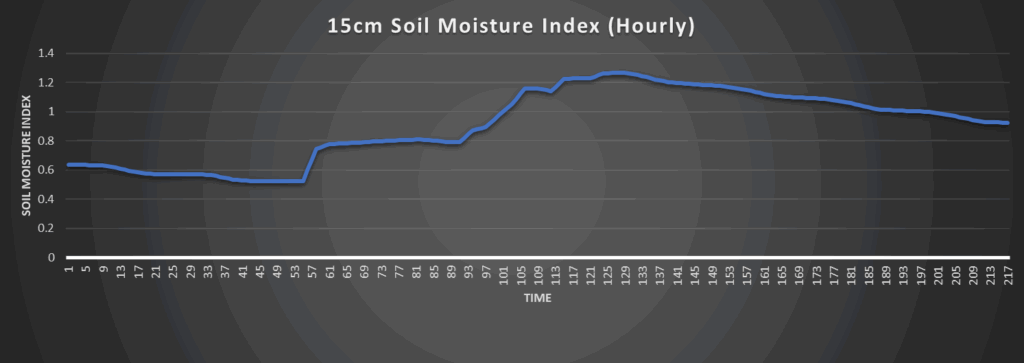
Regional Soil Moisture Outlook
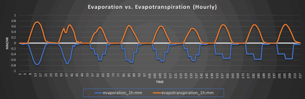
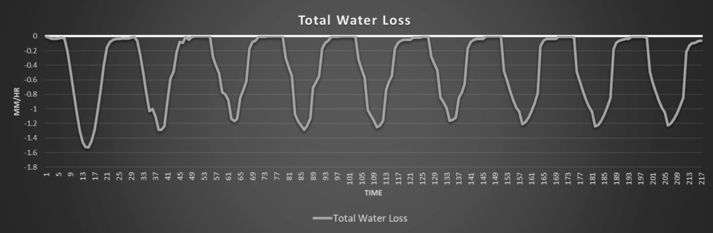
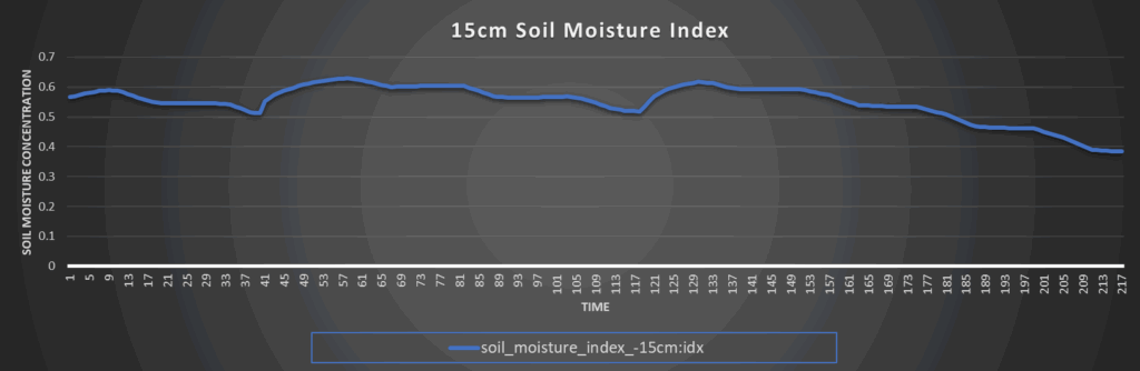
Continued drying of soils will ensue today with the hot, quiet, and somewhat breezy conditions across the area. With rain chances returning tomorrow, some moistening may occur but overall rain totals will remain on the lower side, but isolated pockets of 1-2 inches will certainly be possible. Greater chances for moisture and saturation will keep coming every day until next Monday with the continued chances (albeit somewhat low) of showers and thunderstorms. Overall, soils will still be in good shape this week, especially with most of the region not experiencing any drought conditions at this point into the summer.
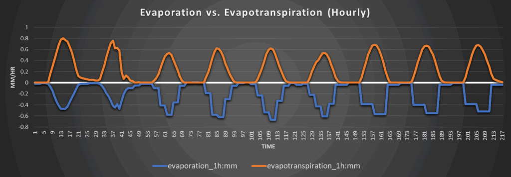
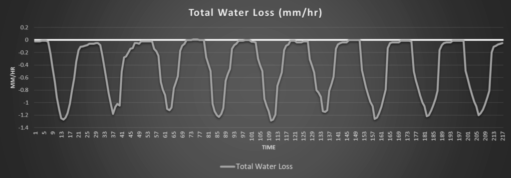
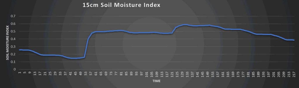
Around Westmoreland
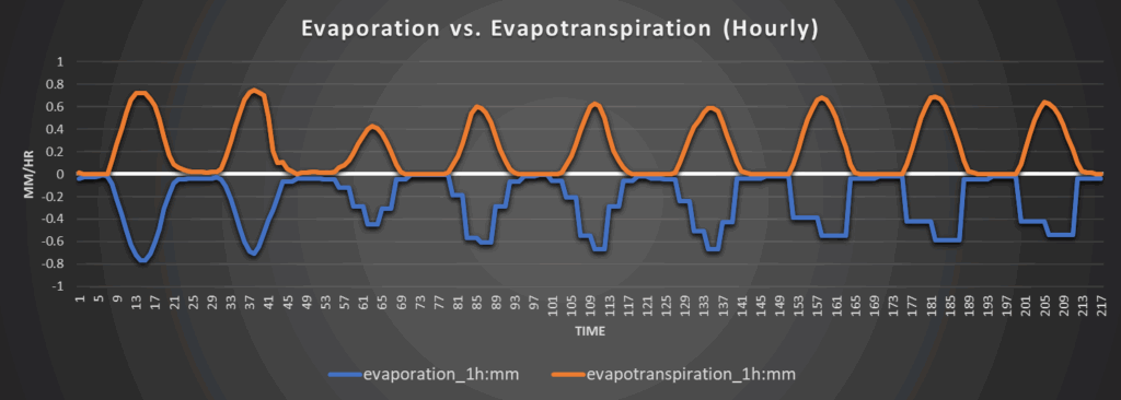
Around Scranton
Around Burlington
Around Altoona