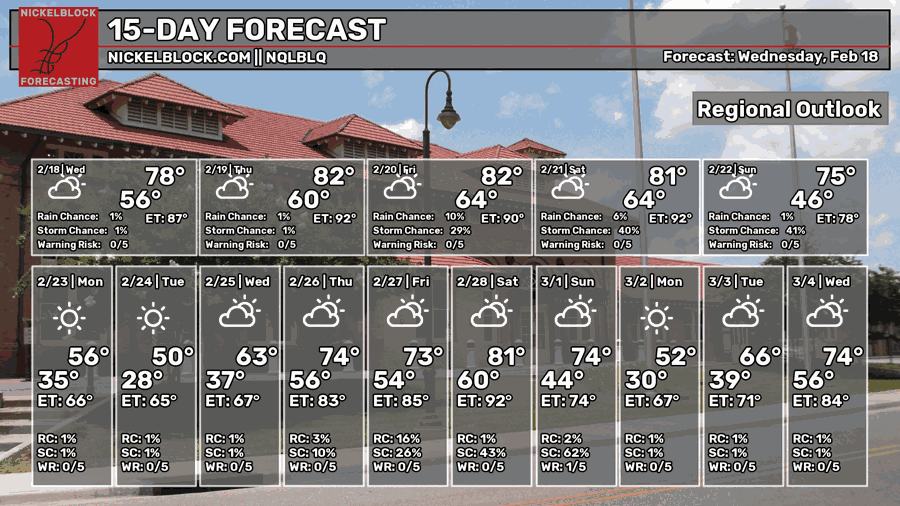
It’s been a warm one already, albeit mostly cloudy for the majority of the day. It won’t change much today as more clouds will continue the stretch of moisture advection with the incoming fronts. We won’t really have a change to the conditions for the next few days until the final cold front rolls in by Sunday.
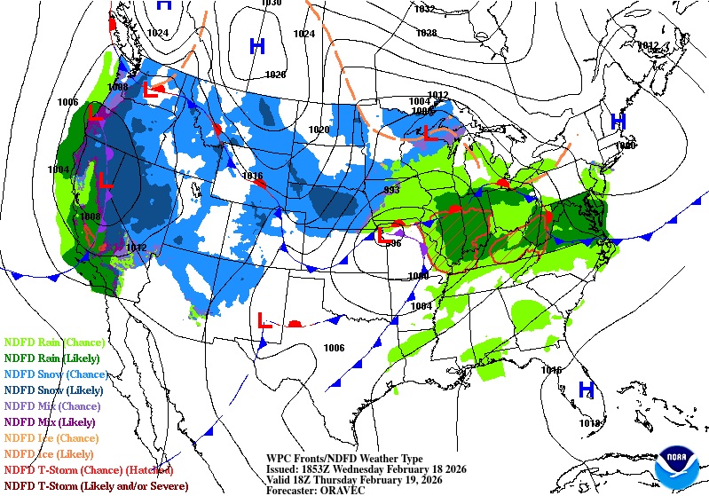
Overall, conditions will be warm and humid for the next several days with continuous southerly flow due to the low pressure system moving through the eastern Plains to the Great Lakes. Not only that, but intermittent rain will also be possible between Thursday and Saturday as one front ejects and another one passes.

Today
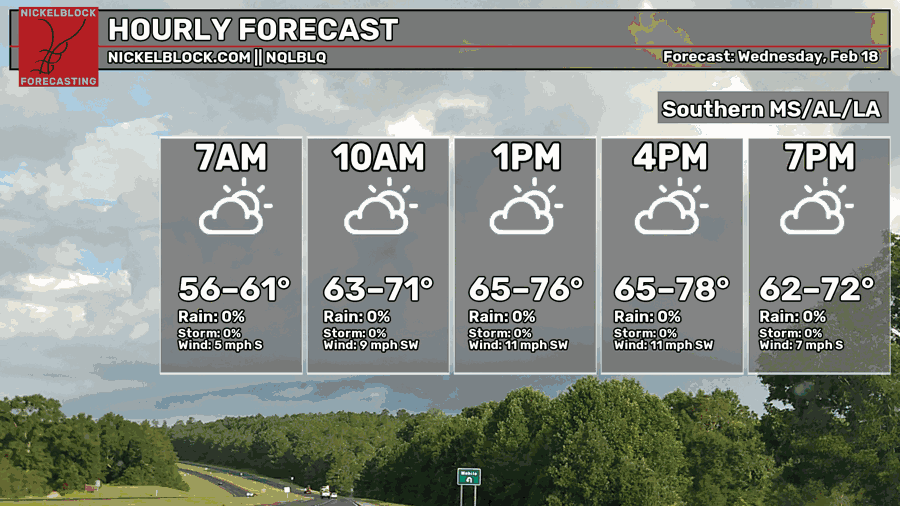
Most of us are going to see temperatures in the mid to upper 70s today. The torrent of southwesterly winds will keep conditions warm and humid throughout the day. Overnight, we’ll reach the upper 50s to 60, so a warm night ahead!

Tomorrow
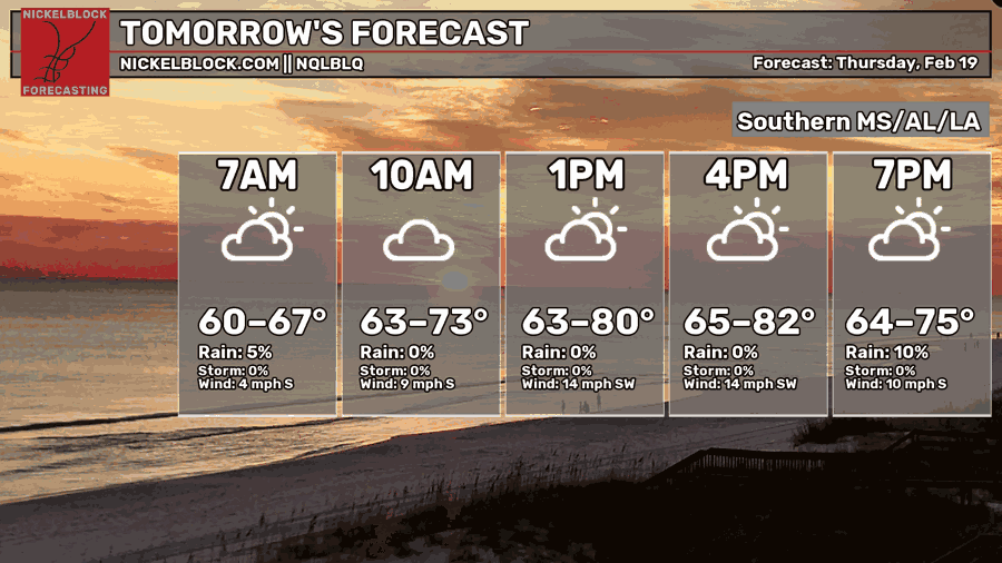
Yep, you’re looking at that right! We’re reaching the low 80s tomorrow! With all the southerly flow, it’s going to be quite warm for this time of year. Winds will still blow out of the southwest with mostly cloudy skies. We can also expect some rain in the later evening hours, but fairly isolated to scattered showers.
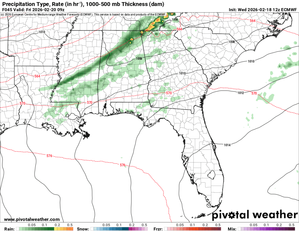
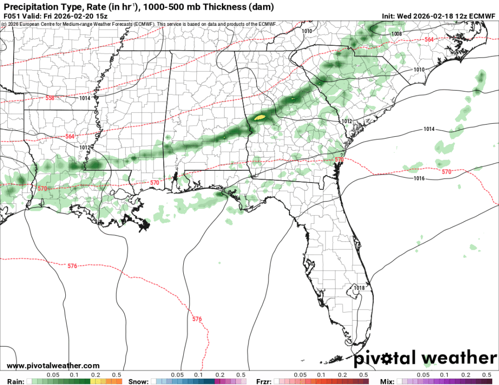
Friday
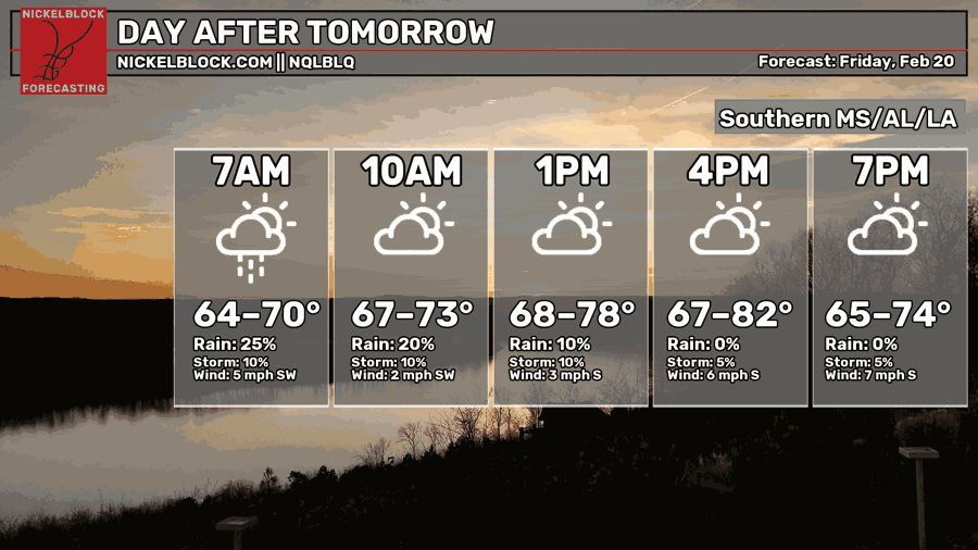
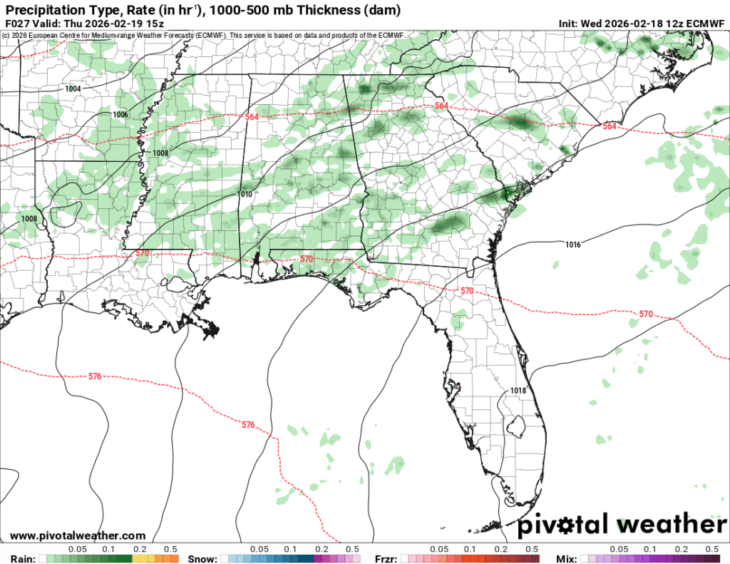
Showers will continue early Friday morning to the mid-morning hours. It’s a fairly thin line of showers, but enough to rain out part of your morning. Afterwards, we’ll go back to the humid and warm with highs in the low 80s and a low in the low 60s.
This Weekend
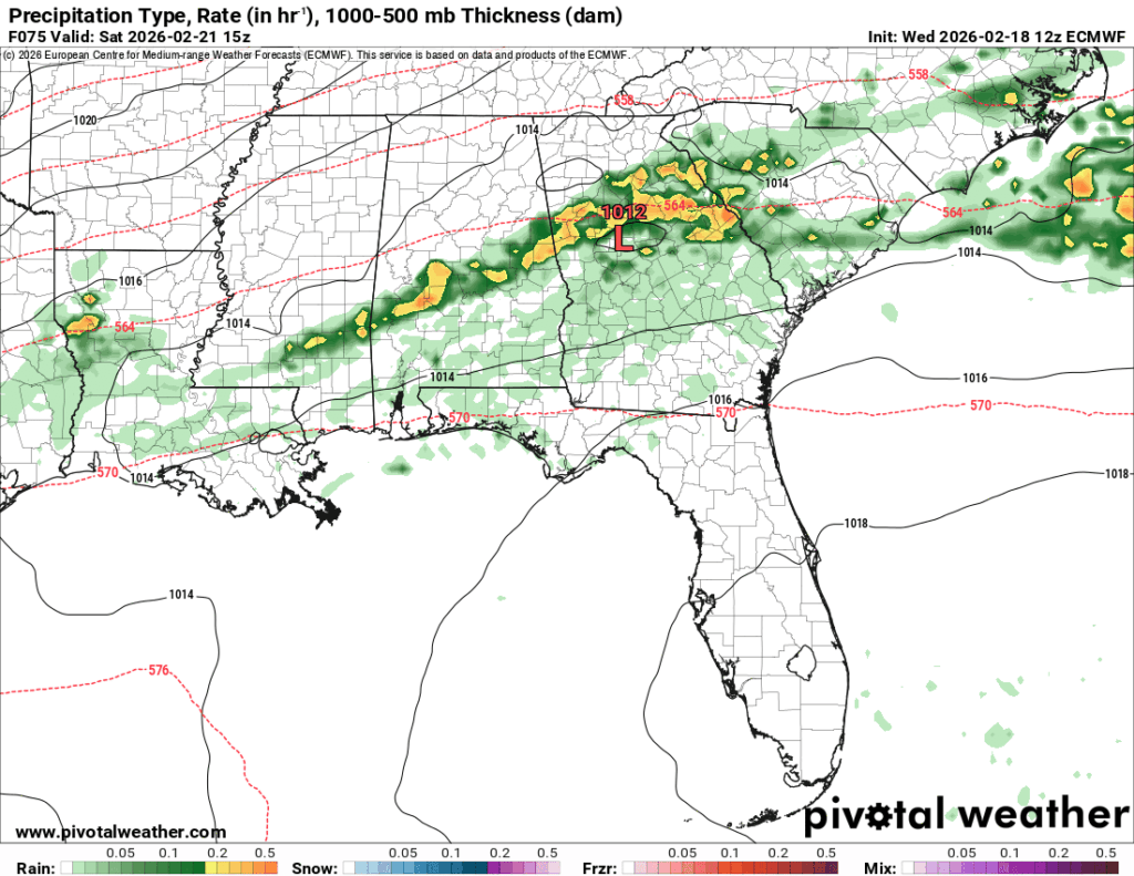
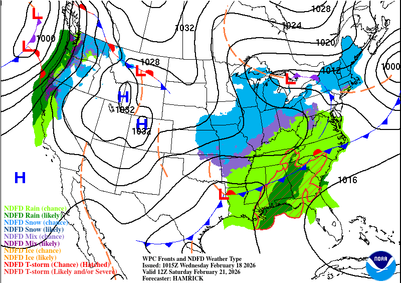
Another front out of the Rockies is moving right behind the ejecting front on Saturday. Another front, another round of showers and thunderstorms. The good news so far is that the SPC has not placed an outlook on the incoming system. This is in part due to the instability and moisture flow further offshore which will limit severe potential. The system itself also begins to weaken as it moves further south and begins to stabilize and dry out in the mid-to-upper atmosphere. This doesn’t mean that we won’t get a few strong storms with heavy rain, though. For those of us in the Pine Belt, it’ll be a soggy morning and early afternoon. Afterwards, I think we can expect a cooldown as more northerly winds move in from the incoming high pressure system.
Expect the first part of your Saturday to be soggy and warm, while the second part will be cooler and windy. The high will top out in the mid 70s but the low will drop to the mid 40s. By Sunday, expect a windy and cooler day with a high in the mid to upper 50s and a low in the mid 30s. Big change, huh? We’ll see another cool day by Monday as well.