Overall Setup
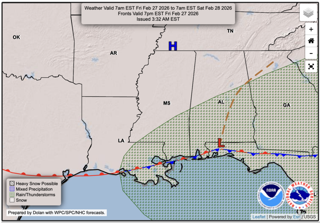
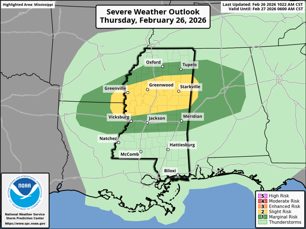
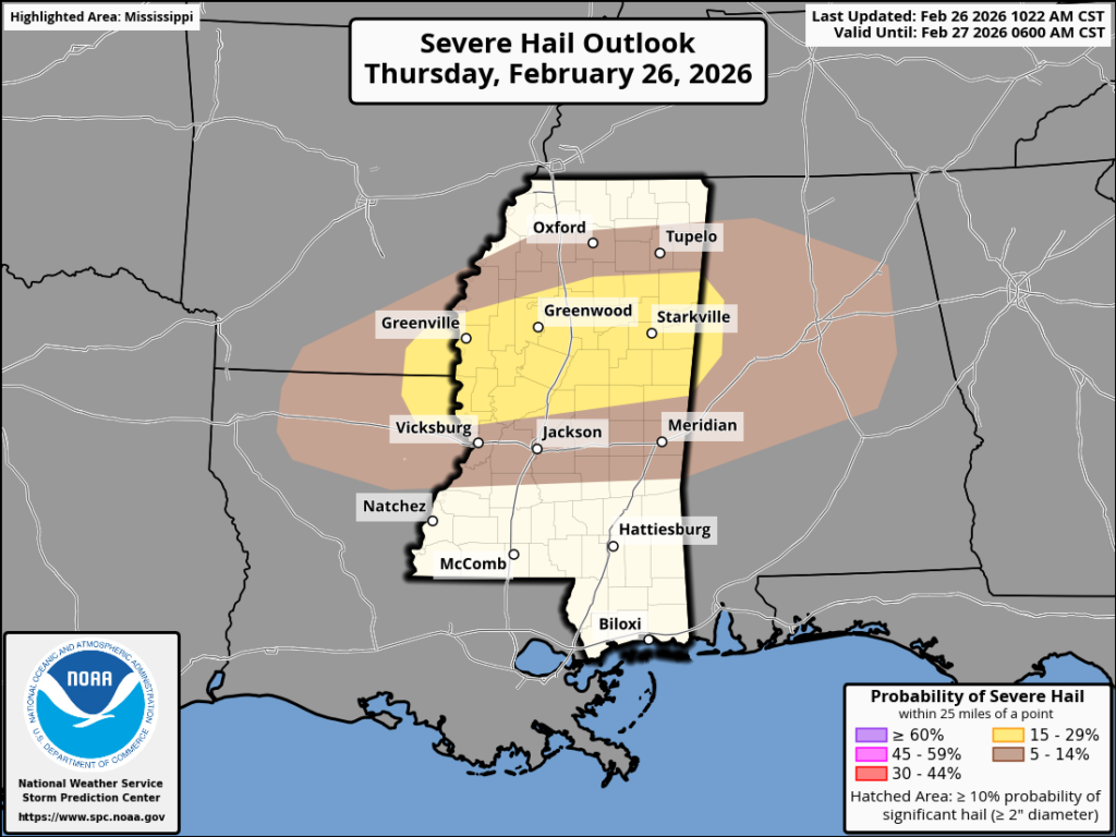
The NickelBlock region is on the fringe of some severe weather this afternoon and tonight. The highest likelihood of severe weather, especially severe hail, is in central and northern Mississippi and Alabama, and in the northeast parts of Louisiana, as shown in the figures above. Areas like Hattiesburg, McComb, and points south are technically only under a general thunderstorm outlook, but once you get to areas like Jackson, Meridian, or Vicksburg, you could see a much better chance at seeing those strong to severe thunderstorms. Luckily, with this one, surface shear doesn’t look too impressive, so the tornado threat is low.
There are a few areas of showers currently throughout the region, but throughout the afternoon and into the evening, storms will fire up, producing thunder and lightning and bringing the potential for severe hail and maybe some gusty winds. Again, this is most likely for those further north, and by the time the storms make their way south into the NickelBlock region, instability will be lacking, and the overall ingredients will mostly already be used up.
To be clear, there is still a chance of strong-to-severe storms for Hattiesburg, McComb, Natchez, and New Orleans this evening, but it’s less likely given their location farther south.

Tonight’s Forecast
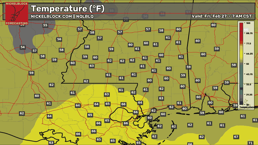
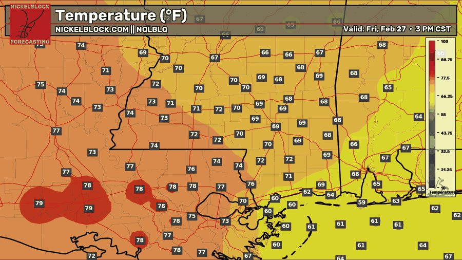
Here’s a look at the future radar, showing the HRRR modeled composite reflectivity, which helps visualize what the radar might look like this afternoon into tonight. Storms will begin to initiate later this afternoon and bring heavy downpours to those beneath them. If you happen to be further north, you could see that hail threat in those afternoon storms and through the evening. Through the night, these storms will move south and east, and will make their way through our region along a line late tonight, around 2-6 AM, exiting by the morning commute. Low temperatures tonight will be in the lower 60s for most, with mid 60s for those further south.

Tomorrow’s Forecast: Friday, February 27
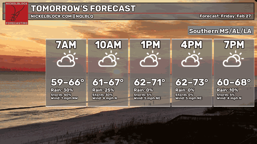
By tomorrow, our stormy weather will be out of here, and we return to dry weather and sunny skies for the weekend. Highs will range from the upper 60s to the upper 70s, depending on your location. It will be slightly humid, but nothing too uncomfortable. Though we will be behind the cold front tomorrow, we won’t feel it’s unfluence in terms of lower humidity until Saturday.
This Weekend’s Forecast
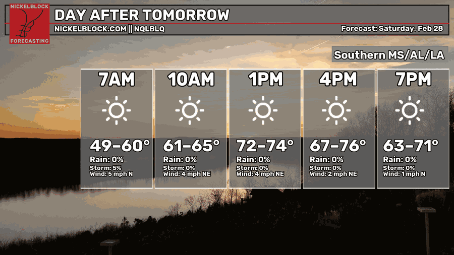
Saturday is shaping up to be a great outdoors day, and certainly one that feels like spring – we’ve had a bunch of those lately! Highs will sit in the 70s, and humidity will be minimal since we will be completely behind the front. Not a cloud in the sky and minimal winds too!
Sunday is also going to be dry and warm, with little humidity, but clouds are expected to fill in, but without completely blocking the sun.

Extended Local Outlook
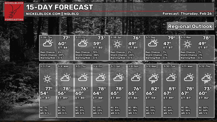
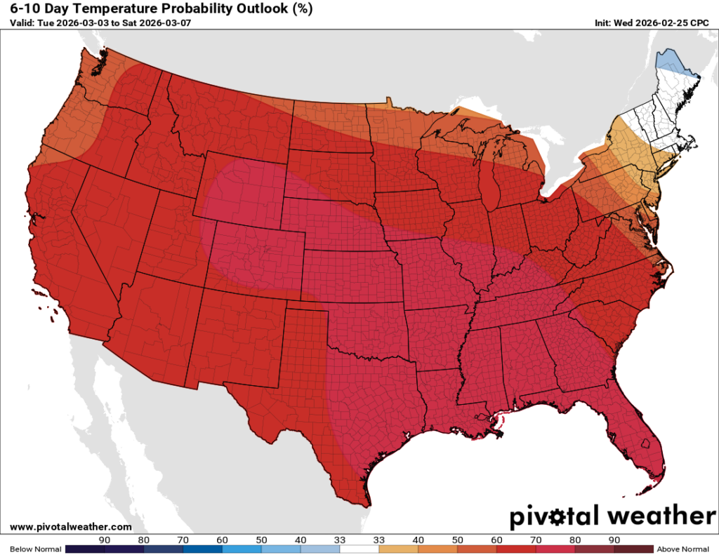
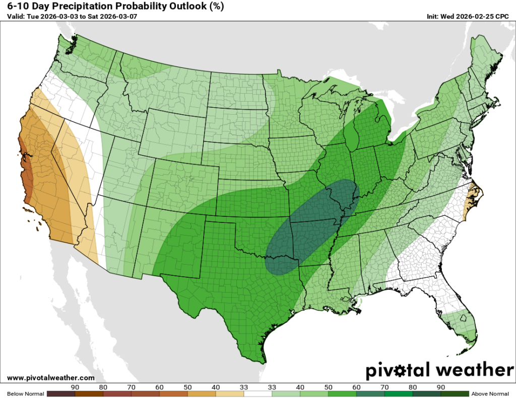
Look at all of that red! It’s shaping up to be a very warm start to March for most of the country, and also a wetter one too! A more active storm track is setting up for the central and eastern portions of the US, which could mean an early start to the severe season?? As for us, more specifically, we’re going to keep the trend of highs in the 70s and near 80 for a little while, and check out the rain chances for the end of the 15-day forecast… we could see an increased amount of rain given the active storm track.


