Overall Setup
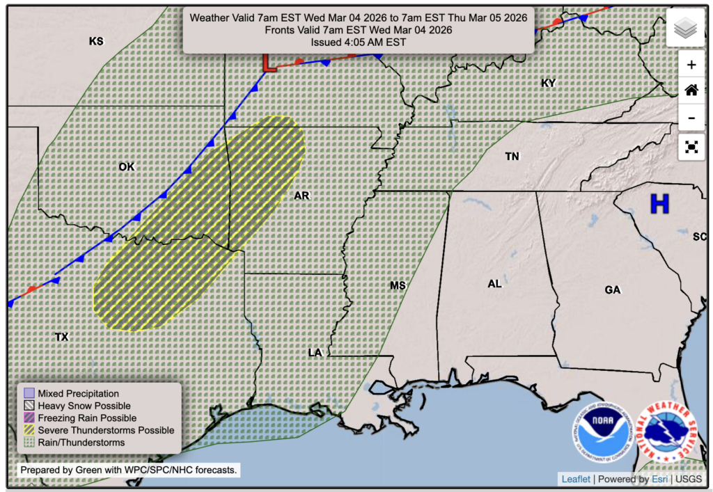
Over the next week, there will be increased rain chances and certainly more clouds around. An active pattern is taking shape in the southern Plains and Midwest, and though we will not see as much rain as our neighbors, we will see some of the action. Severe weather looks to be an issue for them as well, but at the moment, we aren’t expecting any severe weather our way with the next few systems, though we could definitely see some thunderstorms.
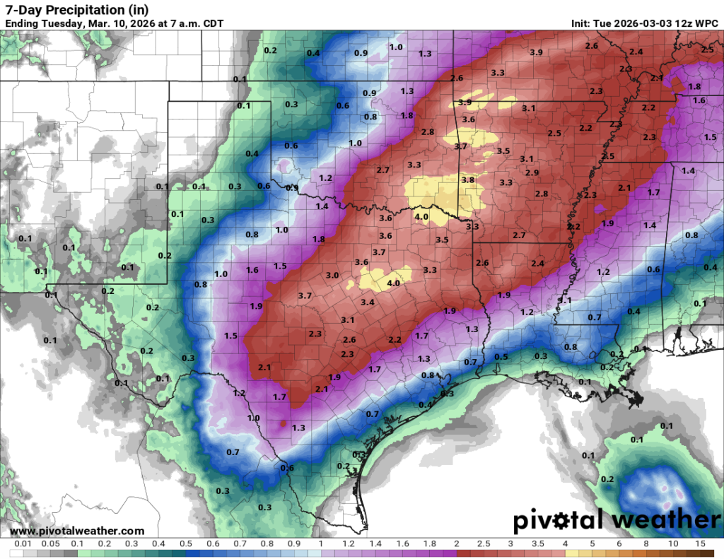
Tomorrow through Friday, we are expecting mostly gloomy weather, with increased clouds and random rain chances throughout the days. Saturday and Sunday are when we could see some heavier rain and possibly some thunder and lightning with a few lines of storms. That is where we will rack up our rain totals, as shown in the image above, which has our region at around an inch or less through Tuesday.

Tonight’s Forecast
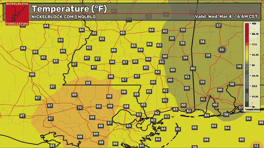
Tonight, we will see increasing clouds and a temperature in the low-to-mid 60s. Those towards Baton Rouge will see upper 60s to near 70. Our average low is 53 degrees, so we are 10-15 degrees above normal, as we have been for quite some time now!
Tomorrow’s Forecast: Wednesday, March 4
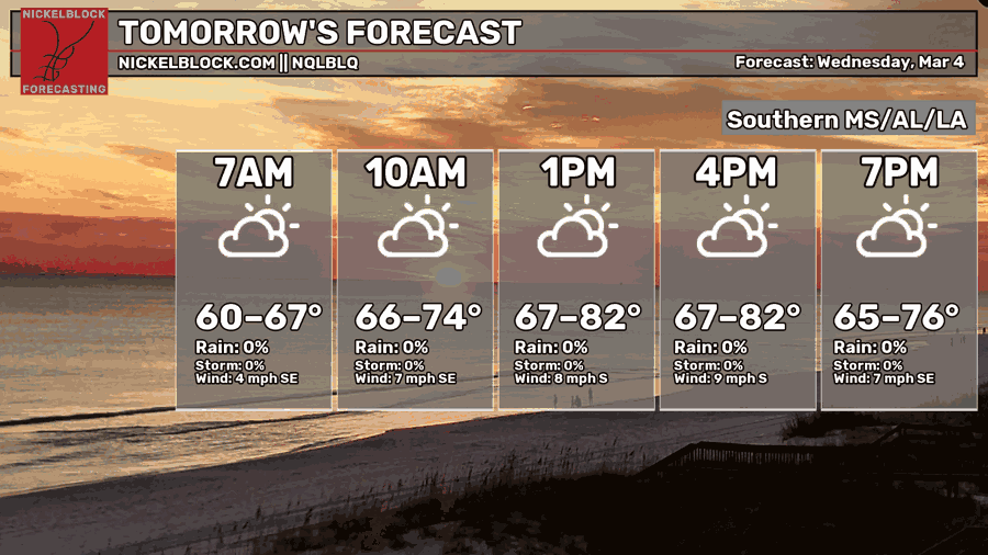
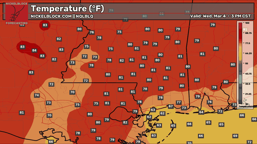
Tomorrow we will see a mix of sun and clouds, but it will still keep that generally muggy feeling, with highs reaching the low 80s. Dew points will sit in the 50s and 60s, and the persistent southerly flow is showing up on the models, with a few showers moving in from the Gulf through the day, likely aimed toward southeastern Louisiana into southwestern Mississippi. These are isolated showers, so not everyone in our region will see rain tomorrow.

Thursday’s Forecast: March 5
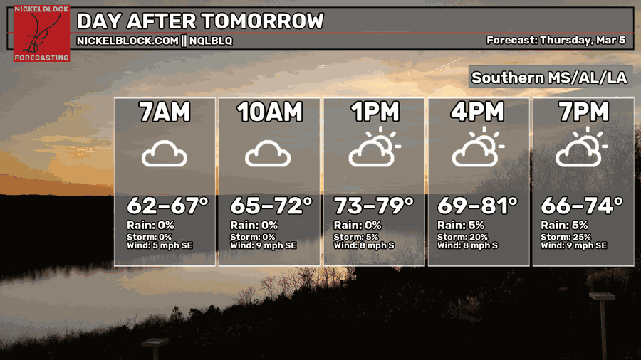
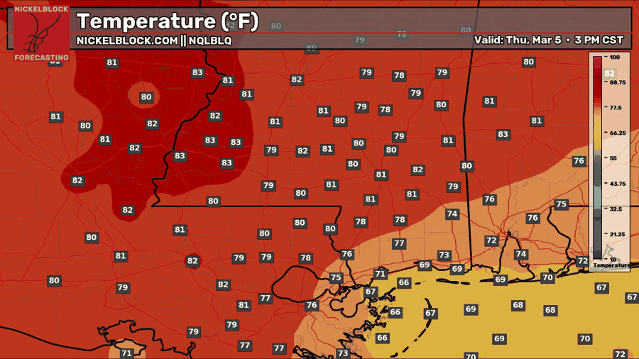
We’ll see a copy-and-paste day on Thursday, and honestly, maybe even a bit cloudier. Spotty showers will be around in some areas through the day, with the better chance later in the afternoon and into the evening than in the morning. Highs will reach the low 80s once again.

Extended Local Outlook
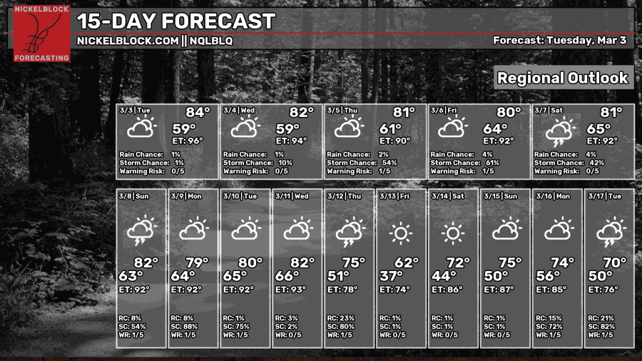
For now, expect chances for heavier more filled-in rain for Saturday and Sunday. A line of heavy rain and thunderstorms is currently modeled to come through in the afternoon on Saturday, and another one is possible sometime on Sunday. We will be updating you throughout the week, so continue to check back when we nail down the specifics and the timing!
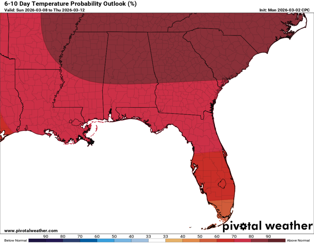
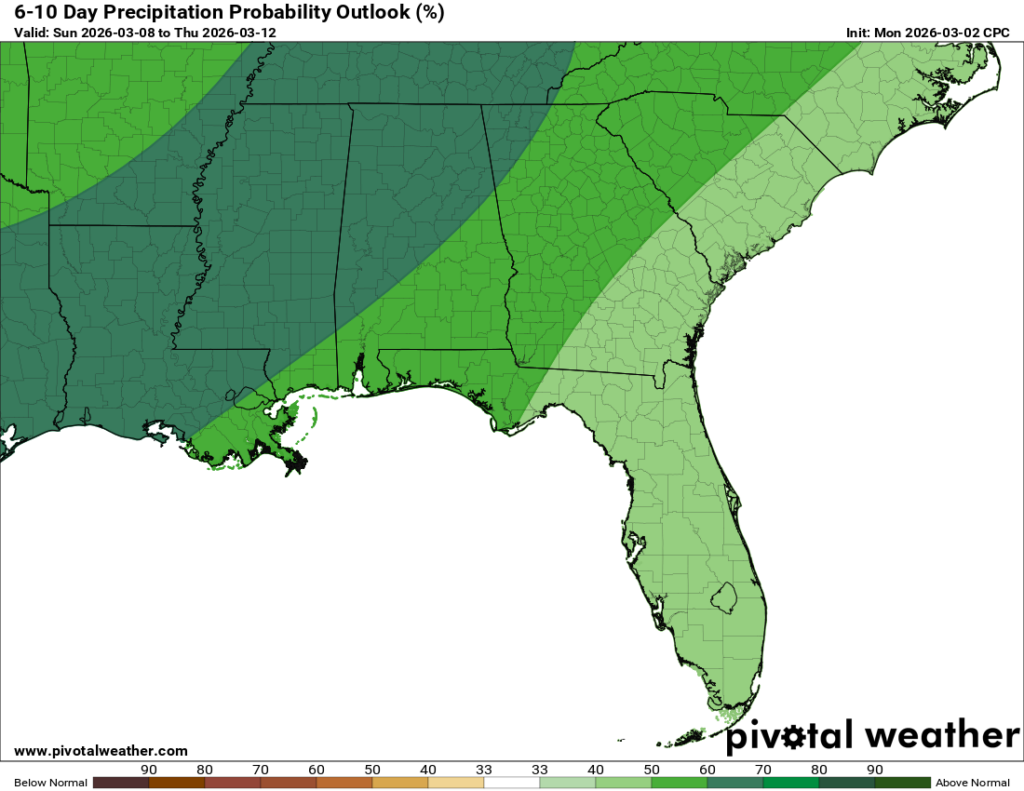
Through next week, we are expecting above-normal temperatures to stick around. Above-normal rainfall is also expected to continue, with a few rain chances in the forecast next week. The NQLBOT 15-day forecast shows we could trend closer to near-normal temperatures, with highs around 71 degrees sometime next weekend (the one after this one). Our super ensembles are also picking up on some uncertainty, with the potential for cooler-than-average temperatures by the middle of March! Are you ready for spring yet?


