It’s that time of the year again! The overblown weather maps have officially been out on social media and many in the south are in a panic again. Shoutout to my boss Nick for assuaging some of the panic with his video forecasts. Otherwise, it’s just another winter-like week ahead for us. Let’s take a look.

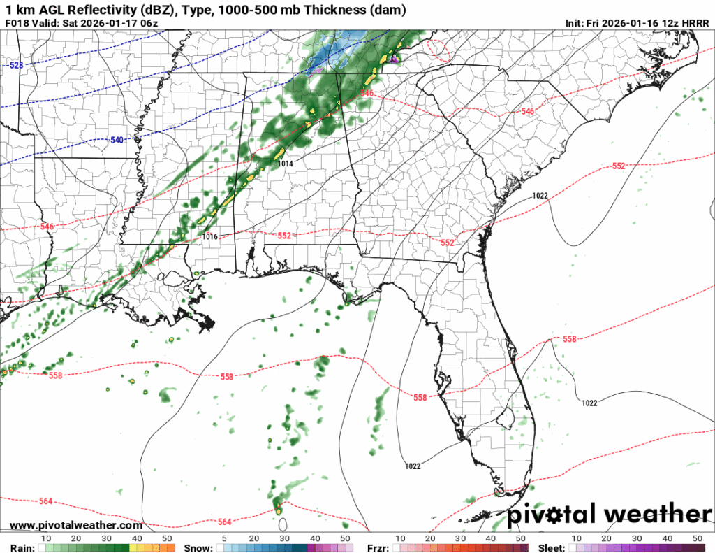
Starting off this weekend, our first little system will bring in some rain during the overnight hours tonight. This is a fairly weak cold front; however, it’ll lessen the temperatures a bit tomorrow compared to today. The effects of the cold front won’t really be felt until Saturday evening when the high pressure builds in from the west. Temperatures will dip below freezing Sunday morning and barely make it out of the 50s. Speaking of which, let’s take a look at the model output for the snow!
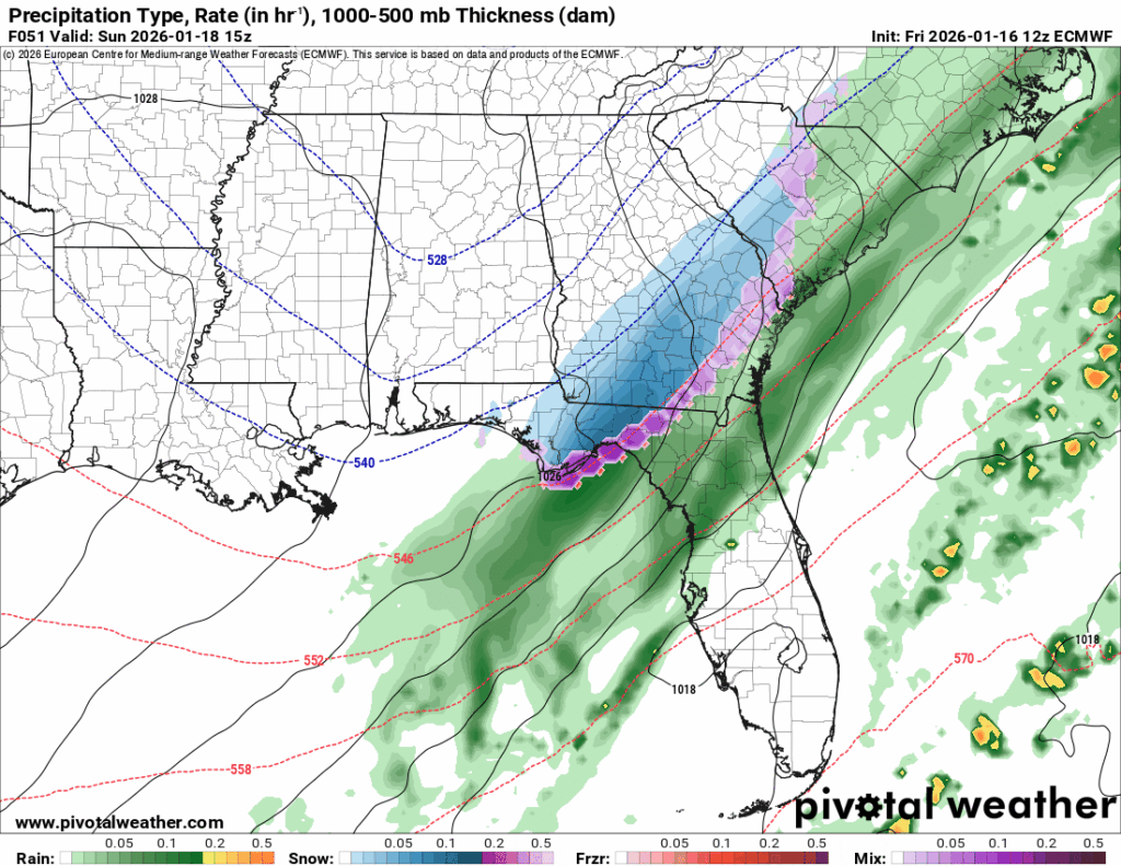
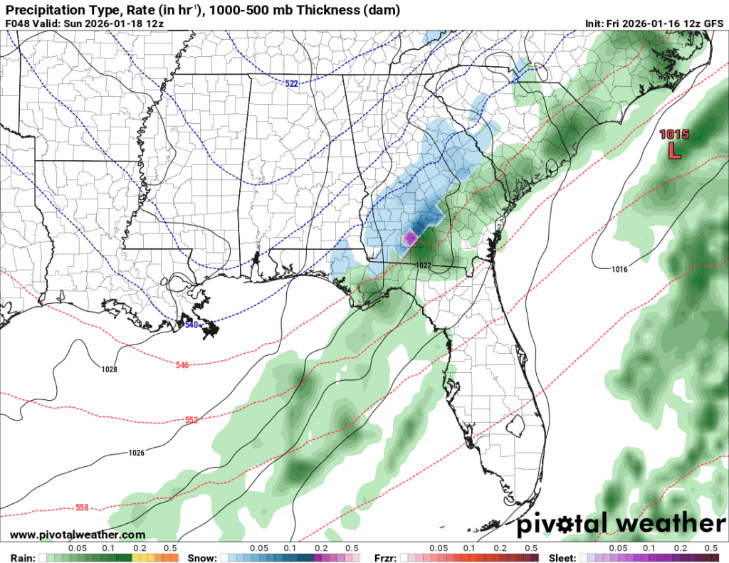
So far, both the GFS and Euro models are in agreement about the location of the winter weather. I do believe it’s possible that some areas closer to the coast may see a few flurries in the sky, however many of us further north likely won’t see much. The moisture has passed at this point, and we have a very dry area in the low-mid levels.
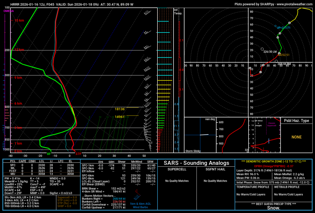
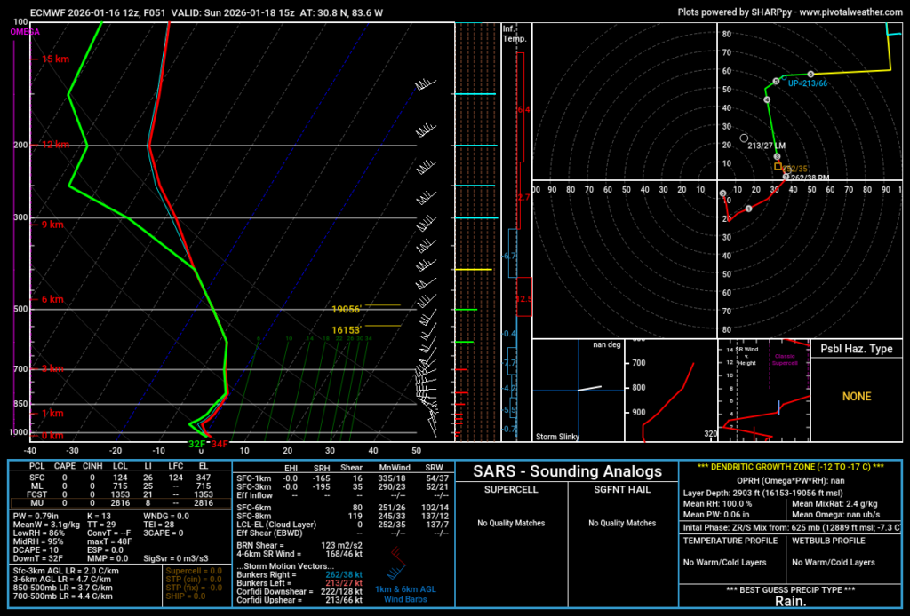
To the left is Harrison County, MS. To the right is Lowndes County, Georgia. Looking at the mid levels for both, we can see there is moisture available and the Skew-T lands right in the dendritic growth zone (where ice crystals can form). However, looking at the lower levels, Georgia clearly has moisture still available near the surface while coastal Mississippi does not. That’s one of the big differences in why we likely won’t see snow.
Next Week
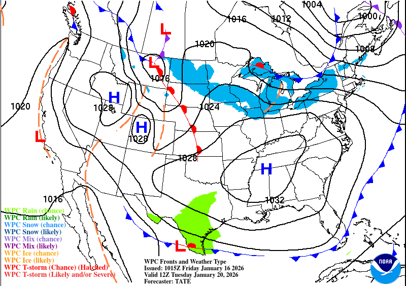
Next week is going to be another mild one with not too much variation in temperature, at least not until the middle of the week. A large area of high pressure will hover over much of the eastern US keeping conditions nice and cool. One thing to look out for later in the week is that low pressure that’s just south of Texas in the map above. That’ll be our next system rolling in.
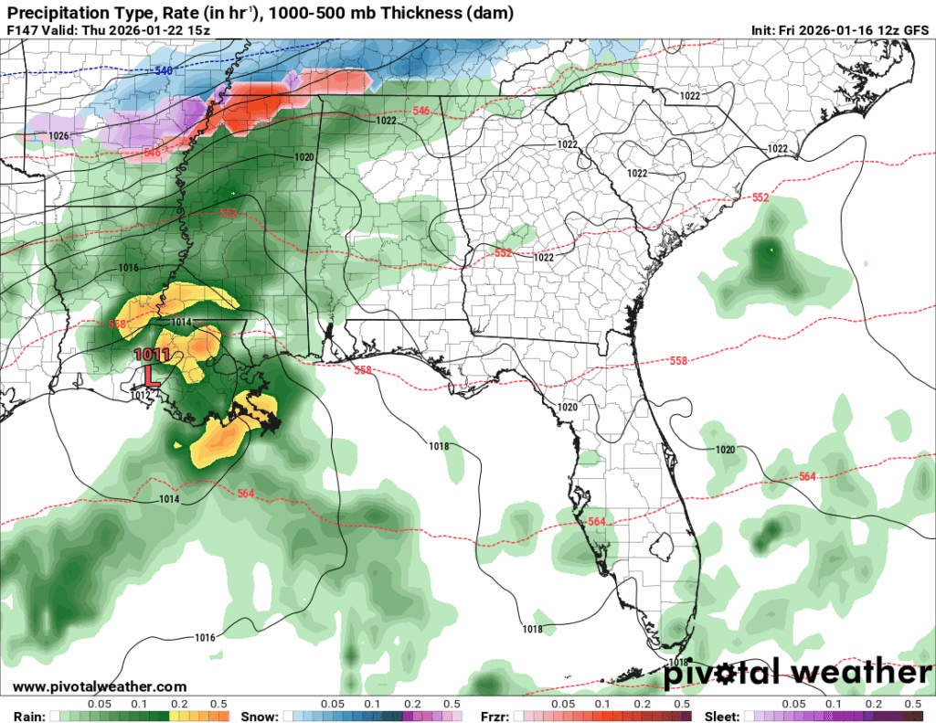
With these kinds of low pressure systems, they can bring mixed precipitation with them along with thunderstorms and even possibly severe weather. For us, however, this system looks to be fairly tame. I think our biggest concern will be heavy rain with a few thunderstorms. Most of the wintry weather looks to stay north near the MS/TN border. Keep your raincoat and umbrella with you on Thursday as it’s going to be a soggy one! Friday will be a cooler one as the low moves out and we go back to more wintry like weather. This won’t last too long as it’ll warm up before the next system moves in Sunday night.

Regional Day-to-Day Forecast
This Afternoon – Sunny, with a high in the mid 60s. South wind 10 to 15 mph, with gusts as high as 30 mph.
Tonight – Showers likely, mainly before midnight. Mostly cloudy, with a low in the low 40s. South wind 5 to 10 mph becoming north northwest after midnight. Chance of precipitation is 70%. New precipitation amounts of less than a tenth of an inch possible.
Saturday – Mostly cloudy, with a high in the mid 50s. North northwest wind 5 to 10 mph.
Saturday Night – Mostly cloudy, with a low in the upper 20s. North northwest wind around 5 mph.
Sunday – Sunny, with a high in the upper 40s. Northwest wind 5 to 10 mph.
Sunday Night – Clear, with a low in the upper 20s. Calm wind.
M. L. King Day – Sunny, with a high in the mid 50s. Calm wind becoming northwest around 5 mph.
Monday Night – Mostly clear, with a low in the mid 20s. Calm wind becoming north around 5 mph after midnight.
Tuesday – Mostly sunny, with a high in the low 50s. Northeast wind around 5 mph becoming calm in the afternoon.
Tuesday Night – Partly cloudy, with a low around 30.
Wednesday – Partly sunny, with a high in the low 60s.
Wednesday Night – A 40 percent chance of showers. Mostly cloudy, with a low in the mid 40s.
Thursday – A 40 percent chance of showers. Mostly cloudy, with a high in the mid 60s.


