General Central/Eastern Kansas Forecast
Short-Term (Wednesday-Thursday)
Some areas in northeast Kansas may see rain this morning, as a complex of thunderstorms makes their way south across eastern Nebraska. Generally, storms will remain east of US-77 and will look to gradually dissipate by the time they reach I-70. New rainfall totals look to be on track from yesterday’s forecast, with up to 1-2 inches possible. Depending on storm maintenance, this activity *could* make it as far south as I-35 but the overall chance of this occurring is low.

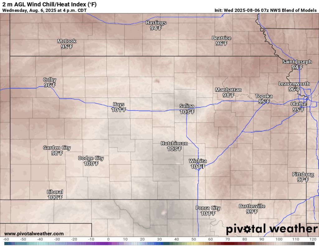
Once the rain moves out, another warm and dry day will ensue for the next couple of days across central and eastern Kansas. High temperatures today and tomorrow will be in the low to mid 90s, with the highest temperatures being closer to I-135 and west. Winds will generally be southerly at 10 to 15 mph today and tomorrow. Dew point temperatures will be in the upper 60s to low 70s will keep the humid feel hanging around, and relative humidity values ranging between 50-55% will cause our heat indices to reach the upper 90s to low 100s once again. Low temperatures tonight will be in the low to mid 70s before being warmer tomorrow night in the upper 70s.

Another small chance of showers and thunderstorms may be possible tomorrow morning, mainly across northeast Kansas, as another small disturbance rotates through. Overall, any activity for now looks to be confined to northeast Kansas and remain fairly isolated in nature.

Long-Term (Friday-Tuesday)
Friday and Saturday look to be dry and hot again before a cold front/stationary front moves in from the north on Sunday and stalls out across northern/central Kansas. Temperatures look to drop into the mid to upper 80s behind this boundary, but more notably, this boundary would provide a focus for increased rain chances through the late weekend and into early next week. Details are a little ambiguous this far out yet, but for now, the best chances of rain will exist north of US-54 (sorry southern Kansas).
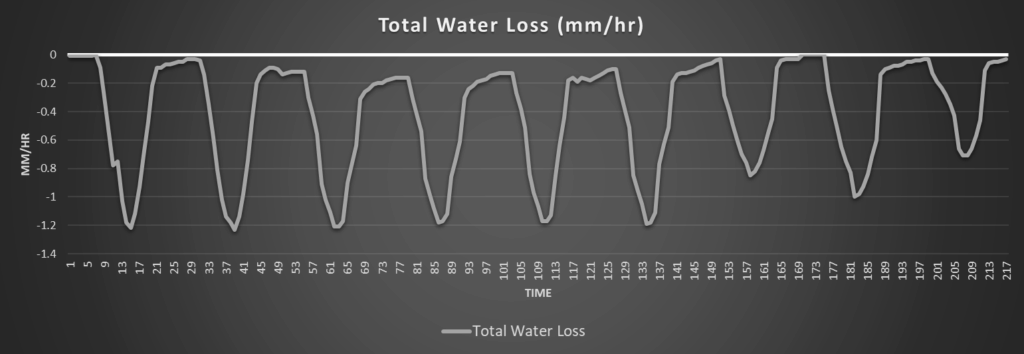
Regional Soil Moisture Outlook
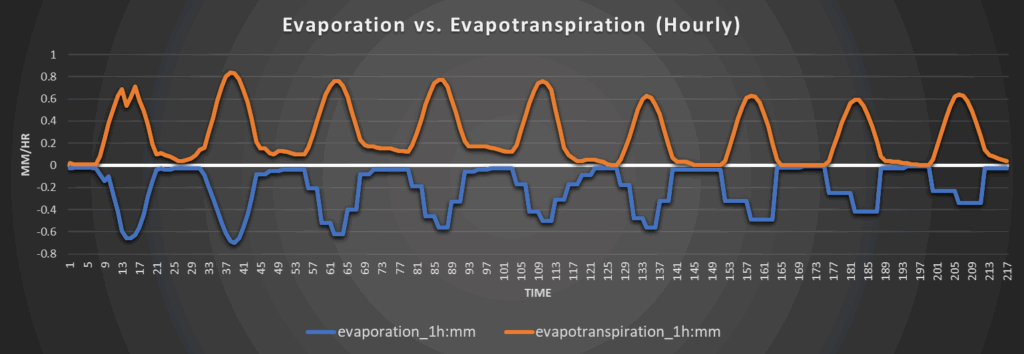
Steady continued drying of soils will persist through the forecast period, at least until this frontal system arrives late weekend. Development of abnormally dry soil conditions is looking more likely, especially across northeast/eastern Kansas, with already dry topsoil and daily water loss rates of 1.2 to 1.5 mm/hr exacerbating this. Expansion of drought conditions across northern Kansas will have to be watched closely due to this, as this area has lacked enough rainfall to fully break the drought for months now.
Around Westmoreland


Around Scranton


Around Burlington


Around Altoona