We’re still stuck in the spotty shower pattern for another day or so as the atmosphere begins to move a bit as we switch gears towards Autumn. This week looks to be warm and rainy as a large front stretching from the Great Lakes to the Southeast will move in by mid-week. Temperatures will cool down a bit as well, mostly influenced by the rain until Friday when the front moves out.
//Courtesy: Pivotal Weather
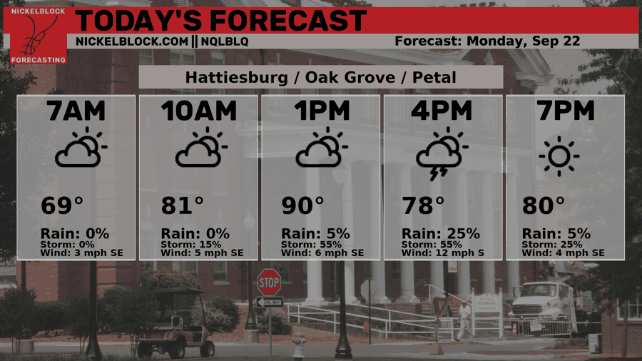
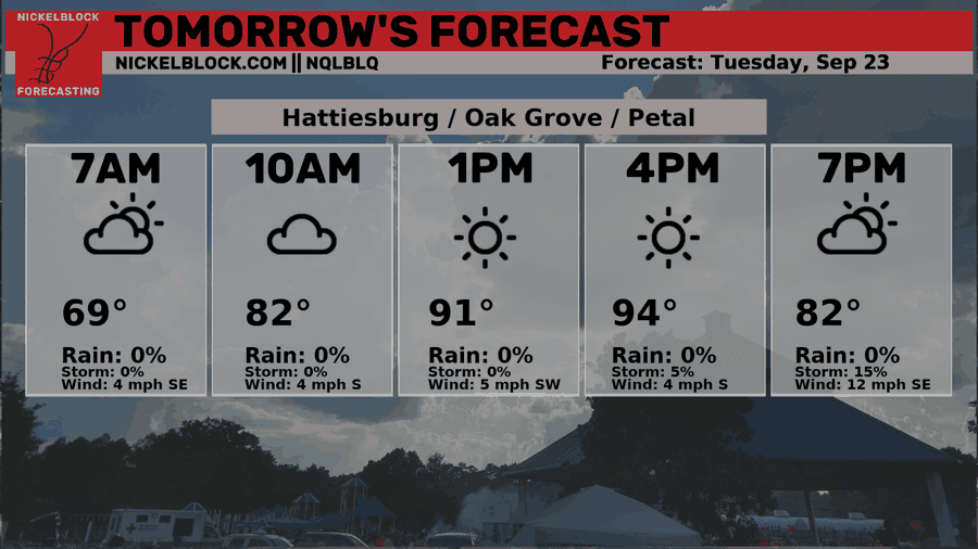
Today, we should expect some isolated thunderstorms during the early to mid-afternoon as temperatures just reach around the 90 mark. It’s a similar setup to the past few days, so some may get a healthy dose of rain, while others in another part of the city or county may not get anything. Tuesday will be a similar story but with fewer clouds in the sky ramping temperatures up a few degrees into the low 90s. Lows will fall into the upper 60s to around 70.

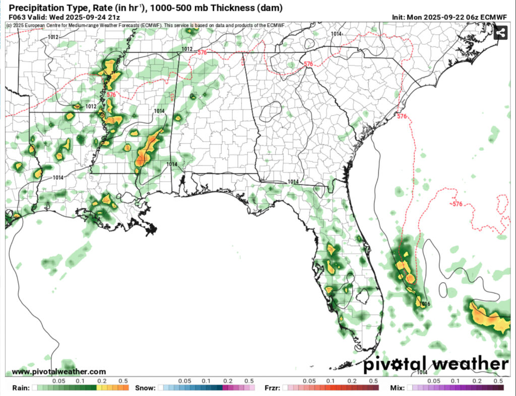
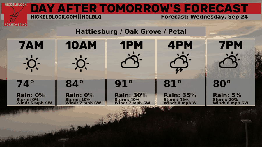
By Wednesday, more clouds will roll in keeping temperatures cooler, however that comes with the increasing rain chances in the afternoon. An MCS line will move in by the mid-afternoon bringing some moderate rain and possible thunderstorms across much of Louisiana and Mississippi and even parts of Alabama. This looks to last past sunset, so keep your umbrella or jacket with you if you’re going to church or going out that evening. Highs in the low 90s and lows in the low 70s.
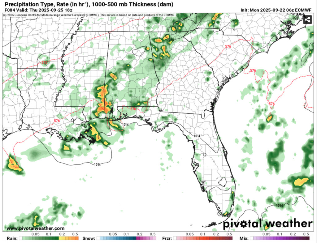
Thursday’s rain chances will shift further east towards the MS/AL line which means that much of the Pine Belt and MS/LA coastline will see rain chances. A few thunderstorms and even a chance of flash flooding in some areas. This looks to start in the early afternoon and last until the evening hours. Highs will be in the mid 80s and lows in the mid 60s. Overall totals for the rain in the 48hr period look to be just over an inch on average, so good news for your plants and lawn! But be sure to water them afterwards as the rain will be gone for a while longer.
Friday will be a nice break from the hot temperatures we’ve had with temps reaching the mid 80s during the day and sunny skies. It’ll be a great start to the weekend and temperatures will fall into the low 60s.
Tropical Outlook
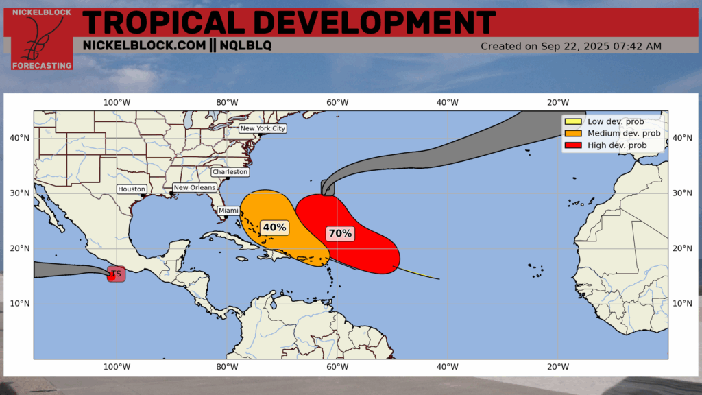
The tropics have been fairly active for mid-September. Hurricane Gabrielle is soon to be swept out to sea while there are two tropical waves we’re keeping an eye on. Both have some rotation to them, however it looks like the wave further east will be the one to win out so far. Due to the high out in the Atlantic, we’ll have a similar pattern to Gabrielle’s with the wave hooking to the north due to the atmospheric influence. Models don’t have a complete grasp on what it will do and diverge from each other, so we’ll have to wait and see in the next few days as models update.
Today’s Forecast:
Tomorrow’s Forecast:
Wednesday’s Forecast: