Not much has changed since I made my forecast back on Wednesday. It’s going to be hot and with almost no rain in sight. Humidity is also a bit lower as the dew point only tops out in the low 60s for the next week as well. The good news? The experienced temperature will match the actual temperature, so at least we won’t have overbearing heat, but it’s still hot regardless.
The Upper Levels
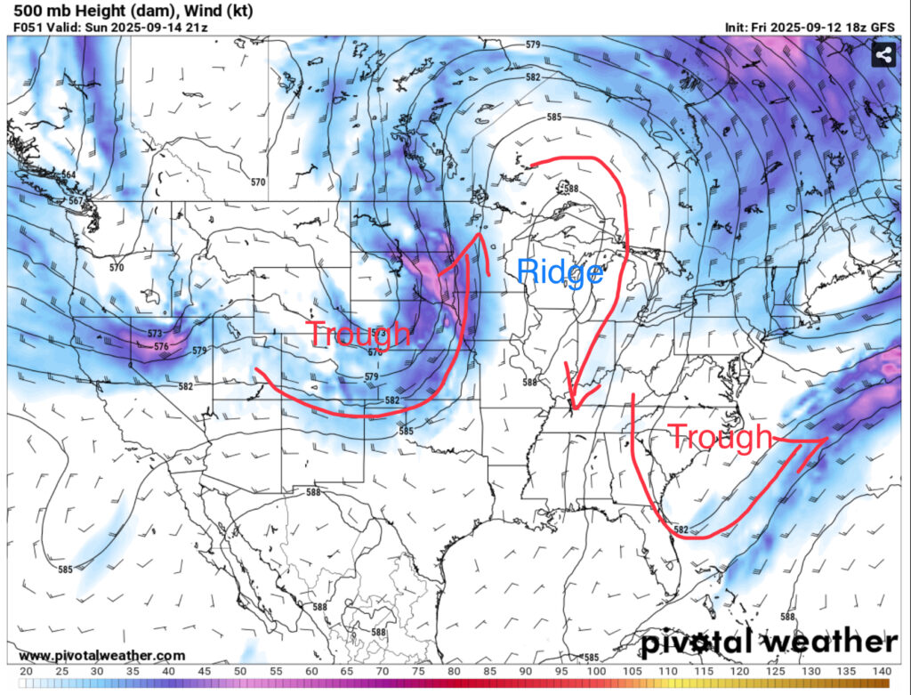
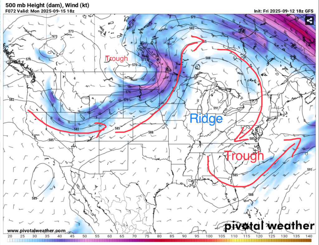
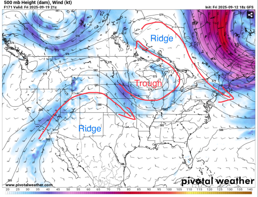
Looking at the upper levels over the weekend, there’s an amplified trough-ridge-trough pattern that is essentially blocking much of the movement across the eastern US. As the trough digs and eventually ejects to central Canada, the ridge will tilt on its axis and funnel air to the trough in the mid-Atlantic. This will provide us with northerly winds in the upper levels which also is a factor to the dry air. As the week progresses, the trough near the mid-Atlantic will move out, however the ridge will move further into Canada as another ridge develops in the Southwest US.

At the surface, we’ll be stuck in a large zone of high pressure and this won’t change for a while. If anything, the high pressure builds, but the mid-Atlantic states will feel the effects of the low pressure system due to the trough overhead. They’ll be the ones to get the rain while we’re stuck with the dry.
Expect pretty same-y weather for the week ahead. Temperatures will climb from the low 90s during the day and mid 60s over the weekend to the mid 90s and upper 60s for the rest of the week. The experienced temperature will match the actual temperature or be just above it, but I doubt heat advisories will be issued unless the heat spikes. We’ll see a few clouds here and there and even some patchy fog overnight Saturday into Sunday. A dry front will move in by Friday, but don’t expect any rain with it. Otherwise, it’s a hot mid-September weekend and week ahead. It’ll be a while before we see rain, so make sure to water your lawns and plants to keep them alive for a while.
The Tropics
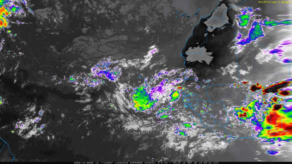
So far, the NHC has put a 40% chance of development over the next 7 days on this batch of unorganized showers coming off the coast of west Africa. It doesn’t look favorable yet, but as it moves further towards the North Atlantic, it will be worth keeping an eye on.

Regional Day-to-Day Forecast
Tonight – Mostly clear, with a low in the mid 60s. Northeast wind around 5 mph becoming calm in the evening.
Saturday – Sunny, with a high in the low 90s. Calm wind becoming east northeast around 5 mph in the afternoon.
Saturday Night – Clear, with a low in the mid 60s. Calm wind.
Sunday – Patchy fog before 7am. Otherwise, sunny, with a high in the low 90s. Calm wind becoming east around 5 mph in the afternoon.
Sunday Night – Partly cloudy, with a low in the mid 60s. Calm wind.
Monday – Sunny, with a high in the mid 90s. Calm wind becoming northeast around 5 mph in the afternoon.
Monday Night – Mostly clear, with a low in the mid 60s. East wind around 5 mph becoming calm.
Tuesday – Sunny, with a high in the mid 90s. Calm wind becoming east northeast around 5 mph in the afternoon.
Tuesday Night – Mostly clear, with a low in the mid to upper 60s. East wind around 5 mph becoming calm.
Wednesday – Sunny, with a high in the mid 90s.
Wednesday Night – Mostly clear, with a low in the mid to upper 60s.
Thursday – Sunny, with a high in the mid 90s.
Thursday Night – Mostly clear, with a low in the upper 60s.
Friday – Sunny, with a high in the mid 90s.


