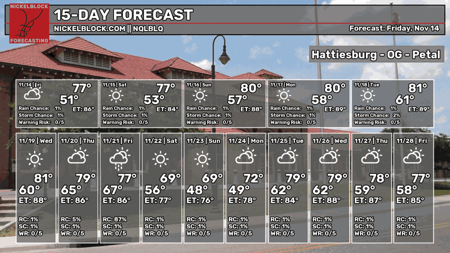
It’s been seasonably warm for the past few days and it looks like that won’t change for the upcoming week. We’re currently stuck under a high pressure dome and it’s very persistent. The upper atmosphere is struggling to move systems from the west, so we won’t see any possible rain until late next week. Let’s take a look.

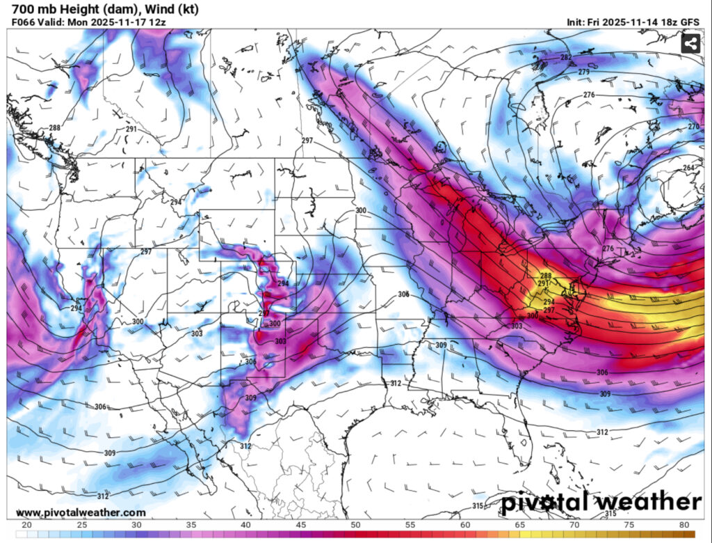
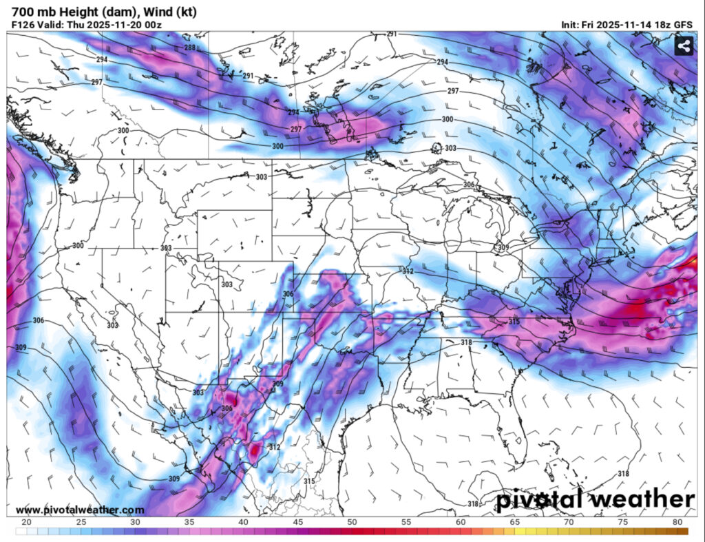
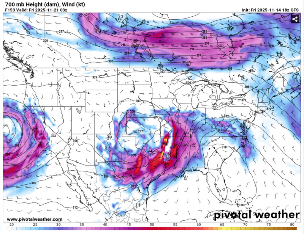
The upper atmosphere early in the weekend will struggle to move the encompassing low pressure system to the eastern US which will result in a more linear pattern. What that means for us is that we’ll continue our pattern of warm weather for the next several days. As we move towards the middle of the week, a ridge will reside over the Gulf and the Deep South and by the end of the week, a trough that develops over the Pacific will move into the Deep South developing into a closed trough which will bring a more organized system our way.
In the lower atmosphere, a closed high pressure system remains over the surface leading to drier and warmer weather overall. Highs will reach the upper 70s during the weekend and fall into the mid 50s. Despite a few fronts moving in during the week, temperatures will top out in the 80s by next week and lows will fall into the 60s. Overall, pretty warm and fairly humid for this time of year. The main system that will move this out won’t be here until late Thursday into Friday.
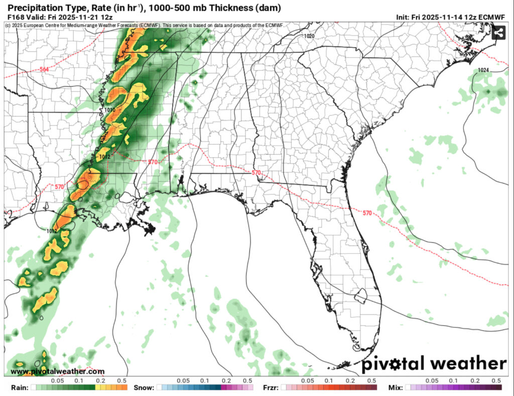
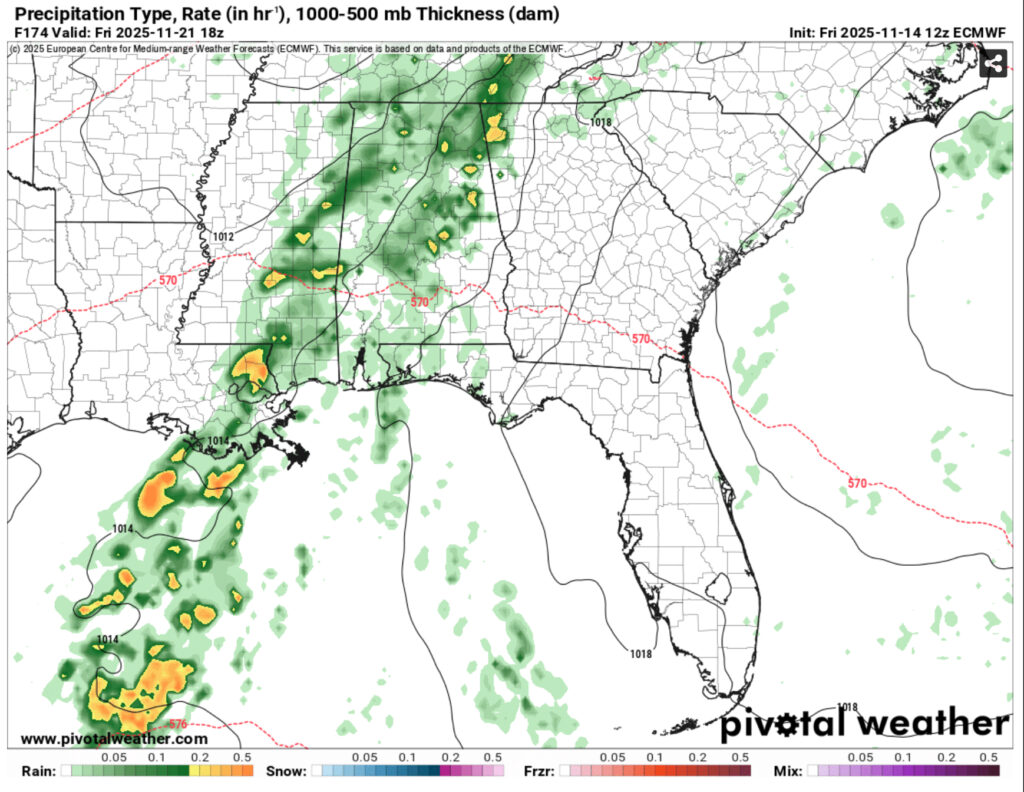
Both the GFS and ECMWF models show the MCS weakening by the time it reaches the central to eastern portion of Mississippi and Louisiana. The main reason is the high’s location in the Atlantic. It has a fairly strong hold over the Deep South still and unless it moves out further east, it will inhibit further convective development as the system moves further east. I do expect some rain will come out of this, but it will likely be on the west side towards the Delta, Louisiana, and Arkansas. Afterwards, temperatures will cool down slightly into the mid 70s next weekend.
Overall, it’s going to be a much warmer week next week as the strong high pressure system holds over much of the Southeastern US. Expect temperatures in the 80s and lows in the upper 50s to low 60s by the end of the week. Rain is likely for much of us in the central part of the Gulf, but potency looks to dive as it moves further east.