Overall Setup
Merry Christmas to all that celebrate. After today, we’ll be entering a period called Twixmas! Those “in-between” days from Christmas to New Year’s where time kind of disappears, the days all blur together, and nobody knows what day of the week it is.
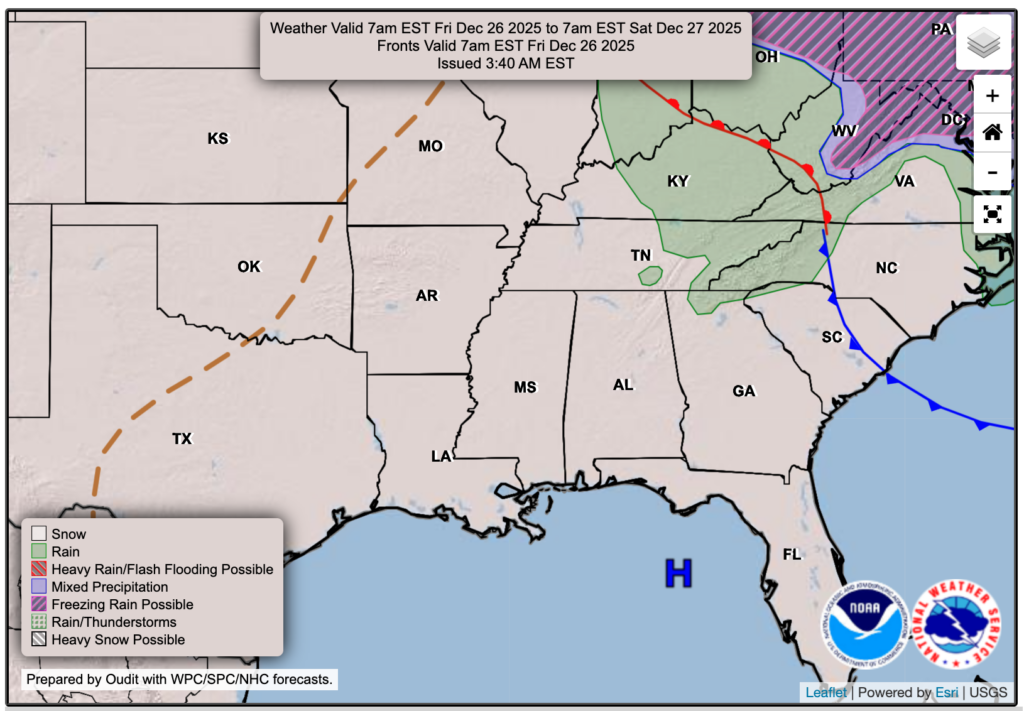
Weather-wise, temperatures stay pretty steady through Monday. After that, we’ll get a brief three-day cool-down, then we bounce right back to warmer temps again. As for rain, Saturday only brings a small chance for a few sprinkles here and there, but the better opportunity for rain arrives Sunday night into Monday.

Tonight’s Forecast
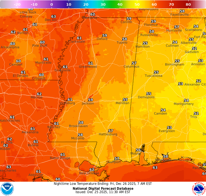
Tonight, we’re in for another round of dense fog, and it may linger into the morning commute before improving around 9 AM. It’ll also be a mild night, with lows running warmer than average in the upper 50s to lower 60s.
Tomorrow’s Forecast: Friday, December 26
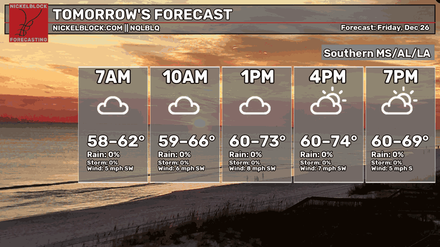
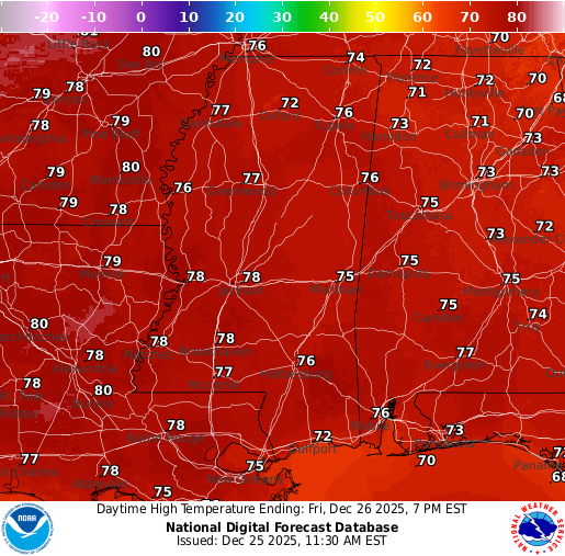
Tomorrow, expect that fog to hang around until about 9 AM, then we’ll stay mostly cloudy through the afternoon. Skies should gradually clear out by mid to late evening. Highs stay toasty and above normal in the mid to upper 70s, with lows settling into the lower 60s.
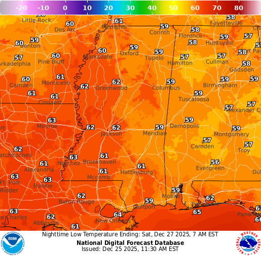
Weekend Forecast: December 27 & 28
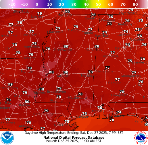
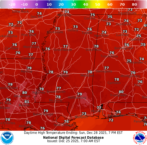
A quick sprinkle can’t be ruled out Saturday morning into the afternoon, but most places stay dry. Fog also looks likely again Saturday morning, so take it slow on the roads if you’re heading out early. Highs both Saturday and Sunday will be in the upper 70s.
The bigger rain chance arrives Sunday night into Monday morning as a cold front moves through. That front will bring a line of rain and some gusty winds, then it’ll quickly usher in much cooler air behind it. Since the front comes through overnight, Monday’s “high” will likely happen around midnight, and temperatures will fall steadily through the day. By Monday night into Tuesday morning, we’re looking at lows dropping into the 30s.
Extended Local Outlook
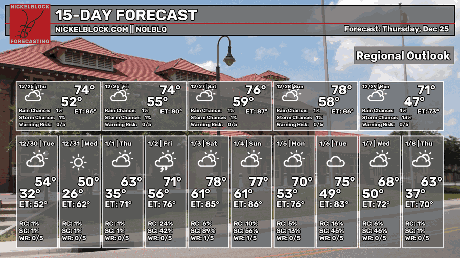
That cold front will kick off a three-day cool-down, with afternoon highs mainly in the 50s (below normal) and 60s (closer to normal). It’ll feel noticeably different after the warm, muggy stretch we’ve had lately, especially with cooler mornings and a more “winter-like” feel in the air. Overnight lows will also trend colder during that period, so jackets will definitely be back in the mix.
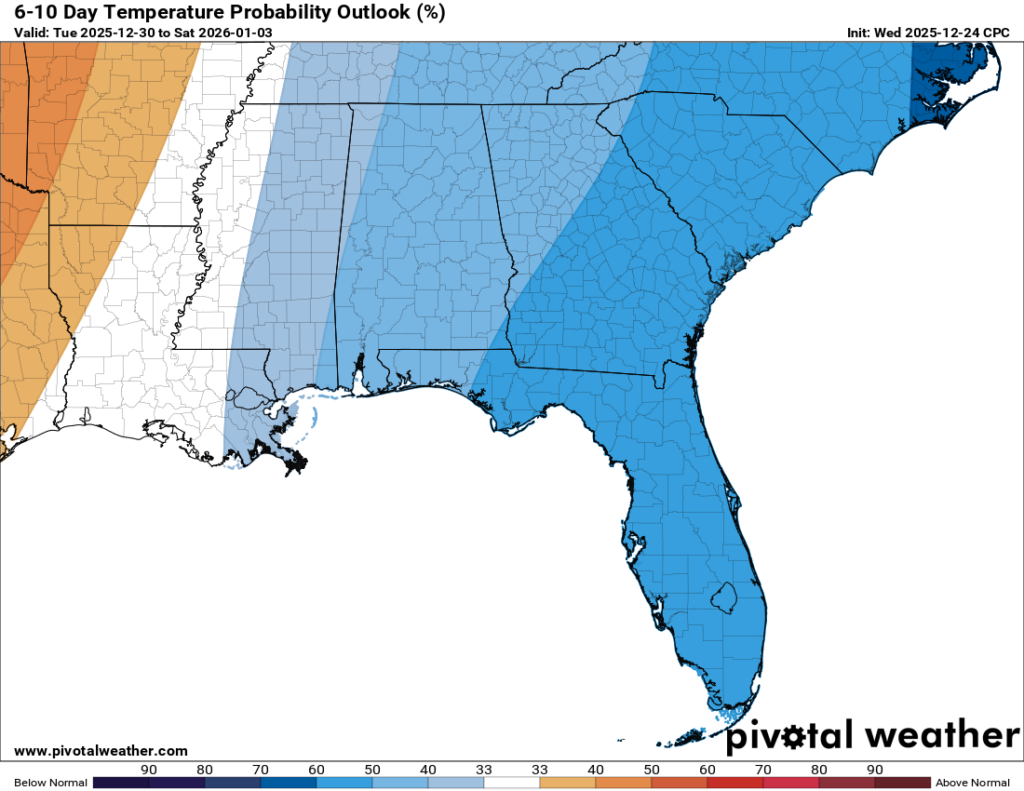
After that brief chill, temperatures rebound. As we move into the New Year, we should climb back to above-normal temperatures, with highs returning to the 70s.

REGIONAL DAY TO DAY FORECAST
Tonight: Patchy dense fog after 11 PM. Otherwise, mostly cloudy. Lows in the upper 50s. Calm wind becoming south-southwest around 5 mph.
Friday: Areas of dense fog before 9 AM. Otherwise, cloudy early, then gradually becoming mostly sunny. Highs in the mid 70s. Southwest wind 5 to 10 mph with gusts up to 20 mph.
Friday Night: Increasing clouds. Lows in the lower 60s. South-southwest wind around 5 mph becoming calm in the evening.
Saturday: Partly sunny. Highs in the upper 70s. Calm wind becoming southwest around 5 mph.
Saturday Night: Mostly clear. Lows near 60. Calm wind becoming south around 5 mph.
Sunday: Mostly sunny. Highs in the upper 70s. Light south-southwest wind increasing to 5 to 10 mph in the morning.
Sunday Night: Showers likely after midnight. Mostly cloudy. Lows around 50. South wind 5 to 10 mph becoming west after midnight, with gusts up to 20 mph. Chance of rain 60 percent.
Monday: A chance of showers, mainly before noon. Mostly cloudy. Highs in the low 60s. North-northwest wind 10 to 15 mph with gusts up to 25 mph. Chance of rain 30 percent.
Monday Night: Mostly cloudy. Lows in the upper 20s.
Tuesday: Mostly sunny. Highs in the mid 40s.
Tuesday Night: Mostly clear. Lows in the mid 20s.
Wednesday: Sunny. Highs in the mid 50s.


