Hey everyone! Today, we will see our last day of low 90s before we see temperatures Monday-Wednesday approaching 100. We are expecting mostly dry conditions to take over the forecast early this week, but a more wet pattern later in the week. Let’s dive into the detailed forecast:
Today’s Overall Setup
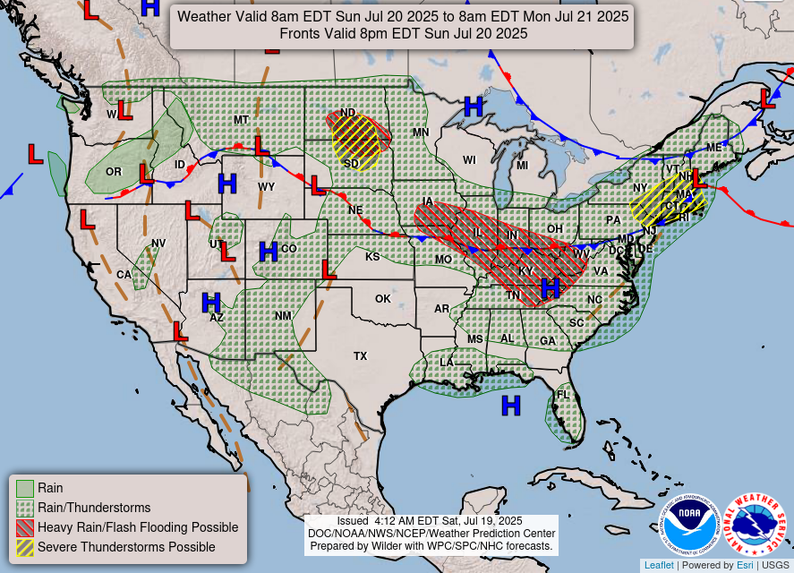
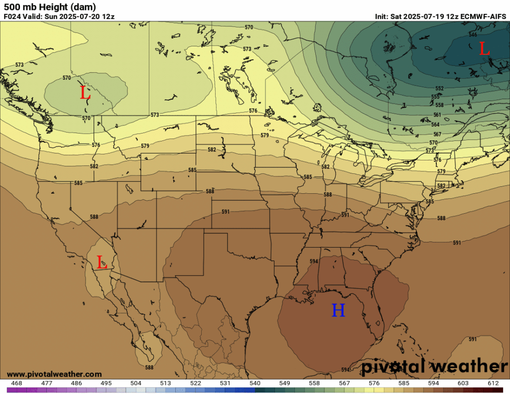
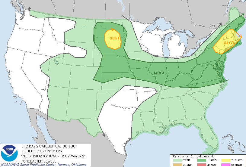
Our overall pattern at the mid-levels of the atmosphere (500 mb) is a ridge of high pressure over the southwest, followed by more troughing in the northeast, northwest, and in southern California. There is a risk of severe weather today in the northern Plains and in New England, as well as a flash flood threat from Iowa through the Tennessee Valley.
Here at home, there is an area of high pressure that is keeping our weather on the dry side, but that same high pressure is funneling in a bunch of tropical moisture that may potentially precipitate out some isolated showers and thunderstorms later in the afternoon.

Today’s Local Forecast
Today, you can expect mostly sunny conditions. We are staying dry for most of us, but there is a chance of some quick showers or thunderstorms by the late evening. These will be very isolated storms and is expected to move off by the late evening.

Here’s an hourly look at the forecast for today for the region.
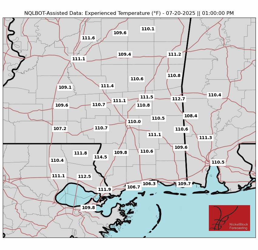
Today, we will expect a high temperature in the low 90s, which will feel up to 110 degrees at 1pm given the humidity. Dew points are in the 70s, which is very high humidity.
Friday-Sunday Forecast
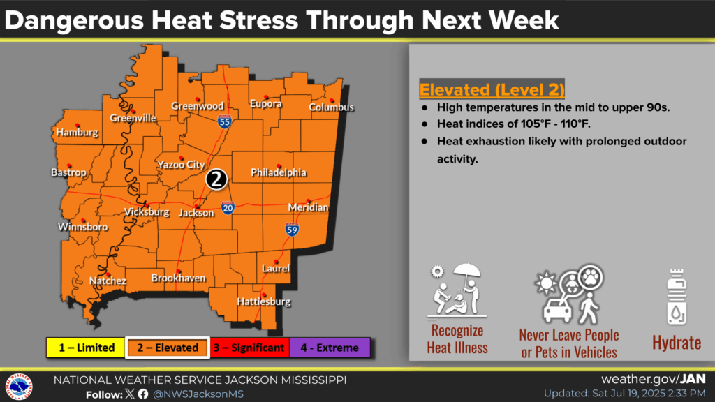
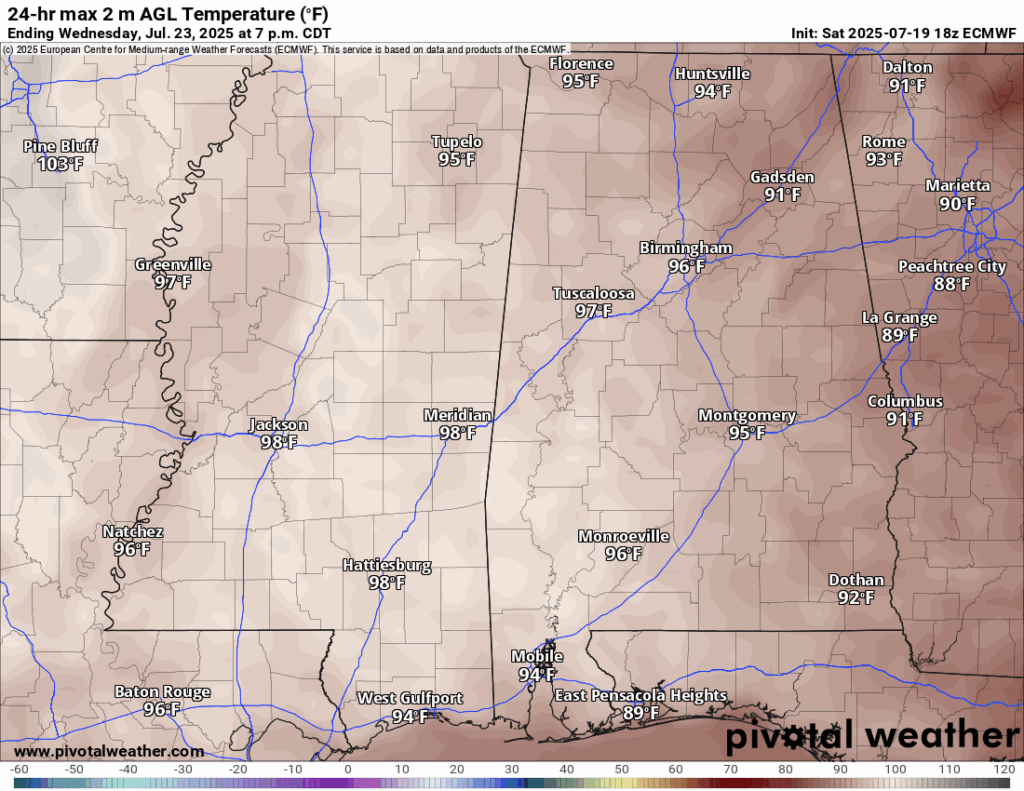
Dangerous heat is expected to continue into this week with high temperatures sitting in the high 90s each day, at least through Wednesday. There is a Elevated (Level 2) risk of hazardous heat from the NWS for our area given the extreme high temperatures along with high humidity. Heat indicies will be well into the 100s for most of us, with some spots potentially feeling like 115. This is nothing to joke around with: do not leave children or pets in cars unattended, hydrate frequentely, and know the signs of heat illness. Stay indoors in the air conditioning whenever possible.
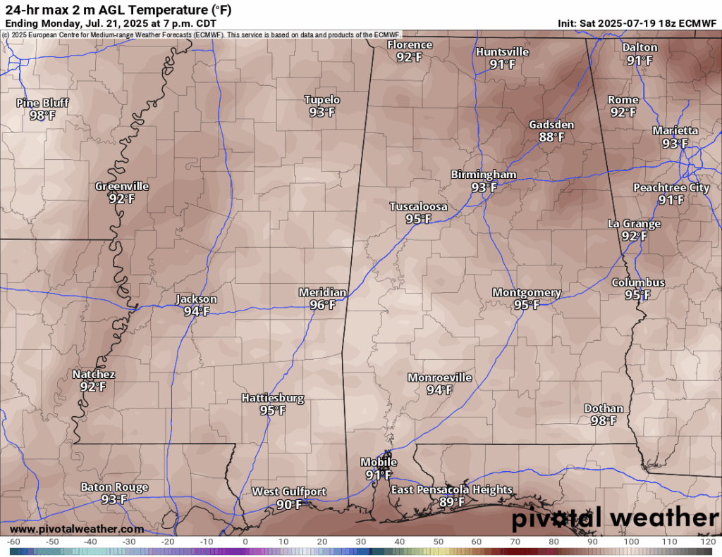
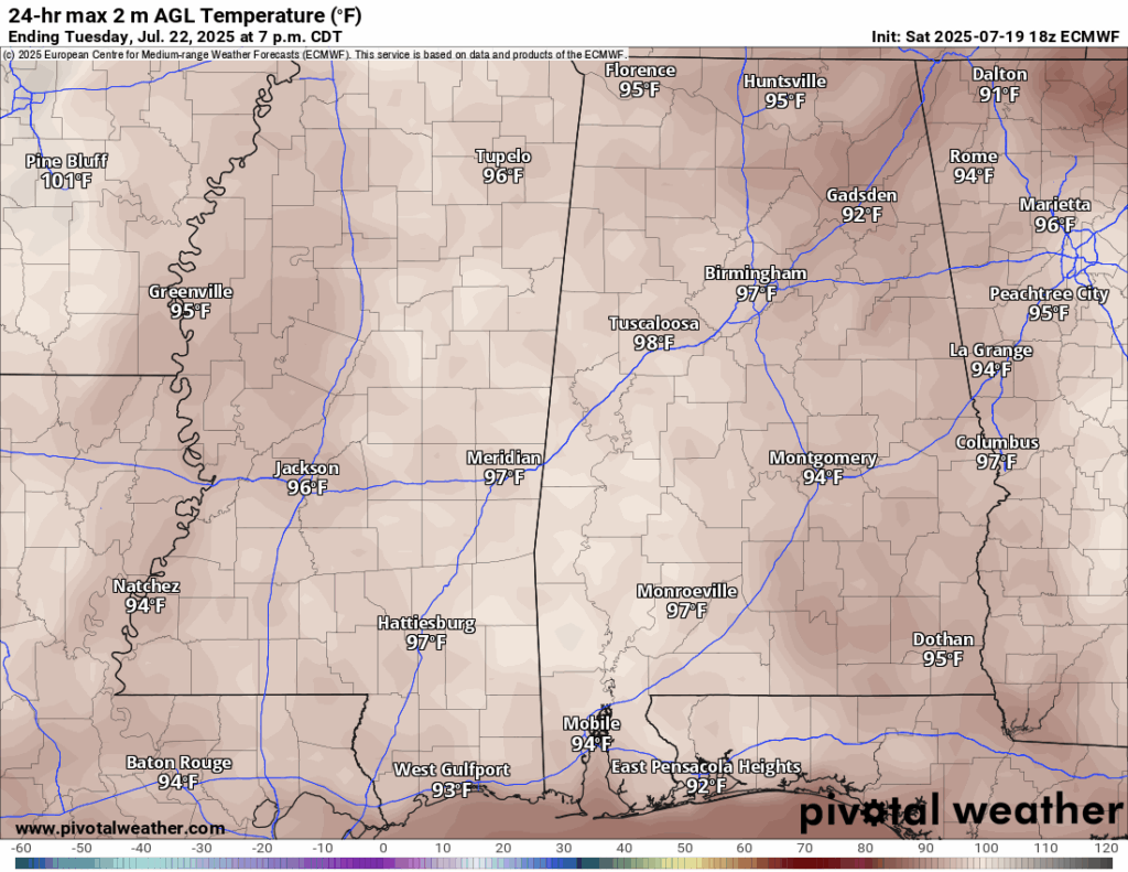
Monday and Tuesday are shaping out to be mainly sunny and dry. There is more of a chance on Tuesday for some popup afternoon storms, but most will stay dry. Wednesday we will see increasing clouds and an increased storm chance. A stalled stationary front will be parked to our east starting Wednesday into the late week. This is the reason for the increased cloudiness and rain chances.
Extended Local Outlook

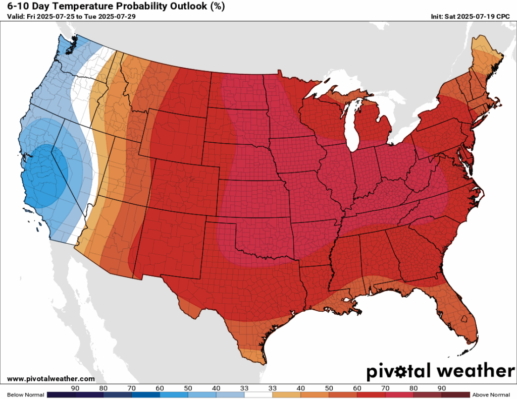
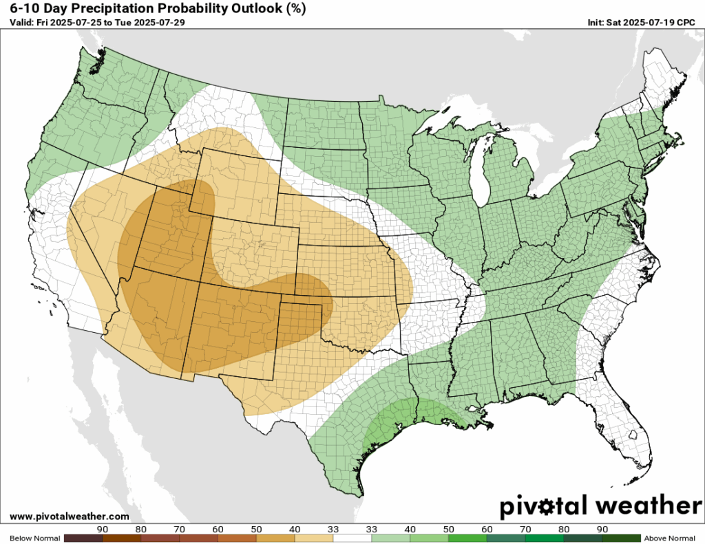
The ridge of high pressure will stick around for the end of the week into next weekend! There’s a good chance that temperatures will stay above normal during this time. There’s a small chance that we will see above normal rainfall, but we are no stranger to that!
Latest Tropical Update
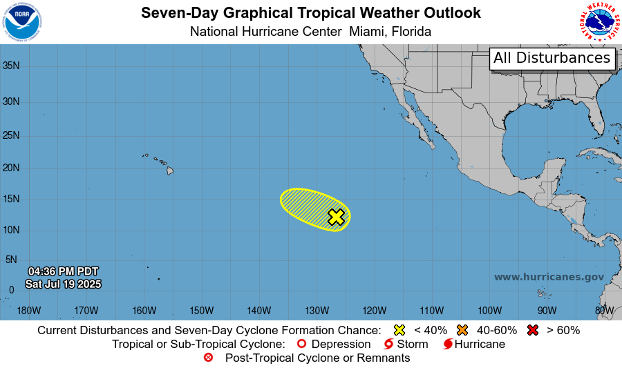
Currently out in the Pacific, there is an area to watch with a 20 percent chance of development in the next 48 hours and a 30 percent chance in the next 7 days. It is overall moving into an environment that is not supportive of tropical development, but we are keeping an eye on it.
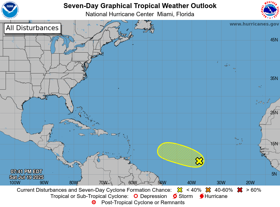
In the Atlantic, we have a tropical wave that is about 1000 miles west/southwest of the Cabo Verde Islands and has a 10 percent chance of development in the next 48 hours and a 20 percent chance in the next 7 days. By the middle of this week, conditions are also expected to be unfavorable for development. But things could change, so we will also be keeping our eyes on this!
Want the latest details on these systems? Check out our daily tropical updates for more in-depth information on the tropics!
REGIONAL DAY TO DAY FORECAST
Today: Sunny. Highs in the lower 90s. Chance of a shower or thunderstorm in the late afternoon. Calm winds becoming west southwest around 5 mph in the afternoon. Chance of rain 30 percent.
Tonight: Mostly clear. Lows in the mid 70s. South southwest wind around 5 mph becoming calm.
Monday: Sunny and hot. Highs in the upper 90s. Calm winds becoming west around 5 mph.
Monday Night: Partly cloudy. Lows in the mid 70s. Calm winds.
Tuesday: Mostly sunny and hot. Slight chance of showers and thunderstorms in the afternoon. Highs near 100. Calm winds becoming northwest around 5 mph. Chance of rain 20 percent.
Tuesday Night: Partly cloudy. Lows in the mid 70s. Calm winds.
Wednesday: Mostly sunny and hot. Showers and thunderstorms likely in the afternoon. Highs in the upper 90s. Calm winds becoming north northeast around 5 mph in the afternoon. Chance of rain 60 percent.
Wednesday Night: Mostly cloudy. Chance of showers and thunderstorms before 1am. Lows in the mid 70s. South southeast wind around 5 mph becoming calm. Chance of rain 40 percent.
Thursday: Mostly sunny. Showers and thunderstorms likely in the afternoon. Highs in the mid 90s. Chance of rain 70 percent.
Thursday Night: Partly cloudy. Slight chance of showers and thunderstorms. Lows in the low 70s. Chance of rain 20 percent.
Friday: Sunny. Showers and thunderstorms likely in the afternoon. Highs in the mid 90s. Chance of rain 70 percent.


