Invest 95L has officially passed and the rain chances are going to fall for the next few days. Which means it’s time to turn up the heat again! Temperatures will reach near 100 with heat indices in the 110s across much of the southeast. A big reason for this is a region-spanning high overhead allowing warm, moist air advection which will drive up the humidity and suppress rain chances.
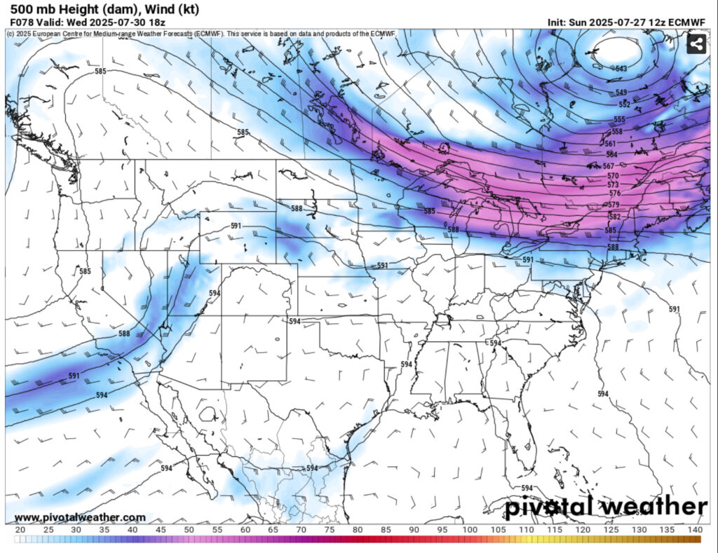
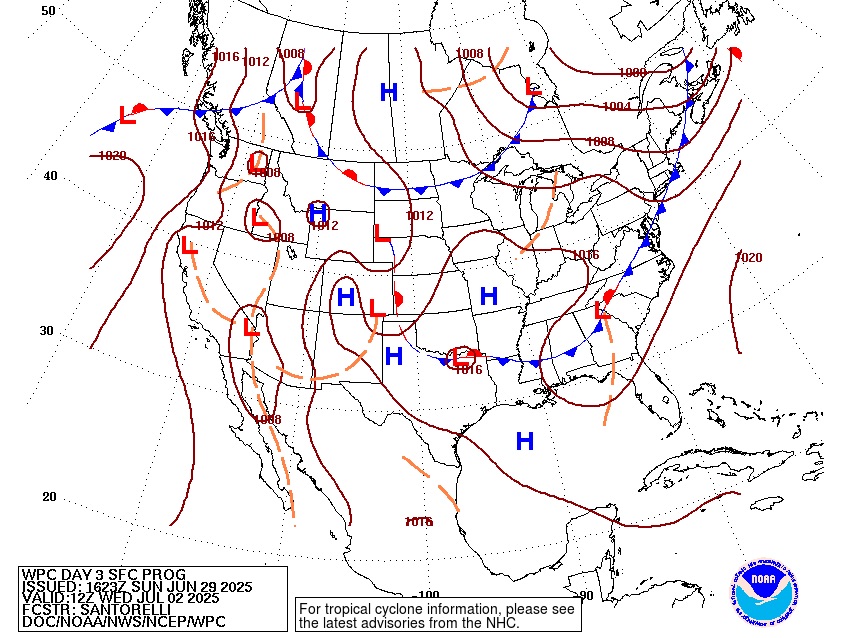
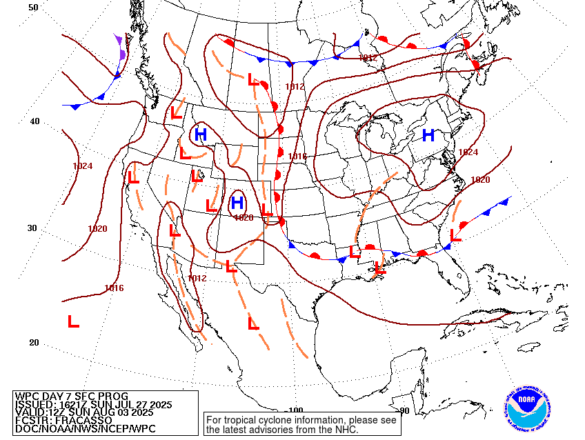
In the upper levels, a strong ridge that spans much of the eastern US will move west and split between the southwest and southeast. This is slightly good news because the ridge won’t have a hold over us much longer. At the surface, the stalling front that has been stuck over much of the Midwest will be moving south towards our neck of the woods, but very slowly. Part of this is due to the overbearing high already in place, but the other reason is a developing high in the Atlantic moving further west hindering much of the dynamic movement.
Starting the week off, temperatures will reach the upper 90s to 100 in some areas with lows in the mid 70s. Storms will be fairly limited Monday due to the high’s location. Heat advisories and excessive heat warnings are imminent with the heat index reaching 110+ in many spots. There won’t be much relief from the heat with humid conditions each night.
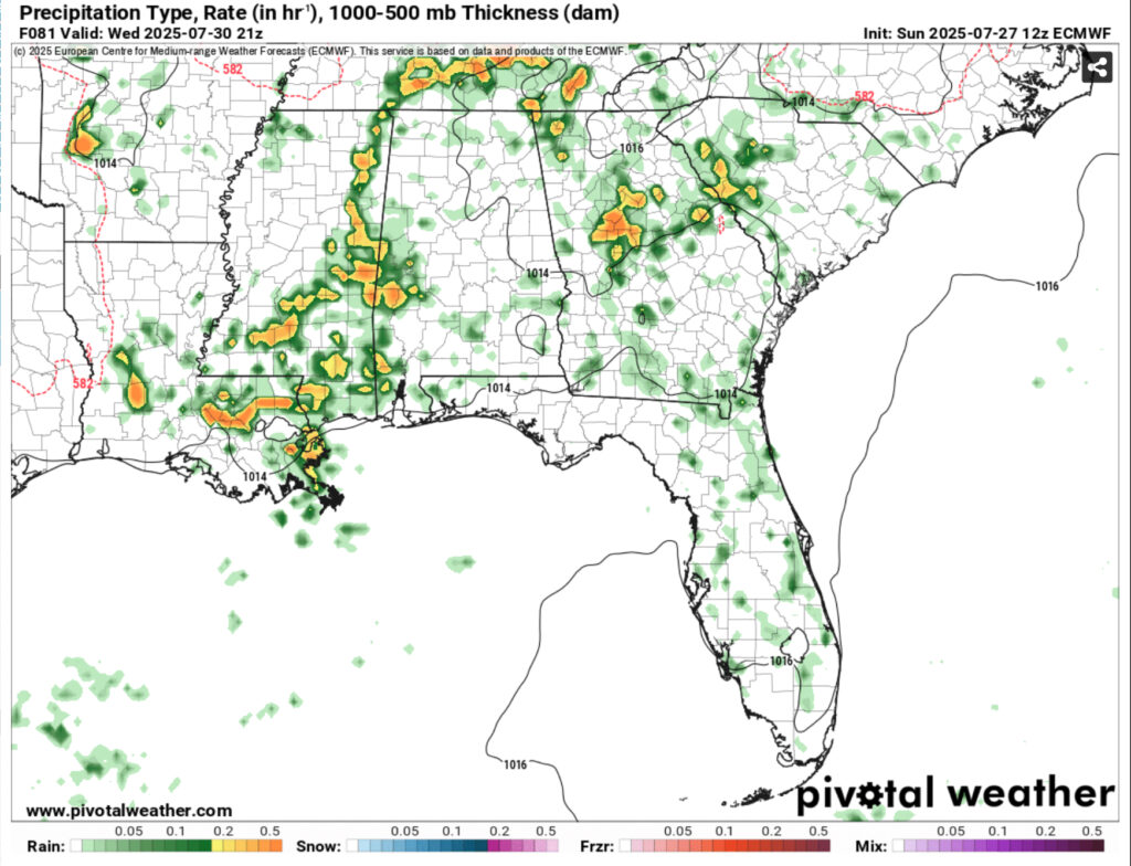
Tuesday will be hot as well, but the front will bring in some storms during the afternoon to evening hours and remain overnight. Wednesday, the temperatures will begin to drop a bit to the low to mid 90s, but the humidity will begin to climb as more storms are possible throughout the day. I’d break out the umbrella by Tuesday but have it ready for the rest of the week.
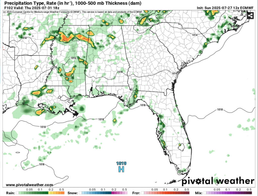
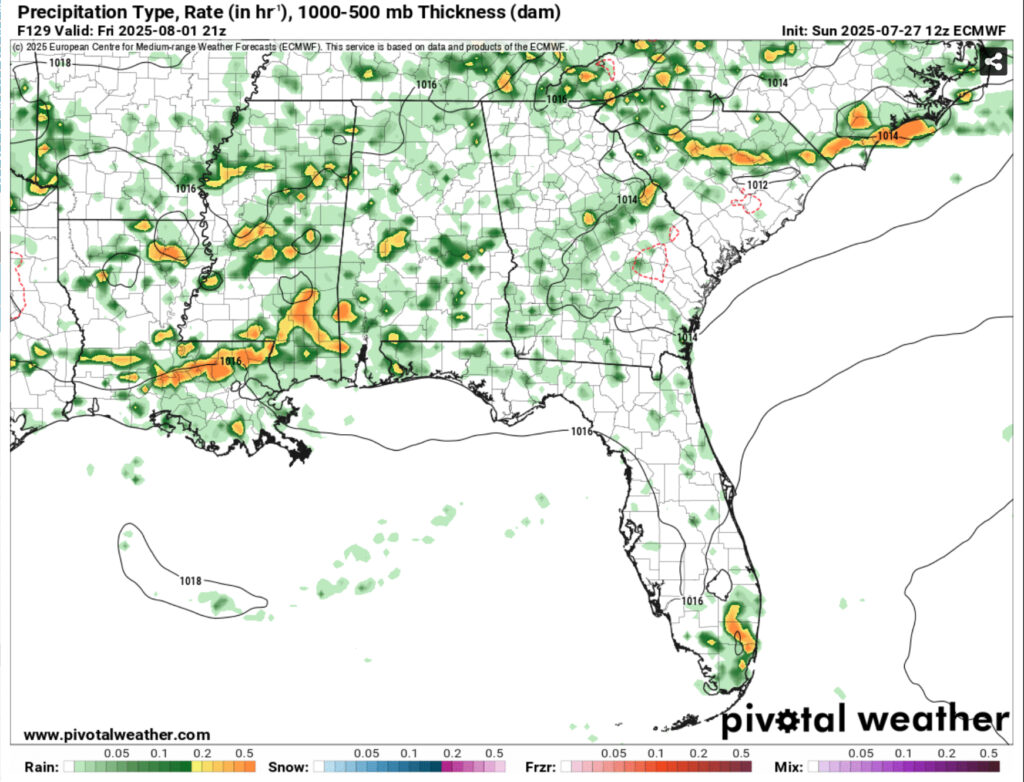
Thursday through Sunday will be rainy and stormy as well. Temperatures will remain the in the low 90s and humid conditions. Expect more cloudy days as well. As we get closer to the weekend, the low that is leftover from the dissipating front will move towards the Deep South and broaden. This will allow more moisture flow and rainfall. Overall, in the words of Ollie Williams, “it’s gonna rain.”
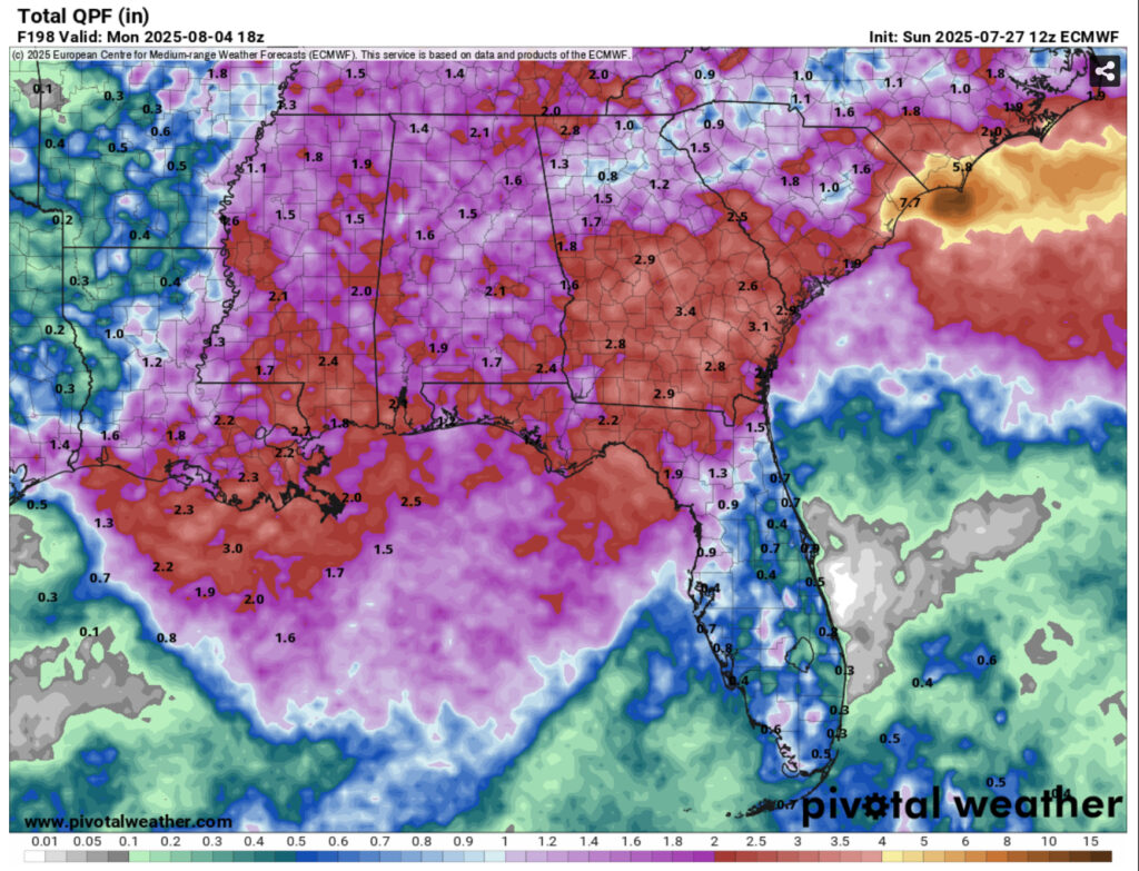
The Climate Prediction Center has already suggested an above average precipitation amount for the beginning of August and this is the main reason why. We can expect at least an inch of rain in many areas with up to 2.5” for those that receive heavier rainfall.
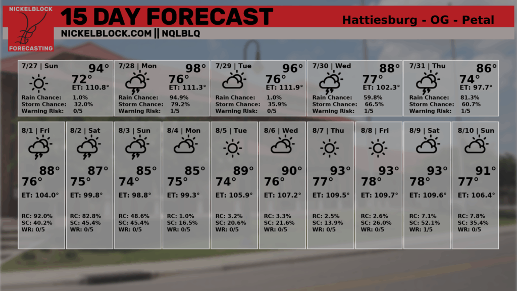
The NQLBLQ model has it fairly down pat, although I’d swap tomorrow and Tuesday’s rain chances. Overall, a hot start to the week with a late summer front bringing humid conditions and soggy days.
Regional Day-to-Day Forecast
Tonight – Mostly clear, with a low in the mid 70s. Calm wind.
Monday – Sunny and hot, with a high in the upper 90s. Heat index values as high as 109. Calm wind becoming north northwest around 5 mph in the morning.
Monday Night – Mostly clear, with a low in the mid 90s Calm wind.
Tuesday – A 50 percent chance of showers and thunderstorms in the afternoon. Mostly sunny and hot, with a high in the upper 90s. Heat index values as high as 109. Calm wind becoming north around 5 mph in the morning. New rainfall amounts of less than a tenth of an inch, except higher amounts possible in thunderstorms.
Tuesday Night – A 50 percent chance of showers and thunderstorms. Partly cloudy, with a low in the mid 70s. Calm wind. New rainfall amounts between a tenth and quarter of an inch, except higher amounts possible in thunderstorms.
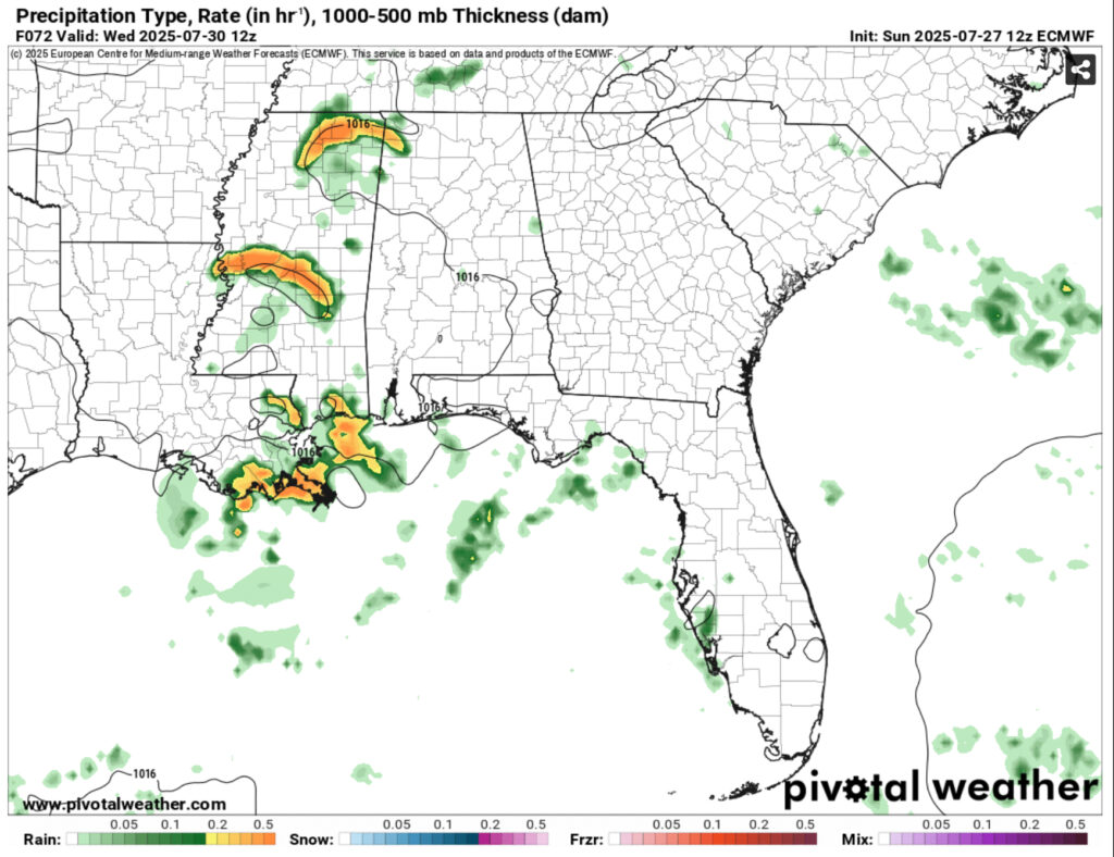
Wednesday – Showers and thunderstorms possible. High near 95. Calm wind becoming west around 5 mph. Chance of precipitation is 80%. New rainfall amounts between a quarter and half of an inch possible.
Wednesday Night – A 30 percent chance of showers and thunderstorms, mainly before midnight. Partly cloudy, with a low in the mid 70s. Calm wind.
Thursday – Showers and thunderstorms likely, mainly in the afternoon. Mostly sunny, with a high in the low 90s. Calm wind becoming west around 5 mph in the afternoon. Chance of precipitation is 70%.
Thursday Night – A 20 percent chance of showers and thunderstorms before midnight. Partly cloudy, with a low in the mid 70s. South southwest wind around 5 mph becoming calm.
Friday – Showers and thunderstorms likely, mainly after 1pm. Mostly sunny, with a high in the low 90s. Chance of precipitation is 70%.
Friday Night – A 30 percent chance of showers and thunderstorms. Partly cloudy, with a low in the mid 70s.
Saturday – Showers and thunderstorms likely. Mostly sunny, with a high in the low 90s. Chance of precipitation is 70%.
Saturday Night – A 30 percent chance of showers and thunderstorms. Partly cloudy, with a low in the low to mid 70s.
Sunday – Showers and thunderstorms likely. Mostly sunny, with a high in the low 90s. Chance of precipitation is 70%.


What I look forward to is an ENTIRE week (Monday THROUGH Sunday) with NO rain. That would be SO nice right now.