Overall Setup
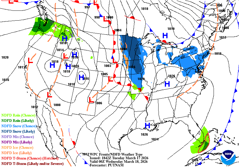
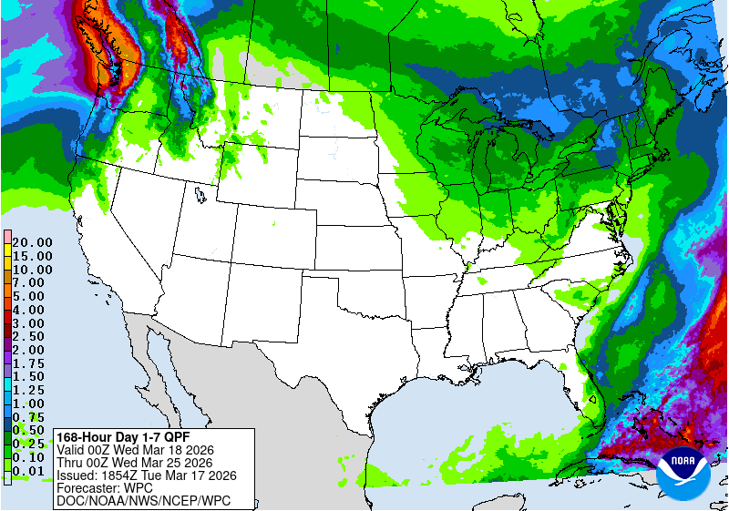
After what has seemed like week after week of severe weather threats, we are finally looking at a more stable atmosphere for a little while. High pressure will be settling in and making itself comfortable, thanks to a pretty large ridging pattern that will also be moving in. In the image above, you can see that there is no rain in the current forecast for much of the southeast and central US, including our region. Plus, some warmer-than-average temperatures are on the way, no shocker there! Astronomical spring is only 3 days away, and it will surely feel like it after tonight.

Tonight’s Forecast
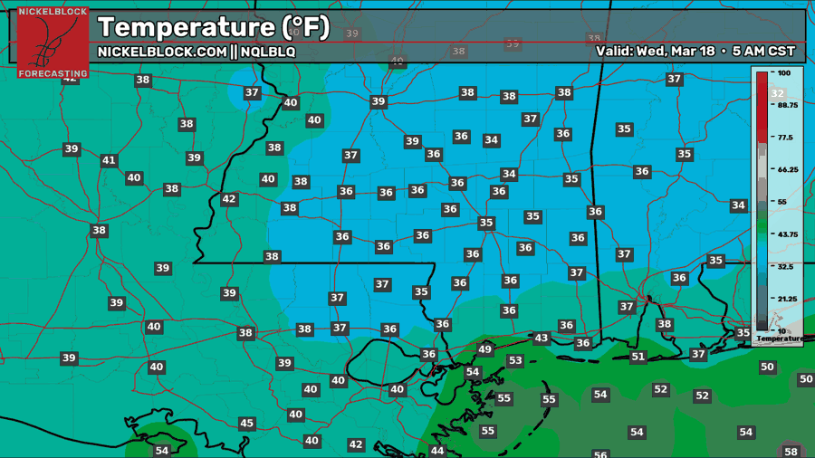
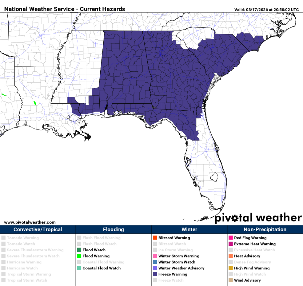
Tonight, we will likely see our last freeze of the season, given that we are under a northerly chilly flow, temperatures will drop to or below freezing, and winds will calm during the late night and early morning hours tomorrow. Our NQLBOT temperatures above might be a little higher than what we’ll actually see, so plan for a spotty freeze in southeastern Mississippi and Alabama with temps at or just below freezing. Ensure any outdoor plants are brought inside just in case. Freeze warnings are in effect for the counties below, which should be the most prepared for a freeze.

Tomorrow’s Forecast: Wednesday, March 18
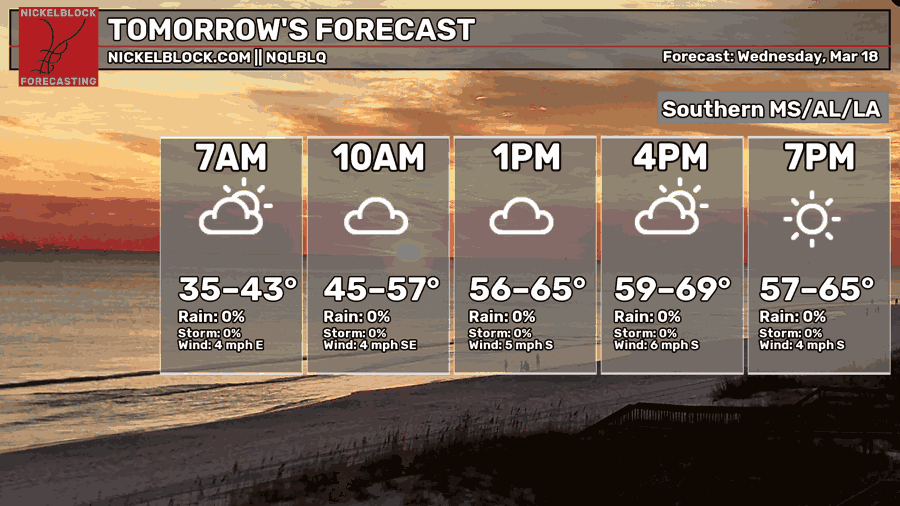
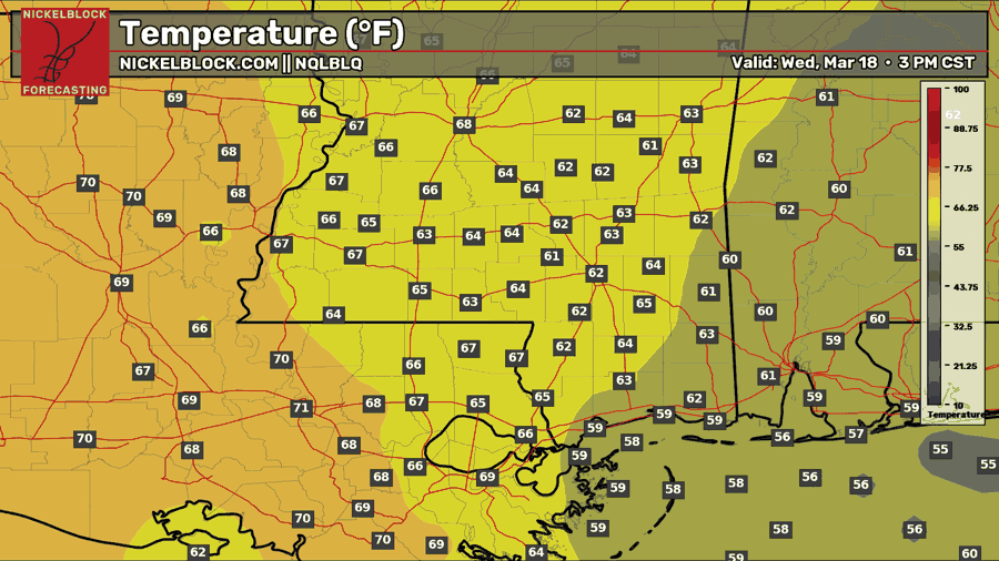
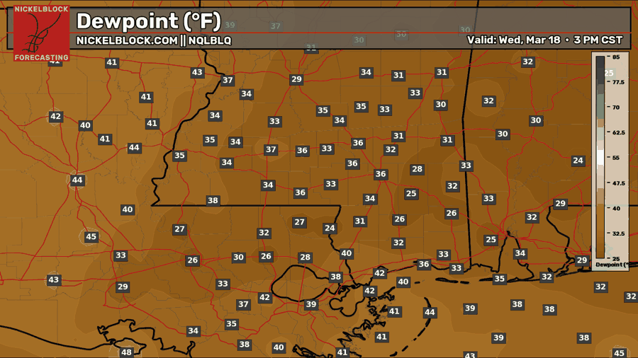
For tomorrow, we will wake up to that patchy frost for some of us and some cloudy skies. Throughout the day, we will see the sun return, and temperatures will rise to the 60s. We will have some extremely low dew point values tomorrow, only in the 30s, making it feel very dry and not at all humid, which is a great thing! No rain in the forecast, so it’s looking like a nice hump day!
Thursday’s Forecast: March 19
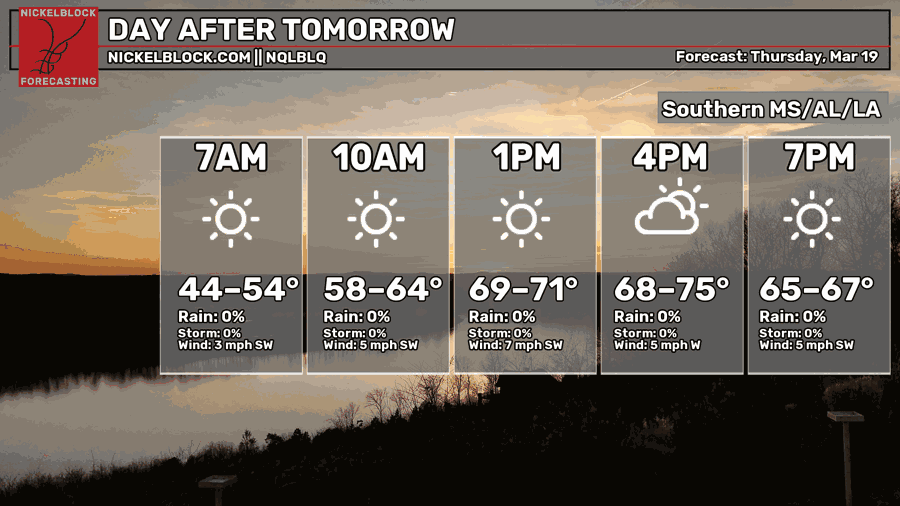
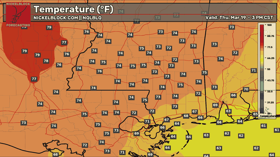
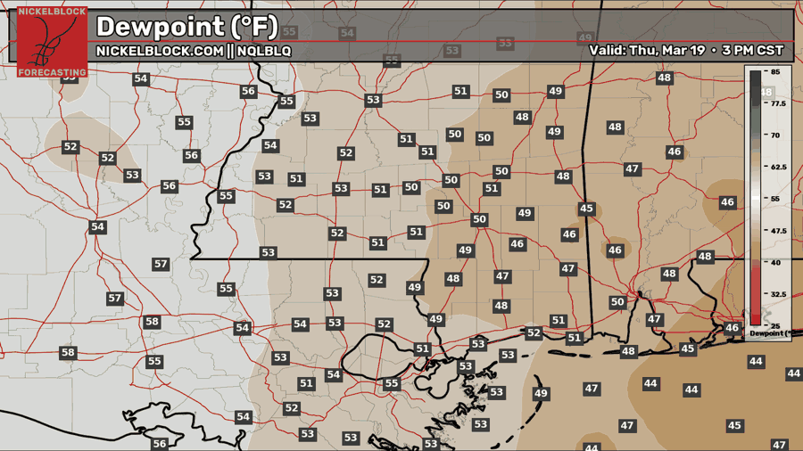
Abundant sunshine is expected on Thursday with temperatures reaching the lower 70s. Dew points will rise into the lower 50s, which is more humid than Wednesday, but not uncomfortable by any means. Another nice day on tap!

Extended Local Outlook
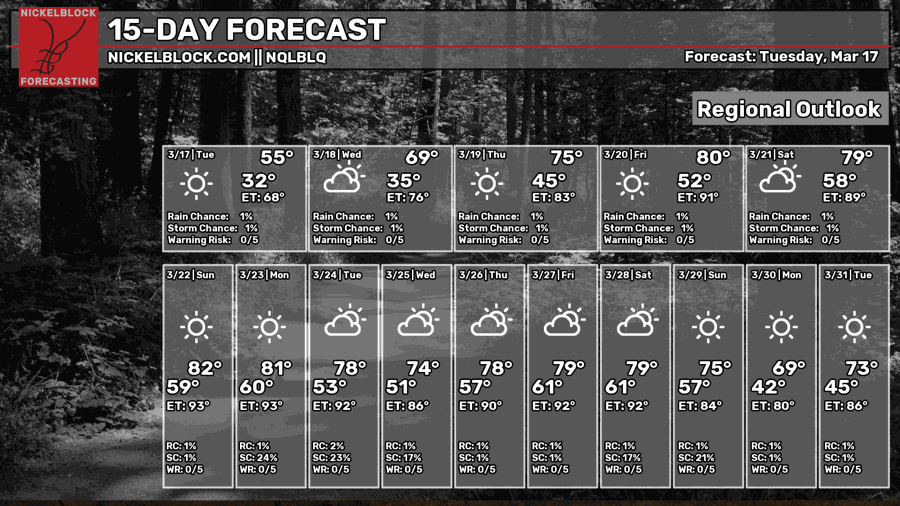
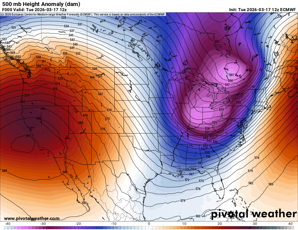
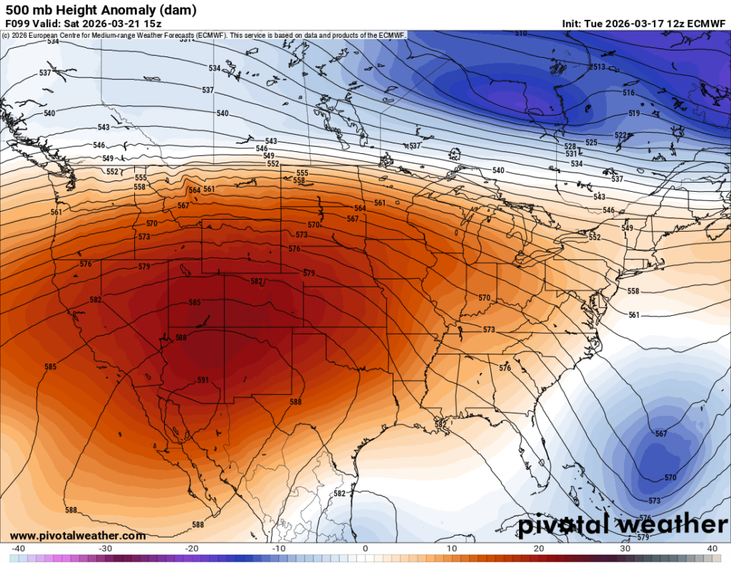
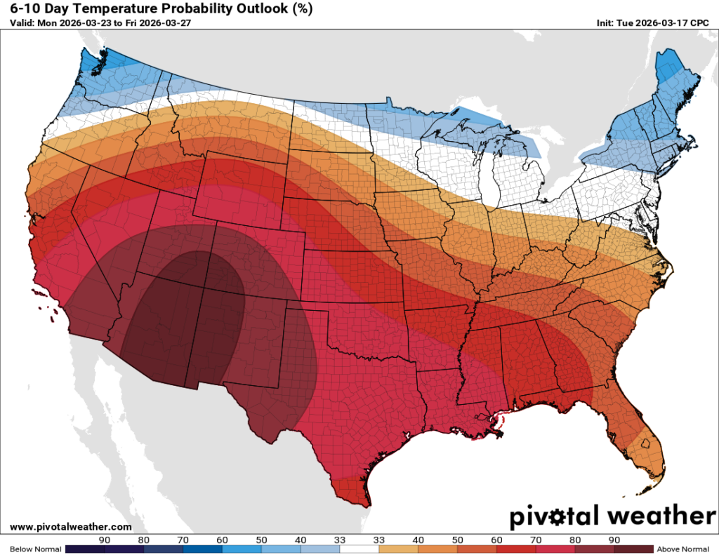
Last week I mentioned that early this week, which is right now, we would see a large trough dip down in the east and into our region, bringing us some cooler weather to look forward to. That was indeed correct and has verified! As mentioned earlier, this pattern will not stick around… instead, a large ridge will settle in over the next few days and bring warmer-than-average temperatures for much of the US, as shown in the 6-10-day temperature outlook from the CPC below. Hello spring!!!