Overall Setup
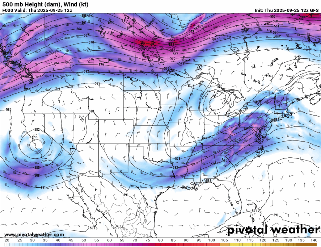
Our 500 mb height pattern shows a trough digging into the mid-south, bringing southwesterly flow and stronger upper-level winds to the region. Over the next couple of days, the trough will shift east, allowing winds to turn more northerly. This change will keep temperatures mild and humidity lower. The downside is that rain chances remain very low, and we may not see a significant rain event again for a while.
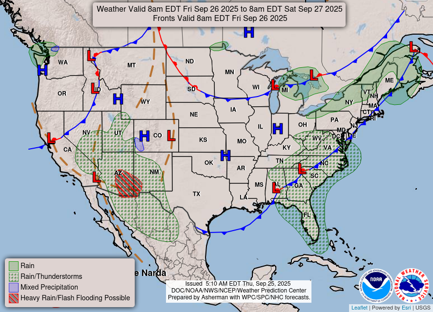
As you can see by Friday, the front will have finally moved out of our region and high pressure to the north keeps us mainly dry.

Tonight’s Forecast
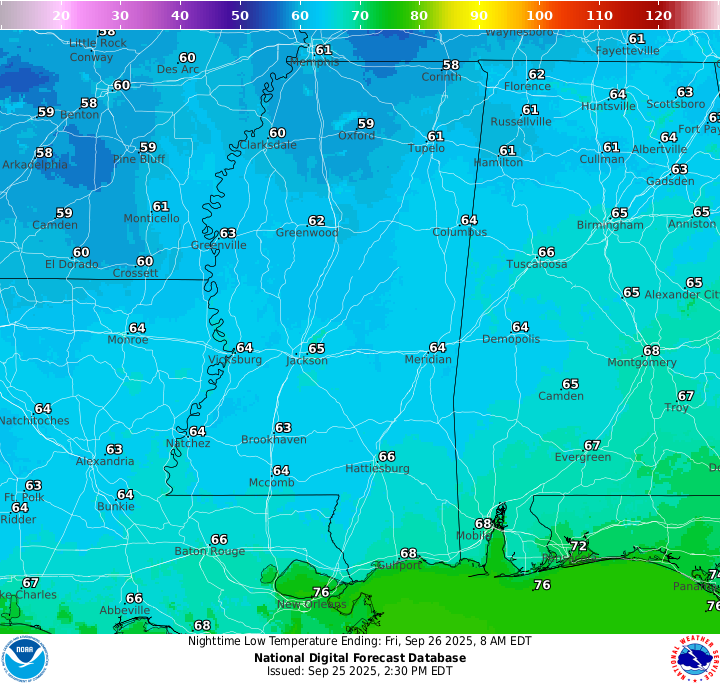
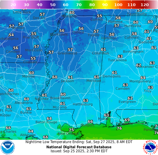
Rain chances will fade this evening as skies gradually clear. Overnight, clouds will continue to decrease. Low temperatures will settle into the mid 60s.
Tomorrow’s Forecast
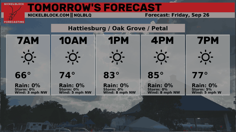
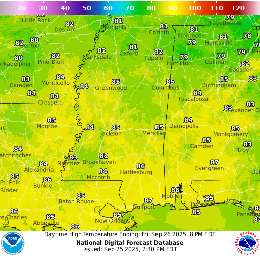
Friday is looking to be a very nice day, with temperatures sitting in the low-to-mid 80s! Some back-end humidity from the front will stick around through half the day, but as the afternoon comes you should notice at least some relief from the humidity. Enjoy the temps in the 80s and the dry weather!
Weekend Forecast
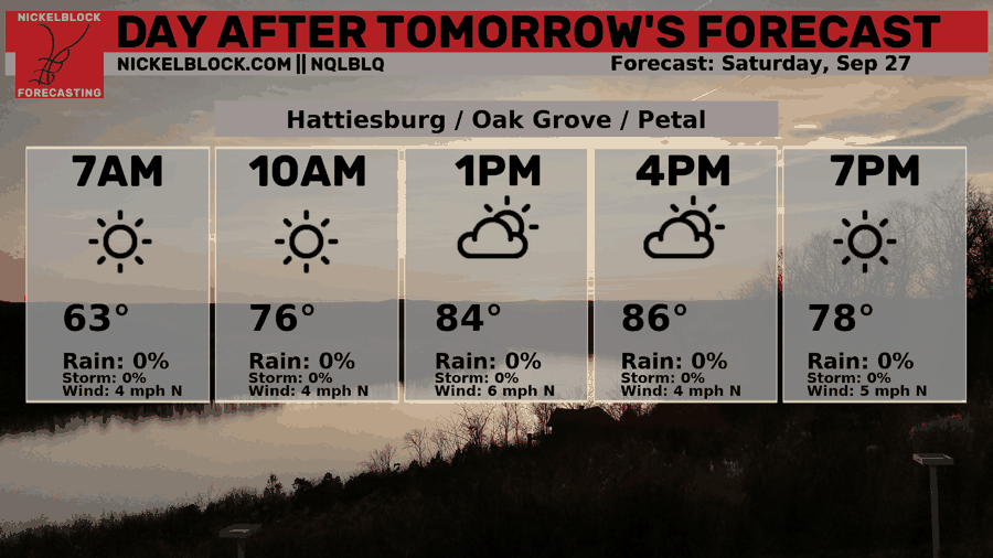
For your weekend, both Saturday and Sunday will be clear with no rain in the forecast. High temperatures on Saturday will again be in the low-to-mid 80s and you will really notice the decreased humidity. We warm up back to the high 80s on Sunday, but humidity will stay lower! Enjoy your weekend!
Extended Local Outlook
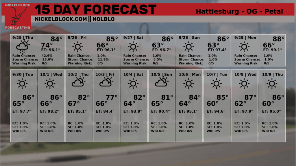
We stay dry, according to our NQLBLQ through the next 15 days. I think we will have some days with scattered afternoon thunderstorms, but we’re currently not looking for any ground soaking or drought reducing rain events in the near future.
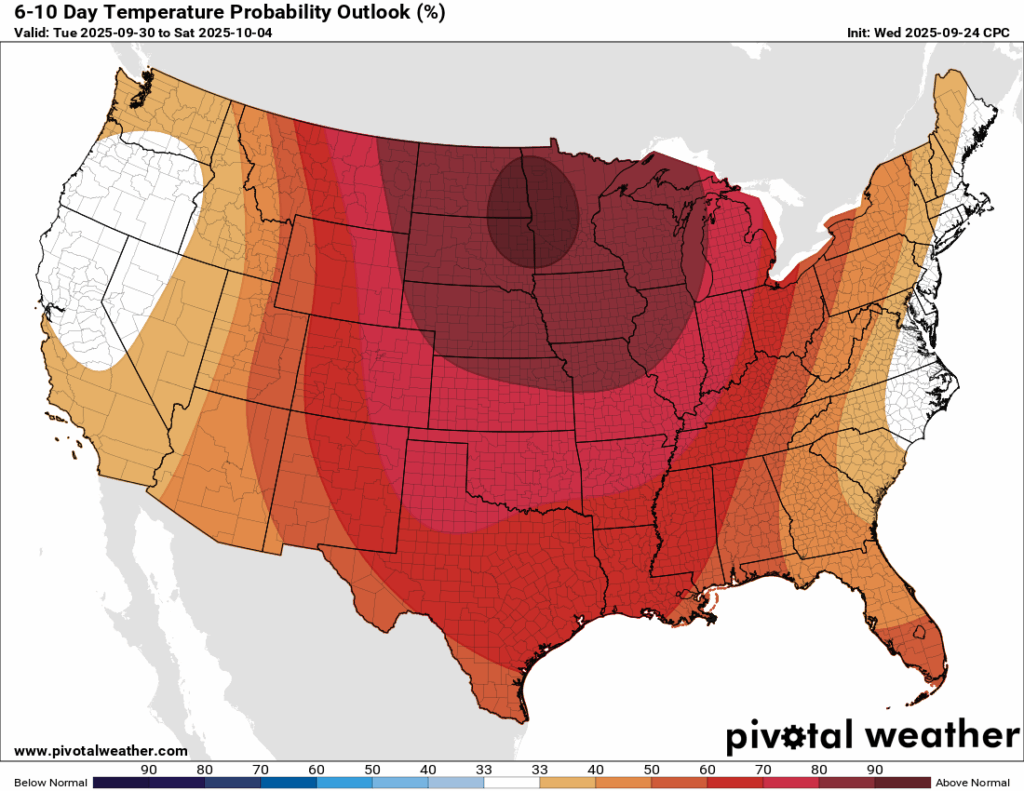
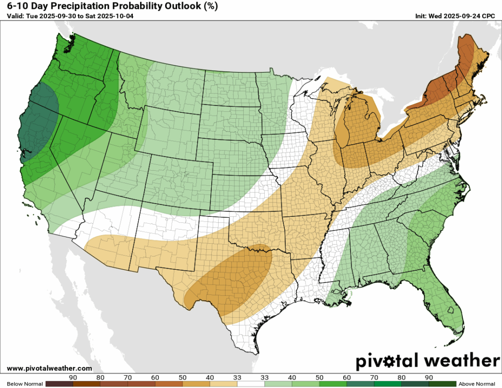
As I mentioned on Tuesday, the CPC has us staying above normal for our 6-10 day temperature outlook, which would bring high temperatures into the high 80s and MAYBE a couple of very low 90s. Rain, again, will be sparce, near normal, but likely below, the way the models have been looking.

Latest Tropical Update
Atlantic:
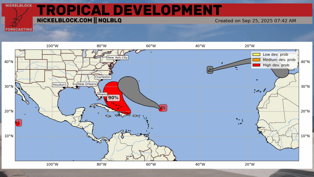
Those on the East Coast will need to keep a very close eye on the forecast for the next few days. Tropical Storm Humberto is forecast to not make a US landfall, but Invest 94L has many models concerned for a landfall somewhere in the Carolina’s potentially by Tuesday.
Let’s look into the details:
Tropical Storm Humberto
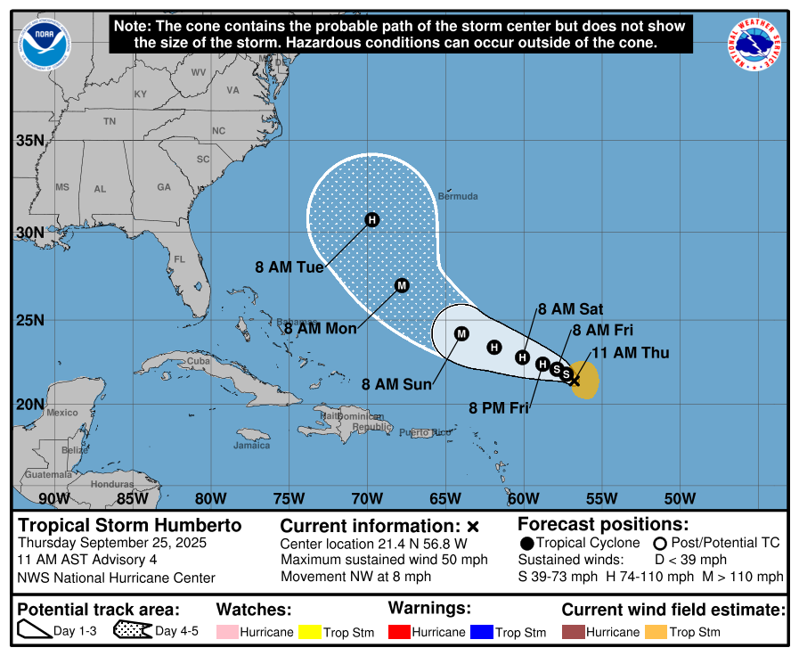
Invest 93L has become Tropical Storm Humberto as of Wednesday, and is forecasted to become a hurricane by Friday and eventually a major hurricane (cat 3+) by Sunday. Models are pretty much in agreement that Humberto will make a turn out to sea by Tuesday/Wednesday, but make a close pass to Bermuda. Bermuda will need to keep a very close eye on this over the coming days.
Invest 94L
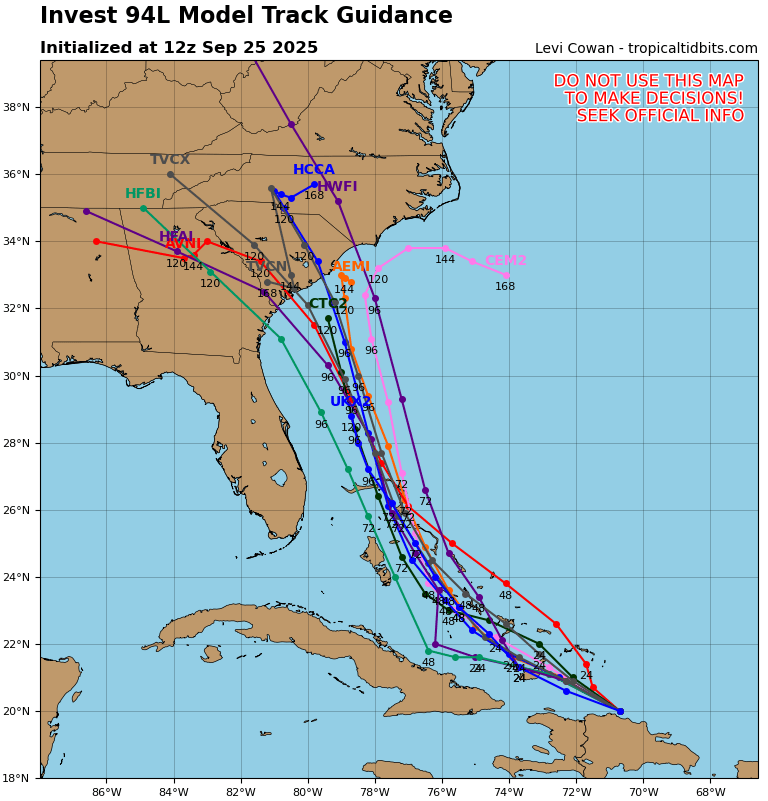
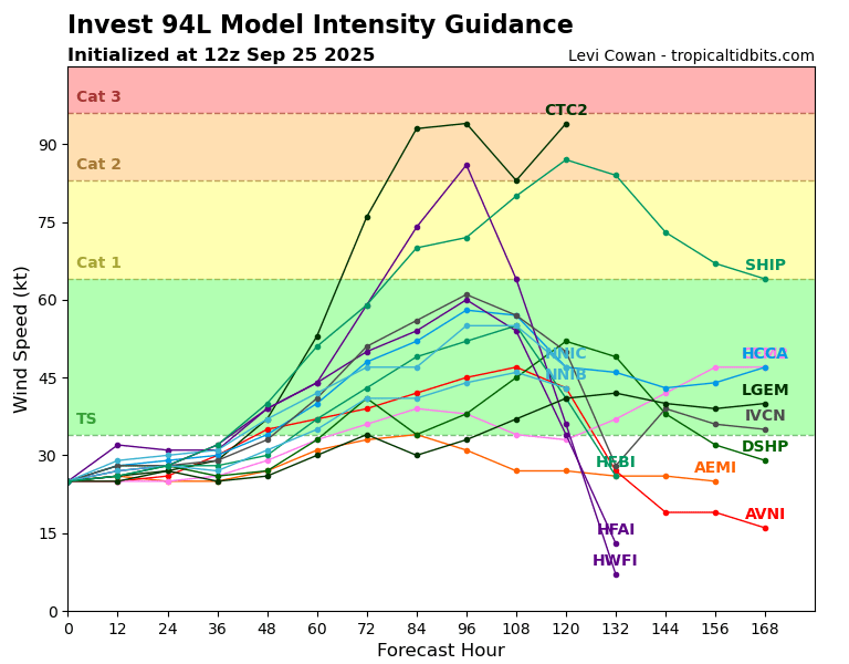
Overnight brought a significant development, as both the traditional and hurricane models came into agreement that Invest 94L, which would become Imelda, could make landfall somewhere along the Carolina coast by Tuesday. The exact track and intensity is still uncertain, and the forecast may change, but odds are increasing that there could be a tropical storm or hurricane landfall in that region early next week.
Eastern/Central Pacific:
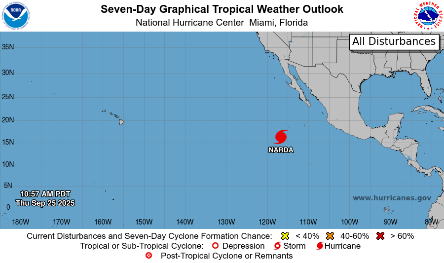
Meanwhile, Hurricane Narda is still churning up the Eastern Pacific – forecast to weaken into a tropical depression by Tuesday. No other areas to watch are highlighted in the basin at the moment.
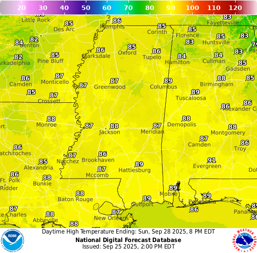
REGIONAL DAY TO DAY FORECAST
Tonight: Partly cloudy with lows in the mid 60s. A small chance of a lingering shower or two. West winds around 5 mph, becoming calm in the evening. Chance of rain 20 percent.
Friday: Mostly sunny with highs in the mid 80s. A small chance of a lingering shower or two in the afternoon. Calm winds becoming north-northwest around 5 mph in the morning. Chance of rain 20 percent.
Friday Night: Mostly clear with lows in the low 60s. North-northwest winds around 5 mph, becoming calm in the evening.
Saturday: Sunny with highs in the upper 80s. Light north winds increasing to 5 to 10 mph in the morning.
Saturday Night: Mostly clear with lows in the low 60s. North winds around 5 mph.
Sunday: Sunny with highs in the upper 80s. North winds around 5 mph.
Sunday Night: Mostly clear with lows in the mid 60s. North winds around 5 mph, becoming calm in the evening.
Monday: Sunny with highs in the low 90s. North-northeast winds around 5 mph.
Monday Night: Mostly clear with lows in the mid 60s.
Tuesday: Sunny with highs in the low 90s.
Tuesday Night: Partly cloudy with lows in the mid 60s.
Wednesday: Sunny with highs near 90.


