Okay, so it’s actually on March 1, but considering the conditions outside, it’s felt like Spring for the past 2 weeks. There is good news and bad news with this. The good news is that for those of us who love the warmer weather, it’s here to stay for a while! The bad news is that rain chances will be more sparse due to the current weather pattern.
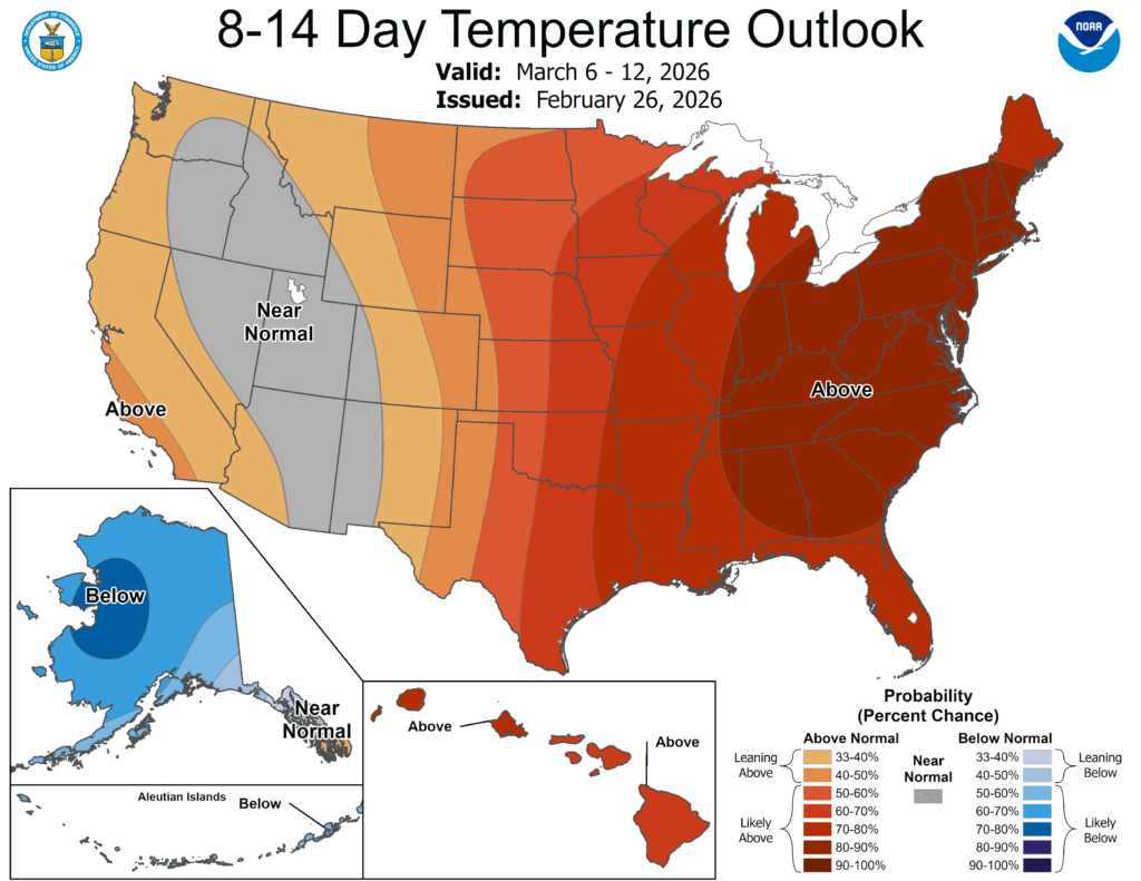
Overall, the next week is going to be much warmer than average. Temperatures will range in the upper 70s to low 80s for the next 2 weeks and lows will only reach the 50s to 60s. The next real rain chance we have is next Sunday with a few isolated chances before the weekend.

Today
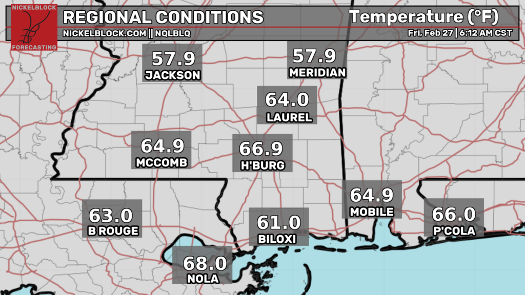
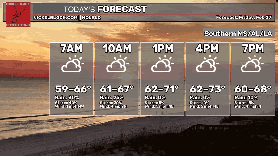
The rain is moving out of the central Pine Belt and is moving southbound towards the coastline. We received about a quarter inch of rain (from the Bobby Chain airport station) overnight. Otherwise, we’re going to have a mix of clouds and sun for most of the day before it clears out later this afternoon. Temperatures will reach the low to mid 70s today with winds shifting towards the north. Overnight, we’ll fall into the low 50s.

Tomorrow and Sunday
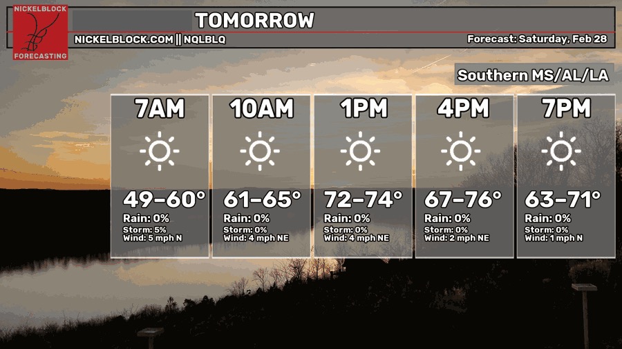
The winds will calm down tomorrow and Sunday with hardly a cloud in the sky. A large high pressure system in the Great Lakes region will hold on for a while keeping temperatures up and rain chances down. Beautiful weather overall! It’ll be a warm weekend with temperatures in the upper 70s to low 80s and lows in the mid to upper 50s.
Next Week
We’re going to be stuck in a pattern for a little while, meaning that it’s going to stay warm with a bit of humidity on top of that. The high pressure system will funnel in more southerly flow bringing in moisture while the linear pattern in the upper atmosphere will bring higher pressure from above essentially putting the squeeze on the pressure, thus increasing the temperature (ideal gas law in a way).
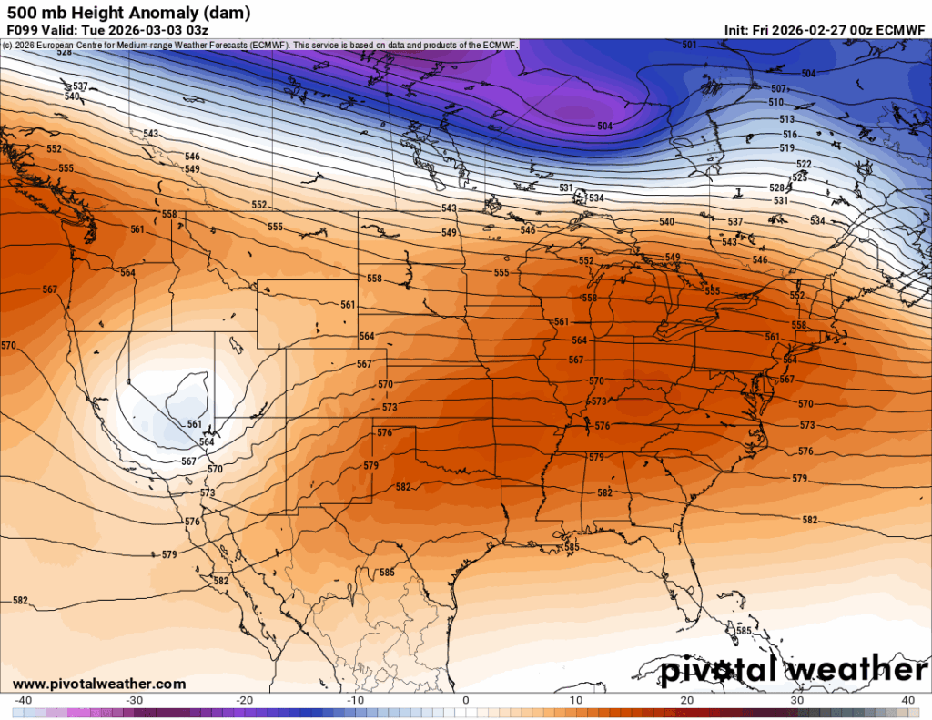
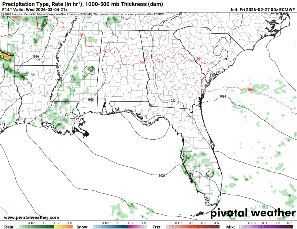
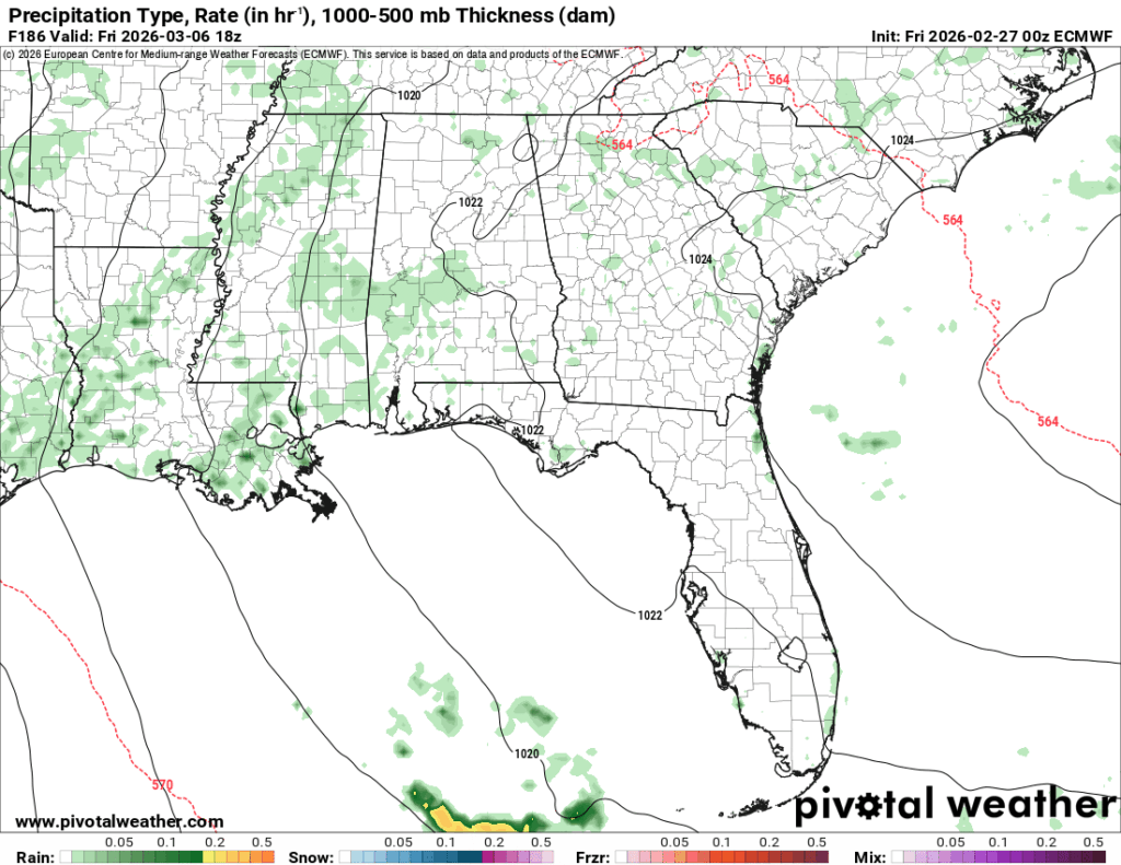
Rain chances will be intermittent in the latter part of the week with an incoming stationary front bringing enough moisture to introduce a few isolated showers Wednesday, Thursday and Friday. Overall, temperatures will reach the upper 70s to the low 80s during the week and lows will increase from the low 50s to the low 60s.

Extended Outlook
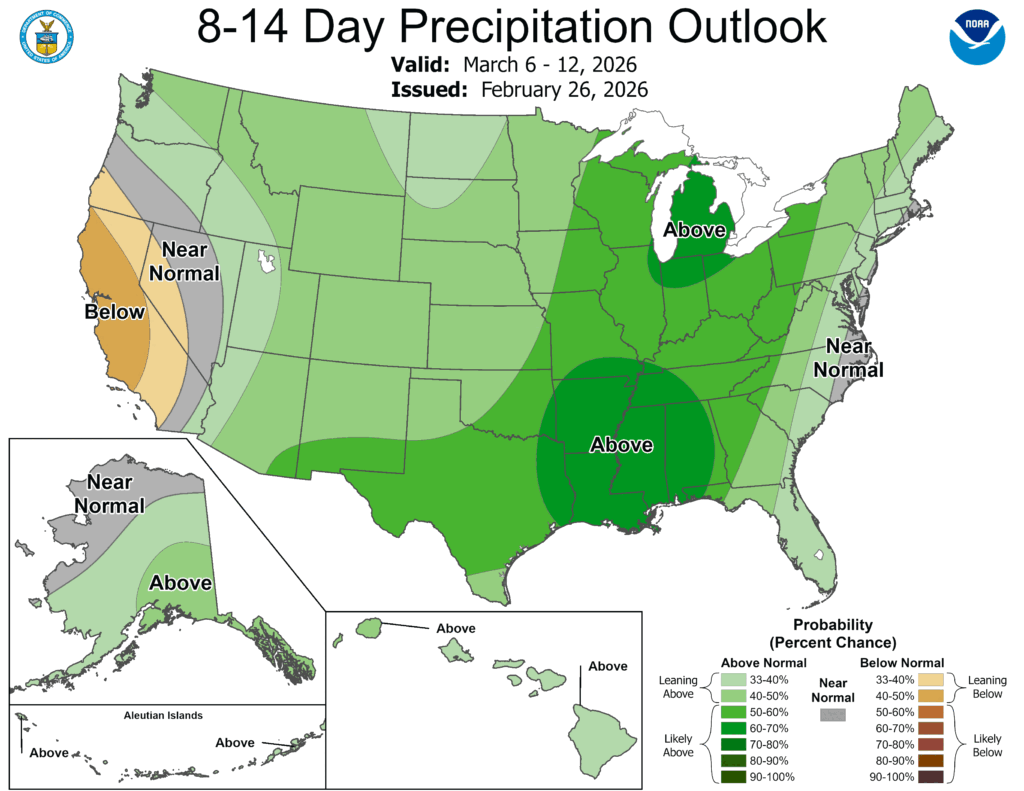
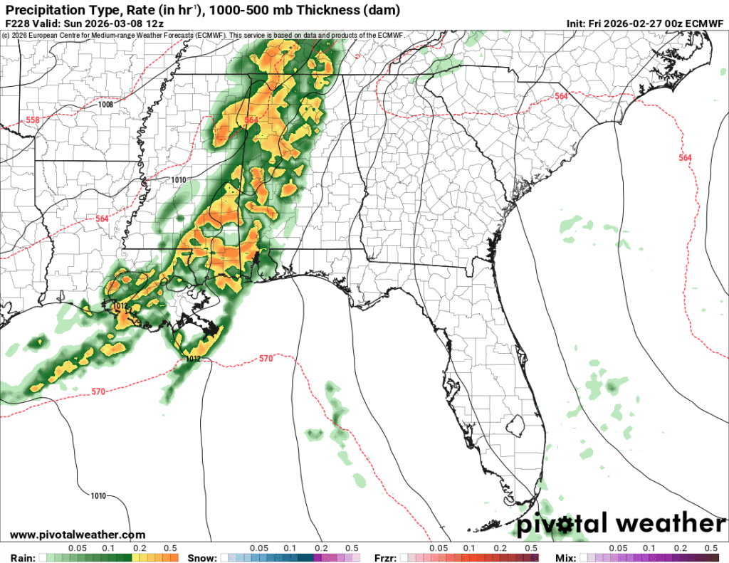
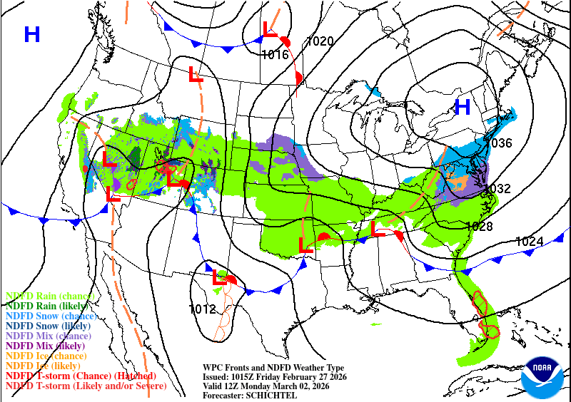
Looking at the Climate Prediction Center’s outlook, we can see the high chance of above average precipitation centered right over us. The main reason is because of a large low pressure system that is going to hit us next weekend. Since we’re still about 8-9 days out, I won’t speak on specifics, but it does look like there could be a chance for severe weather on Sunday. I’ll have an update on this Monday since it’s something to keep an eye on.


