Overall Setup
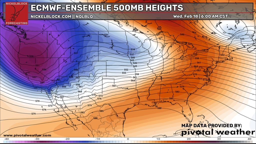
You may be asking, “IT’S WINTER, WHAT’S WITH THIS WARM AIR?”, or saying, “AHH, AN EARLY SPRING HAS COME!” Whichever it may be, the reason for this is that we have been stuck in a persistent ridging pattern, which has been keeping the jet stream way north, allowing for just zonal flow aloft. It’s hard to get any cold shots of air from the north when the jet stream just doesn’t want to transport that type of air! Will we see a change in this pattern, or will it stick around a bit longer? More on that towards the end of this forecast…
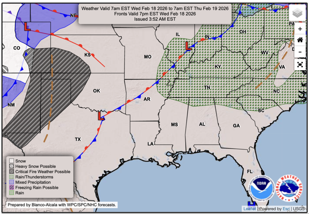
As for our setup for tomorrow, we are overall staying dry, but cloudy skies are locked in out ahead of a frontal system to our northwest. As you can see, there’s some rain possible to the northeast of us, which will move into our region by Thursday. Only spotty showers, not much at all. There’s a higher chance of heavier rain/thunderstorms for Friday/Saturday, which I’ll get to below.
Also of note, there are favorable conditions for critical fire weather in the southern plains east of the Rockies, as winds are strong and a dry line is present.

Tonight’s Forecast
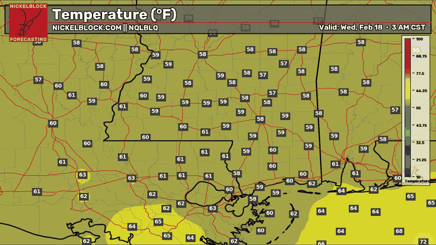
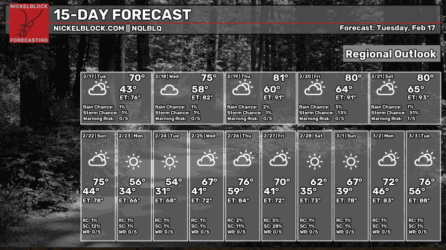
Tonight, we will see lows above normal yet again, sitting in the upper 50s and lower 60s. For reference, our average low temperature for today is around 51, so we’re about 8-10 degrees above average. Cloudy skies will dominate tonight.
Tomorrow’s Forecast: Wednesday, February 18
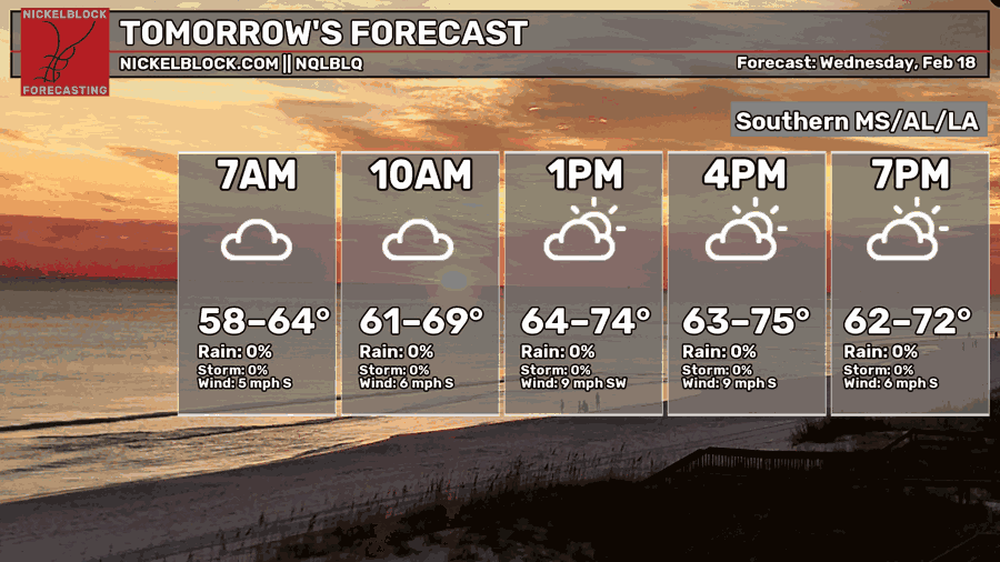
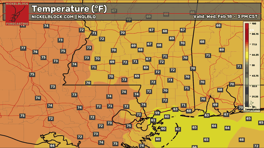
Tomorrow, we’ll keep the clouds around for the whole day, with some occasional peaks of sunshine. Highs will be in the high 60s and lower 70s, and the humidity will stick around. It will feel near 80 with the humidity, but not as hot as it will feel on Thursday, Friday, and Saturday!

Thursday’s Forecast: February 19
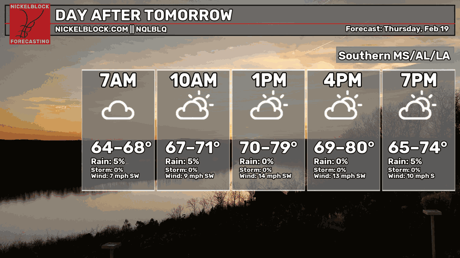
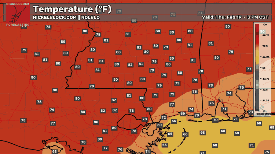
If I had one word to describe how Thursday will feel, it would be SOUP. We start the morning in the mid to upper 60s, then reach 80 degrees as the high for those away from the coast! Add in the high humidity, and we’re feeling like June in mid-February! A nice breeze would certainly feel good on a hot day like Thursday… well, we will see a breeze through the afternoon and evening, gusting up to 30-35 mph! It’s still a southwest breeze, so not a cool northerly one, but any breeze is welcome on a soupy day. Some spotty showers are also possible as we get into midday and the evening ahead of our rainmaker for the weekend.
Weekend Ahead
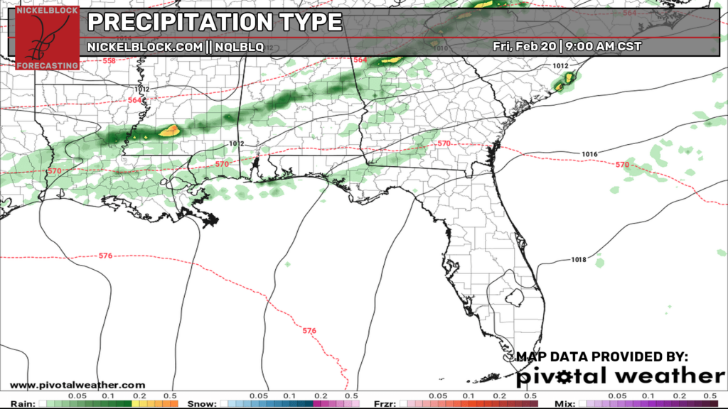
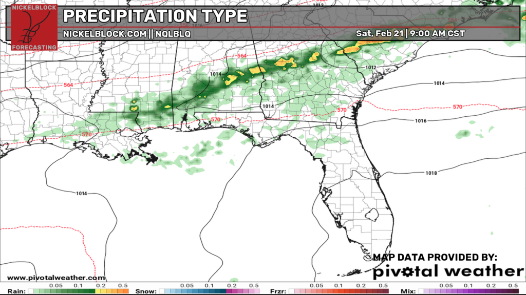
Models are picking up on a frontal boundary passing through on Saturday night. Before the actual front comes through, dew points are expected to rise even more than they are right now. We could see dew points in the upper 60s to near 70, which is certainly soupy. With that, a line of showers and maybe some thunderstorms may pass through Friday, and we may see more of it on Saturday as well, until the front passes Saturday night and leaves us with a dry, cooler, and humidity-free Sunday.

Extended Local Outlook
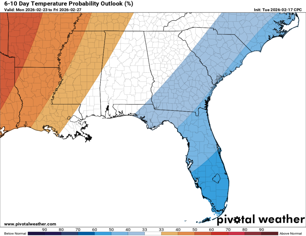
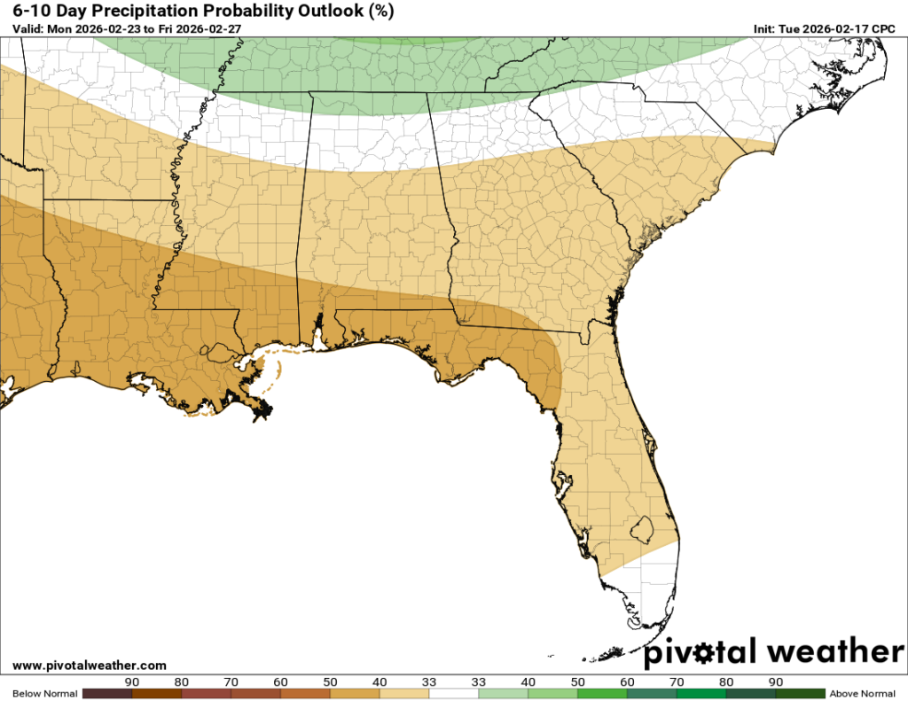
Looking ahead to next week, we’re on the fence between warmer-than-average and cooler-than-average, at least according to the CPC’s 6-10 day outlook. We’re near/below average for Monday through Wednesday, then warm air locks in again for Thursday and Friday next week. The CPC also gives us a good chance of below-average rainfall next week, likely because zonal flow is not allowing many storm systems to pass through our region.
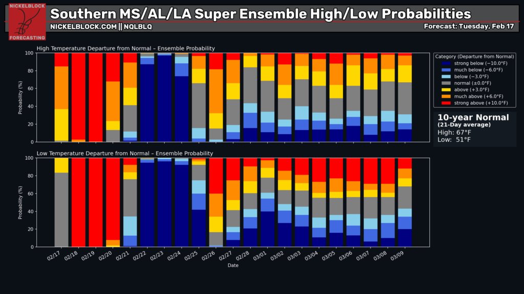
Looking at our in-house temperature probability chart, we’re confident that the first half of next week will be cooler than average, but after that, we could see warmer temperatures return, followed by some uncertainty as we enter March. It’s a 50/50 spread at warmer/cooler for March.


