Overall Setup
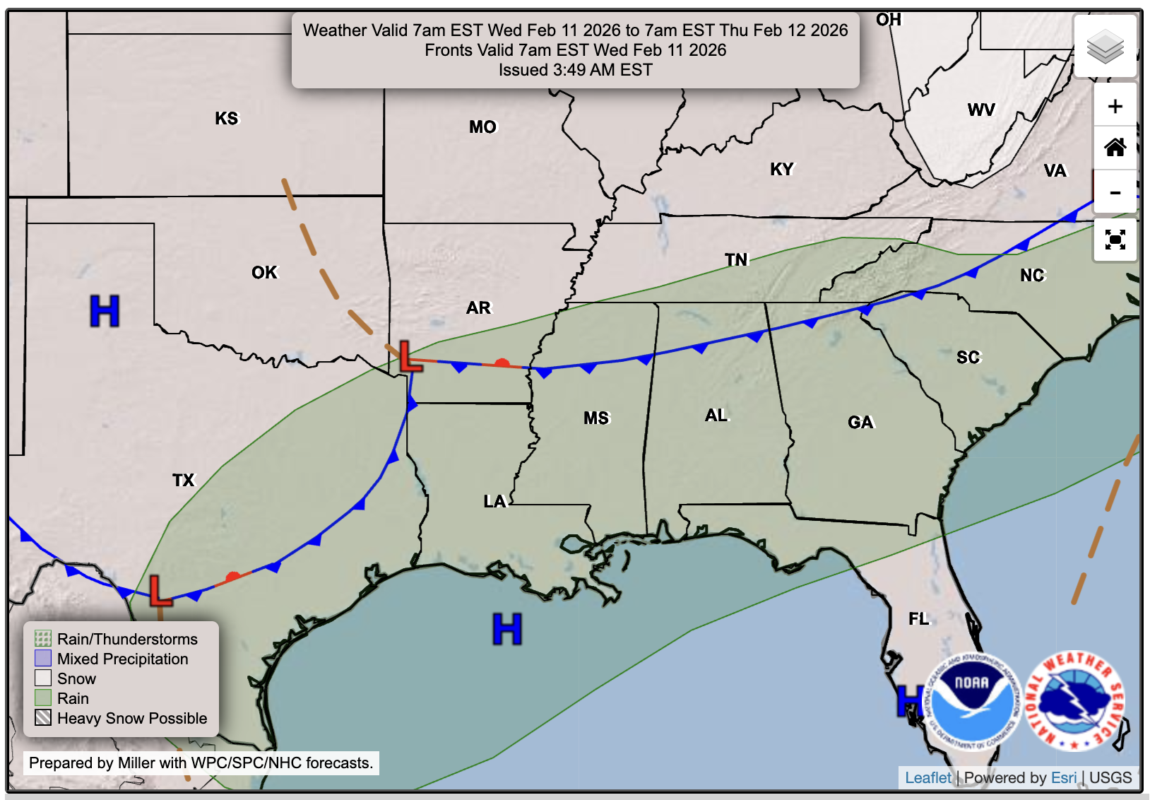
A weak disturbance will move into the Deep South tomorrow, bringing a chance of light rain tonight and tomorrow. After that, Thursday looks clear and good to go, with the same story on Friday. This weekend, we’re watching the potential for heavier thunderstorms late Saturday into Sunday, but Valentine’s Day plans should be spared from any impacts.

Tonight’s Forecast
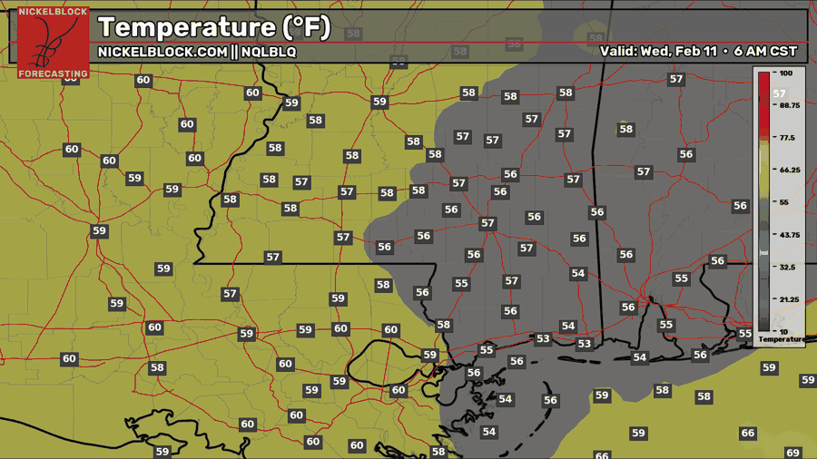
It’s a mild night tonight with temperatures in the upper 50s to near 60 in some locations. Some rain showers are possible in our area, but most are expected to stay well north of the NickelBlock region. These showers will move south throughout the night, so we may see some spotty showers in the morning hours tomorrow.
Tomorrow’s Forecast: Wednesday, February 11
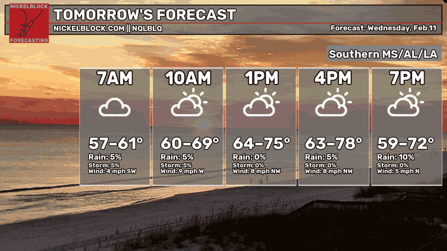
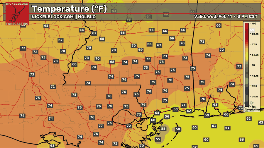
Showers should become more isolated through the morning, but we’ll keep cloudy skies and a muggy feel with highs in the low to mid 70s. As the front exits late afternoon into early evening, a few spotty showers could try to redevelop, but coverage looks very isolated. We’ll finish the day cooler, with lows in the lower 50s.

Thursday’s Forecast: February 12
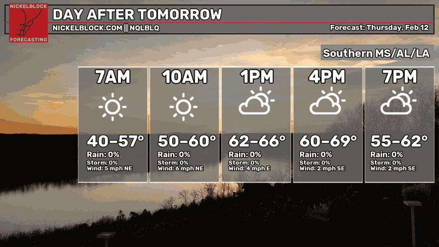
Thursday is shaping out to be a nice reset day for us. High pressure moves in behind the front, so we’re dry with plenty of sunshine and no weather issues. It’ll start off cool in the morning with lows in the lower to upper 40s, then we warm up comfortably by the afternoon with highs in the mid to upper 60s, and a few spots could sneak into the lower 70s closer to the coast. The big change is the humidity dropping too, so it’s going to feel a lot less muggy than today. There is a sharp line of who has the humidity and who doesn’t – so it will feel much more humid in Baton Rouge than Jackson or Meridian!
Weekend Storms?

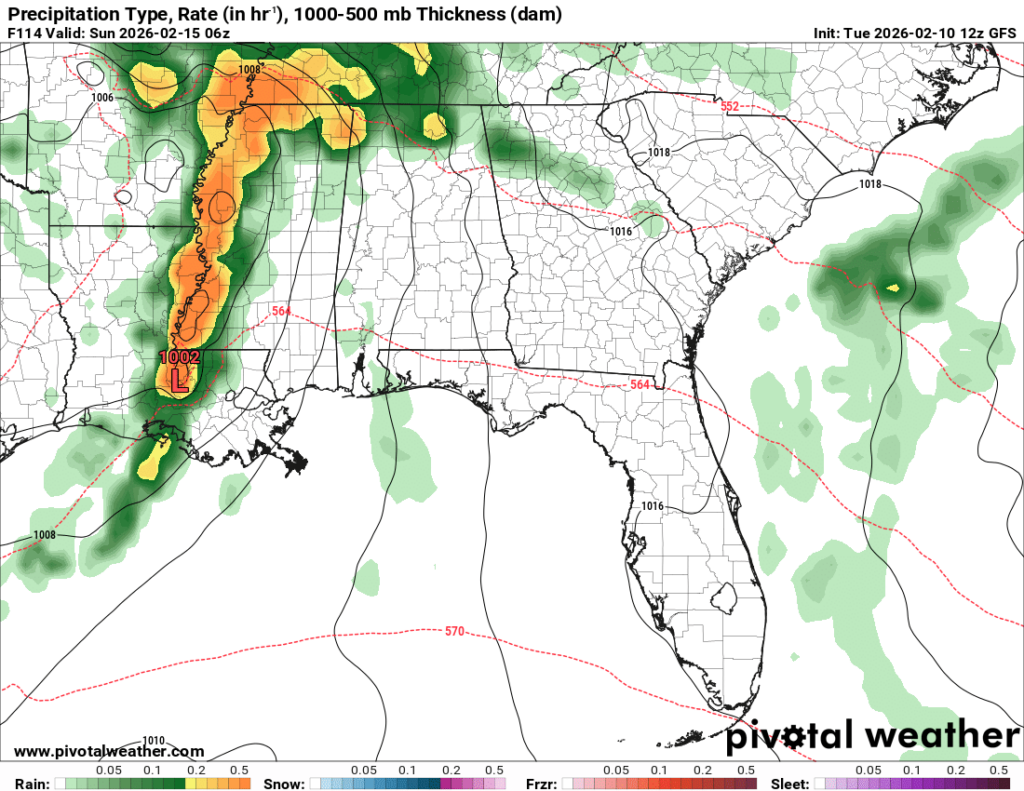
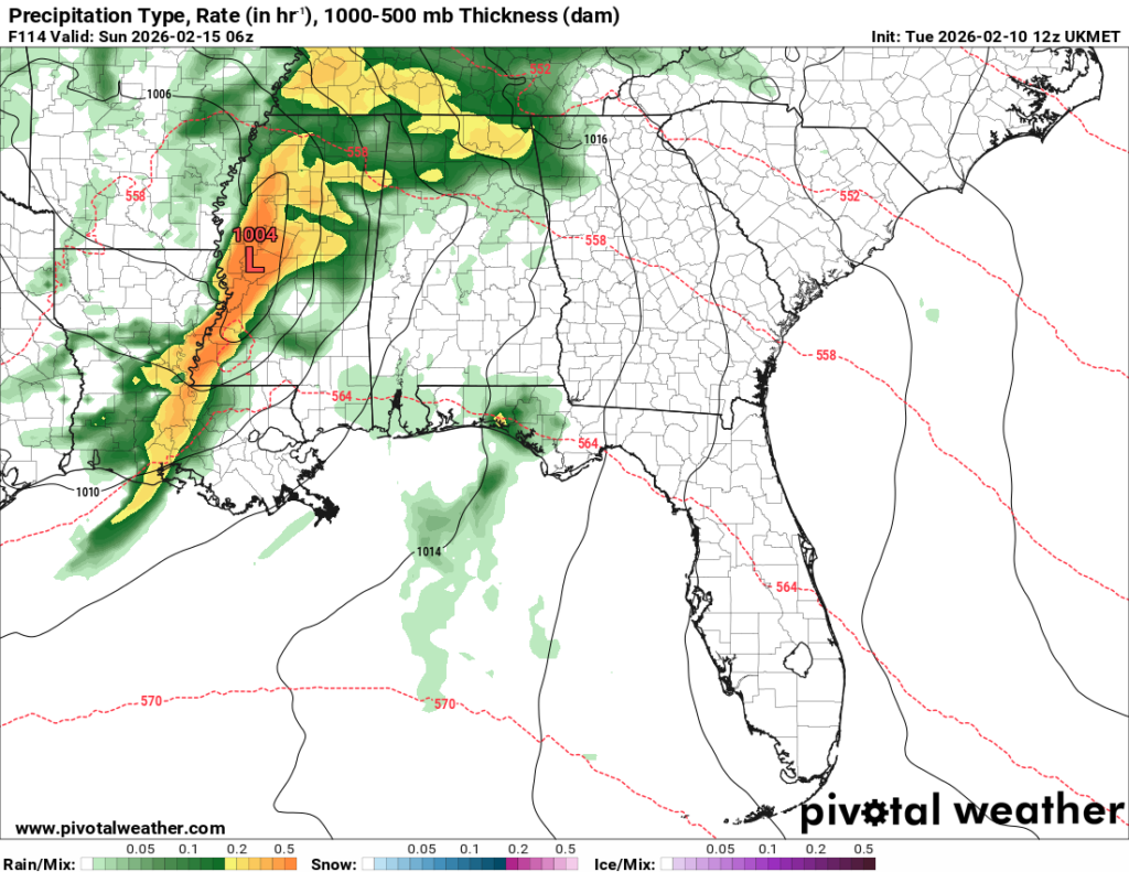
All 3 models we look at show a strong line of thunderstorms moving through our region Saturday night into Sunday morning. We will see whether the models remain in agreement over the next few days, especially regarding the low-pressure placement and the line’s strength. While the SPC has not issued any outlooks yet, it’s possible they issue a severe weather risk outlook in the coming days, so stay tuned.
At first glance, instability doesn’t look too impressive in the latest guidance, but there will be lots of wind energy available, so even with limited instability, a few storms could still produce damaging gusts or a brief tornado if they can tap into the surface layer. We’ll be watching future runs to see if instability trends higher, since that would quickly increase the severe threat.

Extended Local Outlook
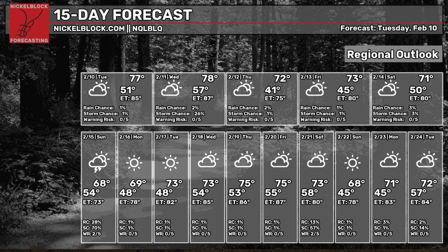
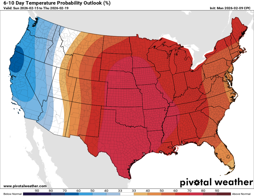
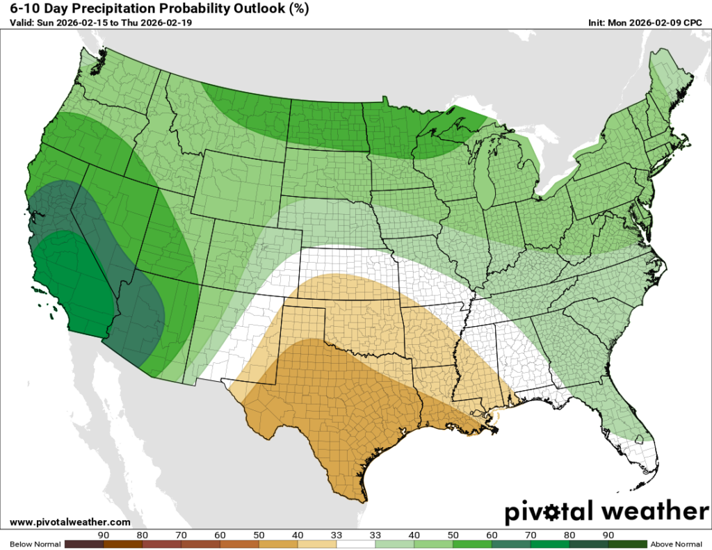
Looking into next week, the 6-10 day outlook shows a massive amount of red on the temperature map, which means temperatures are very likely to stay above normal for that time period. Rainfall looks to be below average for our area as high pressure under the large scale ridging is expected to dominate. Expect low-to-mid 70s all week next week, with experienced temperatures in the 80s with the humidity!
Side note: I am very jealous, our wind chill in New Jersey was -15 the other day… AGHHHH 🙁


