We’re back with another average feeling week for mid-January. And you know what? That’s perfectly fine after the warm and humid days we had about a week ago. What might be a bit alarming is coming up this weekend with some wintry precipitation possible, mainly freezing rain. We’ll take a look at that in a minute, but let’s look at the upcoming week first, shall we?

Today
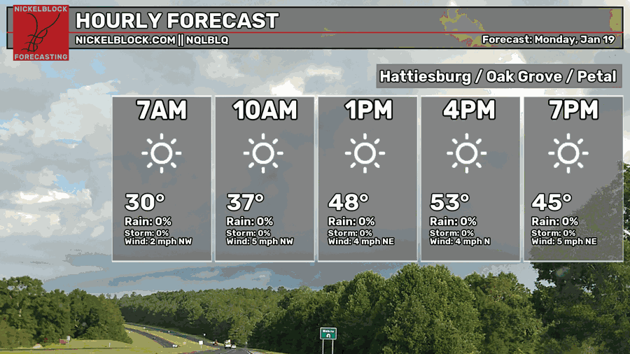
Expect a pretty average winter day today. Winds will be rotating around the northern axis, but otherwise, it’s crystal clear skies outside! Highs in the low 50s and a low in the upper 20s tonight.
Tomorrow
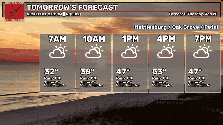
Upper level clouds will cover the skies across much of the Pine Belt and further south. Expect another cool day with a high in the low 50s and a low in the mid 30s.
Wednesday
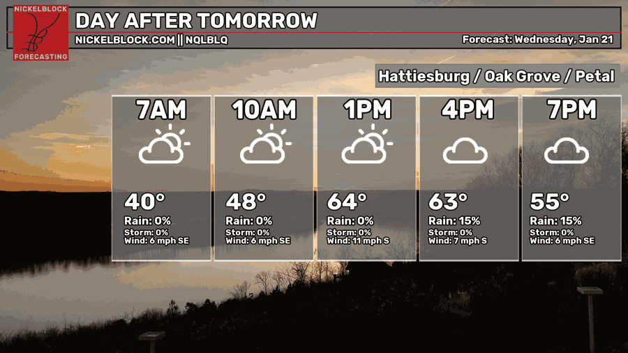
Temperatures will increase a bit on Wednesday along with more clouds increasing. A stray shower or thunderstorm is possible into the evening hours with an incoming front. Expect some gusty winds from the south with the incoming front.
Thursday and Friday
Thursday and Friday will be similar to each other in terms of setup. There will be a line of moisture that will allow a line of showers to move in most of Thursday and Friday. While this isn’t a large or powerful line, it’ll likely keep things damp for those couple of days. Highs will be in the low 60s and a low from the mid 40s to the low 40s.
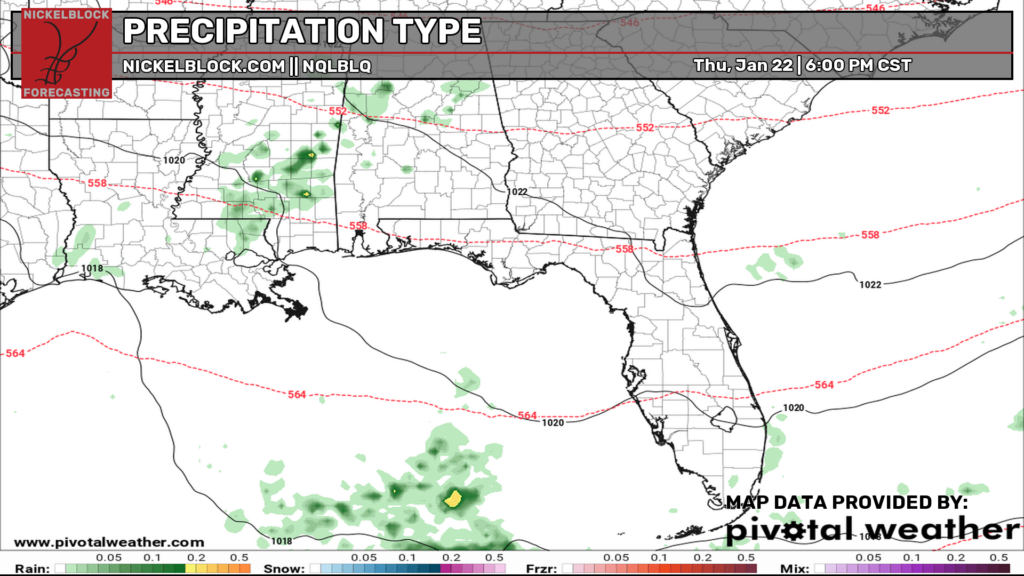
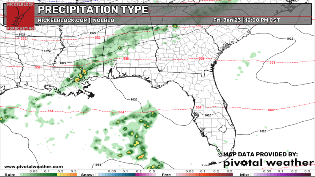
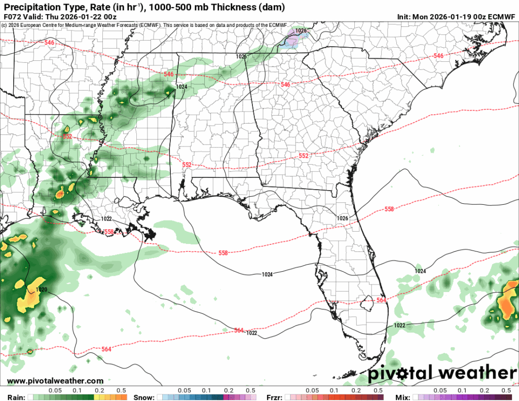
The “Icepocalypse”
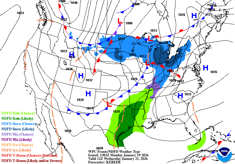
I’m sure social media has been blowing up about the possible ice and mixed precipitation coming up this weekend. That to say, it is looking possible for parts of the Deep South and east Texas. Both the GFS and ECMWF models agree that wintry precipitation is possible and this is due to a large area of high pressure over Canada along with another Gulf low bringing in cold temperatures and moisture.
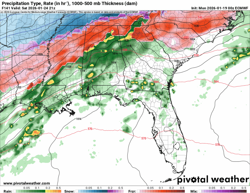
There are a couple of hang-ups with how far south this system will go. While the Skew-Ts look good for their dendritic growth zone (ice crystal formation in the atmosphere), warm sector and ground temperature, this isn’t a guarantee for everyone. Some areas may stay above the freezing mark at the ground and prevent ice from accumulating. I do think that many areas will still see the possibility of freezing rain, though. Another big concern will be how much ice accumulates. If we’re over 1/4 of an inch, then we have some problems.
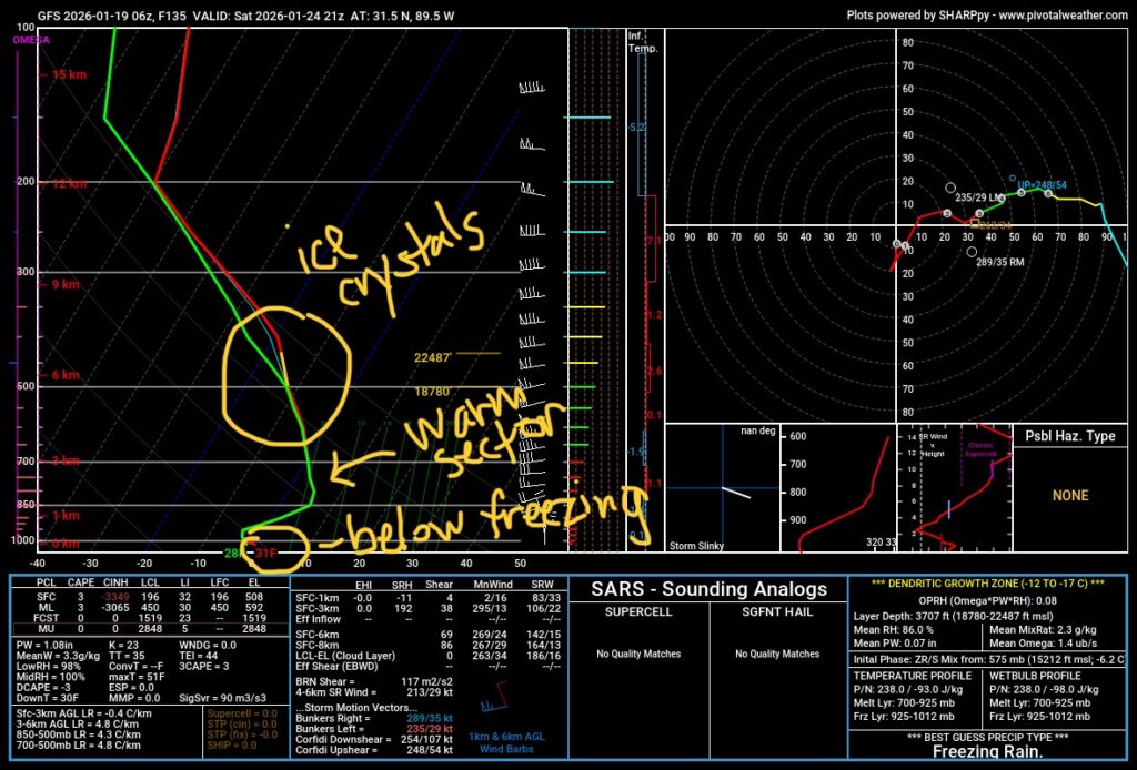
^ This is what I’ll be looking for in the next few days with my forecast. Until then, we’ll keep you in the loop with the evolving model trends to see where the wintry precipitation is headed.


