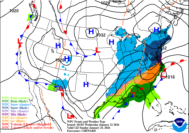
It’s going to feel a bit damp and gloomy for the next few days as the rain moves in from an incoming cold front. This front will take its time over the southeast and won’t move out until Friday leaving us with some scattered rain showers for most of the week’s end. Of course, we also have the freezing rain to contend with in some places depending on where the freezing point lands. Let’s take a look!

Today
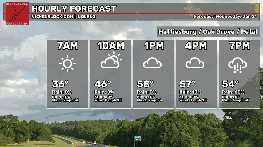
While the forecast graphic may forego the rain until late this evening, we’ll likely see showers in the early afternoon and continue on until the overnight hours. Temperatures will top out in the upper 50s and lows in the low 50s.
Tomorrow
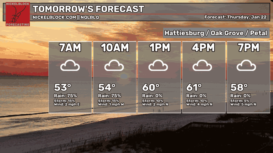
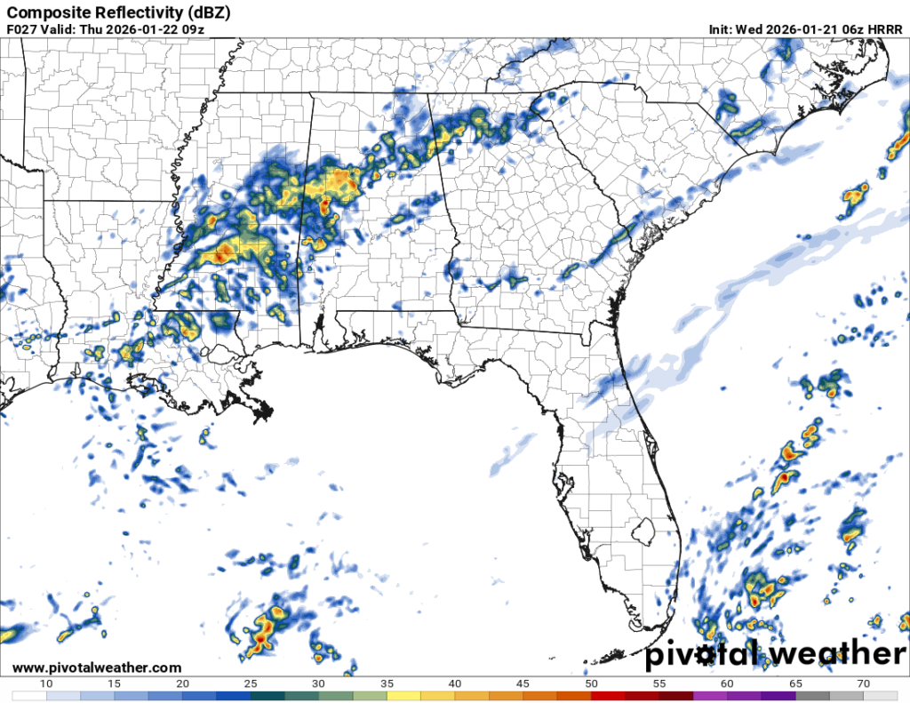
More rain to follow overnight and into the mid-morning hours on Thursday. We’ll also see winds shift to the north as the cold front begins to move past us. Highs in the low 60s and a low in the low 50s. A few stray showers are possible throughout the day.
Friday
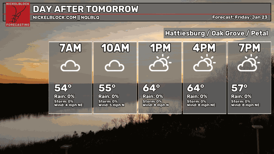
A few stray showers are possible on Friday, but otherwise it’ll be mostly cloudy throughout the day. A high in the mid 60s and a low in the mid 40s.
The Ice
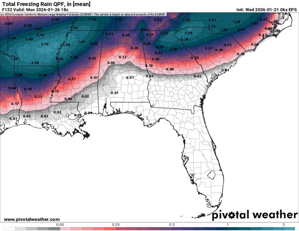
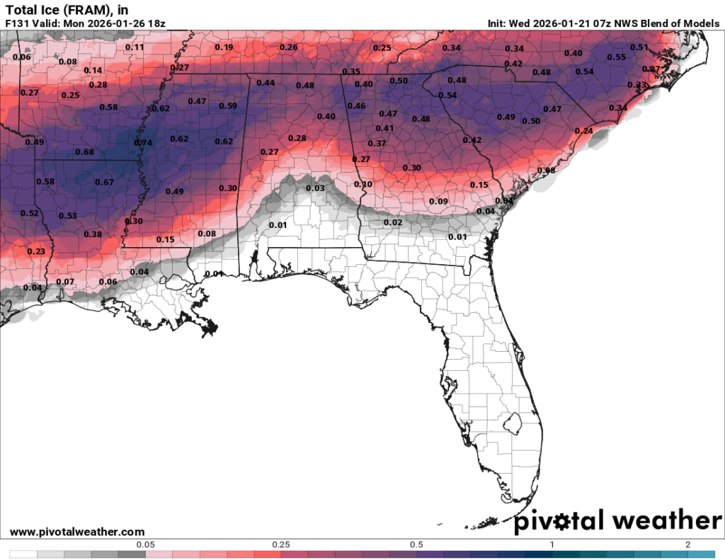
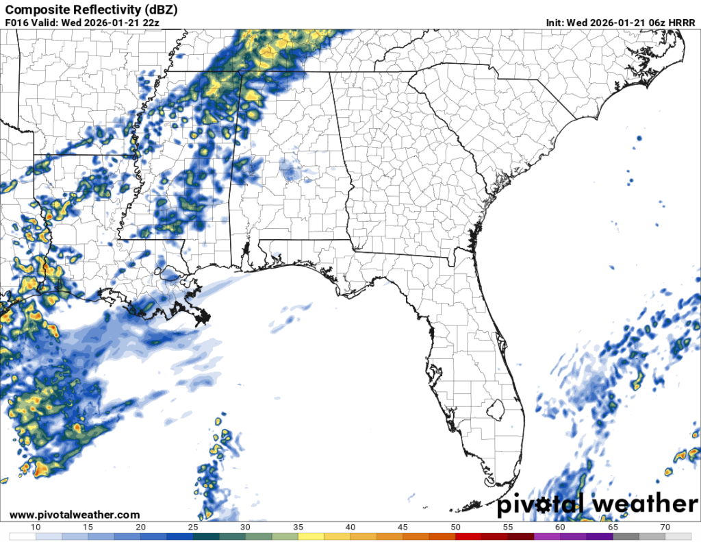
Ensemble models are in a little more agreement of the concentration of ice accumulation. The European model (left) places the accumulation a bit further north, however. Another thing of note is the sweep further south into Louisiana. This is mainly due to the front and the high’s location to the northwest. That being said, there’s still a few factors we have to take into consideration about who may get freezing rain and who won’t.
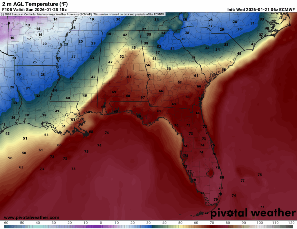
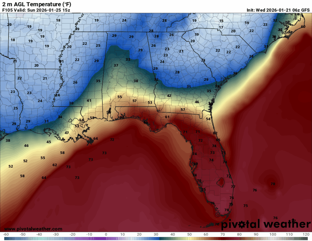
Looking at the ensemble above, there is a fine line between the freezing mark for many of us. This will be a big factor as to whether ice will be able to accumulate as the ground temperature needs to be at the freezing mark. Some areas may just see rain while 10 miles away may see some ice accumulation. Models are more in agreement, but we’ll also have to look at the conditions when the storm system moves in. Another big thing to consider is how much accumulation is happening around the area. Many areas that reach over the quarter inch mark will have something to worry about especially with roads and power lines, so keep that in mind. All this to say that we’re getting closer to an answer but we’re still going to have to wait a bit to know what will likely happen. Until then, stay tuned.


Thanks for the update.