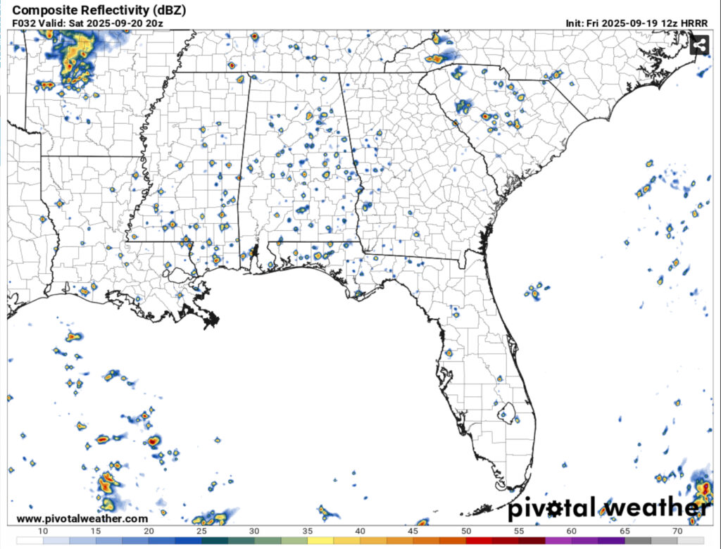
A few isolated thunderstorms have developed across much of south and central Mississippi and look to die out fairly quickly. Expect a few more to develop into the evening and rain themselves out. So far it’s been a hotter one than the past couple of days and temperatures have climbed into the mid 90s. Thankfully, the humidity has been on the lower side so it hasn’t been unbearable.
Tomorrow will be the same story with temperatures starting out in the upper 60s, so it’ll be quite pleasant to start off the day. Afterwards, we’ll jump back to the mid 90s again and bring in the isolated storms again. Sunday and Monday will also be a similar story as the high pressure system eventually takes over by Tuesday.

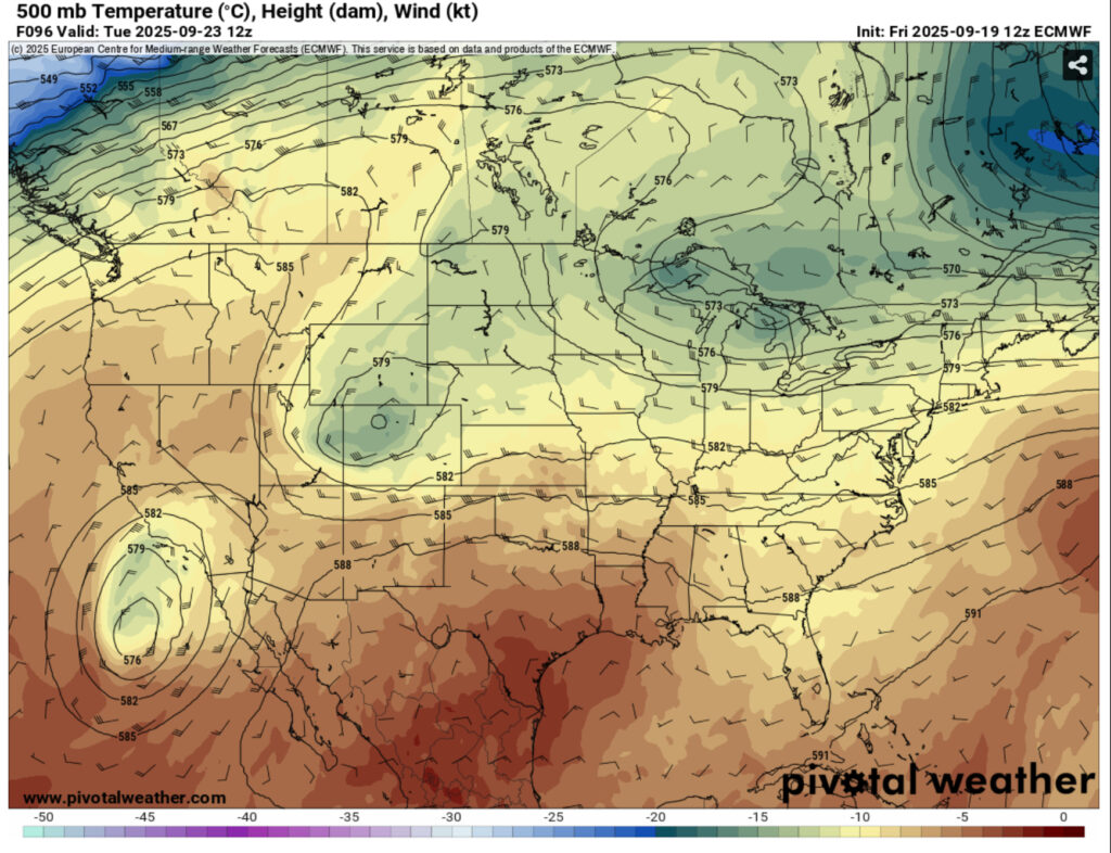
Looking at the overall setup in the upper atmosphere, a large trough over the Rockies will strengthen over time and move into the southeastern region. As it reaches the southeast, we can expect a setup for an MCS over the region come Wednesday into Thursday. So far, no crazy severe parameters, but the precipitable water amounts look to be fairly high with the system.
Overall, expect next week to be hot but not very humid. Despite the south winds moving in, the humidity won’t ramp up much. A few more isolated storms are possible Monday and Tuesday. Highs in the low 90s and lows in the upper 60s.
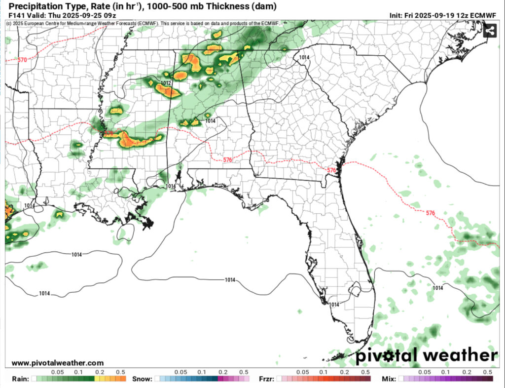
So far, models are showing an average over 0.75” of rain across the southeastern portion of Mississippi and maxes are around 2 inches. This will depend on how organized the MCS is and as long as it doesn’t fall apart. So far, the setup of the trough moving further south suggests that we’ll get a decent bit of the rain over a 24 hour period. It’ll be brief, but it is something. Otherwise, it mainly just looks like thunderstorms and heavy rain. Some flash flooding may also be possible considering the lack of rain and dry ground.
Afterwards, expect a very slight cooldown ahead. Highs will reach the upper 80s on Friday and reach the mid 60s. It’ll be a nice change from the overall heat we’ve had and we’ll even get a little bit of that on Saturday.
The Tropics
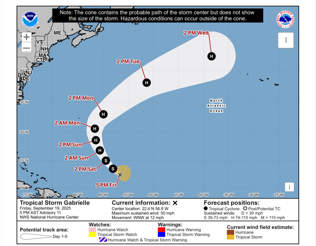
So far, two tropical systems are looming in the Atlantic. Tropical storm Gabrielle is forecast to hook to the east, just east of Bermuda and reach hurricane status before it moves out to sea. Another tropical wave behind it near the Cape Verde Islands has a very low chance of developing over the next 7 days, but it’ll be worth keeping an eye on.

Regional Day-to-Day Forecast
This Afternoon – A 20 percent chance of showers and thunderstorms. Mostly sunny, with a high in the mid 90s. Calm wind.
Tonight – A 20 percent chance of showers and thunderstorms before 9pm. Partly cloudy, with a low in the upper 60s. Calm wind.
Saturday – Sunny, with a high in the mid 90s. Calm wind becoming north around 5 mph.
Saturday Night – Mostly cloudy, with a low around 70. Calm wind.
Sunday – Mostly sunny, with a high in the mid 90s. A 20 percent chance of thunderstorms possible in the afternoon. Calm wind becoming south around 5 mph in the afternoon.
Sunday Night – Partly cloudy, with a low in the upper 60s. South wind around 5 mph becoming calm in the evening.
Monday – Sunny, with a high in the low to mid 90s. A 20 percent chance of thunderstorms possible in the afternoon Calm wind becoming south southeast around 5 mph in the afternoon.
Monday Night – Mostly clear, with a low in the upper 60s. South wind around 5 mph becoming calm in the evening.
Tuesday – A 20 percent chance of showers and thunderstorms in the afternoon. Sunny, with a high in the low to mid 90s. Calm wind becoming south southeast around 5 mph in the afternoon.
Tuesday Night – A 20 percent chance of showers. Partly cloudy, with a low around 70.
Wednesday – A 40 percent chance of showers and thunderstorms. Mostly sunny, with a high in the low 90s.
Wednesday Night – A 50 percent chance of showers and thunderstorms. Partly cloudy, with a low around 70.
Thursday – A 40 percent chance of showers. Mostly sunny, with a high in the low 90s.


