As August begins, the Southeast will continue in the typical summertime pattern of daily thunderstorms throughout the region. The upper-level ridge continues to be centered over the Southwest and the Bermuda high is stretching into the coastal states from the Western Atlantic. That puts the Southeast right in between these two features. Slight upper-level troughing between these two highs will support rising motion for afternoon thunderstorms on Tuesday.
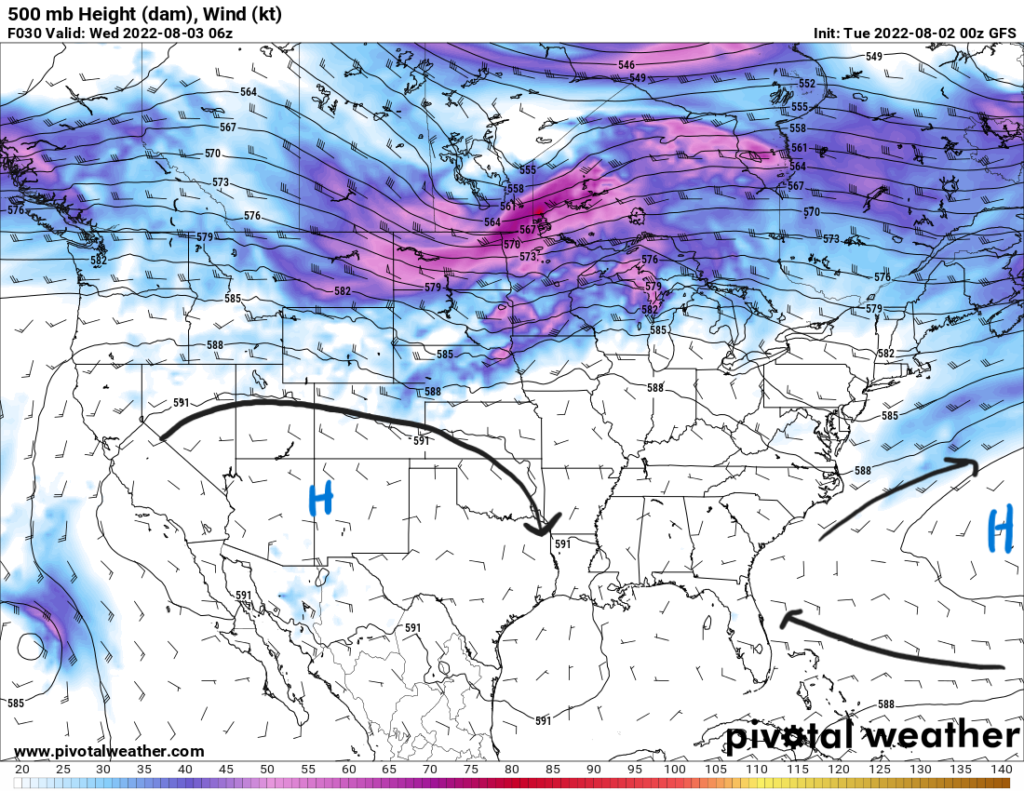
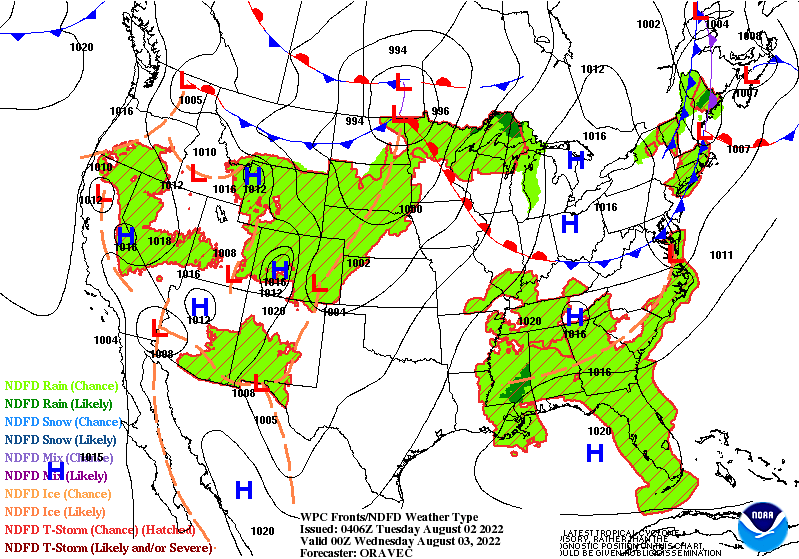
A frontal boundary over the Ohio Valley will stay north of the Southeast as it moves towards the northeast. However, a surface trough, denoted by the dashed brown line in the image below, will be draped across the region on Tuesday. This will be the basis for thunderstorm development.
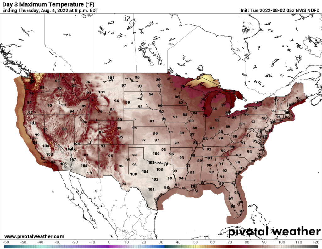
Diurnally driven thunderstorms should pop off into the afternoon hours and will be widespread and scattered in nature. Easterly flow from the Bermuda high and westerly flow from the surface high in the Gulf will help to develop the sea breeze over Florida to produce plenty of thunderstorms. Southerly flow into the Gulf Coast will help the sea breeze there as well. Temperatures will be in the 90s inmost places with highs reaching the upper 90s and 100F more west towards Texas.
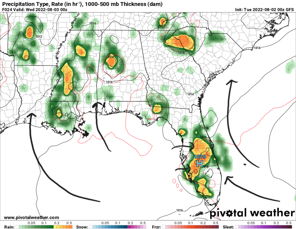
Wednesday
Wednesday will be very similar to Tuesday with widespread scattered thunderstorms developing from daytime heating. Dewpoints in the 70s near the water and the upper 60s more inland will provide enough moisture along with precipitable water values above 1.75″ and around 2″ near the Central Gulf Coast. Slower moving storms could have the possibility for heavy rainfall and localized flooding as there is plenty of moisture to be “rained out”.
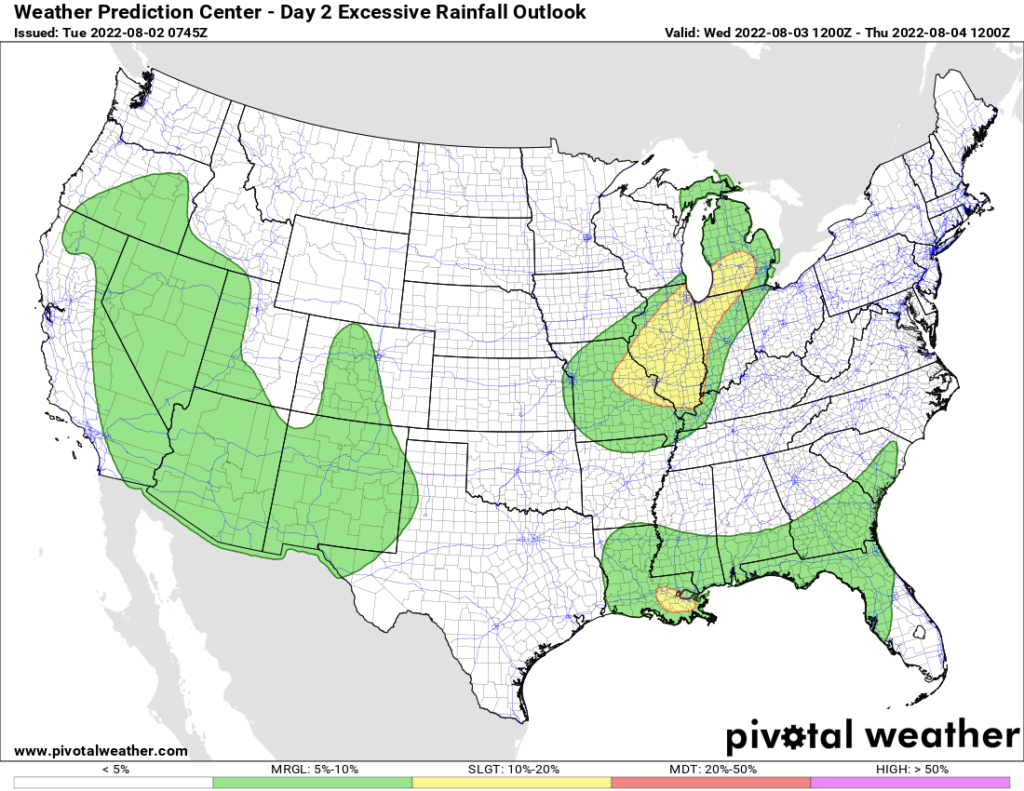
The Weather Prediction Center has the southern part of the region in a marginal risk (1/4) for excessive rainfall. Notice how the areas outlined in green stop by the eastern Texas border. The upper-level ridge is too close and is limiting any rainfall in Texas. Southern Louisiana is placed under a slight risk (2/4) as well.
Thursday
Rinse and repeat for Thursday as well. The upper-level pattern with the high pressures on either side of the region continues. Southeasterly and southerly flow will continue to dominate bring tropical moisture into the area from the Gulf and Atlantic. Scattered showers and storms will be likely more so in the central portion of the region.
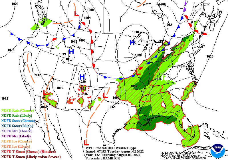
The upper-level ridge over the Southwest will start to shift slight towards the west. This will continue to inhibit rain chances in places such as Texas and Northwestern Louisiana. This will also keep high temperatures over the Southern Plains and Texas into the 100s. Heat index values could reach up to 108 in some parts. More to the east, temperatures will be more mild into the low-to-mid 90s.
3-Day Forecast
| Dallas, TX | ||
| Tuesday | Wednesday | Thursday |
| High: 102 | High: 102 | High: 103 |
| Low: 80 | Low: 81 | Low: 81 |
| Precip: None | Precip: None | Precip: None |
| Houston, TX | ||
| Tuesday | Wednesday | Thursday |
| High: 95 | High: 96 | High: 96 |
| Low: 78 | Low: 78 | Low: 78 |
| Precip: 30-Percent | Precip: 20-Percent | Precip: 30-Percent |
| New Orleans, LA | ||
| Tuesday | Wednesday | Thursday |
| High: 88 | High: 89 | High: 89 |
| Low: 77 | Low: 77 | Low: 76 |
| Precip: 80-Percent | Precip: 80-Percent | Precip: 90-Percent |
| Little Rock, AR | ||
| Tuesday | Wednesday | Thursday |
| High: 96 | High: 96 | High: 94 |
| Low: 75 | Low: 75 | Low: 75 |
| Precip: 20-Percent | Precip: 20-Percent | Precip: 40-Percent |
| Memphis, TN | ||
| Tuesday | Wednesday | Thursday |
| High: 94 | High: 94 | High: 88 |
| Low: 75 | Low: 75 | Low: 74 |
| Precip: 20-Percent | Precip: 30-Percent | Precip: 40-Percent |
| Birmingham, AL | ||
| Tuesday | Wednesday | Thursday |
| High: 90 | High: 90 | High: 91 |
| Low: 72 | Low: 72 | Low: 72 |
| Precip: 60-Percent | Precip: 40-Percent | Precip: 50-Percent |
| Atlanta, GA | ||
| Tuesday | Wednesday | Thursday |
| High: 91 | High: 92 | High: 91 |
| Low: 72 | Low: 72 | Low: 72 |
| Precip: 40-Percent | Precip: 40-Percent | Precip: 50-Percent |


