Today and the beginning of the week are looking to be one of those typical summer days; sunny in the morning with increasing clouds in the afternoon along with scattered popup thunderstorms, temperatures in the low-to-mid 90s, and a very muggy humidity making it feel like 110! Let’s dive into the detailed forecast:
Today’s Overall Setup
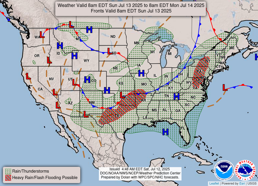
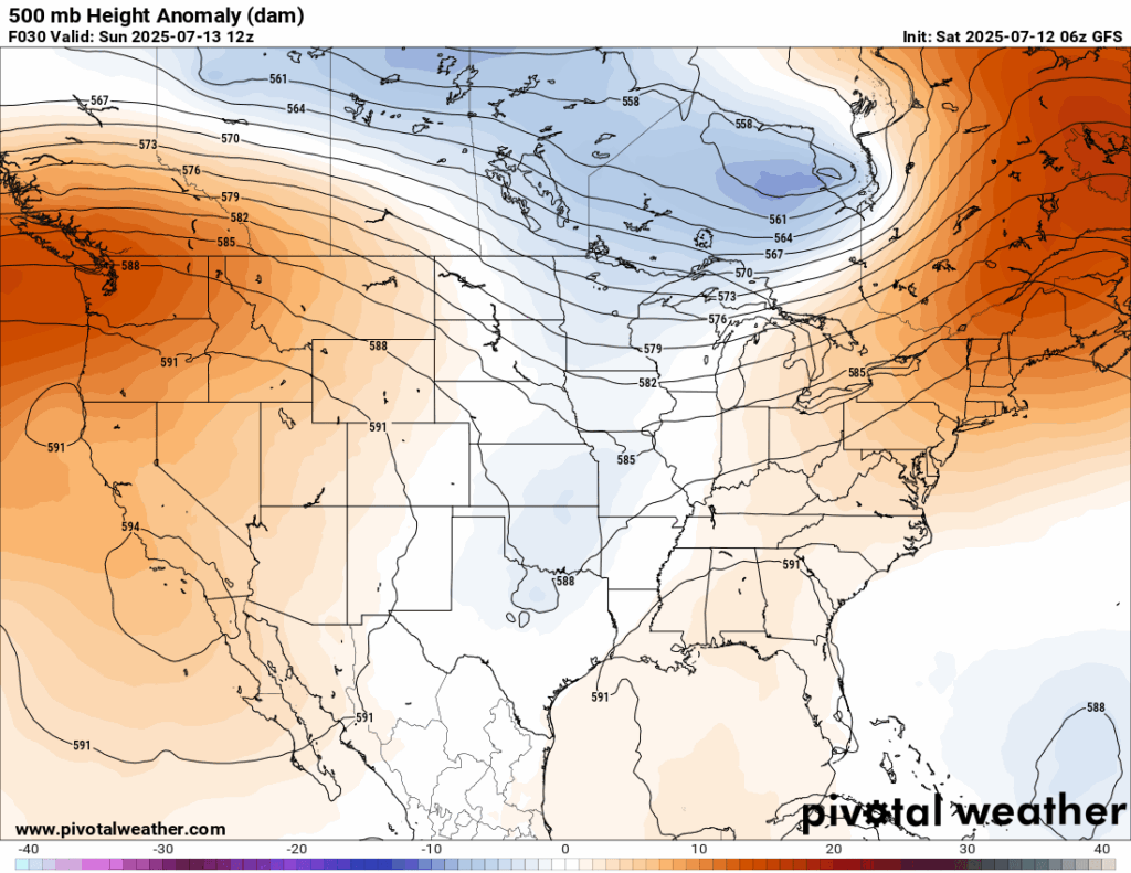
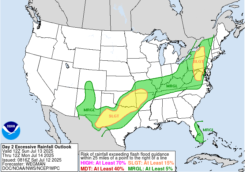
Looking at our current set up at 500 mb, there is increased troughing over the Midwest and plains as well as a stalled out frontal boundary, which is causing the increased chance of heavy rainfall and flash flooding to areas that have seen a lot of rainfall and flooding recently. The troughing will stick around for tomorrow as well, and the flash flood threat will continue into tomorrow. There is also the chance of flash flooding from northern Virginia through Pennsylvania into western New York along with a passing cold front.
Today’s Local Forecast
Looking at our forecast today, we will see sunny conditions with some clouds for most of the day. Very isolated showers and thunderstorms will pop up by 2-3 pm and stick around through the evening. Not everyone will be affected by this, but keep an eye out on the radar!

Here’s an hourly look at the forecast for today for the region.
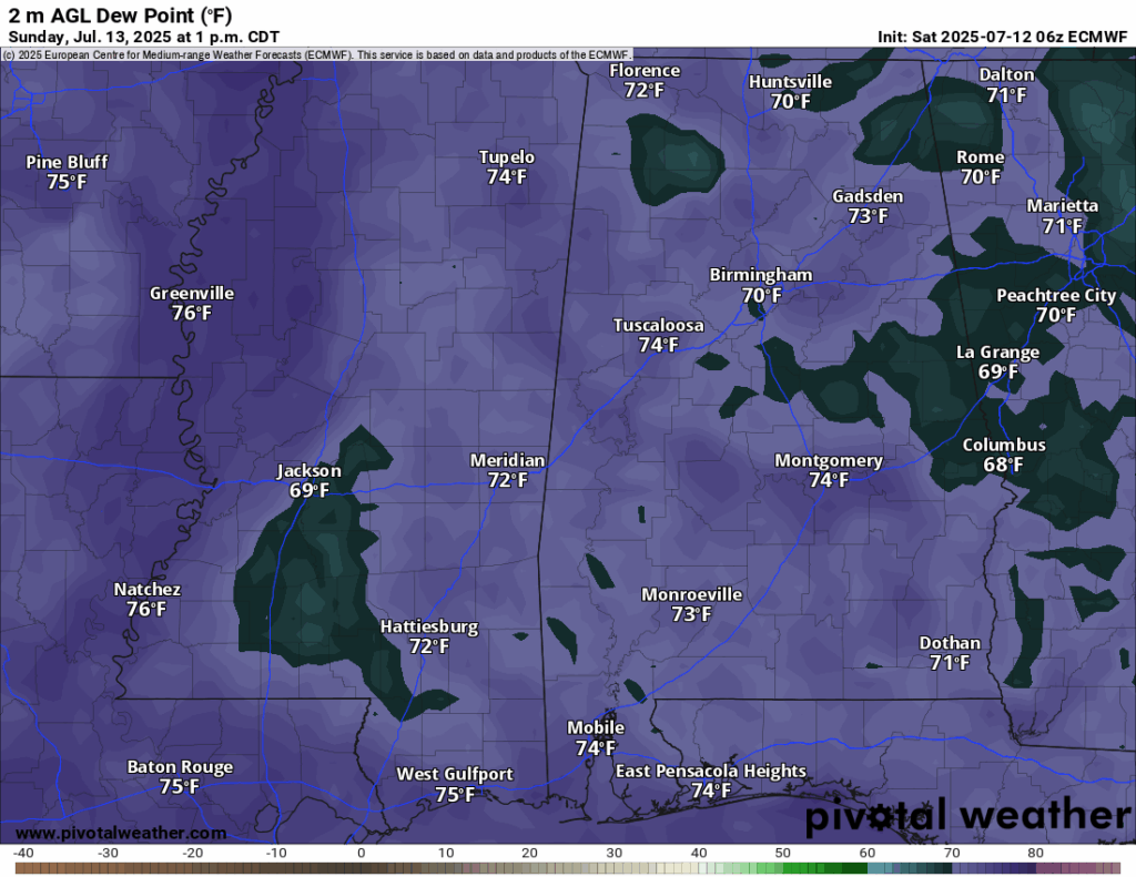
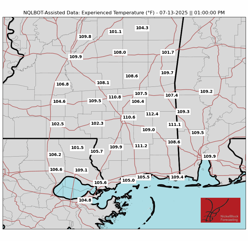
Today’s high temperature will be in the low-to-mid 90s, with low 70 degree dew points making it feel 110+ degrees during the afternoon! If it were me, I would want a quick rain shower to pass over me to temporarily cool things off! Ensure you keep a bottle of water, or two, handy and take frequent breaks when you are outside!
Monday-Wednesday Forecast
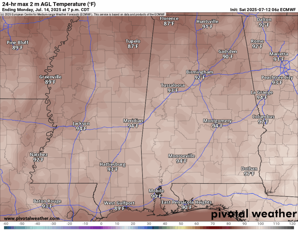
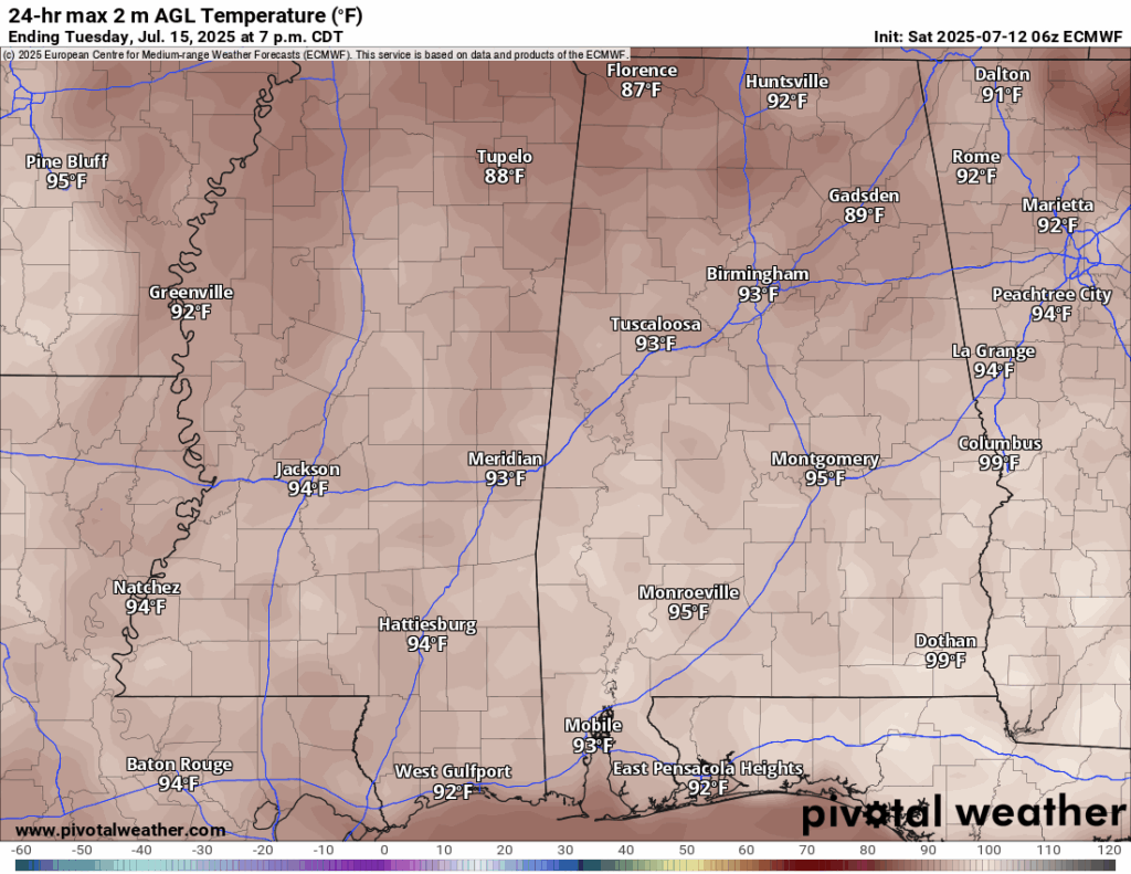
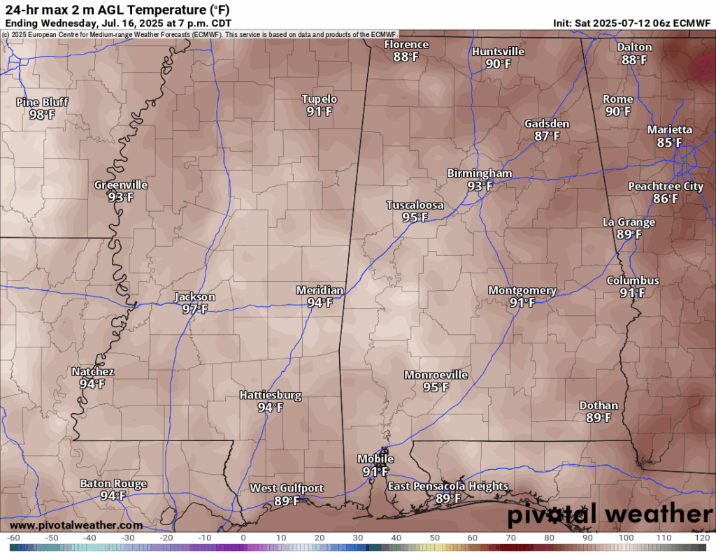
For the start of the week, Monday, Tuesday, and Wednesday will have similar high temperatures in the low-to-mid 90s. This is slightly above average for us, which was accurately predicted by the Climate Prediction Center last week!
Monday-Wednesday is looking mostly sunny during the mornings and the typical 30-40 percent chance of thunderstorms in the afternoon. We are in a very moist airmass, so the heating of the day will cause the air to rise, condense, form clouds, and eventually pour down each afternoon on us. Again, ensure you are checking the Nickelblock radar and have our alerts turned on!
Extended Local Outlook

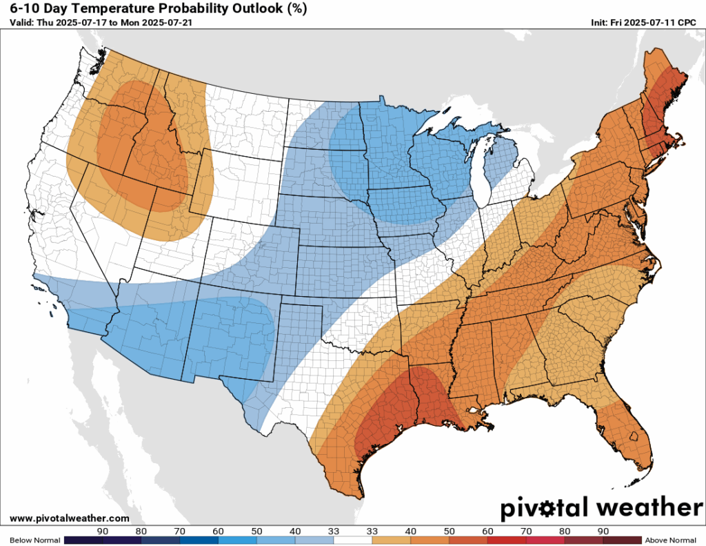
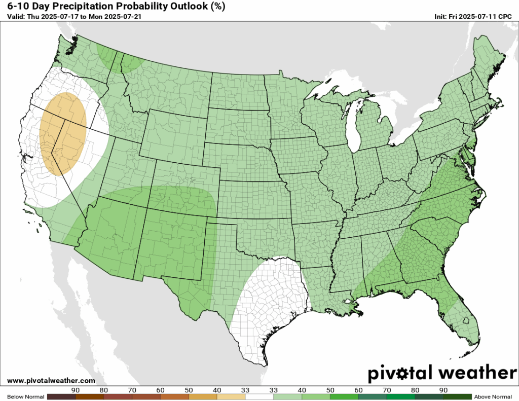
Looking ahead to the next 6-10 days, which takes us into next week, temperatures are likely trending above normal, along with our rainfall. The reasoning behind this is that we are entering a negative phase of the Pacific North American Pattern, or the PNA. When we are in a negative phase of the PNA, we see the pattern, or a pattern close to, the one forecasted by the Climate Prediction Center above. The overwhelming majority of models predict a negative PNA for the rest of July! That means warmer temperatures for our area!
Latest Tropical Update
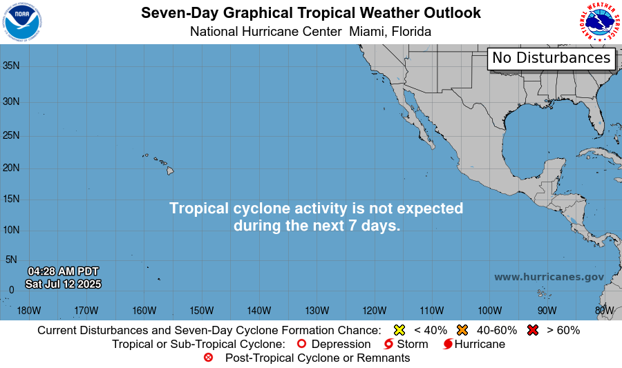
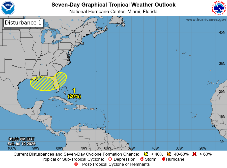
There is a newly announced area to watch with a 20 percent chance of development in the next 7 days in the Gulf. Models are hinting at some sort of low-pressure system forming in the Gulf by Wednesday or Thursday potentially moving into our region.
Want the latest details on these systems? Check out our daily tropical updates for more in-depth information on the tropics!
REGIONAL DAY TO DAY FORECAST
Today: Sunny and hot. Scattered showers and thunderstorms in the afternoon. Highs in the mid 90s. Calm winds becoming southwest around 5 mph. Chance of rain 30 percent.
Tonight: Mostly clear. Lows in the mid 70s. Calm winds. Chance of rain 30 percent before 7pm.
Monday: Sunny and hot. Scattered showers and thunderstorms in the afternoon. Highs in the upper 90s. Calm winds becoming northwest around 5 mph. Chance of rain 40 percent.
Monday Night: Mostly clear. Lows in the mid 70s. Calm winds.
Tuesday: Sunny and hot. Scattered showers and thunderstorms in the afternoon. Highs in the upper 90s. Calm winds. Chance of rain 40 percent.
Tuesday Night: Mostly clear. Lows in the mid 70s. Calm winds.
Wednesday: Mostly sunny and hot. Scattered showers and thunderstorms in the afternoon. Highs in the upper 90s. Calm winds becoming north northeast around 5 mph. Chance of rain 50 percent.
Wednesday Night: Partly cloudy. Slight chance of showers and thunderstorms before 1am. Lows in the mid 70s. Chance of rain 20 percent.
Thursday: Mostly sunny. Showers and thunderstorms likely in the afternoon. Highs in the mid 90s. Chance of rain 70 percent.
Thursday Night: Partly cloudy. Slight chance of showers and thunderstorms. Lows in the mid 70s. Chance of rain 20 percent.
Friday: Showers and thunderstorms. Highs in the low 90s. Chance of rain 80 percent.


