Overall Setup

Hi everyone! I hope you all enjoyed your New Year’s Eve!
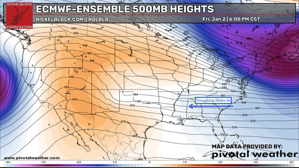
Looking at tomorrow, at 500 mb, which is approximately the mid-level of the troposphere, we’ll feel an influence from some troughing, as indicated by the shaded blue area in the first image. The mid-level troughing, as well as a surface low with a cold/stationary front attached to it, will bring some scattered showers to our area tomorrow throughout the day, Southerly flow from the Gulf will bring moisture into the picture, which will make it feel muggy out and cloudy all day.

Tonight’s Forecast

Our average low temperature for January 2 is about 38 degrees, so given our low temperature tonight in the upper 40s and lower 50s, we are sitting above average. Want an even warmer low? You’ll get a low near 60 in the coastal marshes of Lake Borgne! Cloud cover is moving in tonight pretty rapidly, and we could get some scattered showers late tonight into early tomorrow morning, coming from west to east.
Tomorrow’s Forecast: Friday, January 2
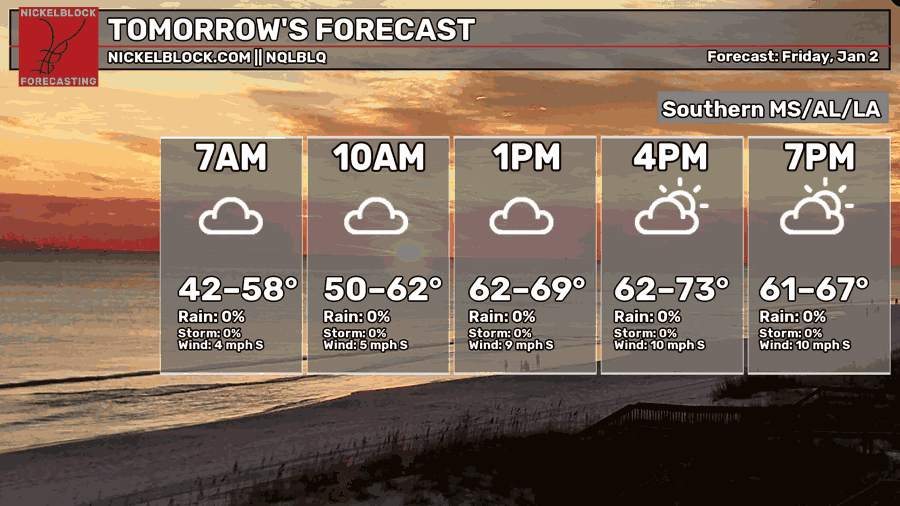

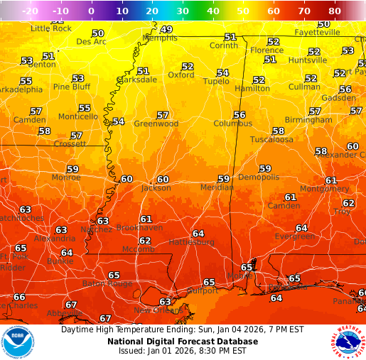
We’ll stay cloudy all day tomorrow and experience some scattered showers throughout the day. Not a huge amount of rain, but enough to keep it wet, muggy, and grey outside. Most of the rain will stay in Mississippi and Alabama following the direction the low pressure and front will travel. Southeast Louisiana is included in the rain, but less so for central and western areas. We’ll see a high temperature from the high 60s to the low 70s in our region. Lows will be very mild Friday night, sitting in the mid 60s, given the persistent southerly flow and cloudy/humid conditions.
Weekend Forecast: Sat 1/3 & Sun 1/4
On Saturday, we’ll see some leftover rain showers through around noon. After that, we should see the cloud cover decrease and finally see some sunshine for the remainder of the day. It’ll still feel humid, but the humidity will die down through the evening into the overnight Saturday night. We’ll see a high temperature from the mid-60s to mid-70s, depending on location on Saturday.
On Sunday, abundant sunshine returns for the entire day, and the humidity should be completely gone since the front will have moved through. Highs will be cooler, as we will be on the “cold” side of the front, sitting in the low-to-mid 60s.
Extended Local Outlook
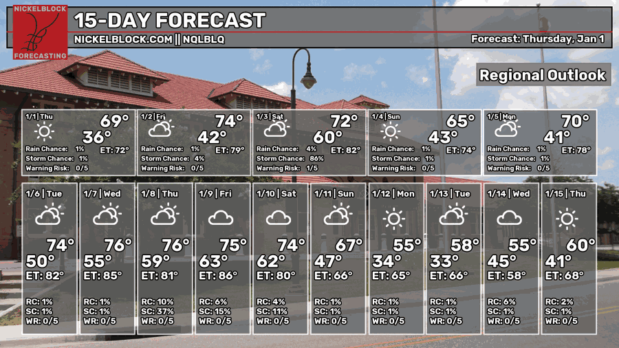
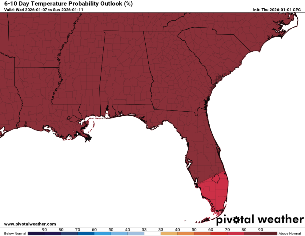
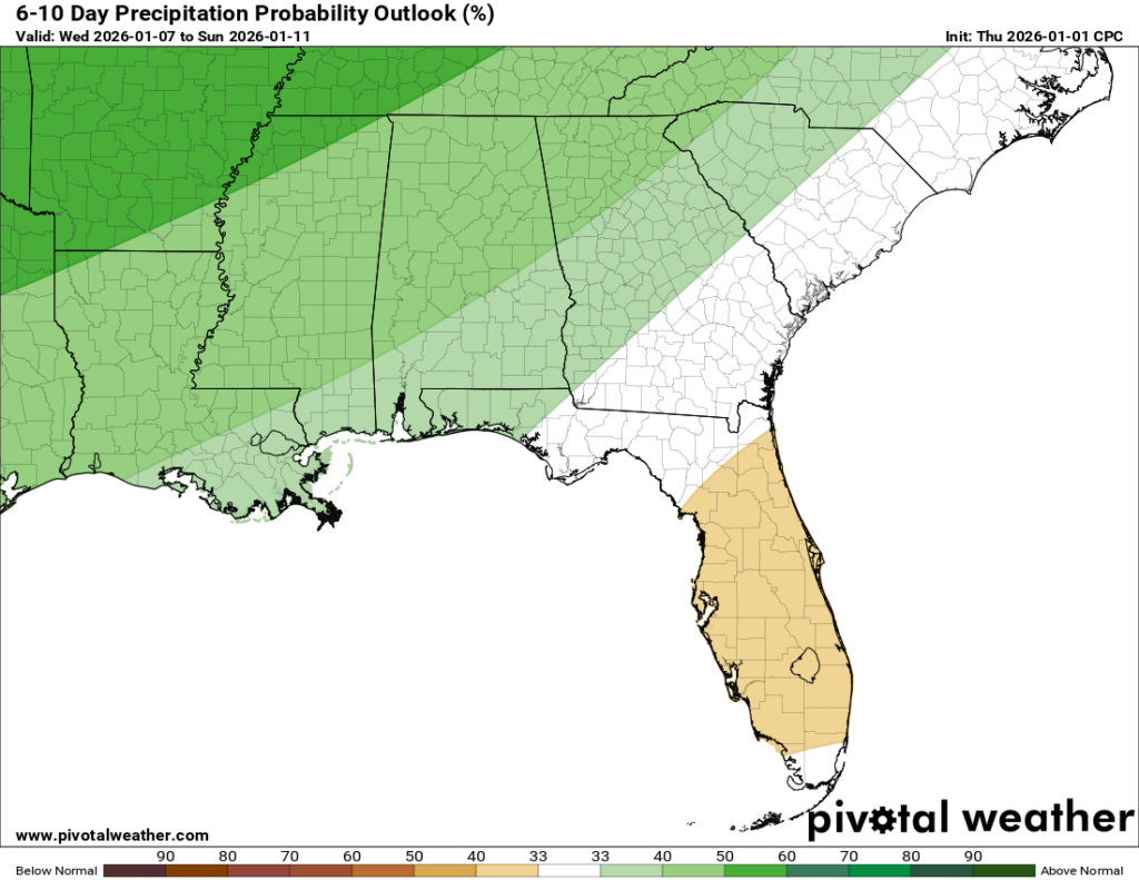
Looking into next week, we’re not looking at any crazy rain makers. The models currently show some rain for Friday-Sunday next week, but given that it’s over a week out, it’s best not to take that too seriously. We will for certain, though, see well above average temperatures next week, with each day seeing a high in the mid 70s. That would be why the Climate Prediction Center (CPC) has given our region a high certainty of above normal temperatures (our average high is 60 degrees).

REGIONAL DAY TO DAY FORECAST
Tonight: Mostly cloudy, with lows in the mid 40s. South-southwest wind around 5 mph.
Friday: Mostly cloudy, with highs in the lower 70s. South wind 5 to 15 mph, with gusts up to around 25 mph. A slight chance of showers during the afternoon. Chance of rain 20 percent.
Friday Night: Showers likely. Mostly cloudy, with lows in the lower 60s. South-southwest wind 5 to 10 mph, with gusts up to around 25 mph. Chance of rain 70 percent.
Saturday: A chance of showers before noon, then partly sunny. Highs in the lower 70s. Southwest wind 5 to 10 mph becoming north-northwest in the afternoon. Chance of rain 50 percent.
Saturday Night: Partly cloudy, with lows in the mid 40s. North wind 5 to 10 mph.
Sunday: Sunny, with highs in the mid 60s. North wind around 5 mph becoming calm in the afternoon.
Sunday Night: Partly cloudy, with lows in the lower 40s. Calm wind.
Monday: Mostly sunny, with highs in the upper 60s. Calm wind becoming south around 5 mph.
Monday Night: Mostly cloudy, with lows in the upper 40s. Calm wind.
Tuesday: Mostly sunny, with highs in the mid 70s.
Tuesday Night: Partly cloudy, with lows in the mid 50s.
Wednesday: Partly sunny, with highs in the mid to upper 70s.
Wednesday Night: Mostly cloudy, with lows in the mid 50s. A slight chance of showers. Chance of rain 20 percent.
Thursday: Mostly cloudy, with highs in the mid 70s. A chance of showers. Chance of rain 30 percent.


