General Central/Eastern Kansas Forecast
Short-Term (Thursday-Friday)
Isolated showers are still ongoing south of I-35 this morning and will continue throughout the afternoon across southern/southeast Kansas. No severe weather is anticipated with this activity, but some thunder can’t be ruled out. Further isolated showers and thunderstorms may redevelop across north central Kansas around US-81 by around noon. No severe weather or heavy rainfall is expected, being more akin to garden variety showers and storms today. Rain activity will look to fully shut down by 8pm tonight with higher pressure moving in and increasing stability.

Probably the best part about the upcoming days will be the well-below normal temperatures we will experience. High temperatures today will only make it to the upper 70s to low 80s, with a northeast wind of 10 to 15 mph gusting to 20. The humidity will be high today, but it will still be a comfortable day regardless due to the lower temperatures, with our relative humidity values between 65-75% and dew point temperatures in the upper 60s to low 70s. Low temperatures tonight will be much cooler than previous nights, dropping down into the upper 50s to mid 60s.
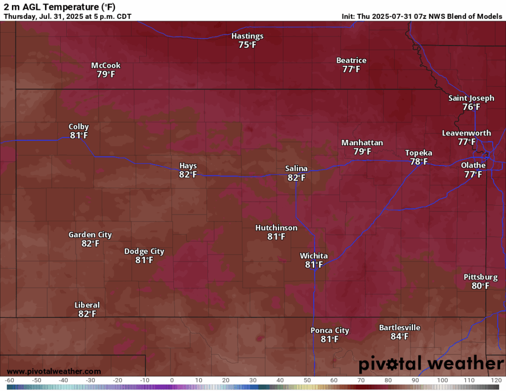
Tomorrow will be a cool and dry day, with rain chances shutting down from a surface high moving over us. High temperatures again will only reach the upper 70s to low 80s across the region, with an east wind of 5 to 10 mph. The humid feel will still stick around, with relative humidity values between 55-75% likely in the afternoon, but the air will dry out somewhat, as dew point temperatures fall to the upper 50s to mid 60s. Low temperatures tomorrow night will bottom out into the upper 50s to low 60s.

Long-Term (Saturday-Wednesday)
Saturday will look to remain largely cooler and dry again, with only isolated chances of precipitation possible across the region. Sunday though rain chances may increase again, as a shortwave makes its way through the state during the afternoon, which could spur scattered showers and thunderstorm activity across central Kansas. Once this disturbance passes, dry conditions will set in again for the early part of next week. Temperatures will stay similar to today until about Tuesday-Wednesday where we then will see them creep back upwards into the mid to upper 80s.
Climate Outlook
One update between last week’s climate outlook and this week’s is that while ridging is still expected to build over the southwest US, as is typical this time of year, it presently does not look to be as strong as forecasted. Temperatures are looking to remain closer to seasonal with this new development, as well as precipitation being closer to average with the weaker forecasted high pressure. This will be the case over the next 3 to 4 weeks, so as of this present moment, abnormally hot and dry conditions will look to largely spare us as we head into the dog days of summer.
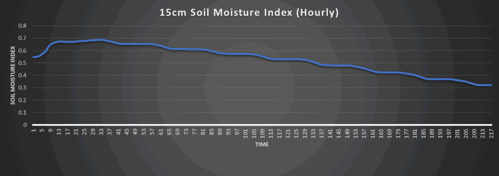
Regional Soil Moisture Outlook
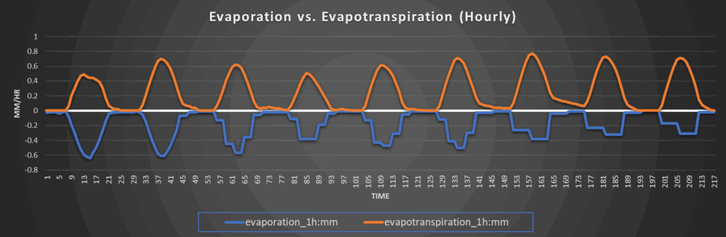
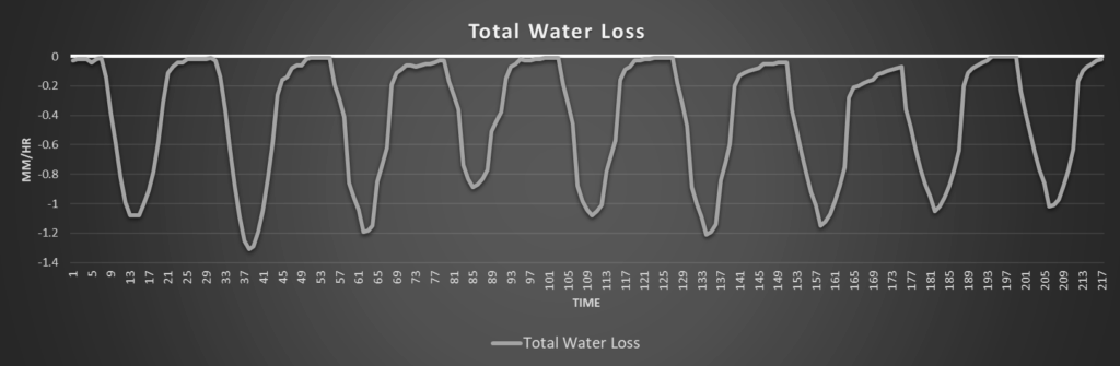
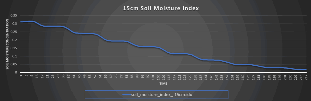
Around Westmoreland
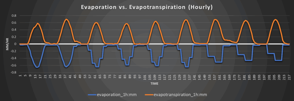
Around Scranton
Around Burlington
Around Altoona