Hey everyone! I am back with your weekly CONUS National Forecast, with a look at the weather for today, including some severe weather in the northern Plains. Plus, I also have a look at the weekly outlook outlined by region! Let’s take a look at all of the details:
Today’s Overall Setup
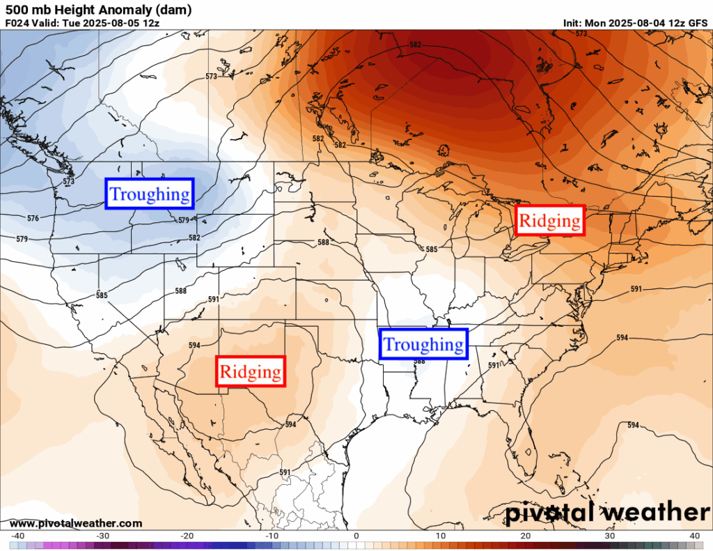
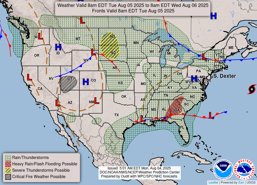
The overall mid-level pattern is producing ridging in the northeast and southwest, and troughing in the northwest and southeast. Under the areas of troughing, or generally near them, are frontal boundaries and areas of low pressure that are bringing the chance of flooding rain or severe weather. We are no longer getting much rain in the south coastal Atlantic states from Tropical Storm Dexter, but we are from another tropical disturbance, in the same region where Dexter formed. Keep an eye out for flash flooding in Georgia, southeastern Alabama, and western North/South Carolina as a result of this low pressure and associated stalled out front.
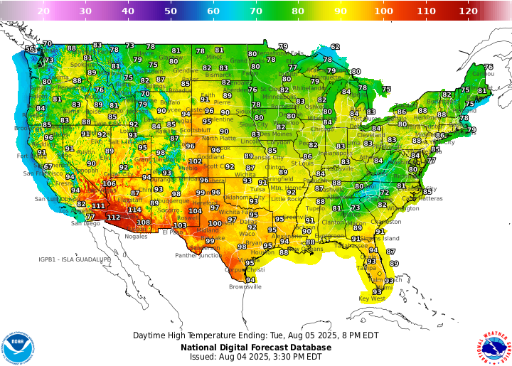
Daytime high temperatures are still generally cooler than average over the midwest and interior northeast. The coastal southeast is still scorching, with not much relief in sight. The desert southwest is pushing 115 degrees, and the interior northwest is looking quite comfortable with 70s and 80s, plus no humidity.
Today’s Severe Weather Threat
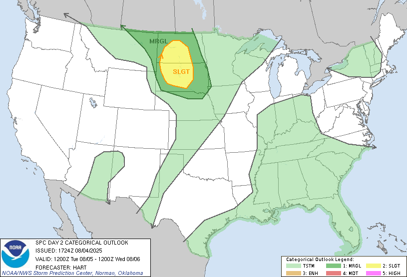
Today we are expecting some severe weather to impact the northern Plains. A Slight (level 2/5) risk of severe weather is highlighted in yellow over the Dakotas, with a Marginal (level 1/5) risk stretching into northern Nebraska and eastern Montana. Areas in light green are expecting some possible thunderstorms today, but nothing severe is expected in those areas.
Upper Plains Severe Weather
A strong system moving in from the west will push a cold front into the Dakotas by late afternoon, setting the stage for severe thunderstorms. As morning clouds and rain clear, the atmosphere will quickly become unstable, allowing storms to develop by dinnertime. Some of these storms could turn severe with threats including large hail, damaging winds, and possibly a tornado. Activity is expected to become more widespread through the evening and continue into the night as storms track east across the Dakotas and into northern Nebraska.
Tomorrow’s Severe Weather
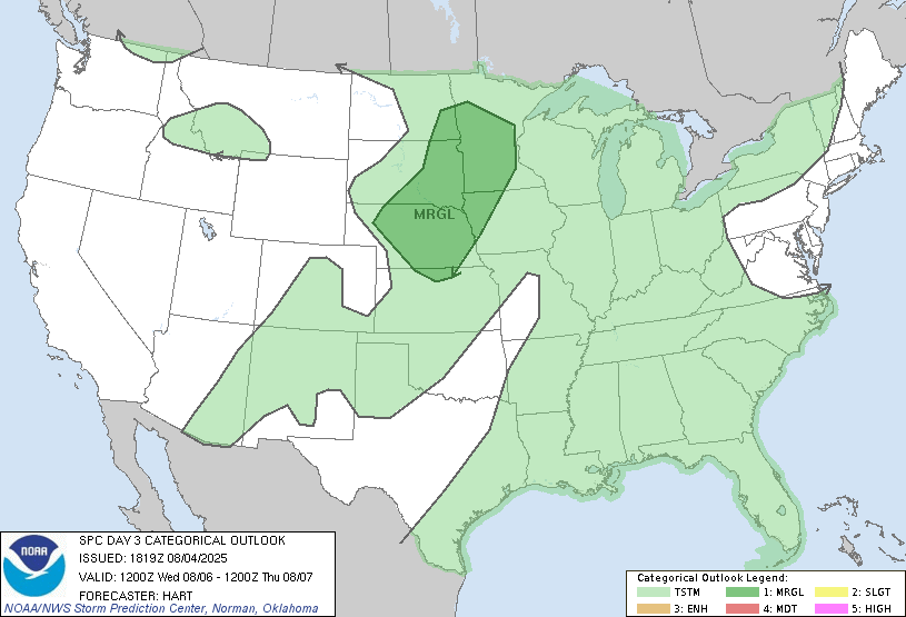
Tomorrow, the severe weather threat moves a little further east and southeastward. A Marginal (1/5) risk is outlined for the threat of the same storms from today producing strong gusty winds and hail in the morning on Wednesday. The system will generally start weakening on Wednesday, but before it does it will impact the region. We will be keeping our eyes out for any upgrades as we get closer.
CONUS Weekly Precipitation Outlook
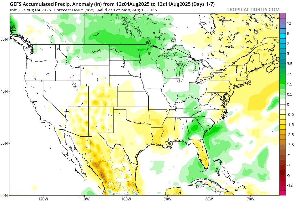
Here’s a look at the GEFS modeled precipitation anomalies through Monday 12z. Green indicates above average precipitation, white indicates average precipitation, and yellow indicates below average precipitation. Let’s look into the details by region:
Weekly Outlook: Western United States
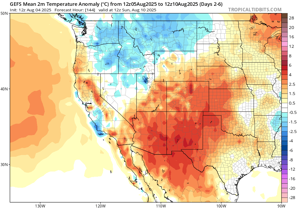

The southwest in the desert regions are expected to be much above average in terms of temperatures through this week. A large ridge of high pressure will stay stationary over the region, promoting downward forcing air, which clears up the sky and generally allows temperatures to skyrocket. Hazardous heat is expected for this week in the deserts, so take caution if you are in the region.
In the Pacific Northwest and northern Rockies region, you could expect cooler than normal temperatures for the week, due to a nice trough digging down into the region by late week, bringing with it some rain (mostly for Montana).
Weekly Outlook: Central United States
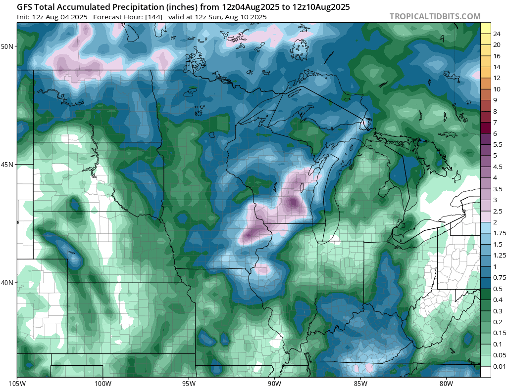
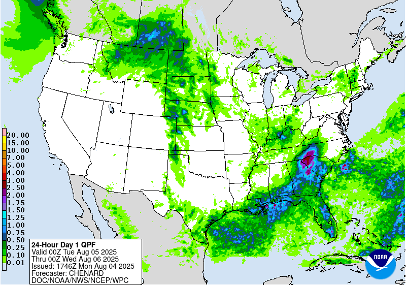
A good 5-8 inches of rain could fall in the upper Midwest and northern Plains this week, as some rounds of showers and storms come through midweek and by this weekend. Excessive rainfall outlooks are in place with the risk of flash flooding being Marginal (at least 5 percent) at the moment.
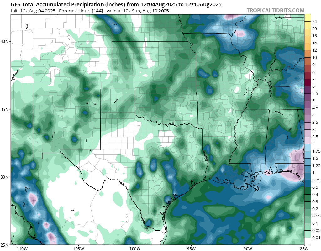
Scattered rain is expected for this week, but mostly dry conditons are expected in the southern plains and through Texas. Sunday is looking to be the day with the most rain for this region, as a low pressure system is expected to pass through from the west.
Weekly Outlook: Eastern United States
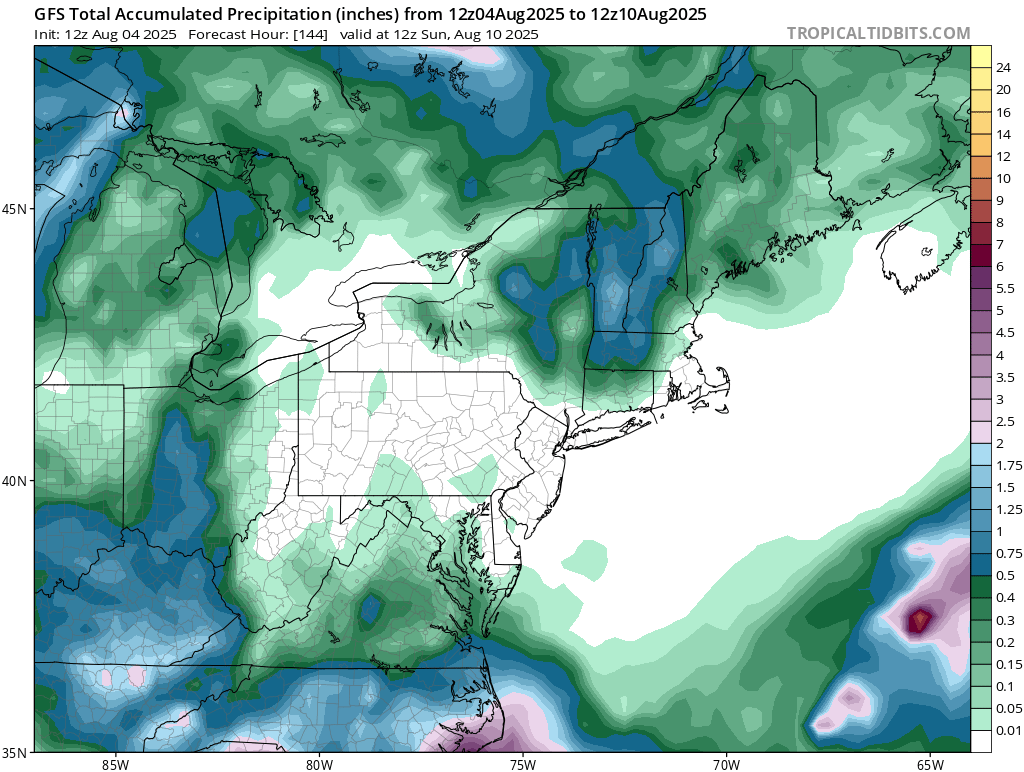
The northeast is looking mainly dry this week, thanks to some high pressure dominating the area. Some areas in the interior northeast could see an inch or 2, but no washouts are expected for the week or weekend for the majority.
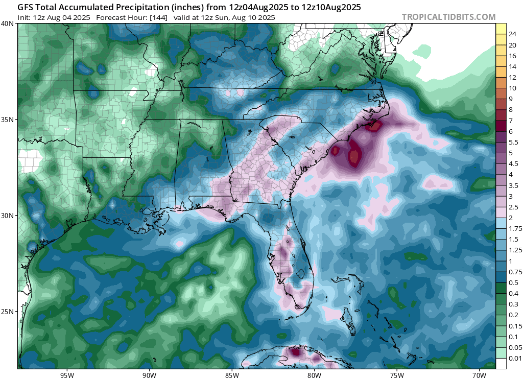
Rainfall will be above normal for the Atlantic coastal southeast states, due to an area of low pressure that will stick around for a few days. This low pressure is currently an “area to watch” by the National Hurricane Center and has a 30 percent chance of forming a tropical depression in the next 7 days. This will dump locally 5-8 inches plus in some areas, so this is defiently something that could be a flooding concern. Marginal (at least 5 percent) risk zones of flash flooding are in place for most of the days this week for coastal NC/SC/GA, but upgrades to this are certainly likely since this will be a slow moving system.
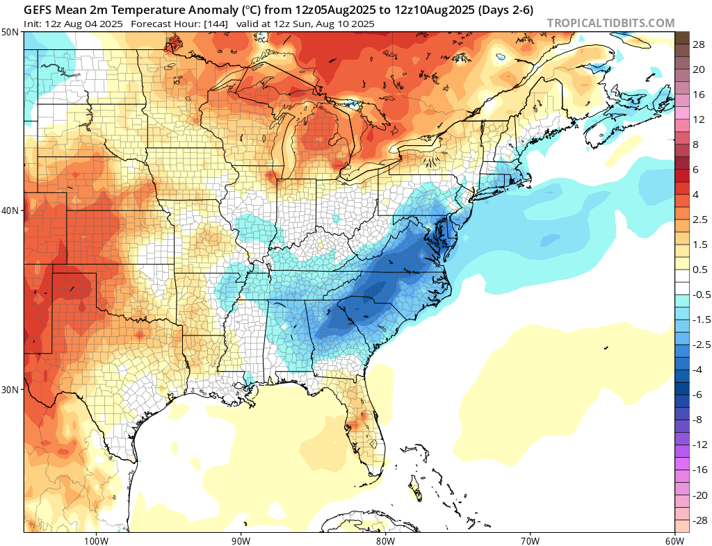
The area of low pressure will increase cloudiness and rainfall, which will keep the temperatures down by 5-8 degrees on average this week ahead for most of the coastal east coast. It will still be hot, but there will be some relief from the heat this week in that region. Those in the upper midwest will see temperatures warmer than average this week, as a result of the passing ridge in southern Canada.
Travel Outlook
If you’re traveling tonight through cities like Bismarck, Fargo, Grand Forks, Sioux Falls, or Norfolk, be alert for changing weather conditions. Storms could impact travel along I-94, I-29, I-90, and parts of I-80. Even outside the main threat area, places like Pierre, Aberdeen, and Watertown could still see storms, so use caution on the roads.
Extended Outlook
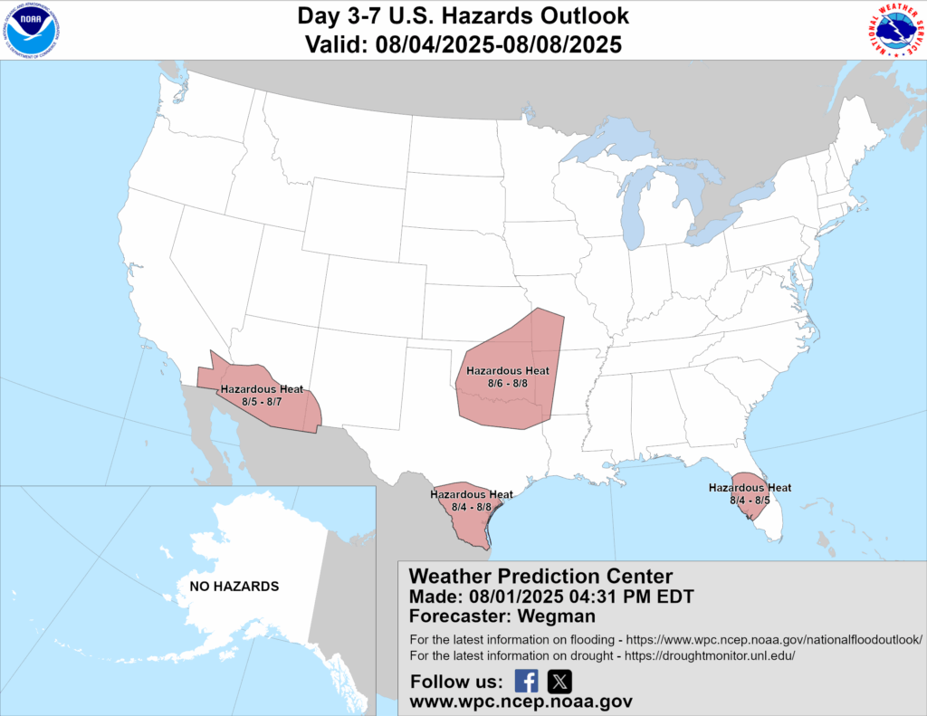
Above is a look at the U.S Hazards Outlook from NOAA, highlighting areas of extreme weather to be aware of for the next 3-7 days. Hazardous heat is the main concerns for the red highlighted areas above.
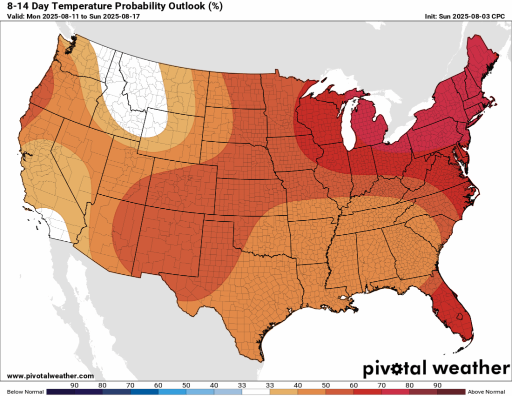
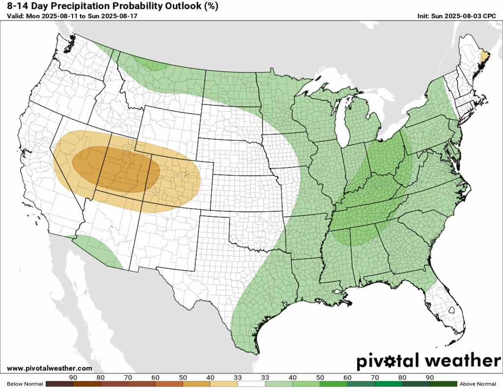
The pattern will indeed flip when we look into the next 8-14 days. Everyone is expected to see above normal temperatures, with a high probability of the Midwest, Northeast, and Southeast seeing it. The east, in general, is expected to see some increased rainfall in that two week timeframe, with the west seeing drier than normal conditions.
Thanks for tuning in to this National Forecast! Tune in to our local, tropical, and regional forecasts to stay updated on the latest!


