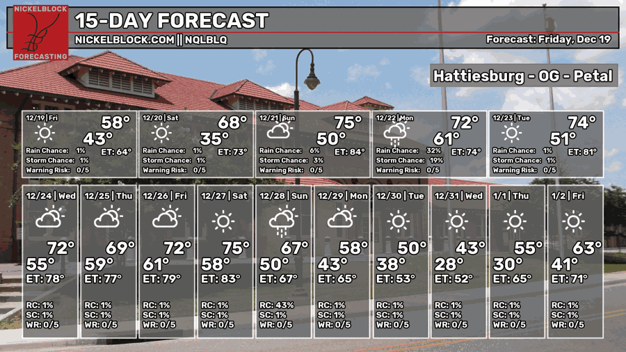
The rain has moved out and the cold front has moved in last night. We’ll have some milder conditions today with highs in the mid 60s and lows will dip down into the upper 30s. Saturday will be a warmer day with temperatures in the low 70s and increasing clouds. In the later evening hours, we can expect some rain to move in and linger throughout the night with lows in the low 50s.

On and off rain is expected Sunday through Monday as a warm front moves in slowly across the southeast. We won’t get a break from the rain until Monday evening. As the cold front moves through on Tuesday, we won’t have a big break in temperatures as a high pressure dome moves over us in its place. Not only that, the upper atmosphere will also build a subtropical ridge over the Deep South. All this to say that we will have above average temperatures for the next week.
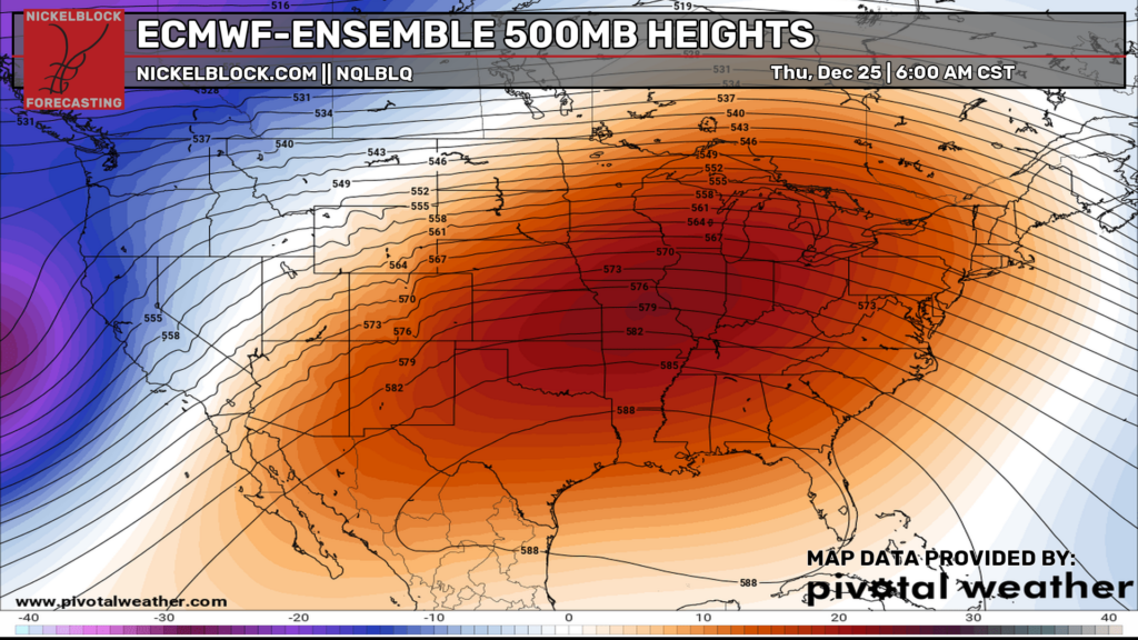
The big ol’ ridge is here to stay until after Christmas, so expect temperatures to be in the upper 60s to low 70s for most of the week and the lows to be in the 50s. It’ll definitely feel unseasonably warm, so you’ll likely be wearing a Christmas t-shirt instead of Christmas sweater for your Christmas party and celebration. The good news is, this won’t last forever. Before New Years, the trough out in the Pacific will move in and bring a cold front in by next weekend to bring overall temperatures back down to average for this time of year.
Everyone stay safe Christmas shopping and going to Christmas parties!