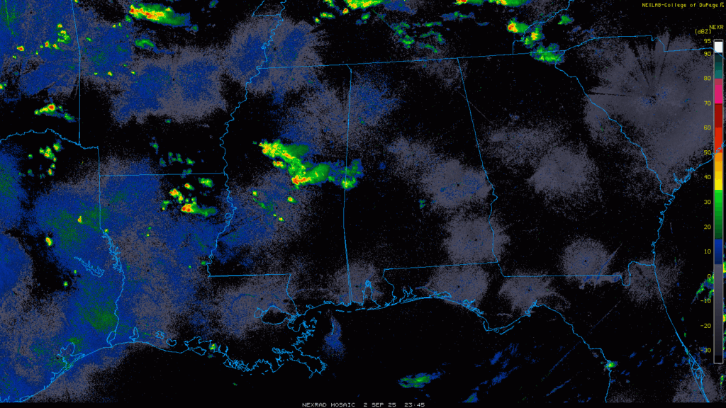
Things are overall clear for the majority in our area, but a cluster of heavy showers and occasional lightning is coming down on those in middle Mississippi and parts of northeastern Louisiana. Besides those folks, the rest of the area is dry and clear! Let’s look at what’s going on:
Overall Setup
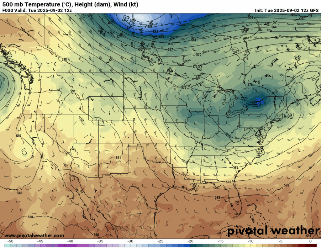
Ridging in the west and troughing in the east is seemingly here to stay for the first half of September. This means there will be more shots of cooler air in the midwest and northeast and warmer air in the west. With that, though, we could see front after front bringing shots of rain. Since the stationary front we’ve been seeing is moving further and further south into the Gulf, will stay mainly dry for the next few days, and temperatures will be back in the lower 90s by Thursday and lasting through the weekend.

Tonight’s Forecast
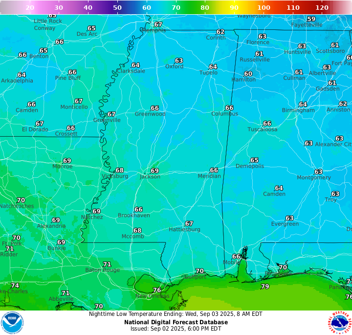
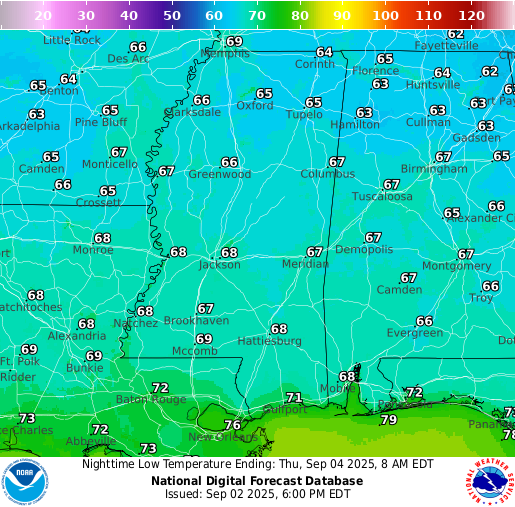
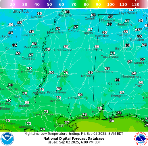
Temperatures tonight will get down into the low-to-mid 60s more inland, and slightly warmer closer to the coast. A passing shower or two is possible before midnight, but otherwise a mainly clear night with few clouds is expected.
Tomorrow’s Forecast
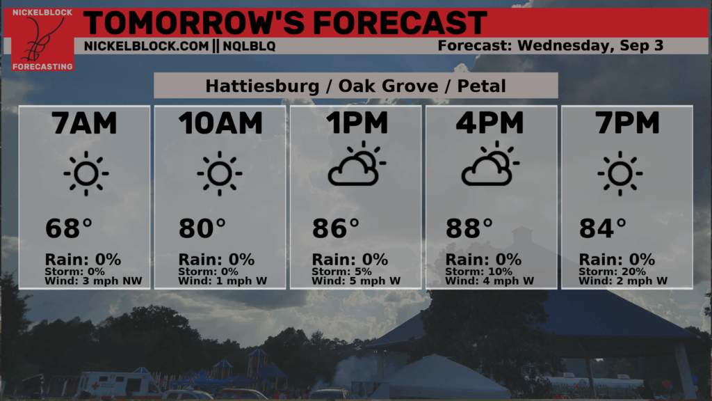
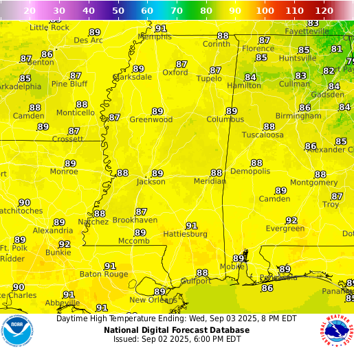
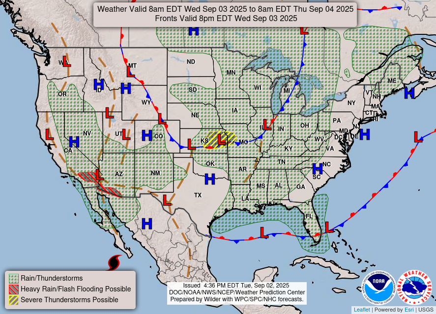
The forecast for tomorrow is a mix of sun and clouds with a few spotty showers or thunderstorms possible as a weak front slides through. Most areas stay dry with only brief rain where storms pop up. Highs will reach the upper 80s to near 90. A similar low temperature to today in the mid-to-high 60s is expected, with skies clearing back up.
Thursday’s Forecast
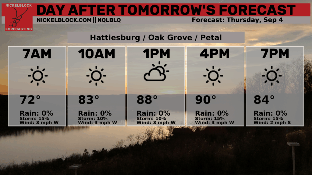
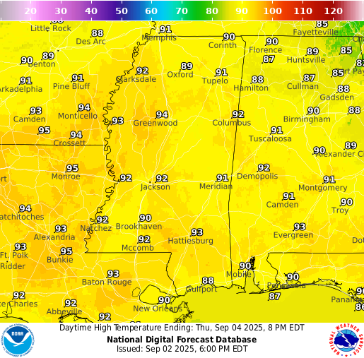
An even nicer day is expected on Thursday with no rain in the forecast! A passing shower or two is not completely out of the question, but I’d be surprised if we see anything at all. Temperatures do warm up, though, into the low 90s and a slightly warmer nighttime low temperature into the very low 70s. Humidity does increase back again, unfortunately, because a warmer airmass typically comes with increased moisture. A great day for some outdoor activities, but stay very hydrated!
Extended Local Outlook
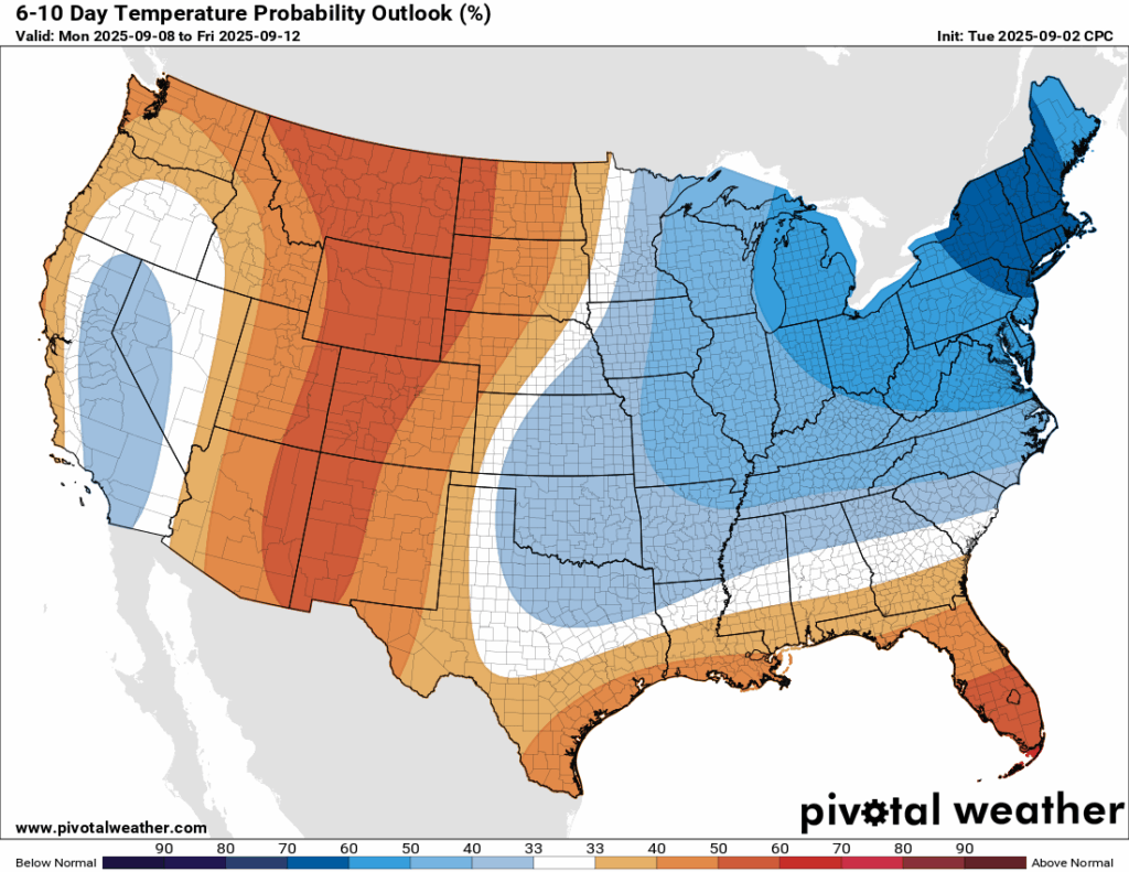
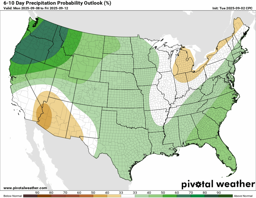
A similar pattern holds for the next 6-10 days: cooler than average in the midwest and northeast and warmer than average in the mountain west. What’s different in this update is that our region is looking to sit a little bit above average. The reason for this is fairly simple, the upper-level winds will transition from a cooler northwest wind to a more warm west southwest wind. With a warmer airmass funneling into our area, there’s a chance of above normal rainfall for this time period, but that chance is rather low from the Climate Prediction Center.

Latest Tropical Update
Eastern/Central Pacific:
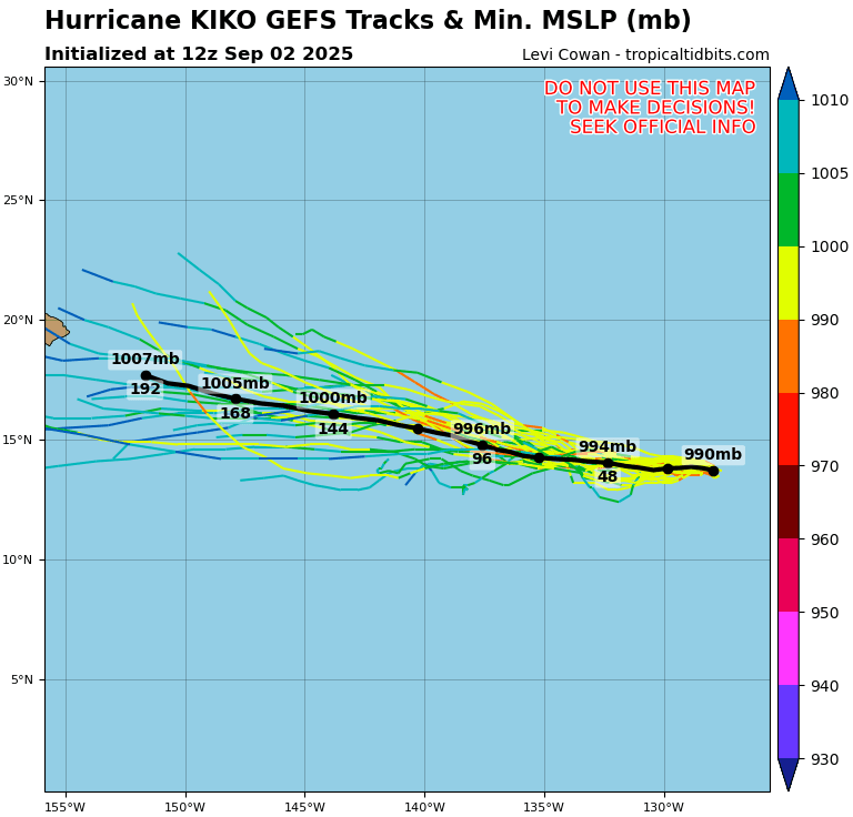
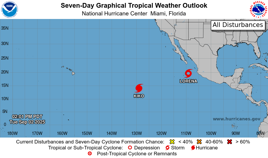
Hurricane Kiki is churning up the Eastern & Central Pacific currently as a Cat 1 with winds at 100 mph, moving west at 6 mph. Kiki is expected to track straight towards Hawaii, and strengthen into a major hurricane briefly before hitting the islands as a Cat 1 or tropical storm by early next week.
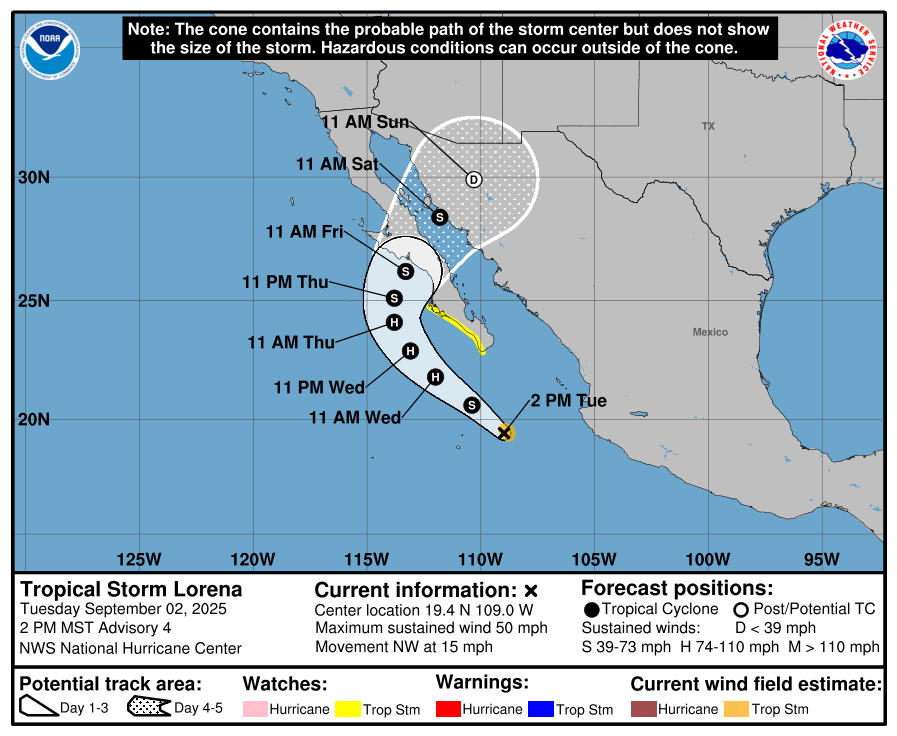
Tropical Storm Lorena is lining up for a landfall in western Mexico Friday morning, specifically in the Baja California Sur. This is what I was worried about in my last tropical update. Tropical Storm Watches are currently in effect for the southern part of the Sur. Up to a foot of rain could fall as the system nears, bringing the deadly threat of mudslides and flash floods. The moisture from Lorena will move into the southwest US, bringing a few inches of rain and the threat for flash floods as well.
Atlantic:
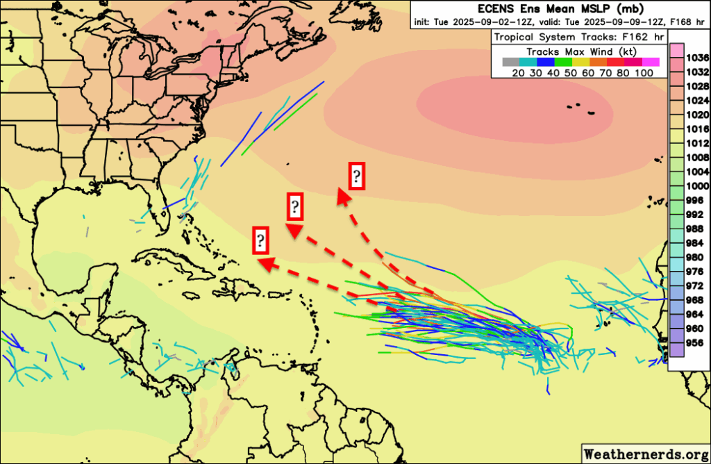
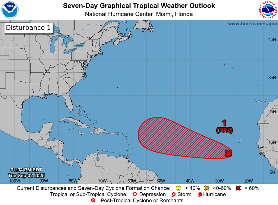
The chance of tropical development for the disturbance in the eastern Atlantic is increasing day by day. Chances are currently 70 percent in the next 7 days, with the NHC saying that a tropical depression is likely to form late this week or this weekend. Models are overall in agreement on a west northwest track up until around mid-week NEXT week, where the ensembles are disagreeing on whether it will turn out to sea or maintain its track towards the Carribean islands and eventually the eastern US. The traditional GFS and Euro models are both spitting out model runs that show a turn to the northeast out into the open Atlantic by the middle of next week, but the ensembles are not as convinced.
It’s too far out to know where exactly it will go, but it’s looking likely that this could become Hurricane Gabrielle. The traditional models show the turn out to sea because of it ridging around the Atlantic High, as well as being swept up by yet again another cold front that will move across the northeast during that timeframe.
REGIONAL DAY TO DAY FORECAST
Tonight: Patchy fog after 1 AM. Otherwise mostly clear with lows in the upper 60s. East northeast winds around 5 mph becoming calm.
Wednesday: Patchy fog early. Isolated showers and thunderstorms possible, otherwise sunny with highs in the lower 90s. Calm winds. Chance of rain 30 percent.
Wednesday Night: Mostly clear with lows in the upper 60s. Calm winds.
Thursday: Sunny with highs in the low 90s. Winds light, becoming west near 5 mph.
Thursday Night: Mostly clear with lows in the upper 60s. Calm winds.
Friday: Sunny and hot with highs in the mid 90s. Winds light, becoming south near 5 mph.
Friday Night: Partly cloudy with lows in the low 70s. South southeast winds near 5 mph, becoming calm overnight.
Saturday: Mostly sunny with highs in the mid 90s. Winds light, turning northeast around 5 mph.
Saturday Night: Partly cloudy with lows in the low 70s. Calm winds.
Sunday: Mostly sunny with highs in the lower 90s.
Sunday Night: Partly cloudy with lows near 70.
Monday: A chance of showers or thunderstorms. Otherwise mostly sunny with highs near 90. Chance of rain 20 percent.
Monday Night: Mostly cloudy with lows around 70.
Tuesday: A chance of showers and thunderstorms. Partly sunny with highs in the upper 80s. Chance of rain 40 percent.


