Although there are no active tropical cyclones, there are two areas of concern to look into. There is one disturbance in the Bay of Campeche, and another off the coast of Mexico in the East Pacific. Let’s see what our current tropical setup is looking like, and take a closer look at each disturbance:
Today’s setup:
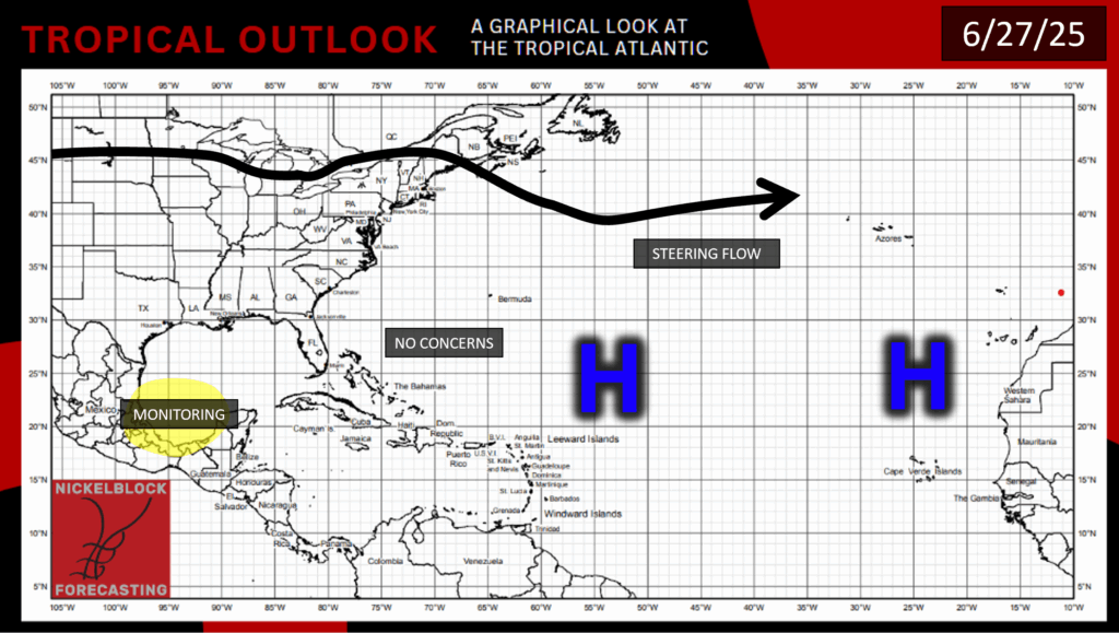
We have our typical areas of high pressure spanning across the Atlantic due to the Bermuda High, but there is one area of concern in the Bay of Campeche, so let’s take a closer look:
Atlantic Disturbance:
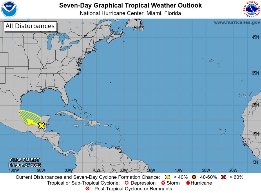
As of Friday afternoon, this disturbance has a 30% chance of developing into a tropical cyclone within the next 48 hours, and also a 30% chance of developing in the next 7 days. This is due to a large area of low pressure, showers, and thunderstorms forming in the area. Because this area of development is heading inland toward Mexico and is in an area of high wind shear, I doubt that this will develop into anything very strong, although some heavy rain in areas of Mexico can be expected:
So, this disturbance’s effects will likely end in Mexico, and possibly Guatemala and Belize as well, with heavy rainfall. The threat of this development becoming anything major is pretty unlikely due to it being forecasted to encounter land, cutting off its main power source of the warm Gulf waters.
East Pacific Disturbance likely to form:
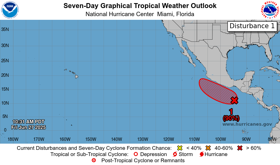
This disturbance looks similar to many of the ones we’ve seen in the East Pacific this hurricane season. It is still slowly making its way up the coast of Mexico, and as of Friday afternoon, has a 60% chance of developing into a tropical cyclone in the next 48 hours, and a 90% chance of development in the next 7 days.
With the current environmental conditions going on in the area, like warm ocean temperatures and high relative humidity, we can expect that this disturbance will likely form into a tropical depression later this weekend or early next week, although high wind shear may help to inhibit this disturbance’s development. So, where might this development end up going? Let’s take a look and the possible storm tracks:
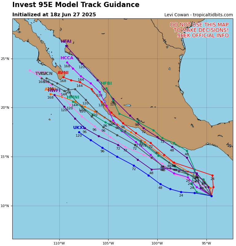
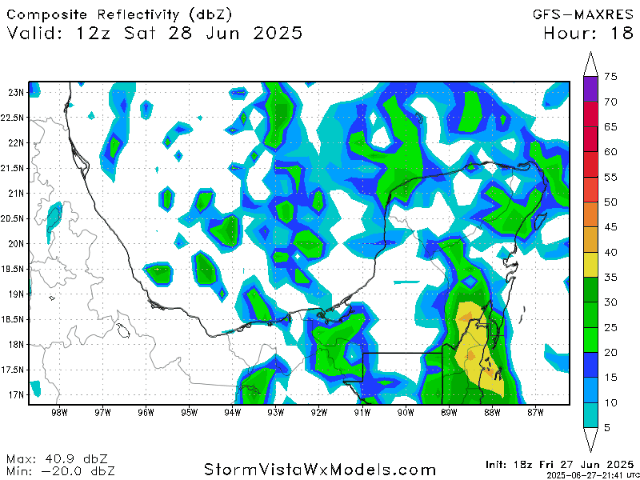
The storm tracks for this disturbance have been moved a bit closer to land since the past couple of days, but this doesn’t mean that direct landfall is guaranteed. This disturbance may end up moving along the coast and weaken after making landfall, or just move off to the West, deeper into the Pacific.
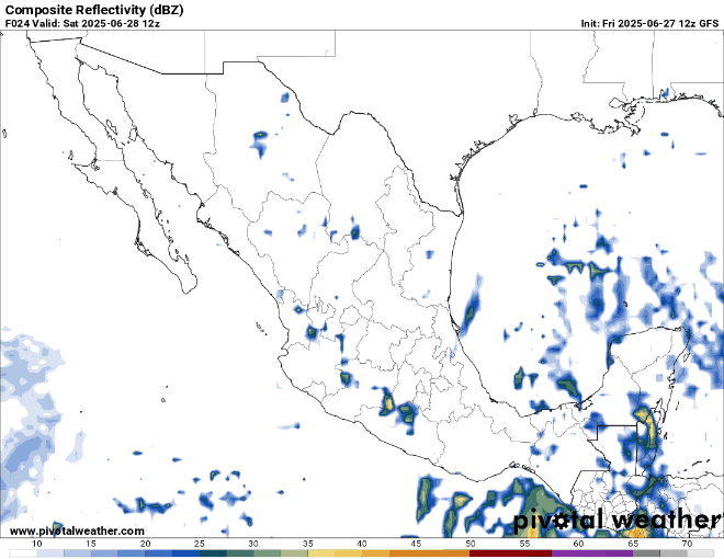
Regardless of whether this development makes landfall or not, Mexico will most likely be receiving some widespread rainfall throughout next week. In localized areas, rainfall may be heavy, so flooding and mudslides are also a possibility to look out for. Take a look at the radar from today through next week:
We will continue to track both of these areas and the rest of the tropics, so stay tuned to NickelBlock for more updates!


