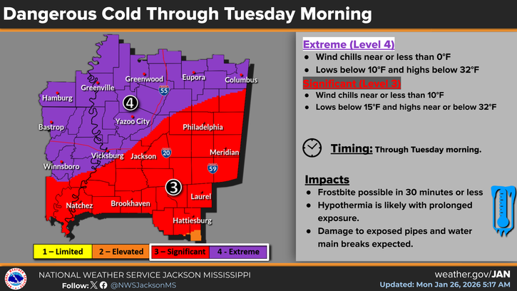
I’ve seen a lot of pictures from across the northern parts of MS/LA/AR and man, that was a lot of ice! Many people are still without power and unfortunately, it’s still going to be very cold for them for the next couple of days. If you have friends or relatives in those areas, be sure to check on them. Let’s take a look at the forecast.

Today
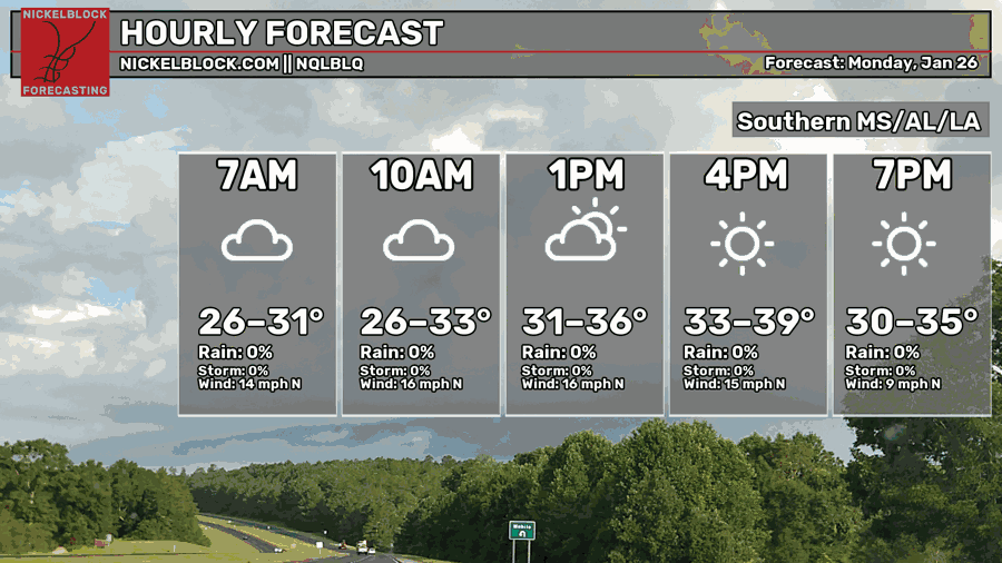
It’s going to be a very cold and windy day today with the outgoing cold front. The clouds will move out by the afternoon, but otherwise, it’s keeping the sun from warming us up for most of the day! Some of us will barely get above the freezing mark while further south, we won’t make it above 40. Bring a coat and something to warm your ears today as the wind will cut through you. Overnight, make sure to cover your pipes and drip your faucets as temperatures will fall into the low to mid 10s tonight. Be sure not to be outside tonight either as the wind chill will be very low.
Tuesday
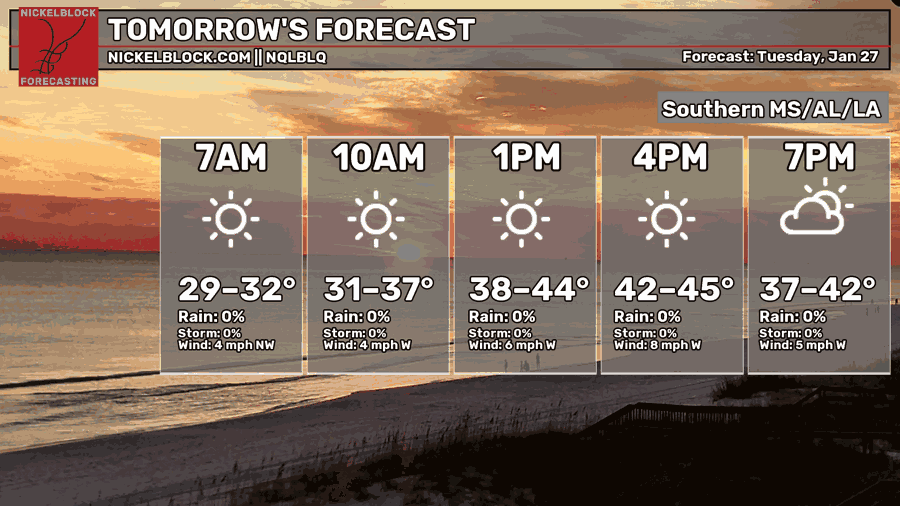
We start off very cold Tuesday morning. The winds will die down a bit, but many of us will just make it to the 40s for a high. Overnight, the temperature will fall into the low to mid 20s.
Wednesday
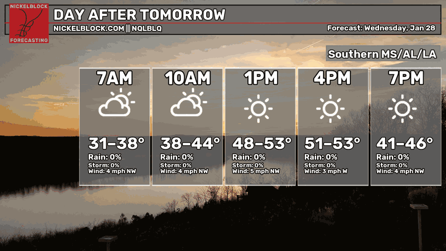
As the high pressure builds in, it’s going to warm up slightly on Wednesday with a high in the low 50s for most of us. The sun will keep things a little warmer as well. Overnight, we’ll fall back into the mid 20s.
Post-Hump Day
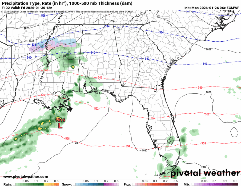
The rest of the week looks slightly warmer as the high moves slightly eastward allowing for more westerly winds to move in. Thursday looks to be on the average side with a high in the low 50s and a low in the low 30s. With an outgoing cold front, we’ll also see some rain possible on Friday as a low pressure system passes through the Gulf. The GFS and Euro models are differing on any rain at all, but the Euro ramps it up a bit and adds a bit of wintry weather to the north central part of the state. Does it look plausible? Maybe, but as dry as the Skew-T’s look, I wouldn’t bet on it just yet.
Overall, expect it to be a cooler than average week. The first part of this week will be very cold, so be sure to take care of your household before you go to bed. The second part of the week looks a little more average, but still fairly cold.


