Overall Setup
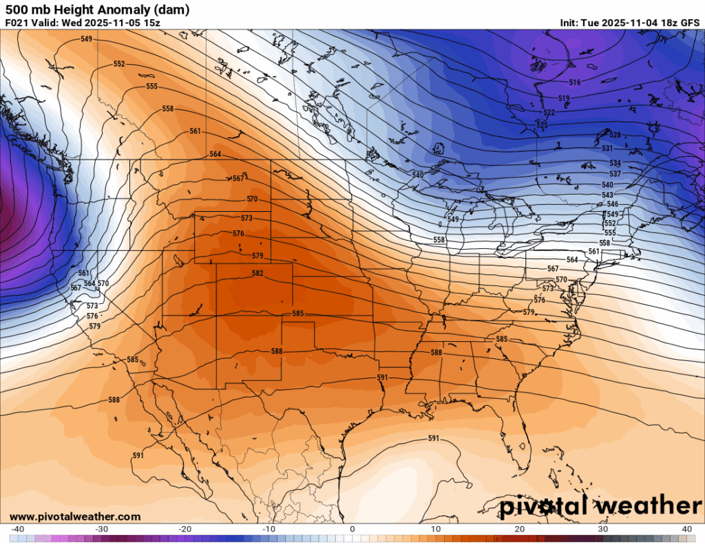
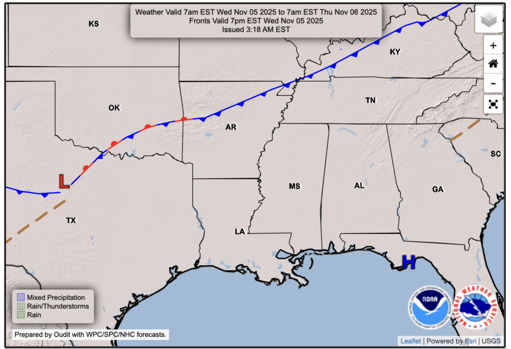
Right now, there is not much going on weather-wise in our region. Things are quiet, there’s not much cloud cover, and temperatures are fairly comfortable due to a large ridge of high pressure in the mid-levels of the atmosphere. At the surface, there’s a weak front to our north, but that looks to stay dry and not give any impacts.

Tonight’s Forecast
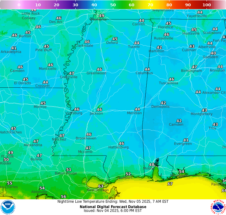
Tonight we will continue to stay quiet and clear with temperatures cooling down to the mid 40s. We could see some patchy fog sometime after 3 am, but otherwise things are looking clear.
Tomorrow’s Forecast: Wednesday, November 5
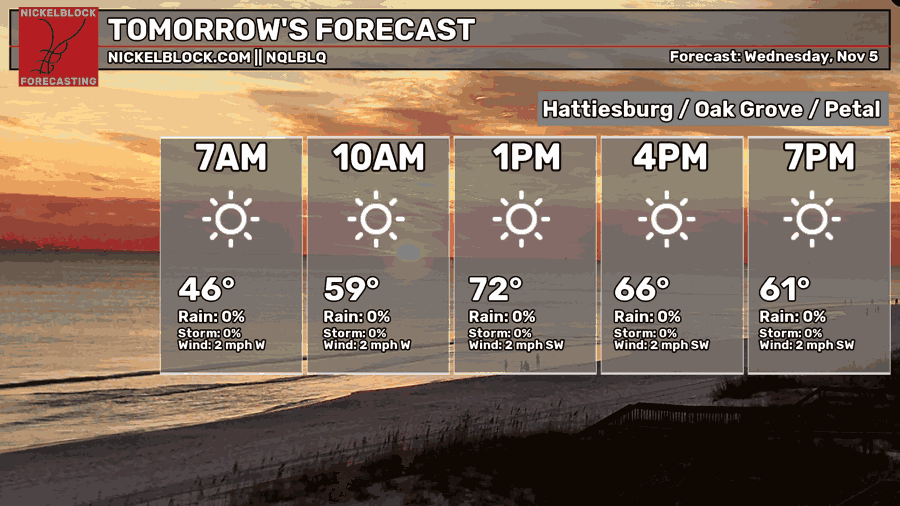
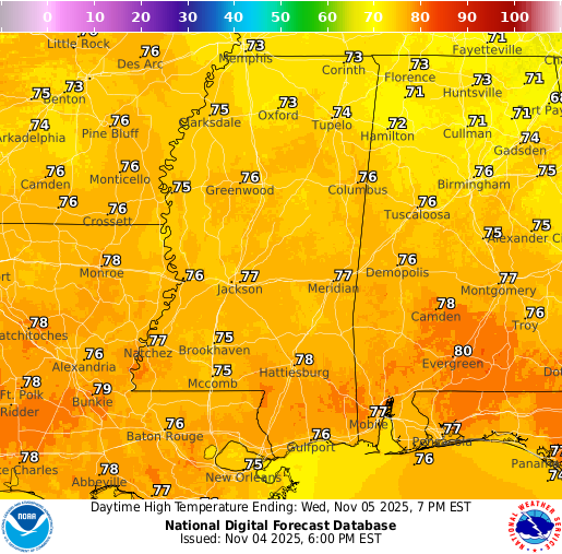
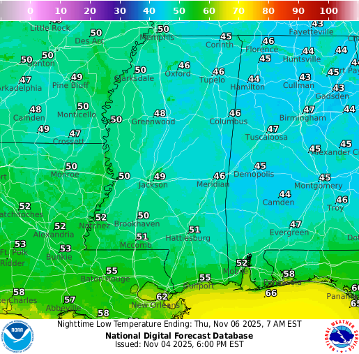
For your Wednesday tomorrow, there’s nothing in the way of any plans since skies will be generally clear with just a few clouds around. Temperatures will rise up there to the mid-to-upper 70s for the first time in a little bit, but a little warm up won’t ruin the fall vibes. Lows will fall to around 50 tomorrow night, continuing mostly clear.
Thursday’s Forecast: November 6
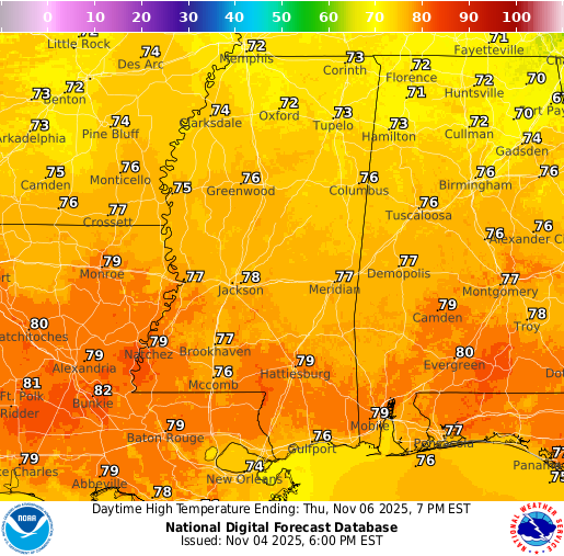
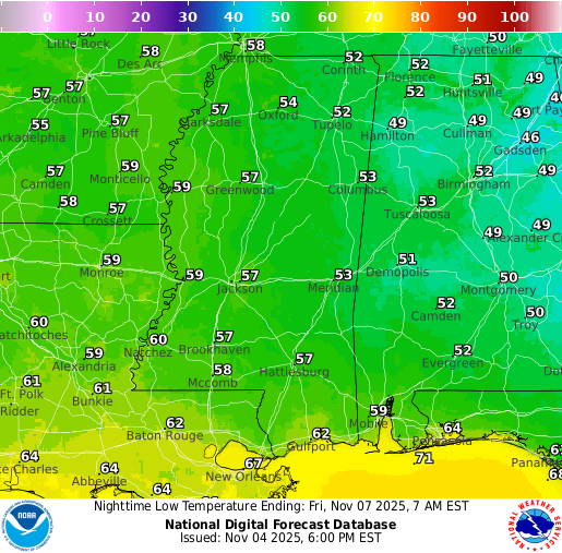
Thursday looks to be a very similar day to Wednesday, but maybe some more fog lingering through around 8am. After that, skies will clear up and temperatures will rise to the mid-to-upper 80s once again, with a low temperature in the mid-to-upper 50s Thursday night.
Extended Local Outlook
Friday, we are looking at a chance for some rain as some moisture might be pulled into a passing frontal system. We aren’t looking at anything severe at this time, but we’ll keep you updated on the rain risk as we get closer.
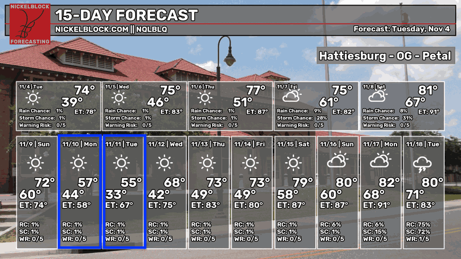
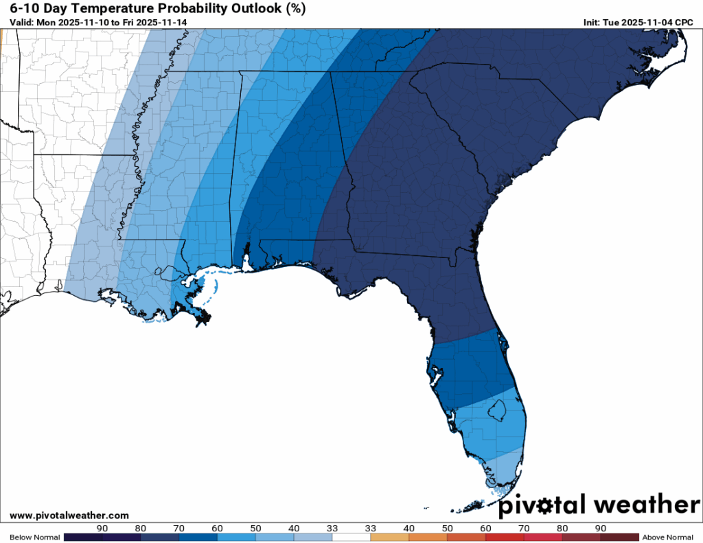
The models have been hinting on a large dip in the jet stream for early next week, which would bring some very cold air to much of the east and possibly spill into the Gulf Coast. As of now, temperatures could be up to 20 degrees below average for next Monday and Tuesday if the pattern verifies, which is why Monday and Tuesday are highlighted in blue in the 15-day forecast. Highs may not even reach the mid-50s, and lows could approach freezing!
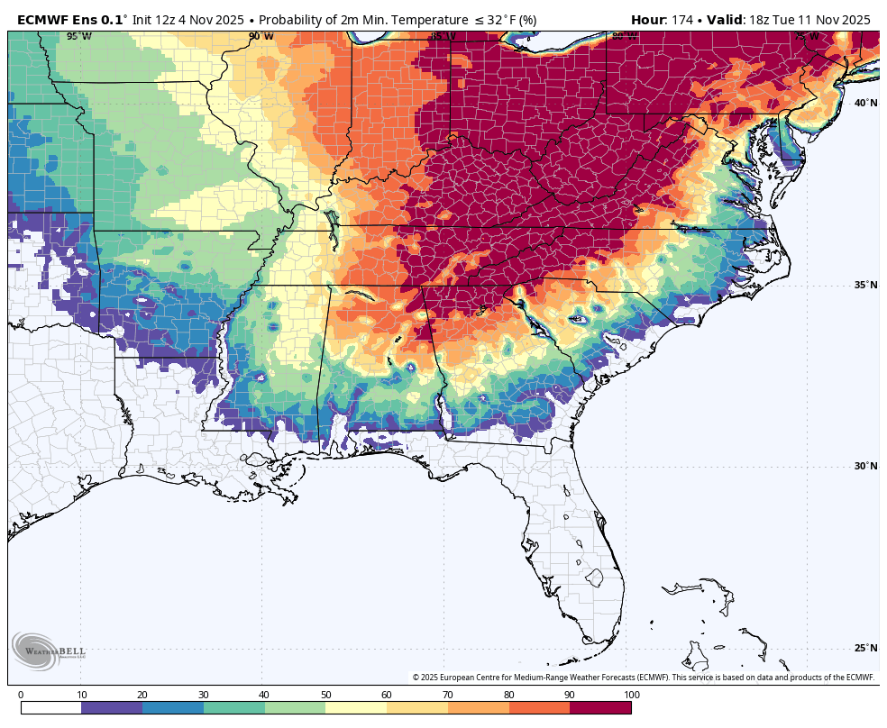
Above is the European Ensemble probability that next Tuesday night’s low temperature will be below freezing. As you can see, if the trough dips far down enough into our region, we have a 40-50 percent chance in the northern parts of our region, and just a bit of a lower chance down into our southern region.

Latest Tropical Update
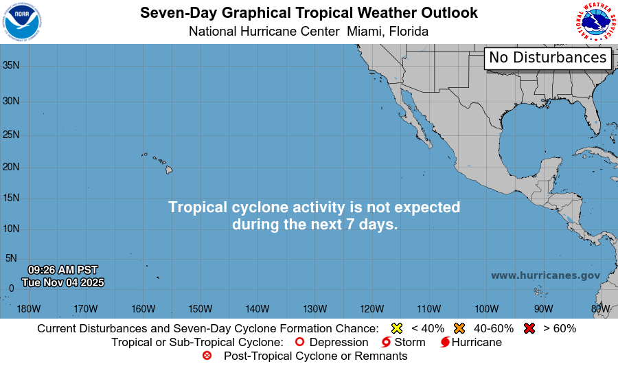
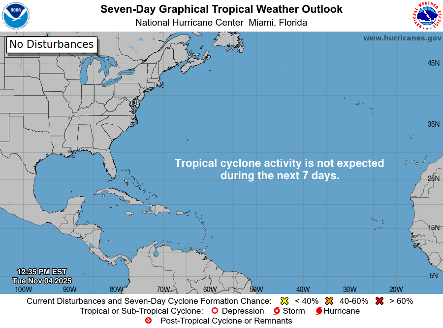
For the first time in quite a while, there are officially no active tropical systems or areas of concern in the tropics. Hurricane season is winding down as we approach its official end on December 1, but there’s still some time left for potential development.
REGIONAL DAY TO DAY FORECAST
Tonight: Patchy fog after 3 a.m., otherwise clear. Lows in the mid 40s. Calm winds.
Wednesday: Areas of fog before 9 a.m., then sunny. Highs in the upper 70s. Calm winds.
Wednesday Night: Patchy fog after 3 a.m., otherwise mostly clear. Lows in the lower 50s. Calm winds.
Thursday: Patchy fog before 8 a.m., then sunny. Highs in the upper 70s. Calm winds becoming southeast around 5 mph.
Thursday Night: Partly cloudy with lows in the upper 50s. South-southeast winds around 5 mph, becoming calm overnight.
Friday: Partly sunny with highs around 80. Light south-southeast winds becoming south 5 to 10 mph in the morning. Chance of rain 30 percent.
Friday Night: Partly cloudy with a chance of showers and thunderstorms, mainly before midnight. Lows in the lower 60s. South winds around 5 mph, becoming calm. Chance of rain 30 percent.
Saturday: Mostly sunny with highs in the lower 80s. Calm winds becoming west-southwest around 5 mph in the morning.
Saturday Night: Partly cloudy with a slight chance of showers after midnight. Lows in the lower 60s. Calm winds becoming west-northwest around 5 mph after midnight. Chance of rain 20 percent.
Sunday: Sunny with highs in the lower 70s.
Sunday Night: Mostly clear with lows in the upper 30s.
Monday: Sunny with highs in the mid 50s.
Monday Night: Clear with lows in the lower 30s.
Veterans Day: Sunny with highs around 60.


